Journal

Paragliding in the UK
I have been debating whether or not to write about paragliding for a while. Partly because it has now been a couple of years ago since I did it. But, more importantly, by far, is I unfortunately had a family member who was killed during a sky dive and a few friends who have been injured paragliding. So making the decision to have a go is filled with so many thoughts, questions and concerns mixed in with the excitement of trying something that I have watched for years.
Going back to 2008 I got my first taste of paragliding. I was out in Argentina on a ski trip where we heard of someone offering paragliding tandem jumps. It was near my birthday and I jumped at the opportunity. There wasn't a huge amount of lift that day so it was a fairly short flight but nonetheless it sparked an idea to try it again one day.
Fast forward to 2015 and I had my chance. Whilst on Baffin Island I had been listening to a audio book called Hanging in There by Jon Chambers. It's quite a niche subject but despite not knowing much about paragliding I enjoyed it as it helped pass the time away. It was interesting hearing about how they pushed the limits of technical skill and ability during the competition as well as inspiring me to have another go at the sport of paragliding.
Once back in the UK from Canada I had a look round and came across High Adventure Paragliding on the Isle of Wight. Finding a route over from Southampton was easy enough and I made my first journey over to the Island. Jumping on the ferry from Lymington to Yarmouth. I sat on the top deck in the glorious sunshine as it pulled away into the channel not far from Christchurch where I had previously practised ocean rowing. I met up with Pad the instructor where he went over how we would progress and an introduction to paragliding. Outside the office sat a swing setup like a paraglider without the wing where we could go over some of the basics before we headed out to the hill.
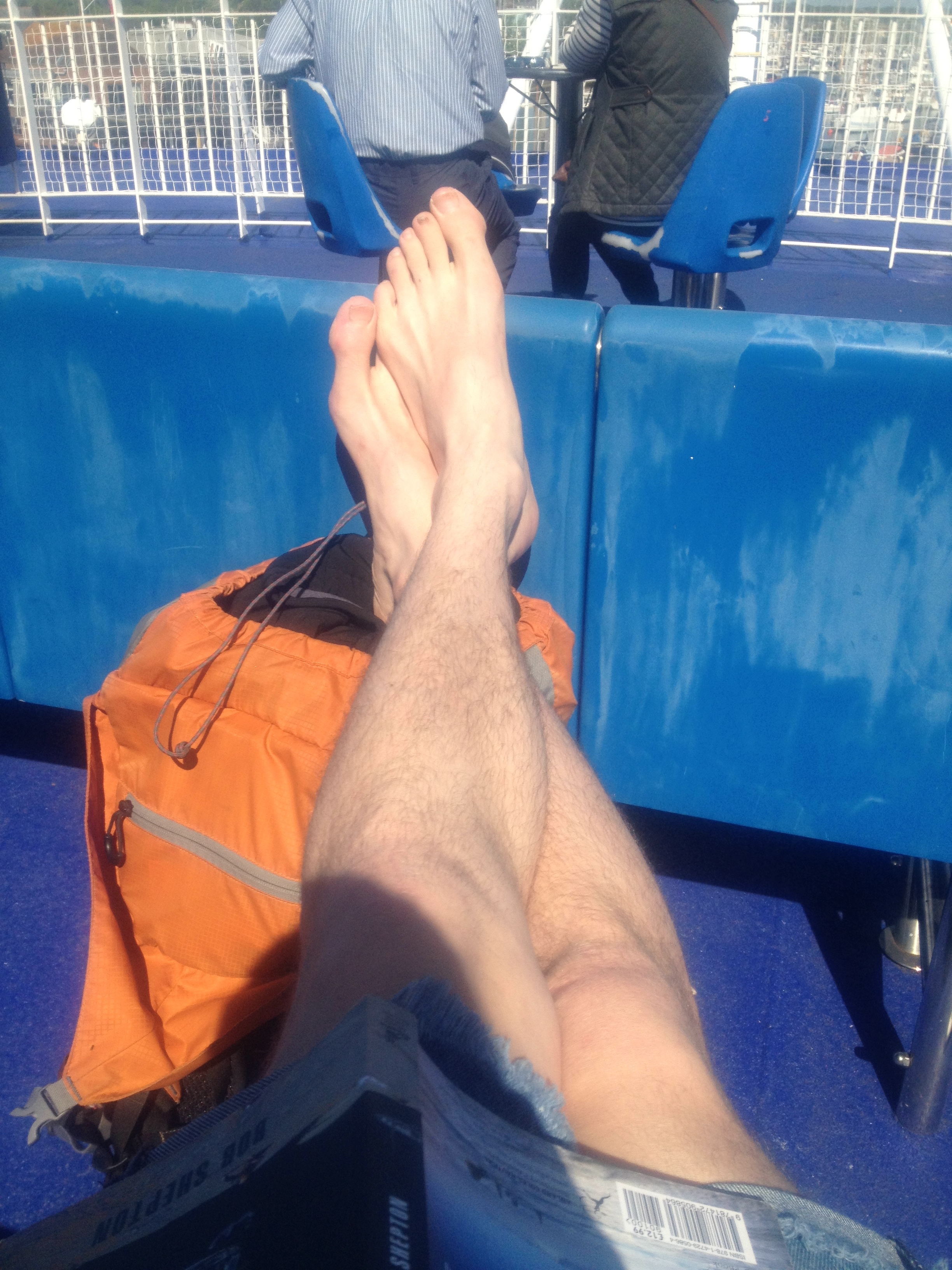
Chilling in the Sunshine on the Top deck
Pad took the time to show me how to setup the wing as we laid it out for the first time in a small valley looking out onto the sea. I could see in the distance small white horses gleaming in the sunshine.The sea breeze channelled up this small gorge providing the lift for us to play on. He talked me through it bit by bit before showing me the first short flight of him lifting and dropping down safely. The main point being to concentrate on each section of the journey and breaking it down into shorter sections. The first bit being the take off. Wing primed it was a case of waiting for the right breeze before running down the hill. Bit by bit the wing would rise above before it felt like you couldn’t run downhill as it started to lift me from the hillside. Focussing on the direction I wanted to go i ran harder, i probably looked like some odd bird desperately trying to take off in a completely ungraceful manner. I was finally up and enjoying my short and sweet flight back down to the grassy slope beneath me as I was directed on the radio.
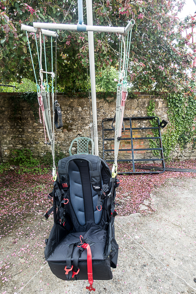
Paragliding swing
The day was spent making longer and longer walks up the hill, setting up under the supervision of Pad before waiting for his signal and taking off for a small hop down the field. The feeling each time was incredible with that small piece of weightlessness cruising down the field and landing. It is of course a big learning curve and I was trying to absorb as much as I could with the terminology and new technique. In the midst of all this I even forgot to about lunch which soon passed me by.

As conditions became stronger into the early evening it was time to call it a day. We finished up with a tandem ride. Taking off near one of the cliffs we cruised backwards and forwards on the sea breeze. It gave me a true feel for what it would be like to be able to paraglide by myself with nothing but the wind on my face. I even got a go at steering us along the cliff line.
We made our final top landing on the cliff before packing up. We made our way back to the ferry and I was excited about my next time already.

With me being a beginner and it being Britain that next flyable day took a bit longer than expected. But soon enough I was on day 2. This time from a slightly different location and a bit of a longer path to fly. I got to practise some reverse launches. This is where you get your paraglide to form a bank in front of you further up the slope as you fill each of the pockets. Once ready and with the wind at the right level towards you I would pull the paraglider up where it would ideally slowly rise above me before I would smoothly turn around and run down the slope. After I got the knack of remembering which way to turn around, the lines at this point are twisted over one another, I quite liked this method. It was a lot more visual and i felt you could see what was happening through each stage.

Came across an adventurous Renault Clio
Again a lot of the day was spent marching up and down the hill. Each landing meant the packing up of the wing before quick marching back up the hill for the next round. Not wanting to miss out on potential flying time I marched up and down as much as I could. By the end of the day there was a bit more flying to do and a written test to complete the first stage. I managed a couple of more days in the UK each time heading higher up the hill side and getting more valuable air time.
At this stage though I got the opportunity for a week of intense paragliding.
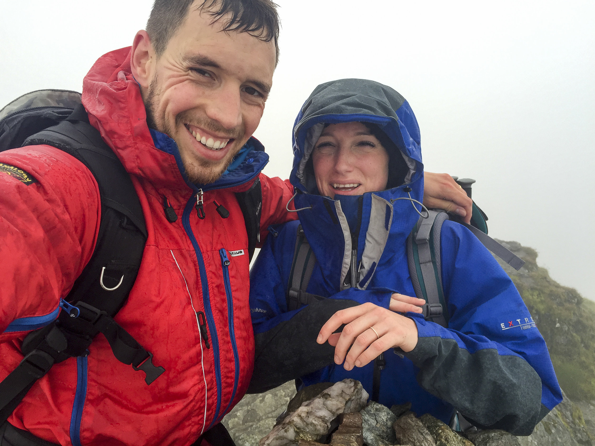
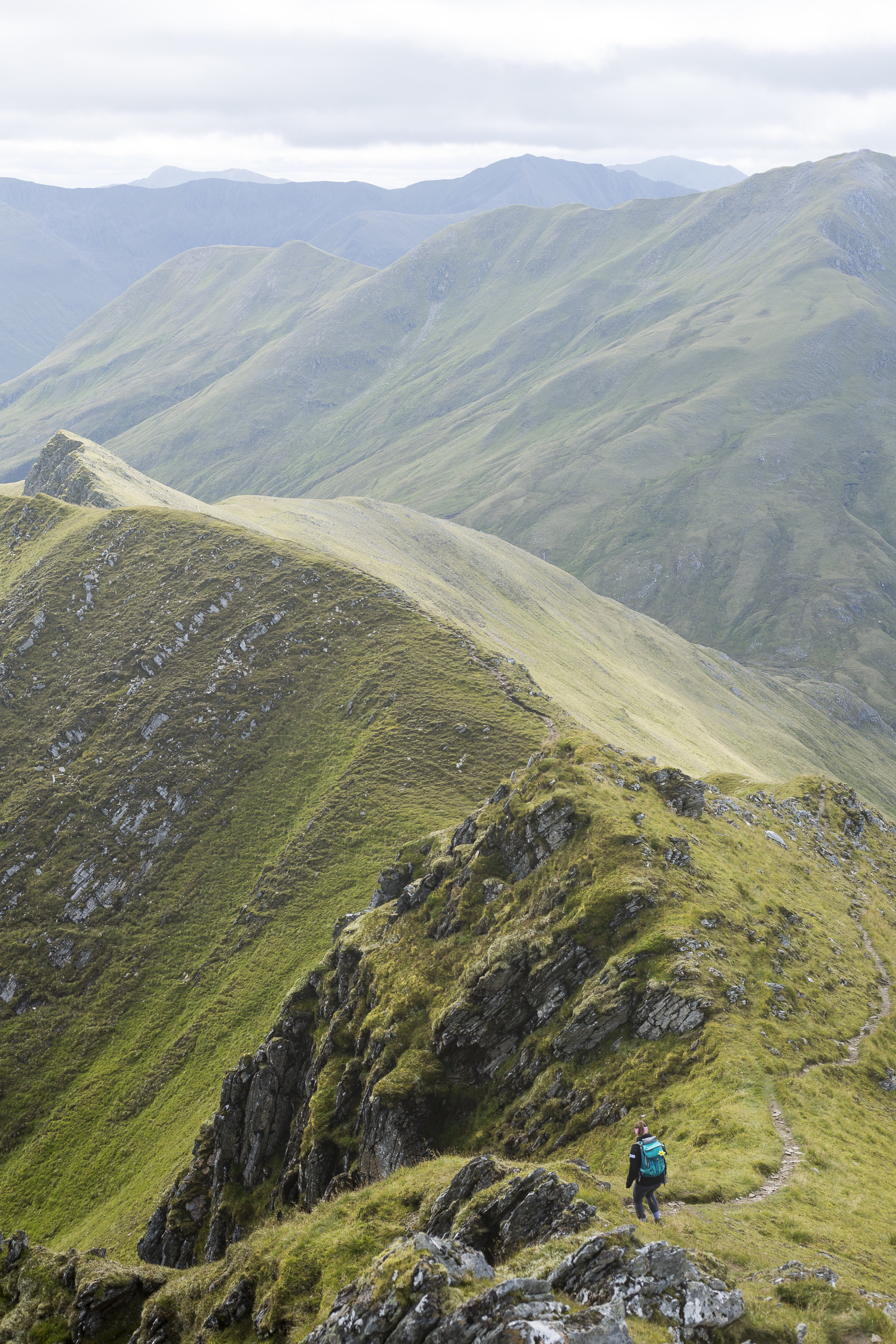
A long day in the Ben Lawers
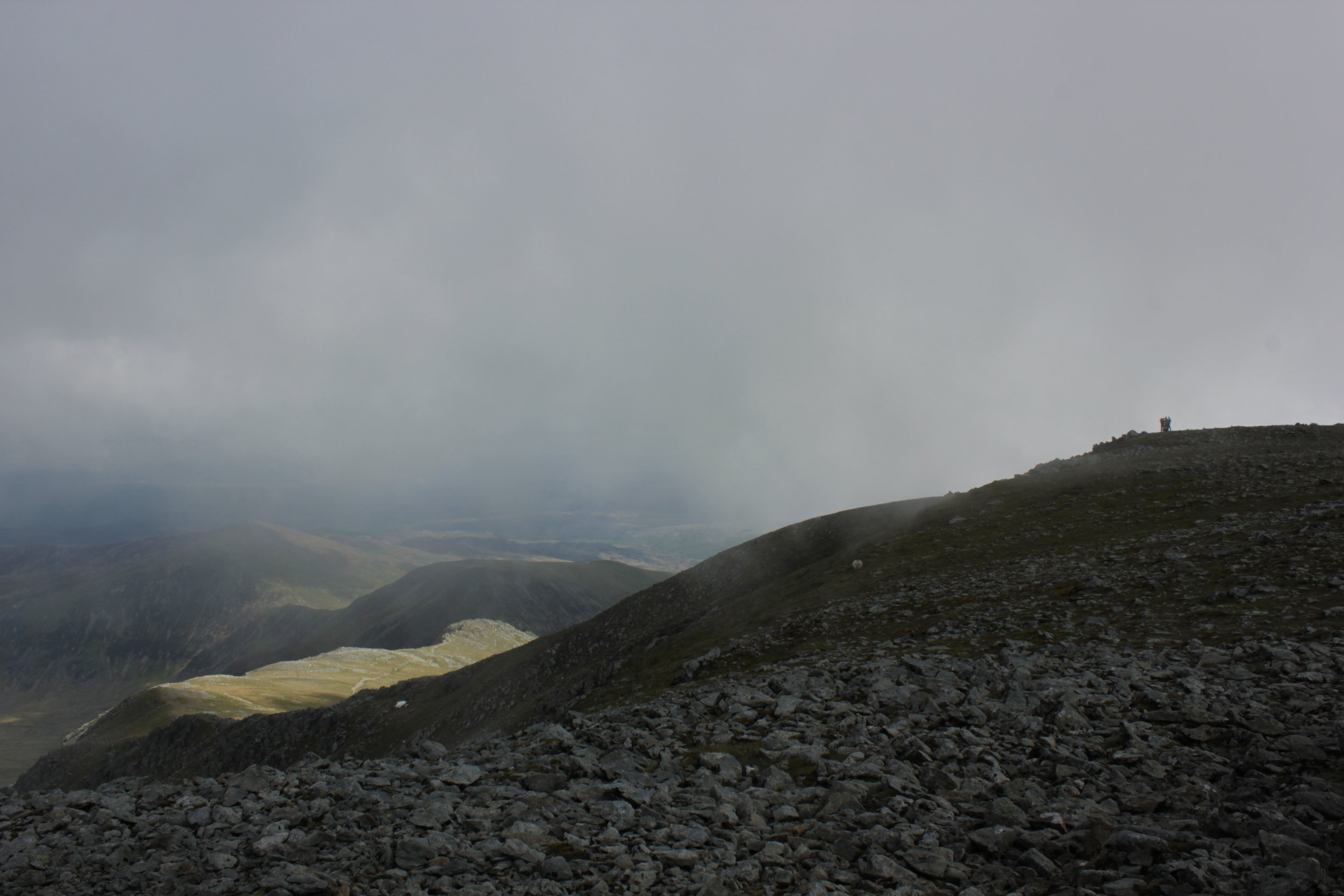
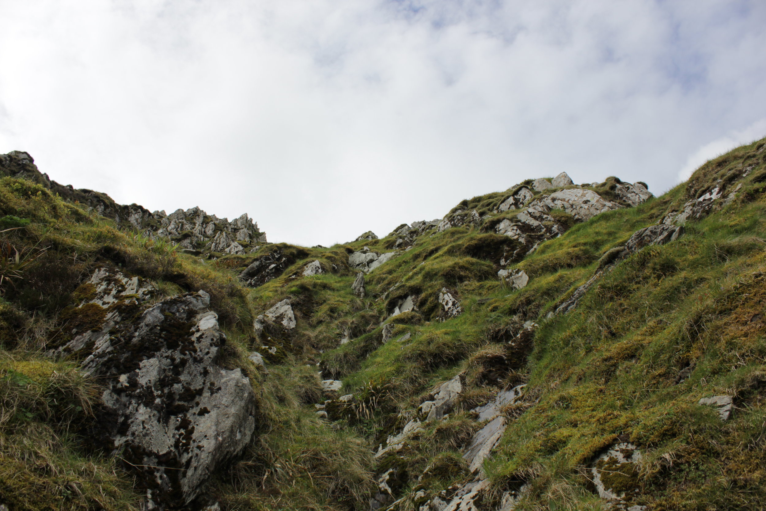
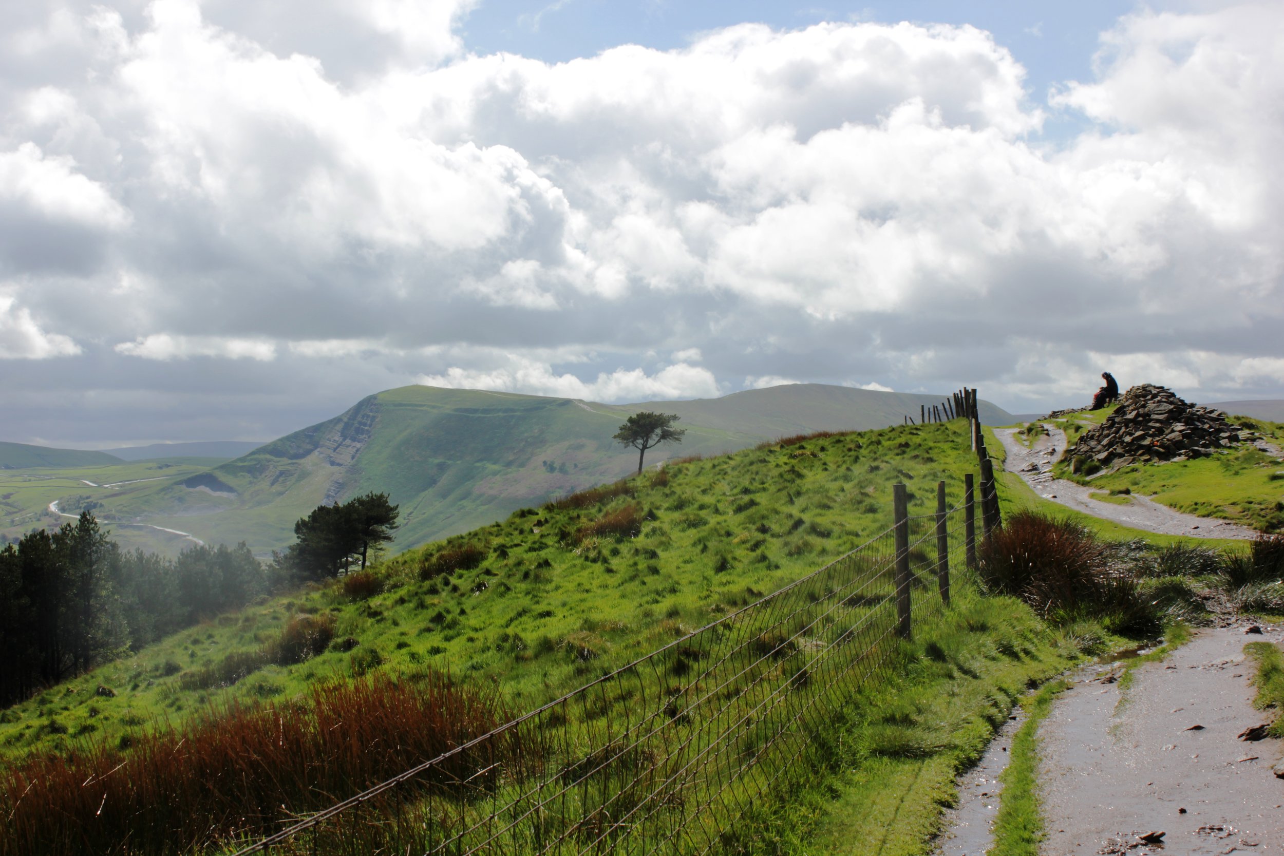
With a waterproof map case at the ready this time we headed back to where we had started he previous day. It was a bit of a déjà vu. The weather hadn't really improved but we set our sights on the Ben Lawers and the first summit of Beinn Ghlas opposite the previous day's attempt. All being well we would continue on peak by peak and see how we got on with the aim of doing a wee circuit.
The first part of the walk took a route through a protected part of the hill. It was amazing to see how diverse the wildlife was there compared to the normal heather covered hills. Would be awesome to see those areas increased!

Heading on up we were in the shelter from the wind heading up switch backs towards the summit. We soon arrived, feeling good and the weather not being too bad despite being wet, windy and very cloudy we continued on.

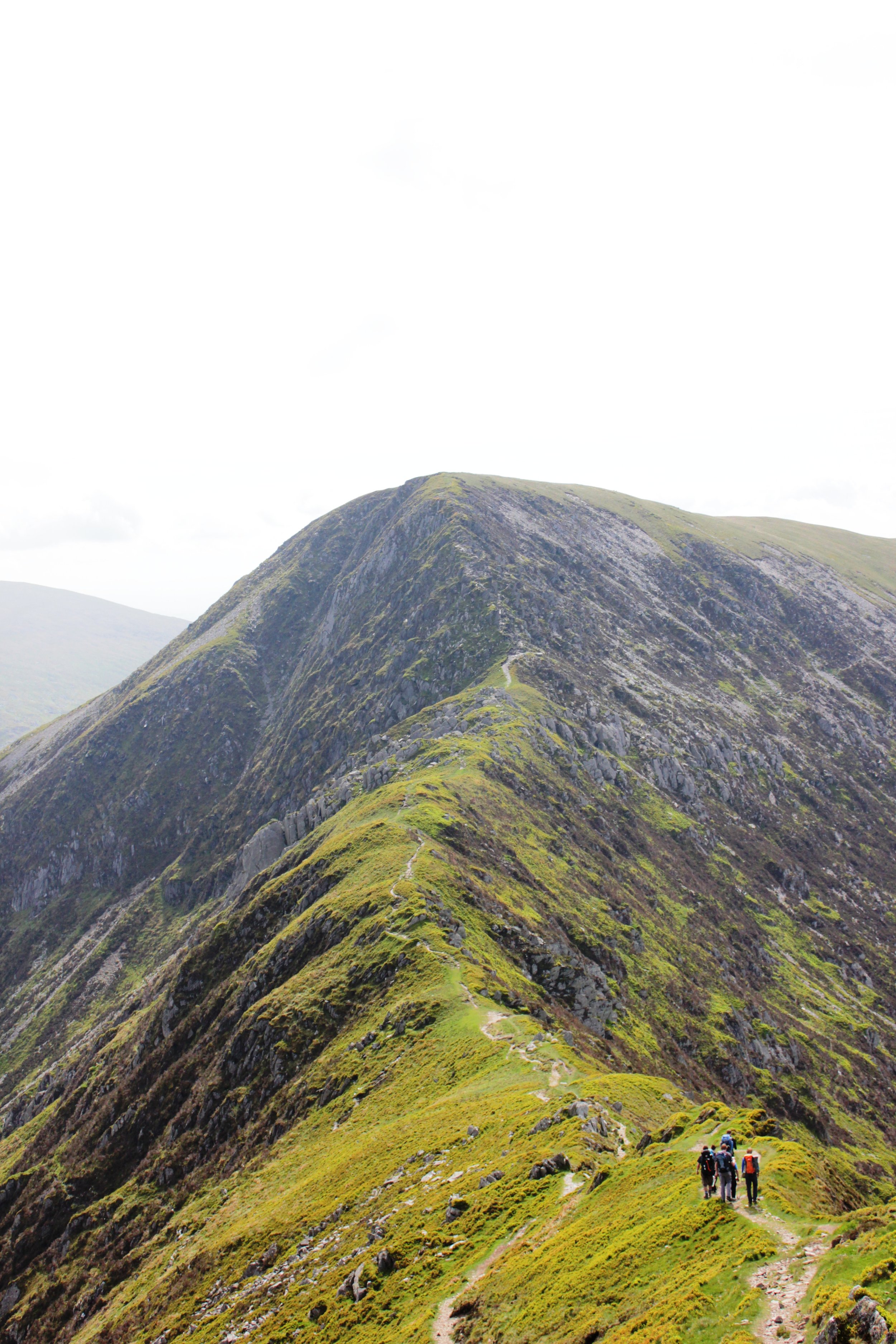
Heading up Ben Lawers was equally quick. With no spectacular views to be distracted by we headed on to An Stuc. The route up was fine then coming over the summit the track leads down a crumbling, rocky and steep path. Fortunately it was in the lee side of the wind, it was certainly an interesting route down and one I would say was much more challenging than some of the ridge scrambles I have done in the past. Making our way down we soon reached the next shoulder to make out way a long.


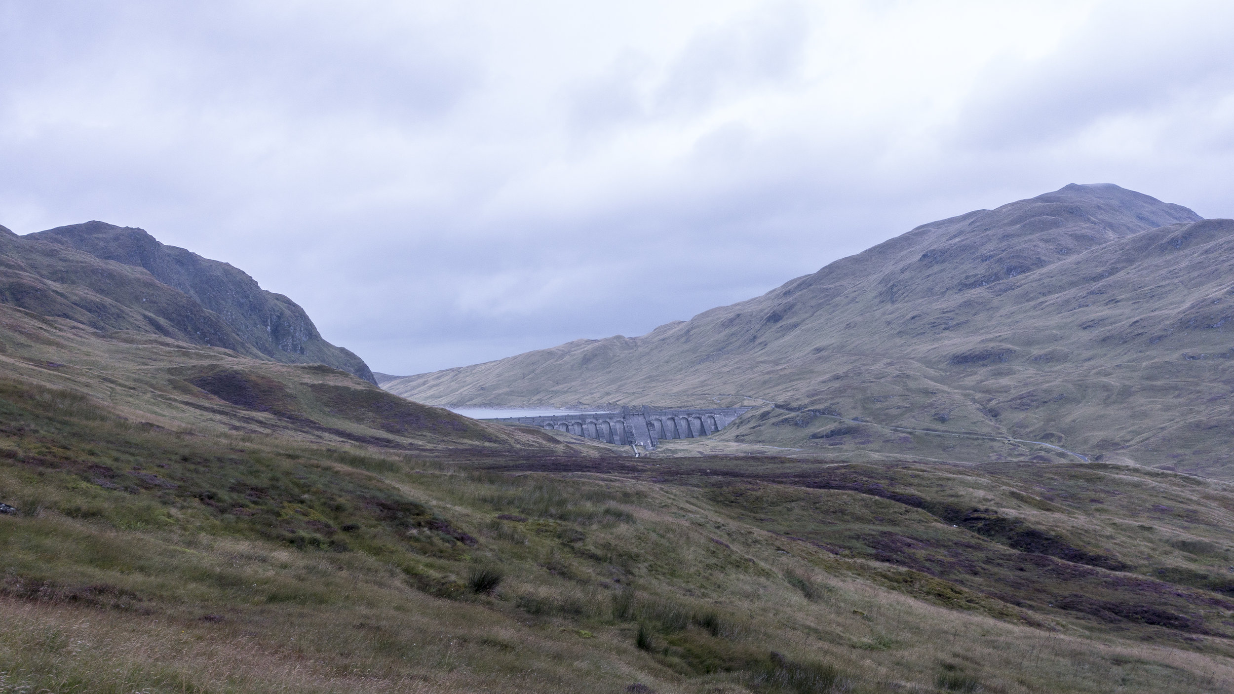
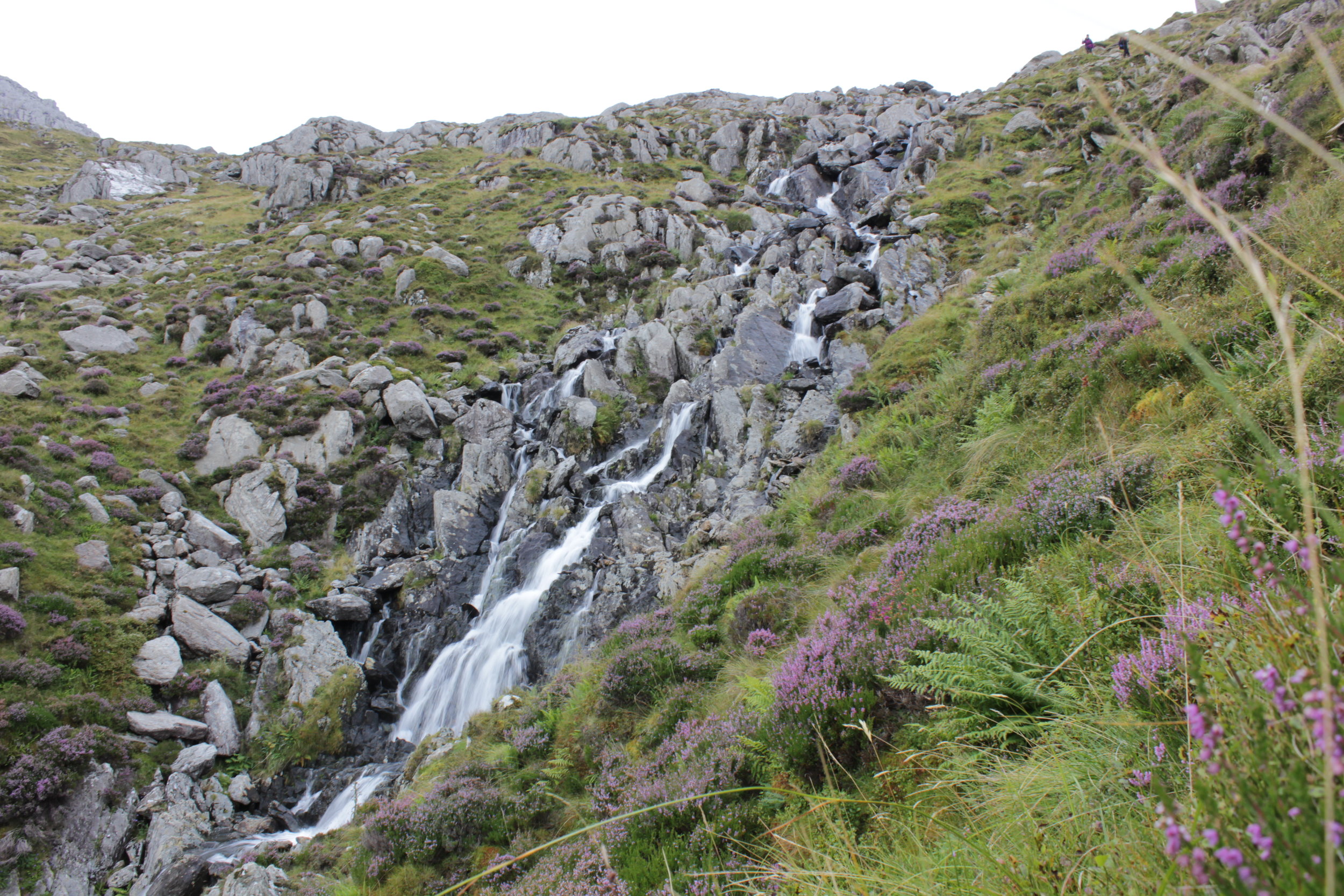
Our route then slowly took us back up to the top of Meall Garbh. The temperature had begun to drop and the wind picked up. We huddled just beyond the summit having a munch to eat and a check of the map for our route. Following a fence line almost all the way to the summit of the final rolling mounds of the last Munro of the day. This section of the route was one of the wetter and muddier parts of the day. With our boots sinking into the thick peattie mud. Some areas previous people had dropped leftover planks and fence posts into some of the more boggy areas in an attempt to create a basic bridge across. These made for a fun balancing act mid walk. Marching on up the final ascent we reached the top where we were finally below the cloud level and could admire the route we had take along the ridge line. A quick bite to eat before dashing down the hillside to a small track servicing a number of mini dams along the hillside. It was an interesting network of mini dams spread across the all the main tributaries and redirecting the water back to a few main dammed up areas. It was pretty impressive. Trekking along and soon the heavens opened. After being dry most of the day we were soon walking a long hoods up and very much looking forward to a hearty evening meal.
We had been using a cicerone guide to the region which suggested taking a beeline traversing around the hillside along a back to the car park. In principle it was a good idea. It was the most direct route. However once we started it proved to be slow going. With a number of small ravines to negotiate along with the sodden ground our boots and clothing were soon clean of any mud. My ankle still recovering from the previous event didn't appreciate the unevenness of the ground and despite the drop in height we opted to get into the road as soon as possible before regaining the height. In retrospect it might have been quicker heading all the way down to the loch side before heading back along to the turn off.

Making back to the car we were one of the last out of the car park. It had been a fantastic day. Although we weren't initially sure about heading round the full ridge it was certainly worthwhile.

Munro's:
An Stuc
Beinn Ghlas
Ben Lawers
Meall Garbh
Meall Greigh
Although the week hadn't gone quite as we had planned we had achieved between us the total of 30 munros in a week as part of a celebration for our 30th this year. Made me really appreciate the effort that it would take to take on something like the bob graham or the Ramsey round.
Weather is on the Change
Looking at the mountain weather forecast for the coming days was not great reading. Cloud free summits at between 10% and 30%, rain heavy at times and wind speeds hitting gale force levels as the days went on. Perfect Scottish walking conditions.
The plan was to go for 4 munros for the day. Heading up the valley we soon spotted a vey clear path on the opposite side of the river to the part we were walking on. Our track soon came to an end as we trudged back to the start.

Finding our way through yet more wet sticky bog to reach the path we had seen became an interesting challenge in itself with elements of the route feeling more like a series of small streams. We finally made it onto the path and route up the valley we had spotted previously. It was also at this point that we spotted the route we could have taken if we had continued slightly further a long our original route on the other side of the river.


All about us small streams trickled off the mountain side allowing us to stop for an occasional drink from these whilst basking in the sunshine. It was starting out to be a glorious day. Heading up the onto the saddle between a few hills the wind hit us. Clearly we had been sheltered by this in the lower valley.
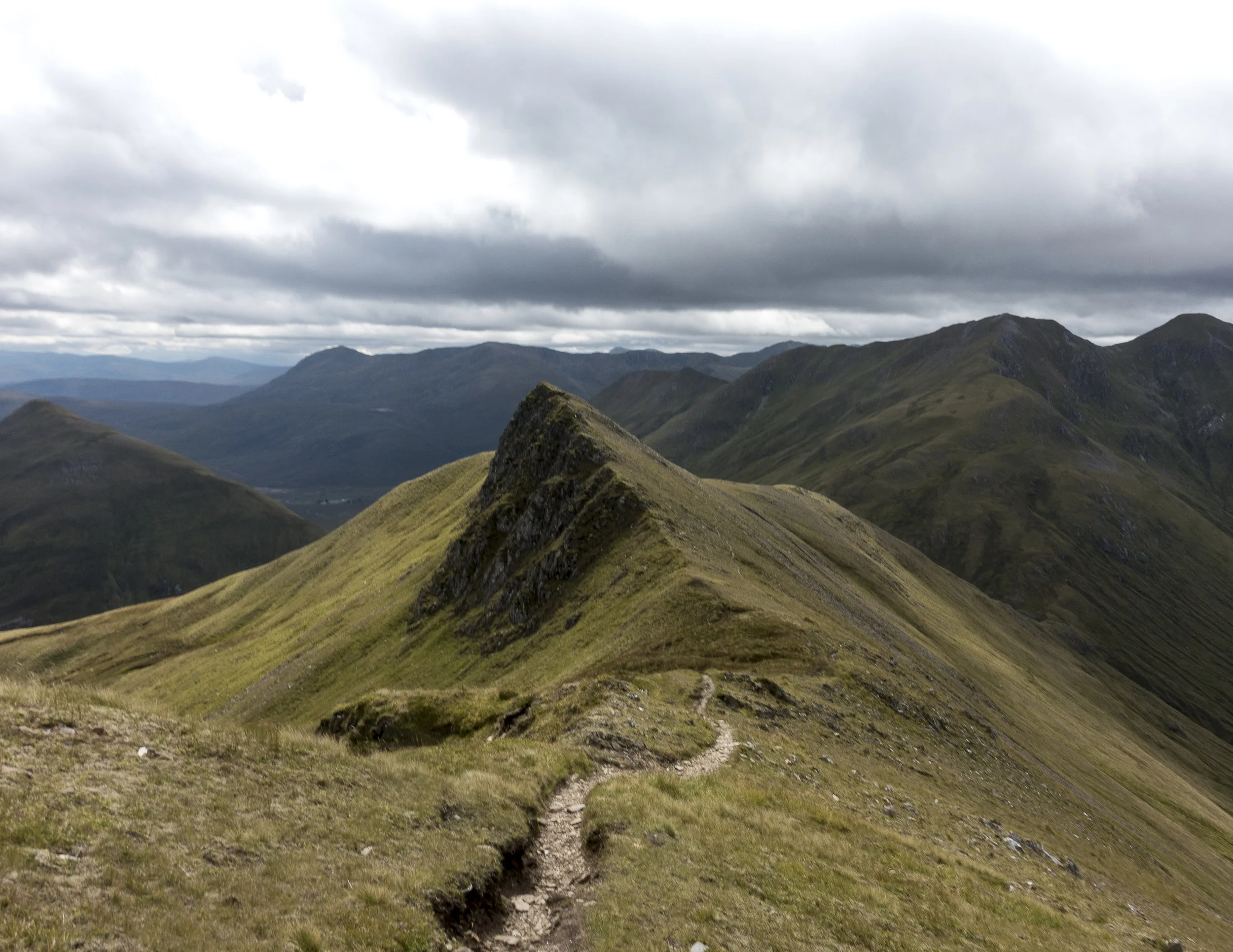
A head of us lay a large swathe of boggy ground before the initial ascent of ciste dubh. The start of the route zig zagged its way up through soft, thick brown sludge. As we came over a crest of the main ridge taking us too the top lay in front of us. It was a spectacular sight.
Overhead the clouds were beginning to build and the wind pick up. We continued trudging on up with a shear drop to one side and a steep slope to the other and views over the nearby lochs it was building up to be the favourite summit of the tour. The thought of these being snow covered and skiing down these slopes would be incredible with the right conditions.
The final part of the ridge was marked by a series of false summits. Each once getting our hopes up before another peaked its head above again. Finally reaching the top, the views were spectacular. After spending the previous day on a ridge line being on a single Munro surrounded by the other peaks was incredible despite meaning we had to go all the way back down before making another ascent.


Despite some of the challenges on the way up, the down was remarkably quick. And we were soon heading up the other side, a steep grassy slope towards the next summit. The winds were really beginning to build up and we only stopped briefly at the top before heading up toward the next summit. As we dropped onto the saddle the winds would increase until we were back into the shade of the ascent. Each time we got buffeted by the wind the temperature would plummet.
We were on a role but as we made our way towards the third summit of the day the wind was beginning to be a considerable force which with a considerable drop on the down wind side was certainly less than welcome. The winds were due to pick up to around 50mph. With this beginning to occur and a natural route down off the hills we made the decision to call it a day and head down.
The route off was initially a lot better than the previous day with a gentle decent back into the valley. This became less than ideal as we hit a fenced off wood land. Skirting round this was definitely possible but the ground was sodden and despite the wet weather a number of bugs and beetles sought refuge in our clothing, faces and hair. You could feeling them crawling all over us. Each one raising a number of expletives as we were attacked from all angles and our feet sank deep into muddy puddles.Hitting the main road was a delight.

Despite our delight it was short lived as we became shocked at the amount of rubbish that lay just next to the roadside amongst the beautiful highlands.

Don't leave a trace.
Munro's
Ciste Dhubh
Aonach Meadhoin
Visiting far places and cycling Great Glens
After a day of enforced rest due to yet more high winds. We opted for a tour to the furthest westerly point in mainland UK. Ardnamurchan.
This gorgeous peninsular involved a short ferry trip before creeping along the roads that meandered along the coastline. It was gorgeous particularly as the colours were changing as autumn approached. Behind us lay a bank of cloud while the sun shone down on this peninsular.


We finally arrived at the end point. A lighthouse perched on a rocky outcrop and protected on all sides by stone built walls. We even became aquatinted to the local goat population. Before heading to a nearby beach to enjoy the white sandy beaches of Scotland. Almost like Barbados just a tad on the cooler side of things.


The next day we woke early from our cosy glamping hut at wigwam. Our sights set on some nearby hills. Coming to our first option the wind began to increase and so we adapted our plan to a nearby summit. Later we found out this one was renowned for being windy. Making our way up the wind was increasing dramatically and the cloud level dropping. As we got closer to the top and with and the wind increasing substantially I thought it wiser to come down rather than to keep slogging for the sake of it. We managed it a few days later under slightly calmer conditions. The route up would have been ok particularly as the slightly more technical part of the route was in the lee of the wind.

We made up for it with a fantastic cycle from Killin to Lochearnhead along a fantastic cycle route. The going was great heading quickly through the valley past streams and squeezing over cattle grids. We came across a Canadian cycling round Europe and was looking to head further north before it became too cold we headed our separate ways wishing him luck. With only an occasional shower and with the sun poking its head out we could enjoy the change of pace. Turning round we realised it had been a bit more of a downhill than we realised and the wind had been behind us. It was going to be tight with the bike hire place shutting. The last mile we lost our luck with the weather and it chucked it down.


Finishing up we headed to our accommodation for the night. With views over the loch it was a gorgeous setting despite the clouds.
We certainly felt fresher for the more relaxed day and the cosy accommodation.

Munro Bagging
c43a1977
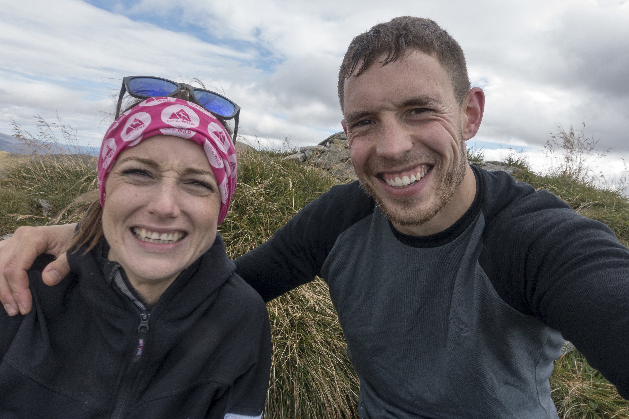
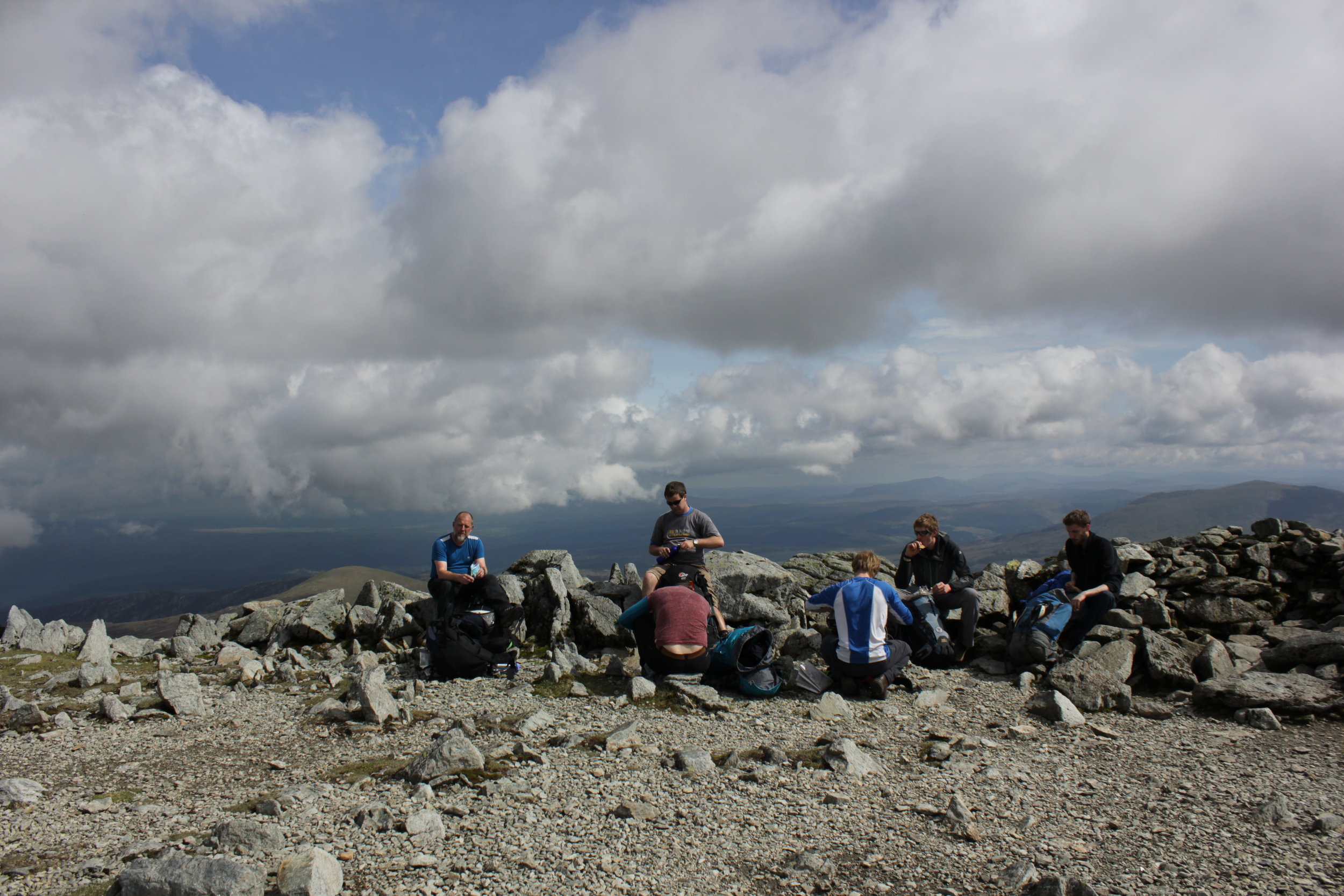
We started the week with an ambitious plan of routes, with the aim of bagging as many munro's as we could whilst meandering our way through the Scottish highlands. We had slight trepidation with the weather set to change for the worst. After a couple of weeks of good weather and the bank holiday on the horizon it was a big ask for a further week of dry weather.
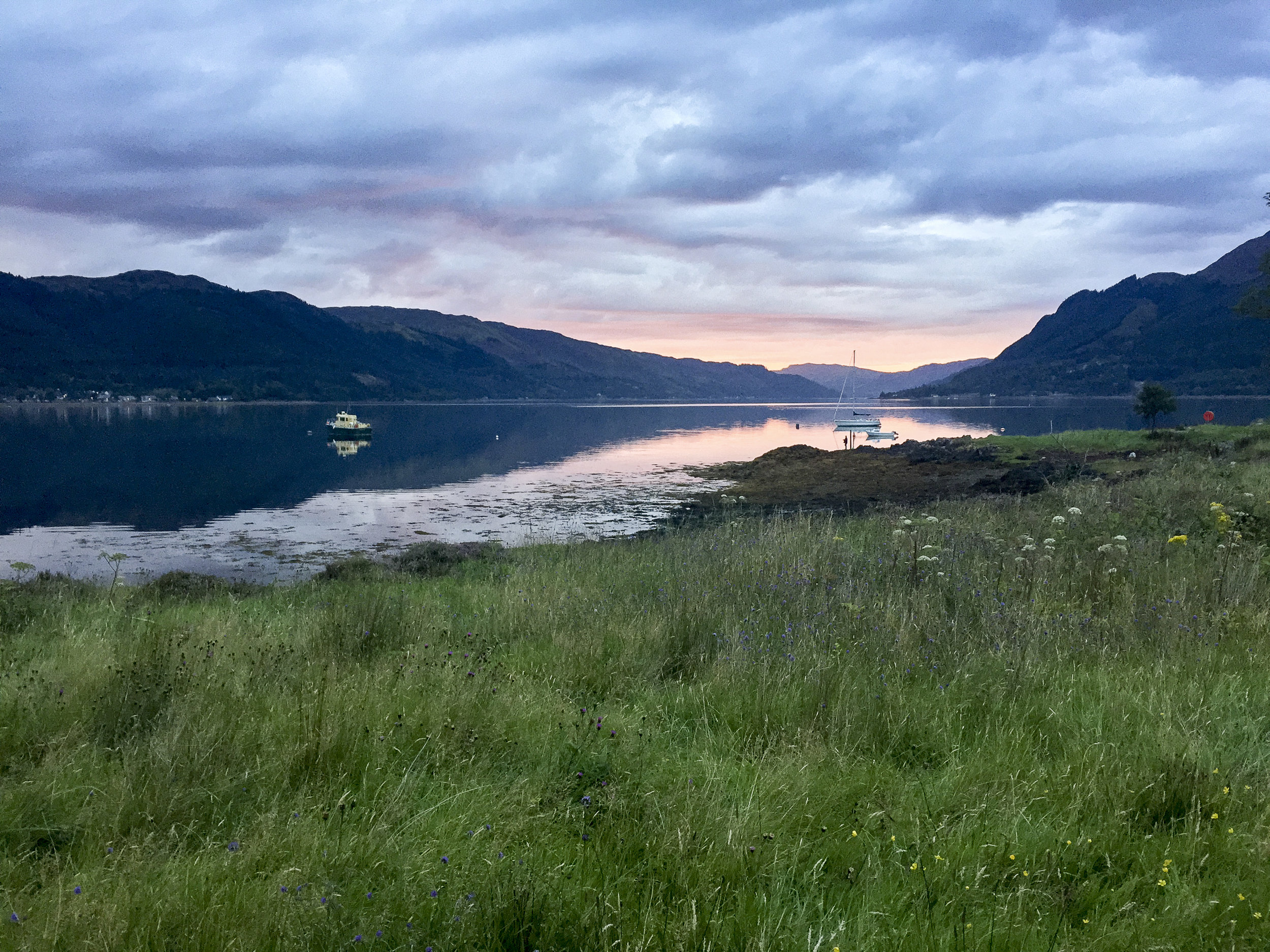
Setting off for the most northerly point on our quest in our trusty Landy towards Glen Shiel and the gateway to the Isle of Skye. Arriving to a glorious evening where we ate at the nearby pub over looking Loch Duich before preparing for the next days long outing.
IMG_4772.jpg
We woke the next morning to an autumnal feel. Dew glistened on the grass and leaves whilst the colours looked like they were changing to slight hues of reds, oranges and yellows. It was looking to be a perfect day for a walk. Arriving at the start point we noticed a few other walkers covered from head to toe as if it was a freezing day. Getting out of the car we soon realised why they were covered as the Scottish midges were out and descended on us as fresh targets. I was nibbled within the few minutes I left my arms exposed.

IMG_4784.jpg
To escape the midges we quickly departed the car park and headed the meandering path towards the foot of the first munro. With hardly a breathe of wind we could hardly enjoy the view for a moment before they descended on us again, trying to nibble any exposed skin. The path began to zig zagging its way up onto the ridge line where we were to follow for the day.

DSC04715.jpg
Seven munro's stood before us on the South Glen Shiel ridge. Each hidden by the one before preventing us from seeing our finish point, which we were very thankful of in many ways. The day turned out to be a scorcher as our water began to run low and we certainly heated up. Each summit was a mixture of rounded tops to the odd scramble. Despite this we met a few other walkers including a group on very good form despite not liking the occasional element of exposure.

DSC04736.jpg

C43A1972.jpg

IMG_4788.jpg

DSC04719.jpg

DSC04708.jpg

C43A1975.jpg
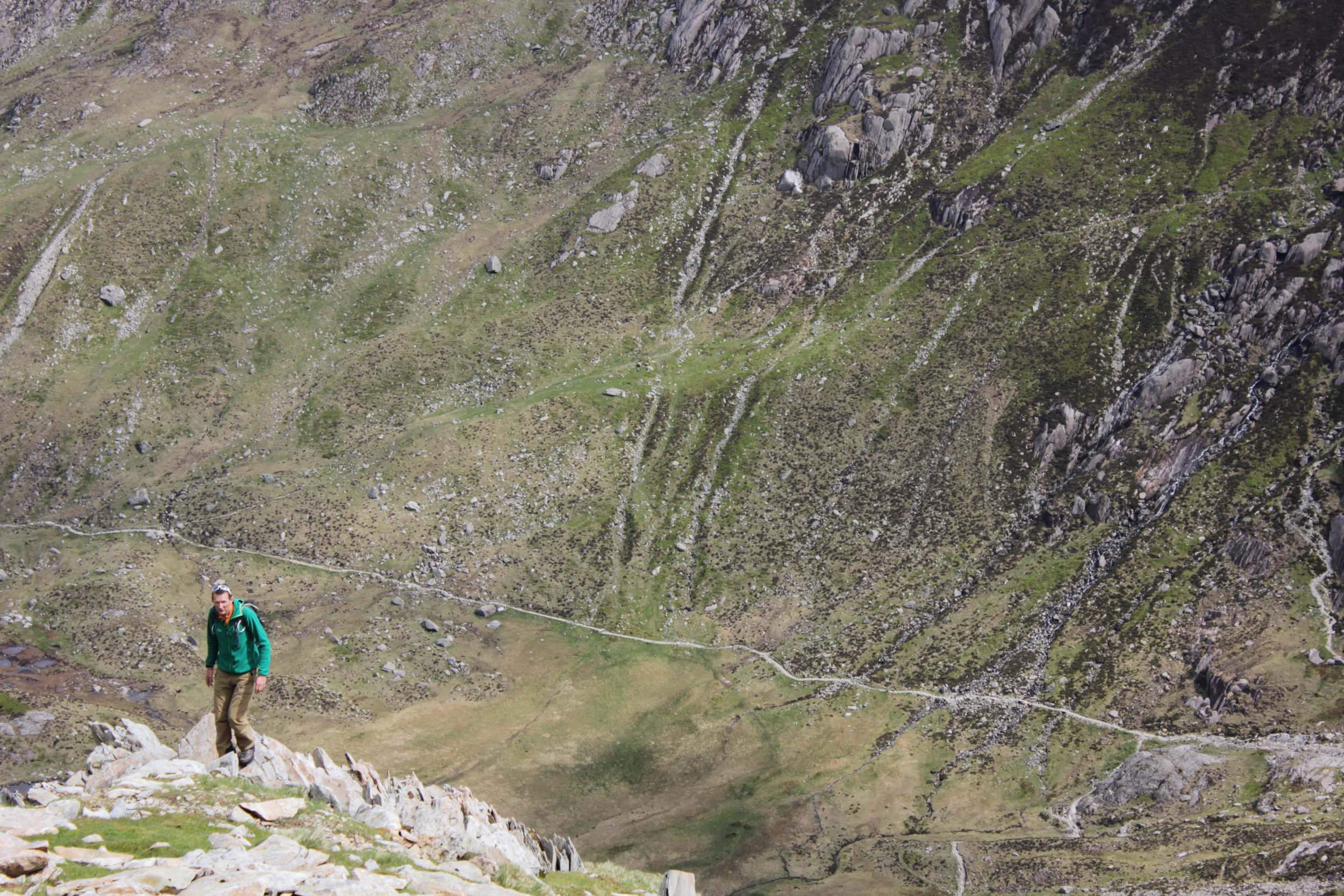
After a day of relatively good weather the final summit clouded over. With the guide book advising on a more direct route down to the main road we made a bid in this direction and soon picked up the start of a rough path. This however disappeared clearly at a point where people either turned back or everyone took on the ethos of "everyone for themselves". Making our down steep boggy ground with no signs of it finishing. Until we came across a sheep track that meander alongside a beautiful stream where we could top up on some more water. Not without its challenges as the bottle top fell off and floated down stream before securing it with a walking pole before it descended the next small water fall. The final section finished with a small detour through woodland. Slipping and sliding our way down through the wet under growth before arriving at the road side. We had been joined by a couple from Edinburgh for the final descent who we had a quick celebration with before attempting to hitch hike back to the cars to finish the evening.

img_4797
The pint of coke in the bar never tasted so good.
7 munro's down:
Creag a' Mhaim,
Druim Shionnach
Anoach Air Chrith
Maol Chinn-dearg
Sgurr an Doire Leathain
Sgurr an Lochain
Creag nan Damh

Screen Shot 2017-02-04 at 22.25.40.png

Scottish Ski Touring

IMG_3178.JPG
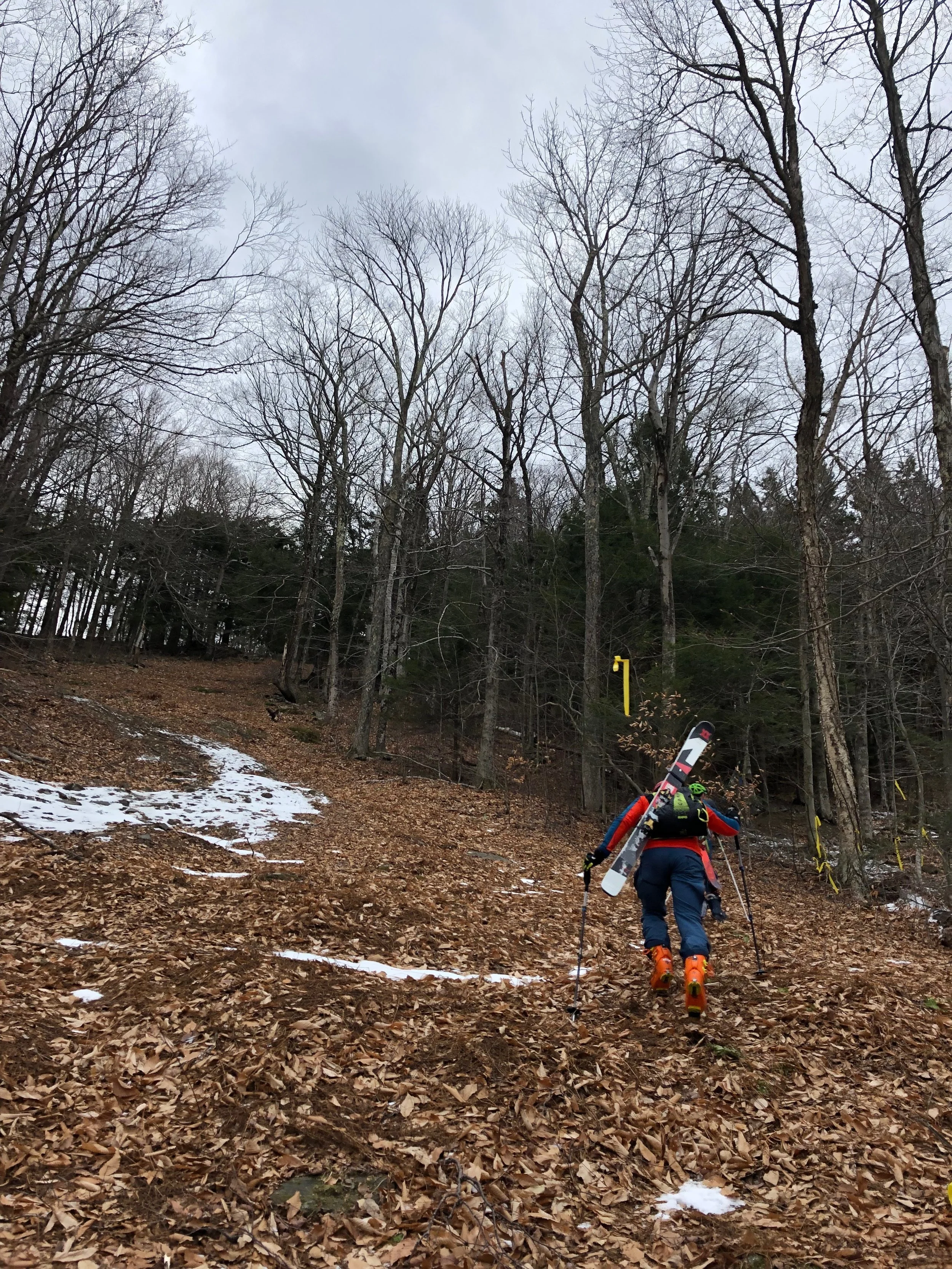
After much deliberating over the last few years I finally took the a spur of the moment to get some ski skins after chatting to one of the team at a local ski and mountaineering shop in Perth. For those who haven't heard of these, it is a material where all the hairs lie in one direction so when stuck to the base of the ski they allow the ski to slide in one direction but hold in the other. Along with a touring binding the whole setup allows your foot to pivot up and down so you can trek up hill.
The first trial trip was just at the end of a beautiful days skiing at glenshee however this coincided with the wind picking up. With the temperature plummeting and the skins flapping around I learnt a lot about the equipment and using it in poor conditions. Some of which I should have checked in the warmth of the house! The short notice of good conditions in the hills meant for a quicker trip and slightly rushed prep as I cut the skins to shape at midnight the evening before heading off.

IMG_3730
After the initial delay I was off. Gliding along the snow, over snow drifts, heather, ice and rock. I was rewarded with views from the high point across the valley. You could see the snow line across the valleys and the winding road up to glenshee. The nearby stream gleaming in the sunlight. All topped off by a great ski down. The little bit of effort rewarded with untouched Scottish powder, not quite the depths of the alps or further afield but powder nonetheless. I passed a couple making a similar journey up the hills.

IMG_3191
The second outing was much better with perfect weather and the snow was due to be good in bits despite the recent warmer conditions. Being in the hills covered in snow is a beautiful sight as was meeting a few like minded people up there. I stopped to discuss route options and snow conditions with a fellow ski tourer. It also gave me the chance to cool down despite the cool breeze I was vastly over dressed for the constant trekking and "warm" weather. If it had been the arctic I would have definitely been sweating far too much. As it brought back memories of the tougher days we had whilst trying to minimise any sweating to an absolute minimum in order to prevent our clothes from freezing.
IMG_3195
Some of the more exposed slopes were quite icey. I don't mind skiing down ice but skinning up hill in a zig zag fashion makes the turns quite interesting. Still perfecting my technique I slid back occasionally on the turns as I shifted round.

It was slightly gutting every time about the loss in hard won height despite it only being a tiny difference. Once at a decent height it was time to head down hill. Skins off, realising I had forgotten the gauze that makes them easier to pull apart, I packed them away eager to hit some fresh snow. Heading down into some of the bowls the skiing improved and I could carve out some turns down the hill between clumps of heather. Before slowly making my way back to the car.
It was a great experience learning a new skill but there is the greater satisfaction knowing you put in the hard graft to experience and reach the area you wanted to ski in. I learnt about how using normal ski boots although does work is not only much heavier but you don't have nearly as much flex in the ankle which ended up giving me a couple of blisters.
End of a good day

IMG_3185 (1).jpg
Despite skiing in Scotland being a bit of an experience compared to the likes of the alps. It often involves some rock, streams and heather avoidance. Its close, you can get some incredible conditions particularly if your willing to put some effort in and I will certainly be doing it again! Skiing and ski touring in particular in Scotland is certainly on the increase with the snow lasting well past spring if your willing to go away from the ski areas. As well as allowing you to visit areas with potentially more snow and certainly a lot less skied on gives that adventure and exploration experience.
If you have some ski or other touring experiences why not share the story or the pictures here or on Instagram #Mytour
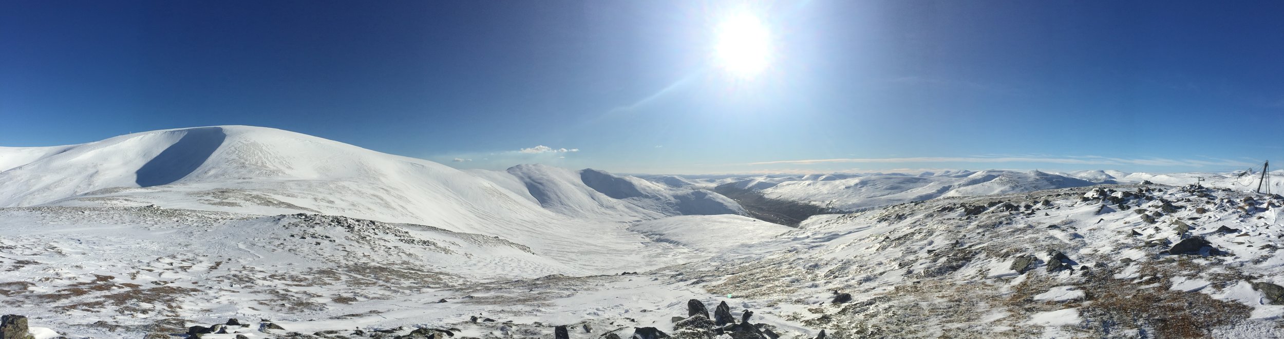
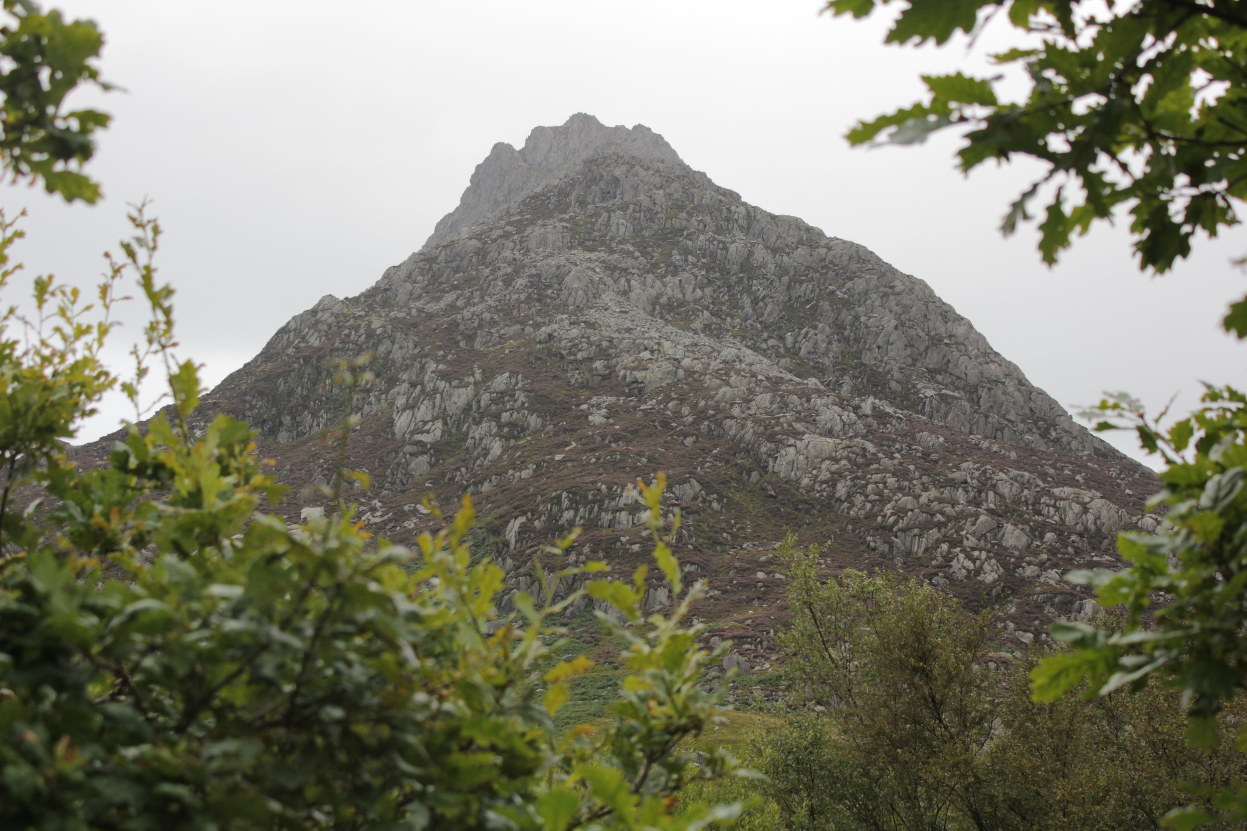
Scambling Tryfan
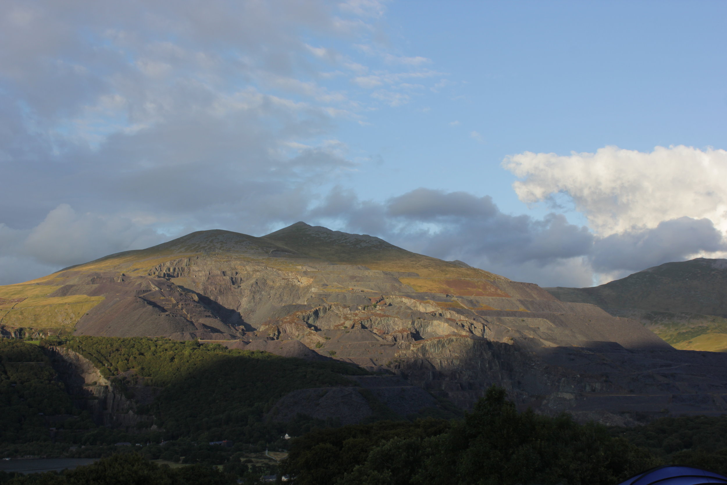
LLanberis Mine Opposite the campsite
Following a better nights sleep due to us not sliding down the hill, we woke to a beautiful morning, unfortunately it was not due to stay that way.
Heading into Llanberis and we hadn't decided exactly where we would head but first thing first was breakfast and sorting out some new boots due to the fact that they had completely stopped being waterproof. Not ideal during the welsh summer. Joe browns outdoor shop turned out to be a great place for kit and advice. We had soon narrowed down the selection on both the boots and our route for the day. We had decided to go for the classic Tryfan ascent which I had described to Laura as not much of a path and a bit of a scramble. The whole thing can be a good scramble if you choose the right route and equally certain parts can be a full on climb or a gentler route up. So there is something for all levels.
Our route to the car was slightly diverted to a shop packed with honey, I had never realised there was so much choice. We found ourselves being given a master class and tasting by one of the bee keepers from numerous different jars that covered the counter. Each one had its own distinct flavour and he could tell where the bees had sourced it from as different flowers had come into blossom. Not being able to resist I came away with some tasty souvenirs. Definitely worth a visit if you are in the area. You can check the place out on the link below.
http://www.snowdonhoneyfarmandwinery.co.uk/
The weather started off not looking to great with a bit of a shower but it soon cleared enough that the heat of being in waterproofs far outweighed the slightly damp weather as we scrambled further up the route. We started at the same point as another couple but within moments had opted for different routes each preferring the look of a different part of the mountain. Its part of the beauty of tryfan there are a huge number of different routes you can take depending on how adventurous you are feeling.
Tryfan a head
Each turn we took we could choose a variety of different routes which made the journey all the more fun, sometimes heading up a section to turn back and sometimes forging on. What became very noticeable was the degree of adventurousness improved as the rock dried out and our appreciation of what we could do changed. We also invariably kept crossing paths with the original couple at the bottom of the hill. Making parts of it seem a bit like a race. I am not entirely sure they were thinking the same thing....
One of the first highlights of the day was coming across this huge sticking out rock that we decided to clamber on (find out what it is called)

Yoga on the Mountain
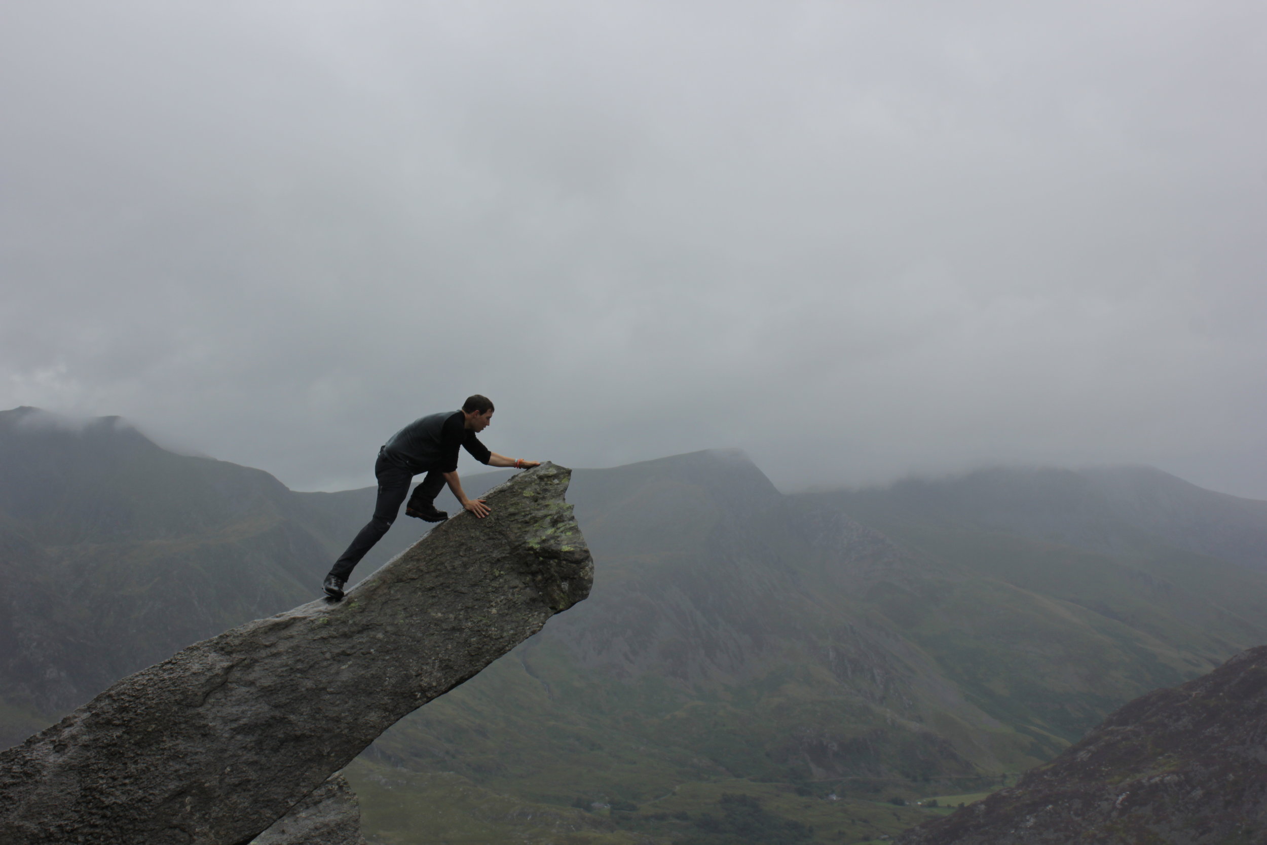
Having a closer look
Heading on up and the ground flattened out before sharply rising upwards. The route we took skirted round the side of this. It followed a small track round the side with a steep ish drop to our left down grassy gullies. We could watch climbers coming up the side of the mountain which was amazing to watch as the occasional head poked above a rock.

With dog in tow
Weaving our way round we found ourselves at the bottom of a gully with a number of people and quite unexpectedly a Labrador. As we clambered up finally passing them we ended up having to go back and give the couple a hand getting the dog up the route. It wasn't an easy situation with both the route ahead and behind being very difficult for the dog.
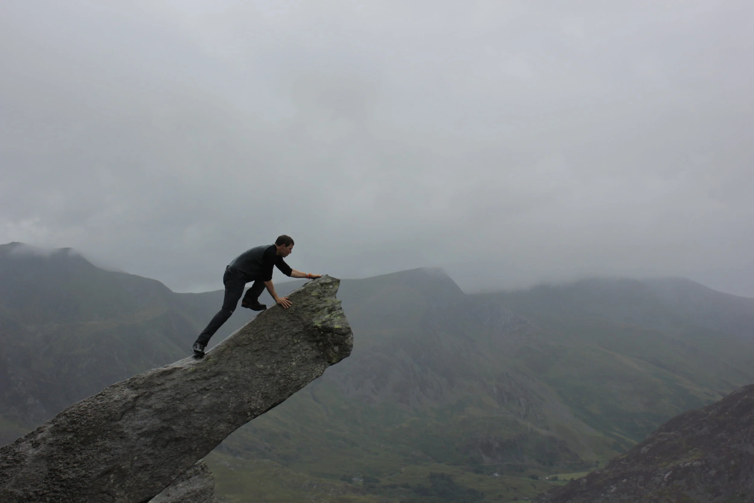
Coming out the of the gully and we were at the top confronted with the stones of Adam and Eve. People were already on top of them and jumping between them. After a drink and some well needed food it was our turn. Looking down from them and they certainly felt a lot higher and the gap wider!
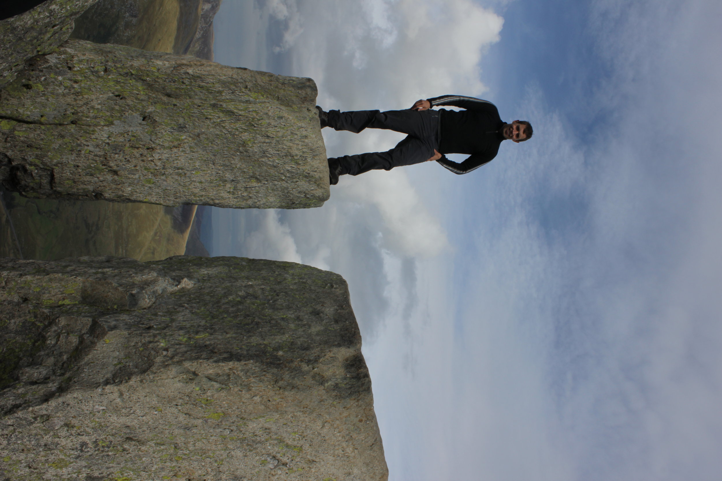
Preparing for the Jump

Adam & Eve at the Summit
We continued on down the mountain scrambling away as we picked our way down to the path off the hill. You can link it together with the glyders which would be a really good walk but that would have to wait for another day. The environment and surroundings constantly changed as we descended; from the craggy rocks, to heather and finally to a well trodden path with streams merging together. We found ourselves coming out further from the car than we had wanted so finished up along the road before that great feeling of switching boots for flip flops.
IMG_0227
Our search for food that night started at pizza and a pint but due to it not being open settled for a fantastic pub filled with people and massive portions.
The next day we woke to a cleared out campsite as people had left due to the weather turning bad. Due to me mixing up the breakfast order we found ourselves on breakfast round two. Back at the honey shop for welsh cake! Certainly not a disaster.
With the rain set to continue and a long drive a head we detoured to the slate mine with some huge zip wires. Unfortunately both that and the tours of the mines were full. We found ourselves wondering around checking out the area before making the long and incredibly wet drive back down south.
Check more of my photos out from the trip below:
https://www.flickr.com/photos/bennorawlinson/sets/72157646928749422/
Mountain Leader Expedition

The final stage of the mountain leader training course is a 2 day expedition, with the aim of bringing together all the elements that had been covered into a more realistic scenario. Fortunately for us (not so good as a learning experience) the weather was due to be on our side, with predictions of glorious sunshine and little to no rain. The next morning after a large fry up in what became a rather smoky kitchen, we sat in Pete's cafe with large mugs of coffee to present Mat our mountain guru our idea. The place was filled with walkers, climbers, bikers and basically anything else outdoors in a whole assortment of clothing from leggings with flip flops to big puffer jackets. All of us planning, dreaming and thinking of the upcoming days activities.
He made a couple of small alterations to give us more options on the night navigation as with the weather forecast we weren’t going to be able to demonstrate our skills in poor conditions. We drove out to the starting point where despite all the reports we had watched and read it soon began to drizzle. Typical British/ Welsh weather.
changeable conditions

A misty summit
With the first point marked on my map case we were off. Slight issue as instantly the point was in a different place due to the case and map shifting in opposite directions, I quickly gave up this approach. We started making our way up into the hills each of us taking it in turns to lead to the next point, choosing the route, checking the time it would take. The aim was to head up towards Carnedd Llewelyn before dropping down into a wee corrie called Ffynnon llyffant. Although we knew this was the plan, after the first few points where everyone knew the direction, the remainder of the day was spent either leading to a random point or following and then trying to work out where we were.

Carnedd Llewelyn - wee loch on the right of it is our camping spot
Arriving we soon discovered one of many aircraft wreckages that litter the hillsides in the UK. We later found out that some people go out on walks to try and find these wreckages instead of always aiming for a summit or similar fixed point. After finding a suitable place it was time to set up the tents in this beautiful spot. Wild horses, including a foal and a rather aggressive white horse charged up and down the valley as the sun began to set. With it getting closer to the longest day we were in for a long wait for darkness as food was cooked, eaten, washed up and slowly more clothes were worn as the night began to cool.

IMG_9080

Plane parts scattered over the area
Finally dusk was setting in so with head torches at the ready and maps in hand it was time to head off into the darkness for a night navigation session. It was at this point the lack of light coming from my lightweight head torch became more evident as it's glow just about made it to the ground in front of my feet. Having not done much of this it was a really different challenge working between points on the ground, counting footsteps, timing the route and compass reading all in aid of reaching the right final point. As the night progressed we developed from the specks of light over the hillside as our group dispersed in different directions to more of a single glow as we converged on our destination. As we got closer to camp our thoughts became more wrapped up in the thought of slithering into a warm sleeping bag. The almost full moon certainly helped in taking in our surroundings once the head torches were off, to reveal a crystal clear and starry night.

Night Navigation area
The sun glowed through the tent as I stumbled out of it for a bit of breakfast, freeze dried curry. What better way to start the day than by a wee corrie loch, sitting on part of the old aeroplane wing and eating curry with the sun rising up. The plan for the day was to take it in turns to navigate point to point out of where we were, heading back towards the cars.
We weaved our way along the side of a cliff face before heading up a gully towards to top of the peak. Passing a variety of plants Matt pointed out the different varieties. Not realising this was part of the assessment I just assumed this was just one of his interests until he started recommending different topics and books that would be worth reading up on. At which point the penny dropped, part of the final assessment is showing your knowledge of the local flora, fauna, history or geology I believe. Probably need to check this out before I finally do it in more detail.
The route took a beautiful stretch along a ridge line where we stopped to take in the views, have a quick stop for a bite to eat and some photos. This area also gave us the chance to test our risk assessing abilities over rockier ground with larger packs on. It was certainly a different challenge when you have a larger weight on your back and feeling a lot more cumbersome.
IMG_9119 v2
I did find the experience amazing as compared to a 2 day mountain marathon when speed and light weight are the essential ingredients the slower going meant we spent more time on our feet and ended up carrying more weight despite the journey being the same length as the need for more layers and the odd luxury makes a big difference which soon added up in more weight.
Happy Campers
The other big difference I found was moving compared to navigating point to point over large distances and generally to obvious features in my running to much more micro navigating to very specific destinations or features.
The final section for the day was not so much a slog but more a random straight line through bracken, streams and a long sheep tracks before arriving at the final point of a cafe by the car park for biscuits and a coffee. The course had certainly been a success especially in terms of working out what I needed to work on. The next stage is to get more time in the hills in a variety of weather condition, more to come on how this goes.

Mountain Leader Training in Wales

The area for the day
We spent the evening driving over to a hostel called Pete's cafe which has a well deserved reputation for huge breakfasts and a bit of a Mecca for all things outdoors in North Wales. Compared to the last hostel of having an entire flat to myself it was time to go back to a shared room. It was a beautiful evening, a ripple less lake with the back drop of the setting sun basking the hill tops in golden hues. Apart from around the bobbing orange head as one of the group opted for an open water swim. The rest of us chose a cold beer, should have taken my swim shorts!
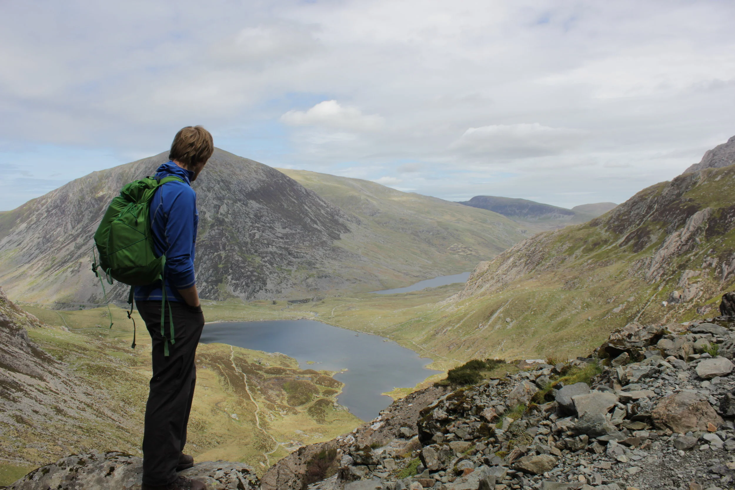
The next morning we sat in the hostel drinking large steaming mugs of coffee and pouring over maps, before deciding on where to go. Parking up outside the National Trust centre at Caneddau and Glyderau with large slate stones marking the start of the path. Heading straight up into the Glyders towards to top of Y Garn.

Views part way up
The objective for the day was to put into practise our risk assessing of groups on scrambling terrain, with the idea being to understand when assistance was required and in its different forms. After a few alterations to our initial route we weaved our way onto the beginning of the ridge. We came to the conclusion (admittedly it had been pointed out to us before hand) on the importance of route planning from a distance by using what you can see of the terrain as well as hints from the flora and fauna. So once you are on a section of it you have a rough picture in your head of any key features or obstacles. So on this occasion if we strayed too far to the one side we would find ourselves off the ridge and if we went too far the other the ground resembled more of a rock climb than a wee scramble.

Supporting Each other up the ridge

Making it look much easier
Making our way up and along the ridge line we stopped occasionally to discuss areas of concern and have the odd snack. The weather had done a complete change and was beginning to warm up as sweat began to slowly drip from us. Arriving to the top and it was time to find the path downwards. For this we opted to find a mountain goat track.
Found the route down, somewhere to his right
From the top it certainly didn't look like a route as we tracked our way down by the side of a stream and taking it easy to make sure we didn't slip or dislodge the loose rock onto those below.
Our route down
The track narrowed as it followed the slope across the hillside with a bit of a drop to one side and water flowing down it. We finally reached the devils appendix which I believe is an area for ice climbing when the conditions are right. As it was not cold enough this provided us with a quick shower instead. Making it to the bottom beside a crystal clear lake our instructor, Dave, opted for a route that would bring together the skills we had learnt with getting groups up a challenging scramble as well as the risk assessing/ route finding that we had done previously. With some larger steps up rock faces being involved we certainly had to think a lot more and it was certainly not something we envisaged doing when we have large packs on our back. Reaching a good stopping point we turned around and repeated the process down hill. The interesting bit being that heading down the hill is much harder to do as you can't see as easily where to put your hands and feet, which if you had to do unexpectedly really highlight the point of knowing your and the groups skills. We cris crossed a stream over, down and around rocks some of the group making it look far easier than myself. All comes with practise apparently!

Checking out the valley below, it was quite a steep drop!
The nights activities was to plan our expedition. With maps, empty mugs of coffee and beer bottles littering the table, fingers traced different potential routes across the grid lines in front of us as plans began to hatch. Ensuring it would be a realistic distance to cover in the time period and give us enough potential to test our navigational skills. Each route was discussed at length as we each tried to sell our ideas. Part of the fun in all these is in the planning. That initial building of an idea into a concept and looking at try to realise it. In the end we decided to present a couple of options to our instructor the following day one of which was Matt.
Mountain leader training stage 1
Having been on the cards for a while I had the opportunity to go on mountain leader training with peak mountain training who are based up in the Peak District. Driving up with forecasts of rain and relatively high winds wasn't the most appealing to be out in the Peak District but it would certainly make for a more interesting experience!
My room in the bunk house, with beautiful views onto the hills
After the long drive I reached the bunkhouse at Pindale Farm where it turned out I was the only one in my room out of a possible 7 others. So with kit spread out I began making myself at home and although relatively basic it had everything I wanted and was comfortable enough. I woke early the next day to get all my kit ready and have a look over the map to see where I could head on my first day. Normally the course is a 6 day course but for a number of reasons outside of my control I could only start it after the first day. My plan for the day was to make a loop around the local hills before heading back. The forecast hadn't improved as I sat with my coffee cupped between my hands viewing the map but with a plan, lunch packed and kit ready it was time to go.
Planning time
The initial section was heading up a valley with a castle overlooking the area; the recent weather had turned the path into a wee stream as water swirled between the rocks and my feet.

The Castle overlooking the valley
The day was certainly one of all seasons with patches of sun mixed with rain, strong winds and hail that stung any patch of skin that was exposed to it!
One of a couple patches of sunshine
While I saw quite a few groups hunkering down behind stone walls avoiding the worst of it.
My turn to hide behind a wall
I made my way round admiring the view from each of the peaks despite it being slightly imposed on by a rather large cement factory. I finished up at a cafe full of cyclists, motorcyclists, walkers and runners enjoying a final blast of coffee and a sugar hit before heading back to make homemade pizza.

another wet evening
The next day was much more classroom focused with us learning about risk assessing both before and during an expedition, understanding weather patterns and looking at emergency situations involving mountain rescue. This was quite appropriate given the wet conditions outside. The afternoon was spent out in the hills to put into practise the risk assessing we had been doing in the classroom into practise. Heading to some of the steeper areas I had been on the previous day where we would consider the potential for an accident and the severity of it. We also practised the art of walking slowly and I mean really slowly to the point where one bystander stopped to witness the event. Stopping for a bite to eat we tried experiencing how it would feel just needing to wait around in a relatively cool day to see how quickly we would start feeling the cold. The results were quite surprising in terms of the speed by which our body temperature fell and certainly highlighted the need for the right equipment in the mountains. Heading back for some cold pizza, soreen malt loaf and setting my tent up to make sure it was all ok ahead of our expedition phase.

Day 1 sunshine

Day 1 rain and hail

Day 1 strong winds
The next day was our last day in the Peak District and it was due to be a pretty interesting one. The morning began in the classroom, planning expeditions before we decided to head to an area called Stanage Edge to do some scrambling and rope work. The emphasis of the exercise was that rope work within mountain leading is definitely a last resort but if the terrain, group and/ or conditions require it then we need be to able to do it safely. Soon we were all tying ourselves in and climbing up and down areas. For those interested it was using the remote belay using a rock as an anchor as it is designed to be safer method if anything goes unexpectedly wrong.
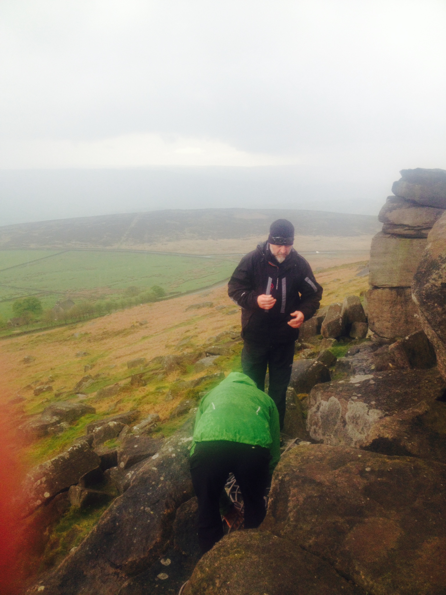
Remote belaying and the challenge of finding a suitable anchor
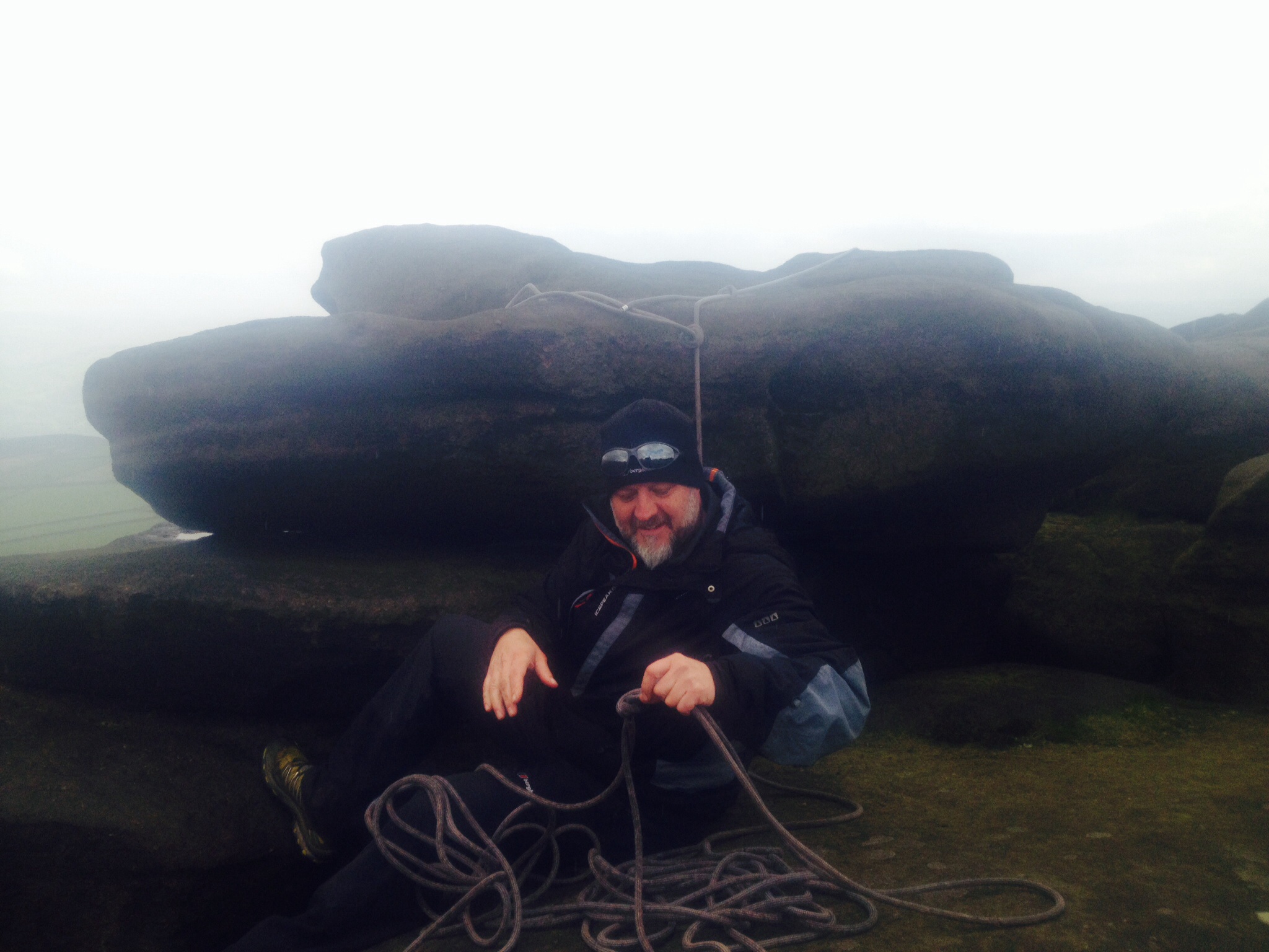
Finally in a suitable spot
Whilst standing admiring the surroundings we could make out bands of rain rolling towards our position as it rain began waterproof trousers and jackets were donned. The area is very popular with climbers particularly in the area and you could certainly see why with options of bouldering and climbing on shorter pitches. The final exercise was leading an individual down and up steep slippy terrain which was now in perfect condition thanks to the recent rain. The idea wasn’t to create the impression of danger but more act as a confidence rope. With the exercises all done it was time for a quick bite to eat and driving over to Wales for stage 2 of the training.
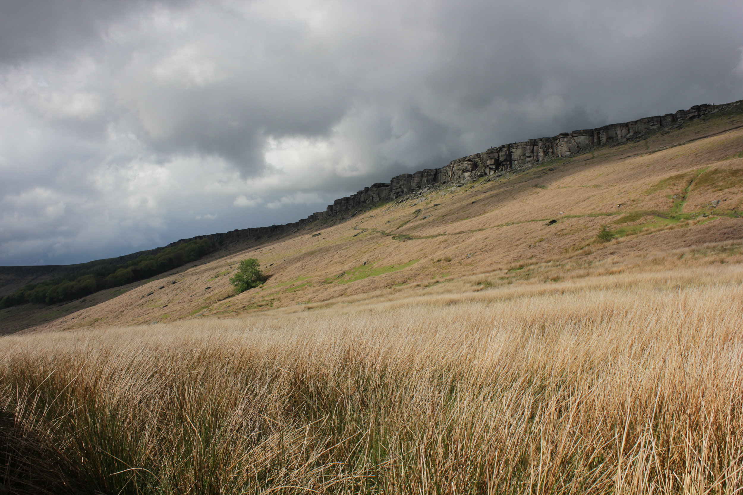
Stanage Edge on my way to Wales
Out in The Scottish Wilderness
After not racing or running much for a while I decided a new aim was needed. I wanted something tough, would only take up a weekend and was in the UK. It didn’t take long before I came across The Original Mountain Marathon otherwise known as the OMM. It is a race with a reputation for being wet, cold and tough and this year’s race was staged in the highland of Scotland between Loch Tay and Loch Earn with the start and finish near Crieff which was handy being near my home. [youtube=http://www.youtube.com/watch?v=sjWBODfduWk]
The race is done in pairs where you carry everything you might need over the weekend such as food, sleeping equipment, clothing and most importantly food. There are no water stations or food points it is very much about self sufficiency. I was competing in class B with Kov, who was one of my tent mates from the marathon des sables.
After a late night packing and an early start to catch an 8am train including a wee jog down the platform to ensure I actually made my train, we were off on the journey up to Perth. We met my parents and organised all our kit into the stuff we actually needed from the huge pile of stuff we had taken up. My dad made an amazing and vast amount of pre-race spaghetti bolognaise which was quickly demolished before heading up to Crieff the night before the race. The camp was set in a 2nd World War POW camp and after almost getting the car stuck we pitched our tent (in typical fashion it started to rain at this point) and went in search of the beer and registration huts. They had already sold out of beer.
The next morning we woke to yet more rain.
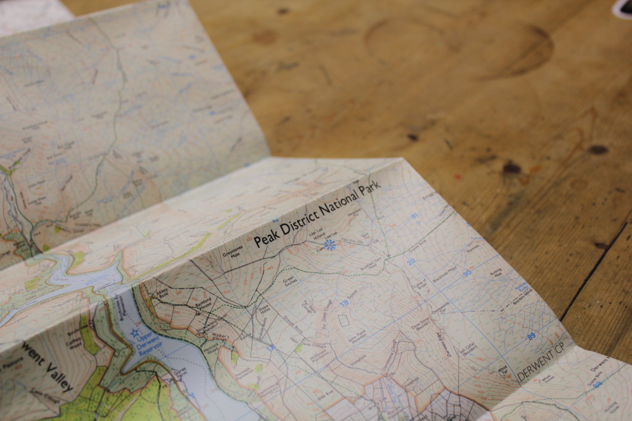
With a coach full of lycra clad people we headed up to the start line, a short drive followed by a very dubious “1 mile” walk to the start line right at the bottom of a valley not far from Loch Earn. The format for these races is that you have no idea where you are going until a minute before the start of the race. At which point you are given a map with various checkpoints which you have to reach in order but the route is up to us. The pre-race nerves began to kick in, a mixture of nervousness and excitement.
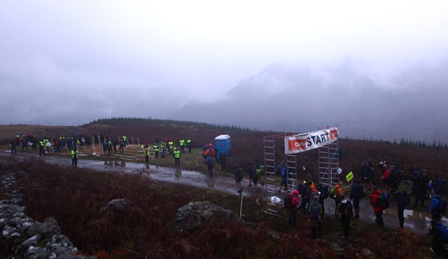
The Start of the Omm
On the sound of the horn we were off and within about 5 minutes of starting we had already gone through heather, 1 stream up a bit of a hill and my once dry, clean and white socks (bit of a mistake I admit) were soaked through and covered in mud. It was going to be a long, hard and wet day. As the day wore on the cloud level dropped making map reading up high quite a challenge. We ended up trying to follow the route as the crow flies. On the longest section this resulted in us almost scaling a Corbet (something between a hill and a munro I found out) as well as having to scramble up a fairly miserable, wet and windblown rocky section. My fingers were getting incredibly cold; it was time for gloves and hat. At this point everything was soaked and as we reached the checkpoint Kov was pretty cold too and couldn’t get his gloves on. We decided a bit more running and a bit less scrambling was needed.
We traversed round a hill side and the ground was dropping away quite steeply. It was becoming a bit more of a scramble again and resembled a hillside made up of a series of large steps but we managed to keep the speed up. This was until I came round the corner to see a map on one track and an in pain Kov a few tracks below after slipping on one of them. We made it to the finish of the 1st day knackered, elated but feeling pretty strong, despite having a bit of dip after my energy levels got a bit low. We finished the day in 28th place with a time of 6 hours 29 mins.
As we pitched our tent it started to rain the heaviest it had done all day, typical. After getting water and changing into dry kit we decided to cook and stay in the tent for the rest of the night. I found a great use for my sleeping bag, it has holes around the arms which can be unzipped to make it into a gillet (something I don’t recommend) but it was great for being able to cook whilst completely cocooned in my bag.
The night was quite restless as I couldn’t get comfortable and later on was desperate for a pee but the warmth and comfort of the tent and the rain prevented me from going. It stopped about 5 am and I decided to run for it. I came out the tent and almost fell into another which had been pitched later in the evening right next to ours. It turns out that at 5am in the dark and starting to rain again that a green tent amongst a sea of 400 or so green and the occasional red tents is pretty hard to find. I spent about 20 minutes trying to locate mine before having to revert to calling out to Kov till I found the tent. Not ideal but certainly a learning point.
As it was in Scotland they had organised a piper to play at 6 am. After cooking breakfast and trying to put off the crawling out of the sleeping bags it was time. We slipped back into our wet kit after trying to wring out as much water as possible, except a pair of dry socks the one luxury. As soon as we stepped into the morning air the wind began cooling us in the damp clothing. We trudged off to the start line slightly stiff and trying to avoid the puddles before our feet were guaranteed to get wet.
The route for day 2 was different again but took us towards the campsite from the 1st night. Although the cloud levels were higher today there were still points that were difficult to navigate particularly on a rather flat plateau. I found the day a real challenge as I ended up having a constant battle with something known as “bonking” after allowing my energy levels to drop to low. With the help of Kov and by trying to stuff as much food as I had into my mouth we managed to overcome it. My eyes and mind began coming back from the glazed over state that they had become. The day was a lot drier at least. Instead of the wet conditions though there was more up and down over some big steep sections. This really sapped the energy from our legs.
As we got closer to the end we met some others who were going a similar pace and we constantly switched positions for a while despite not knowing where each other were in the field overall. It was great to have a visual and more competitive influence for a period of time rather than just the sight of hills, heather and a point on the compass. We did go past some incredible views; one that particularly shone out was coming down a hillside to the view on the opposite side the valley of 2 huge waterfalls crashing down the hillside. We were also about to run back up that very hillside which was slightly putting off.
The final sprint to the finish was pretty sickening with even slightest of gradients feeling tough but we knew that that extra effort would pay off. As the finish line came into sight all the negative feelings went and we crossed the line together. Shuffling over to the drink station at the finish we downed a load of sweet tea, think there was about 6 heaps of sugar in mine, and some juice. As we rested it began to sink in what we had been through and achieved it was an incredible feeling and definitely something to have a big grin about. We were 13th in our class on the day, helping us to finish 20th overall.
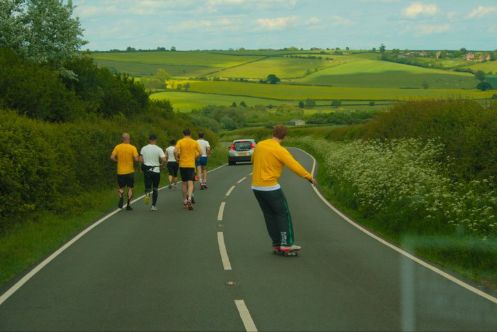
4 marathons, 24 hours -The Rampant Run
It all started the day I arrived back in the UKhaving just run 250 km through the Saharadesert. I was in Whsmiths in Euston train station on my way home and picked up a running magazine while waiting for my train. As I flicked through I noticed an article about Ed Stafford, the 1st person to walk the length of theAmazon River. It finished with an invitation to join him and other runners on a 103 mile run from a small village in Leicestershire to the coast ofNorfolk. There was a cycle race following the same course and the plan was to arrive at around the same time. It was in 6 weeks time, so I thought it was more than enough recovery time. After a couple of emails and a phone call I was in business. [youtube=http://www.youtube.com/watch?v=4kq0VvOFMMs]
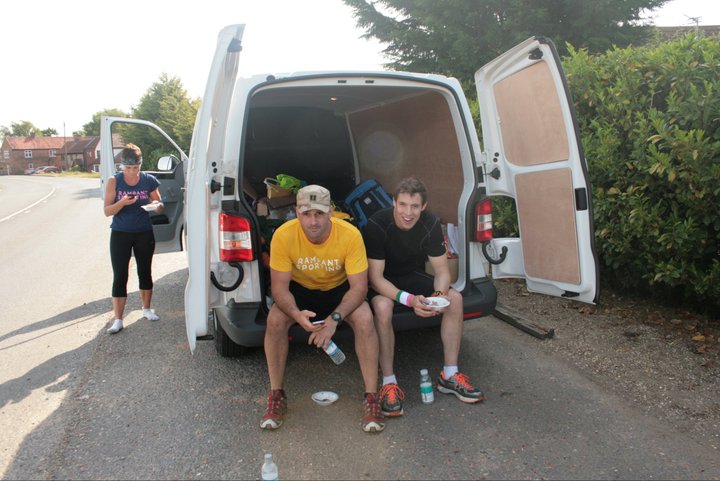
6 weeks later and hardly any running miles under my belt since finishing in the desert I was on the train to do my first +100 mile run. It had taken longer to recover but I was more than ready, it wasn’t a competition but a challenge to see if we could do it and finish. I met the other 5 members of the team (Ed, Cho, Rich, James, Charlotte and myself) that was up for the challenge and our support crew from “Rampant Sporting”. Laura and Fred had found themselves having to crew for us for the next 24 hours. After waiting all day for it to start, the start was only 30 mins to go and we still had photos to go, I had to get changed and get my feet prepared. I had left too much too late. Between photos with the local press I was hurriedly getting ready and as the others called me to start I had my socks partly on but had to shove my trainers on regardless and start as I threw my travel clothes into the back of the van that was to be our home for the next 24 hours or so.
As we introduced ourselves to each other having never met or really spoken other than the odd email it became evident that although we were all strong runners but none of us had done anything like this before. Mentally we were in a good place however it was going to be a steep learning curve.

Team Rampant
Having never done a road marathon my 1st one and with still 3 to go was certainly fast at around 4 hours 30mins. I also had the pleasure of visiting ever pub toilet along that section of road as my stomach was doing cartwheels. I wasn’t sure whether it was something I had eaten, drunk or just nerves but it wasn’t pleasant. Trying to rectify this problem on the run was pretty difficult. My stomach didn’t want anything else but I had to try to balance this with the food and water that I needed to keep performing in a couple of hour’s time. It was certainly a challenge that I hadn’t anticipated at such an early stage.
What I had learnt from my running in the desert was the lag between the choices, decisions and actions I make don’t usually have an immediately but do in several hours time by which stage it can be too late and the damage already done. Whether it is the sore spot on your foot or the amount of food and water I was consuming at each stop.
“Every action or more importantly inaction has a reaction.”
We slowed the pace, especially as one of the runners Cho became increasingly sore as he ran. He done incredibly well and run the furthest he had ever done at about 30 miles, but it was over for him as he jumped in the back of the van for some well deserved rest.

Cho in the Van
The sunset was incredible as we watched the sun slowly cross and then sink from the sky. We were eating up the miles. We seemed even quicker in the dark with no points of reference to go by other than what we could see with our head torches and the vans headlights cutting into the darkness. It was a crisp night and the music pumping out of the vans speakers helped pass the time as we became engrossed in our own thoughts as if our minds slept while our bodies continued.

The Longest Night
Sun rise came at about 4am as our beanies and extra clothes that had kept us warm over night began to come off. Morning revealed the flat surroundings as we came into a small village and we were feeling strong.
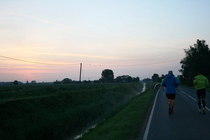
Perfect for a Morning Run
We were coming up to our next stop and breakfast arrived, which charlotte had prepared consisting of banana sandwiches, wheatabix and 9bar cereal bars. Rich had a quick snooze. As we continued leaving the village behind the smell of cooking bacon was wafting from one of the nearby cottages, it smelt delicious! The day was already heating up and as the day wore on Rich unfortunately had to drop out after reaching a monstrous 70 miles. We were all disappointed.
It wasn’t long after this that we were passed by the first cyclist of the day, what was to be one of many. The day was heating up and after being up for almost 30 hours it was beginning to show. The final marathon was going to be very tough and as the breaks became longer we realised we would be pushing it to reach the 24 hour mark. The now stream of cyclist passing us helped keep our spirits high with them shouting out to us as they shot passed. We increased the pace as we made our way towards the final check point for the cyclists, after a brief chat and top up with mars bars and water we continued on. Passing through the park we tried to get in as much shade under the tall trees as possible.
A Good Long Stop
The final 3 miles were the longest and hardest 3 miles I think I have ever done the heat felt like it was increasing and the final section of the course felt incredibly hilly. Getting treats off some of the support vehicles for the cyclists helped lift our spirits and the addition of charlottes family coming along for the final trundle in the last few miles down to the coast. Our pace at this point was painfully slow but all we could manage.
The finishing line marked by a pub came into view helping us jog it in at a better pace and despite the miles already done, the tiredness we felt remarkably fresh. After 26 hours we had done it, not quite as a full team but Ed, James, Charlotte and I. It had been an incredible effort. The reception by the cyclists was incredible and completely unexpected. Thoughts of a cold pint were swapped to that of a seat and a pint of lemonade in the evening sun. Hobbling round the pub chatting to the cyclists and telling the story of the last 24 or so hours it felt fantastic to be finished.
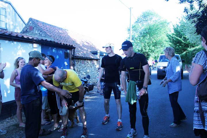
26 hours later
Finally a big thank you has to be given to the support provided by Rampant Sporting, check them out http://www.rampantsporting.com/
The Support Crew Cursing on Behind