Journal

Mt Mitchell - North Carolina

This was the first long holiday of the year and after much debate we had settled on exploring Asheville and the Black Mountain area in North Carolina. Renowned for outdoor activities and a lot of breweries! The first task was for a casual 11 hour drive down to the area from New Jersey. With a car full of people and kit. Loaded up with snacks for the drive we began making our way south.
One of the first spots we visited was a natural slide. Hidden in Pisgah National forest we braved the slightly cooler weather for the chance for a wild swim. By the time we got there their were only a few people milling about and sliding down the rock face into the plunge pool at the bottom. With it being the end of the season we had definitely avoided the crowds which you could imagine being the norm in the heat of the summer. After spending some time sliding down and hiking up it was time to head on back to our base for the next few days.

Sliding Rock
After checking out the weather that evening and various trails available we settled on heading up Mt Mitchell. Mt Mitchell itself was high on the wish list for our time there. Partly because its the highest peak east of the Mississippi and eastern North America (when you exclude some of the Arctic region) standing at 2,037m or 6,684 feet. Making it about 400ft taller than Mt Washington up in New Hampshire or roughly 2,200 feet taller than Ben Nevis in Scotland. The mountain and surrounding area have an interesting history as well. Originally the Cherokee tribe were one of the more prominent in the Black Mountain region until settlers took over the region. Since then it was first climbed by a French Botanist and Explore named Andre Michaux (who commenced quite a few expeditions from New Jersey & New York). Making a climb to the top all the more relevant having travelled from New Jersey albeit far easier to get there compared to his travels. A Professor from the University of North Carolina, Elisha Mitchell, explored and studied the height of the mountain before confirming it as the highest mountain in the East of the US. He later unfortunately went on to die on the mountain after an accident.

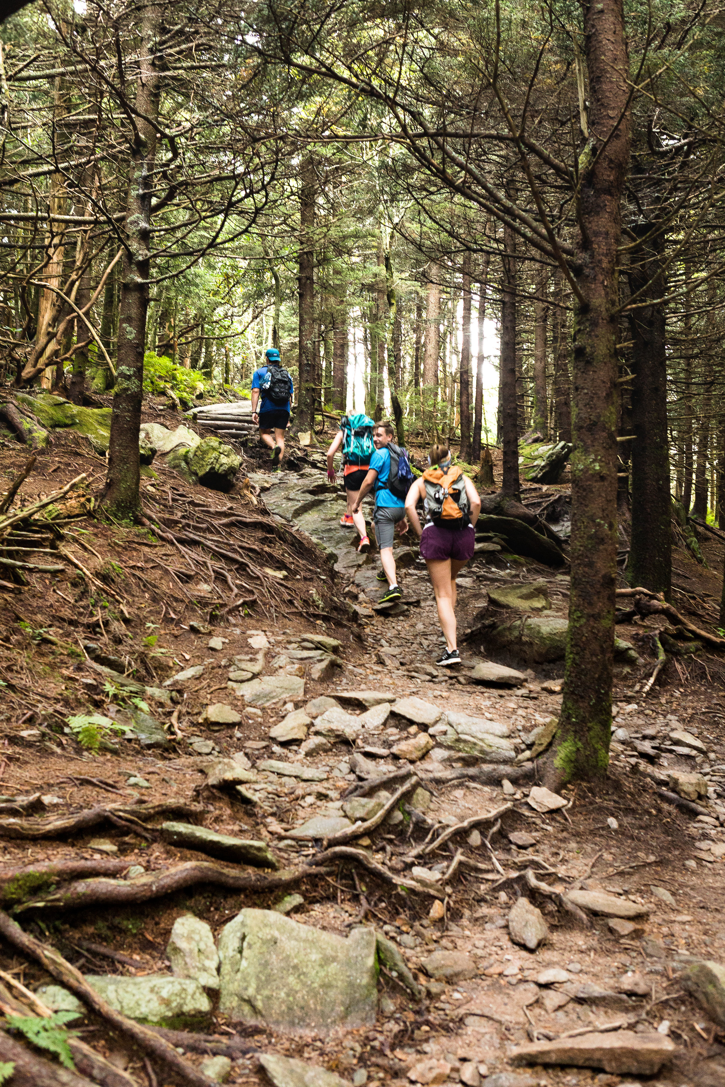
The trail up Mt Mitchell
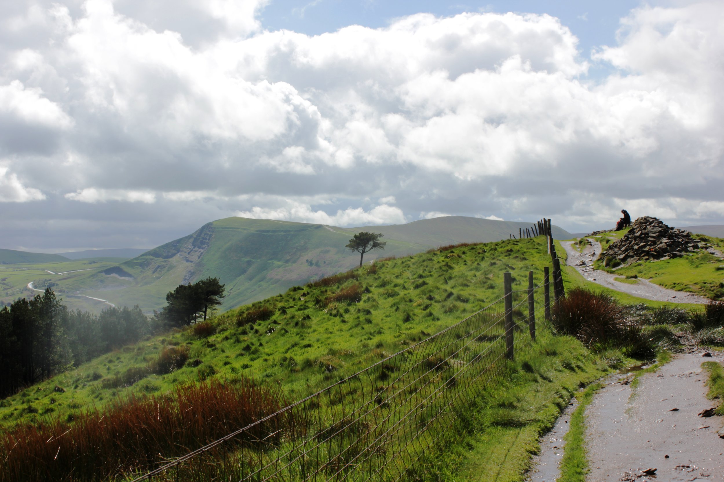
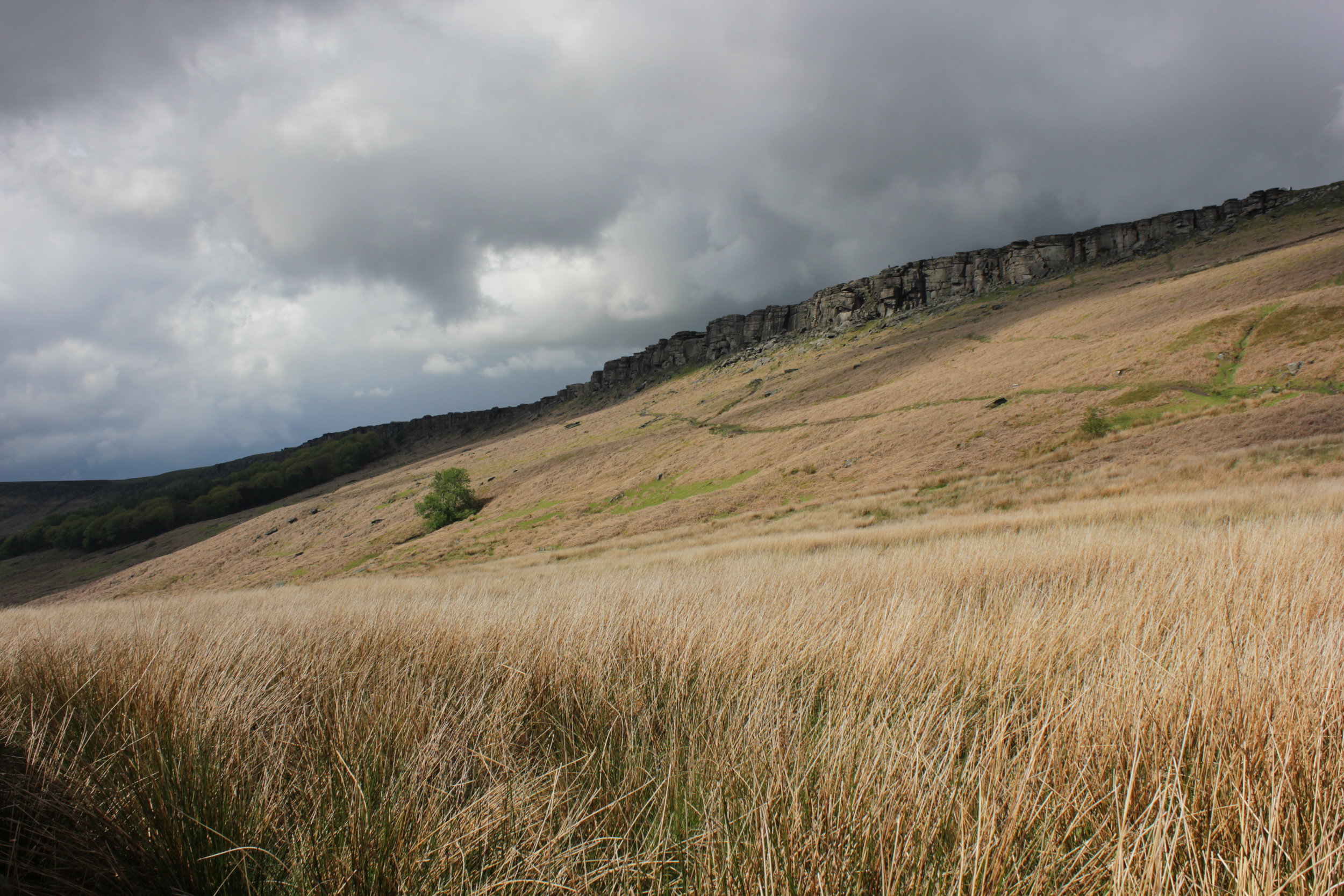
In the 1940’s a road was created along a ridge that runs 469 miles between Virginia and North Carolina, with a stop off at the summit of Mt Mitchell, creating the Blue Ridge Parkway. However since then the environment has had a tough time. A mixture of effects have been damaging the eco system. From logging and fires through to foreign invading plants and animals. The more recent effect has been acid rain, which is still to this day severely affecting the forest and killing many of the trees. In 1993 it was declared an International Biosphere by UNESCO. Despite the challenges it still has a rich environment. Its not surprising that its one of the most visited national parks in the US. Due to its popularity there are a variety of options to reach the summit including a drive almost to the summit or horseback ride. We opted to hike from the base starting at the Black Mountain campsite.

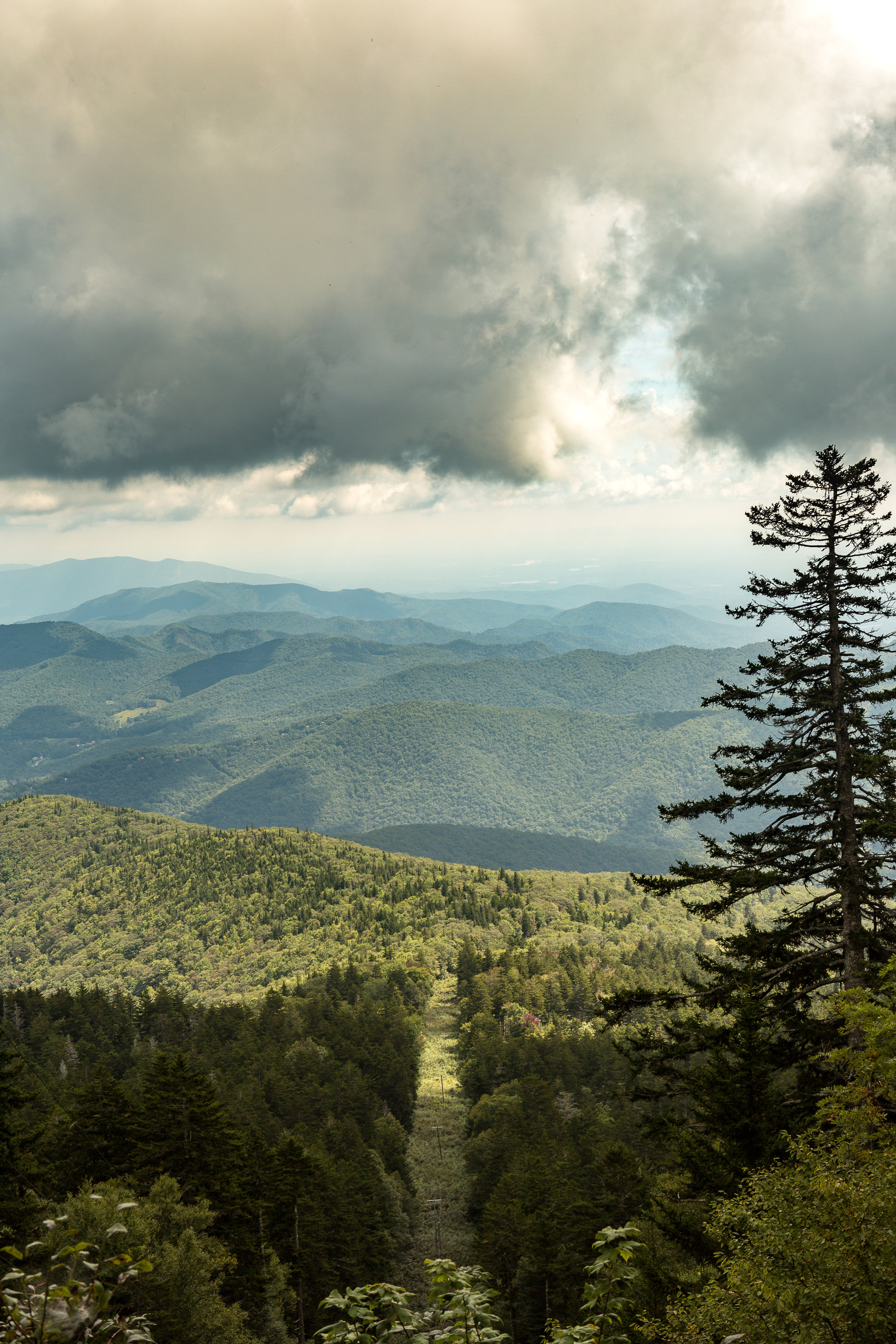
Blue Ridge Parkway meandering below us
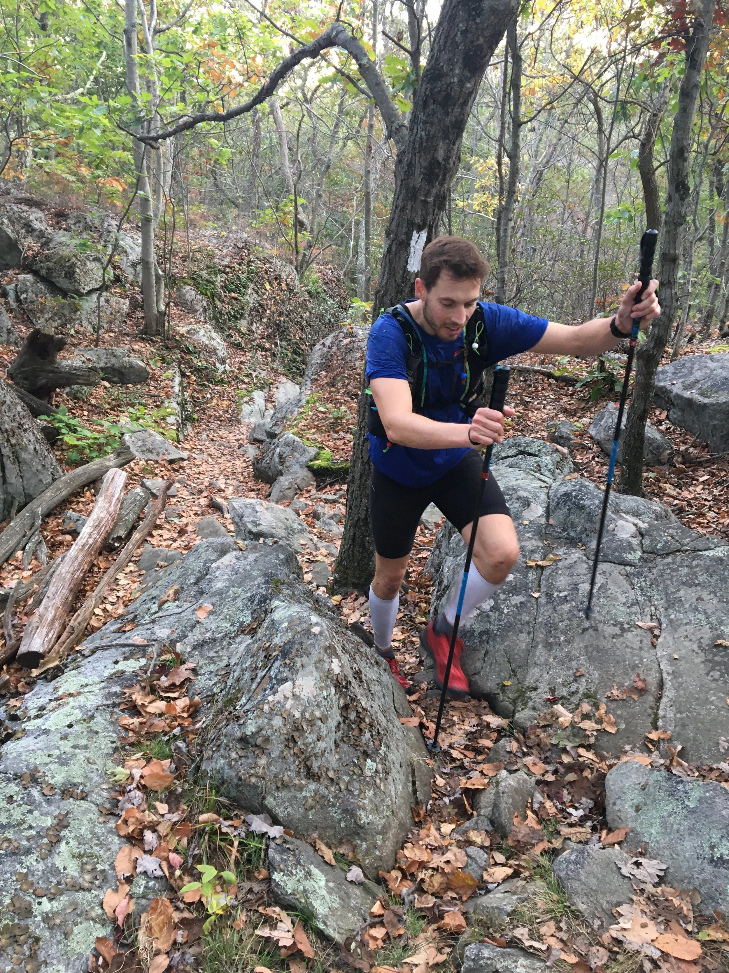
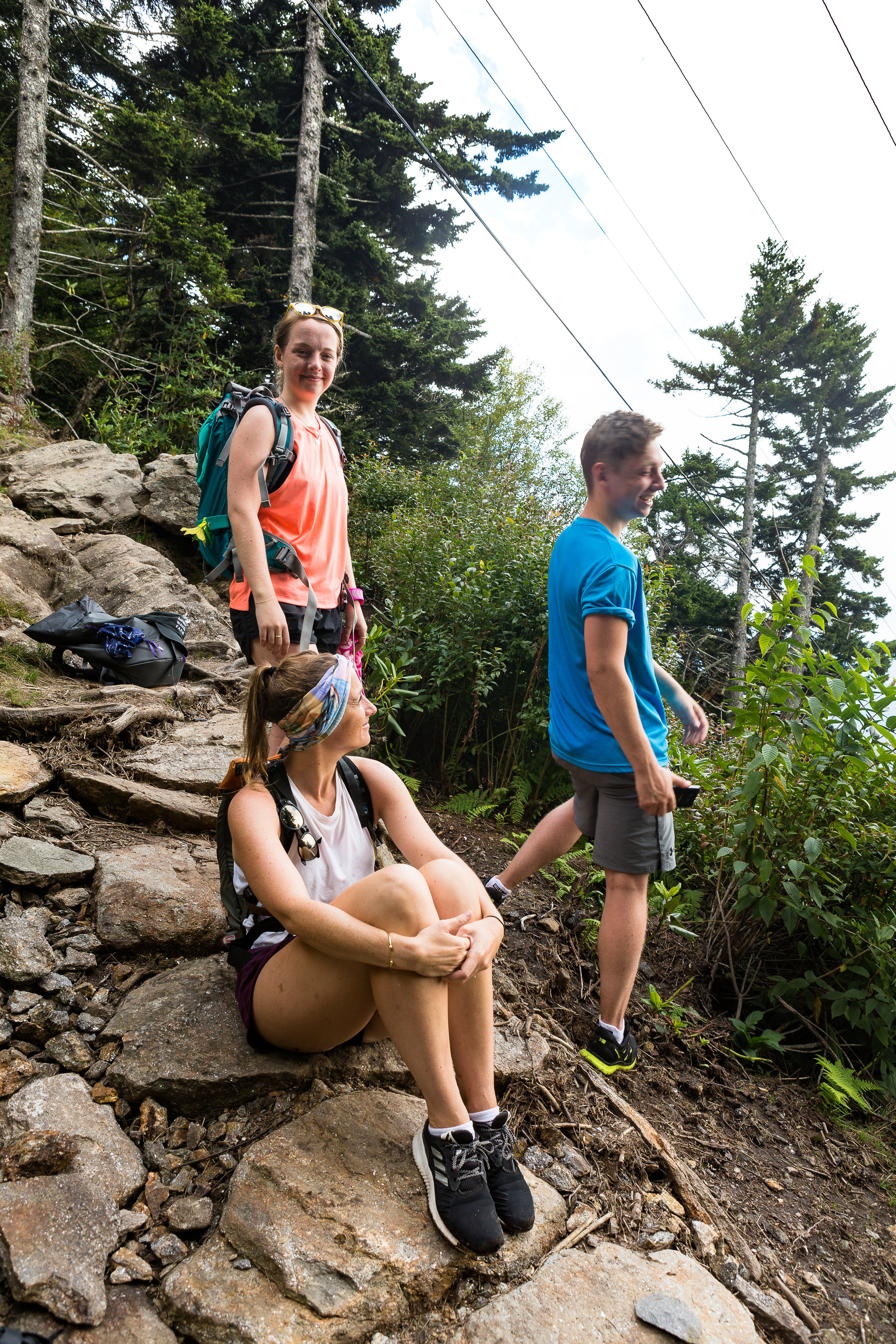
The adventure started with the drive over there. Plugging the campsite in as the start point for our hike we soon found ourselves driving up a rough track road with ever tighter switch backs. Higher and higher we headed up the mountain. What we had not appreciated when going with the route the GPS suggested was that this would take us the off road route. It showed the importance of having a road map of the local area! It was quite the experience driving up with sheer drops to one side and some fairly impressive pot holes amongst other parts. It turned out the road should have already been closed for the season. We had managed to sneak through for a final ascent whilst they were conducting some maintenance. As we climbed our expected time of arrival got later and later. It felt like we had driven to the top of the mountain as we emerged onto the main and perfectly tarmacked road. Trying to find the second segment for the onward journey, which unfortunately had been closed for the season, we began searching for alternative routes. After trying a few different ones we were finally heading in the right direction on the only remaining route to get to the start of the trail head. The trail started from the Black Mountain camp ground. We soon enough arrived far later than expected but there nonetheless . The campground is tucked in beneath the mountain. Parking up we crossed over a bubbling river to get into the camp group which was filled with campers and surrounded by towering trees.
Some wooden signs directed us towards the start of the trail, with a fairly flat section to warm us up into the hike a head of us. This however did not last long. We soon found ourselves in amongst the trees and working our way up wards. The cooler weather making for some perfect conditions for hiking.
One of the plants of interest for the day was poison ivy having spoken to a few people about the various poisonous plants in the US. We had spent some time over breakfast reading a few warnings and articles about poisoned ivy, oak and a few other plants as well as how to spot them. We were on the look out for these plants in a bid to avoid them. Not being your flora expert anything that looked remotely similar suddenly became a hurdle to overcome. Not wanting to be covered in the resin that these plants secrete which waits up to 48 hours before revealing the blisters of the infected area. Unfortunately you can spread it around during this time so in the event of getting it on your hands imagine all the places you might touch during a 48 hour time period….
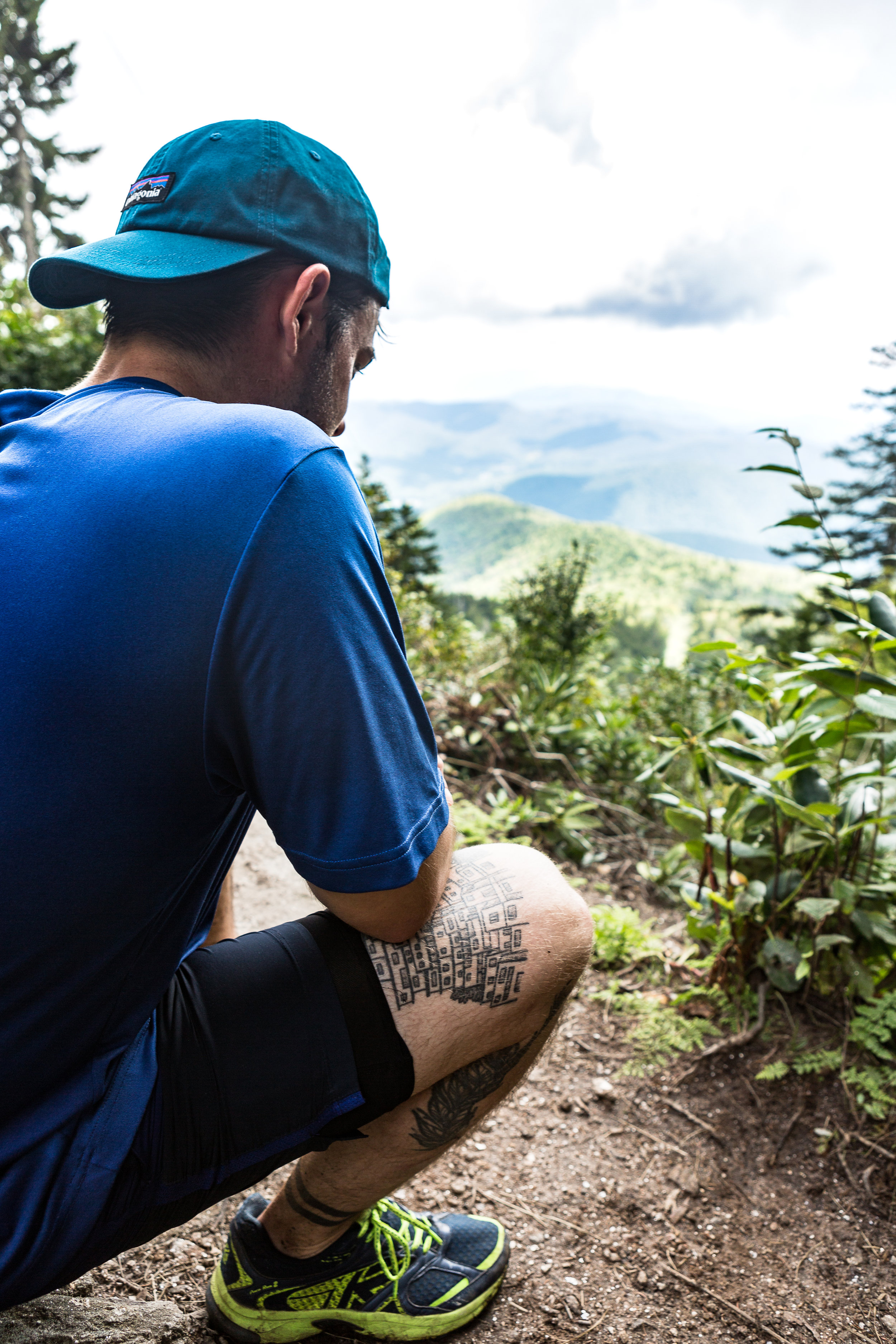
Slowly but surely we made our way further and further up wards. With most of the mountainside covered in forest we did not have much of an opportunity to take in the views around us. Until we reached a small clearing which had been carved out to make way for a electricity pylon that was strung up the side of the mountain and also headed for the top albeit in a much more direct fashion. Straight up. This gave us a small glimpse into what we would see from the summit and it was already pretty spectacular.
I find it fascinating seeing how the environment changes as we meandered our way along and higher up the mountain. We passed through thick groves of rhododendron’s as we climbed and the scenery slowly changed from chestnuts and oak trees to fir trees as we made our way higher and higher. Unfortunately we didn’t see any flying squirrels or local black bears. Admittedly not seeing a bear up close although an amazing experience would have been a bit nerve racking for the group and the bear.
You can read about my last bear experience in the link below
We were not disappointed on reaching the summit. The 360 degree views were pretty awe-inspiring. We even met some cyclist that had made a bid for the summit under their own power as well. Munching away of some snacks before the second leg of the journey we watched large grey clouds moving in on the area. With the weather on the turn and due to it taking longer than expected to reach our actual starting point we made the decision to make a dash for the bottom rather than continue along the ridge to some other nearby peaks. Part the way down the first rain drops started to make their way through the foliage. We stopped briefly for an attempt at some easy bouldering before pressing on quickly to the bottom. We got back down in pretty quick time, with the rest of the evening to explore the nearby town and its array of Breweries and Bars.

The Weather Turning
If you are interested in reading a bit more on Mt Mitchell and the surrounding area the link below has a bunch of info.
https://www.ncparks.gov/mount-mitchell-state-park/ecology

Views from the Summit
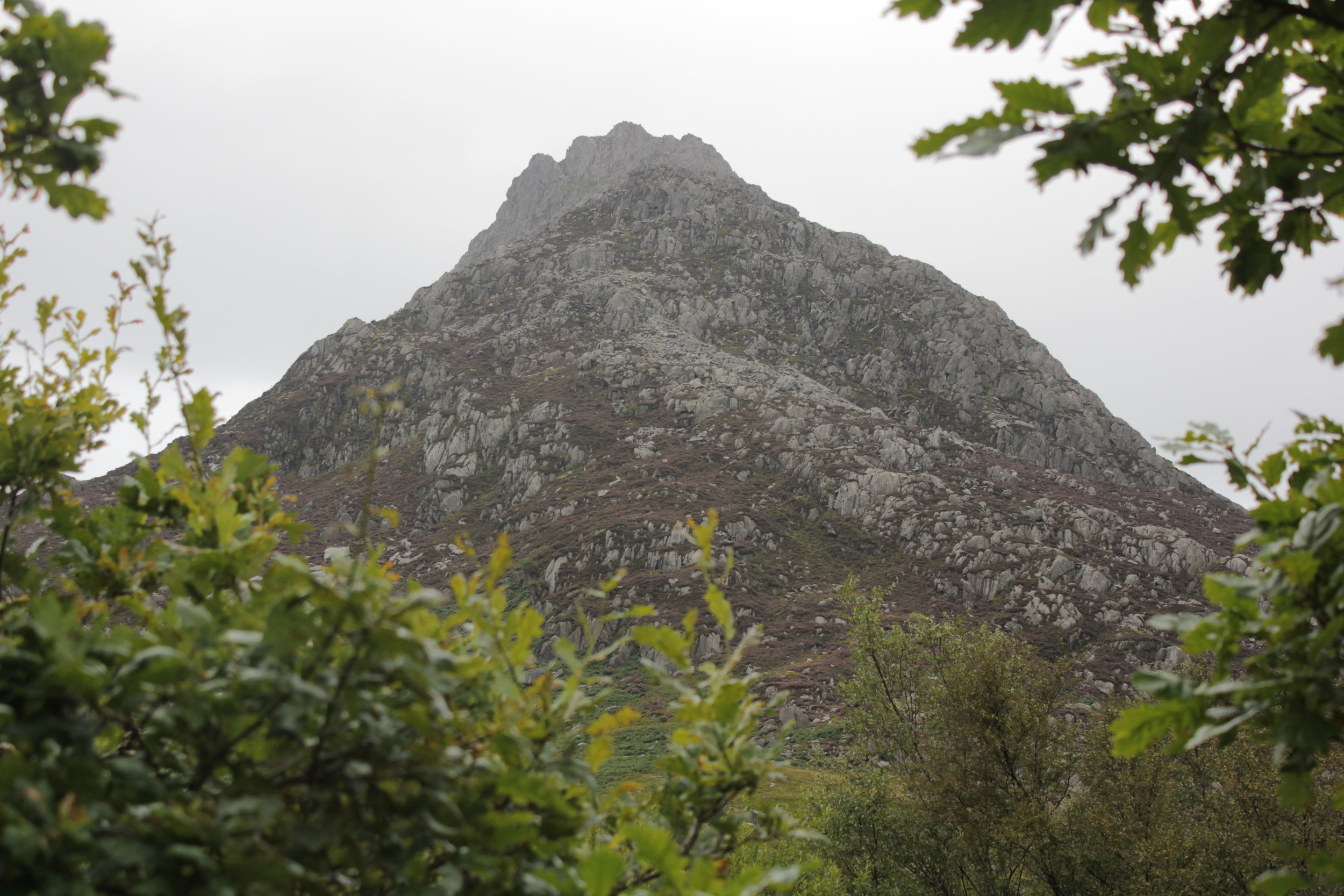
Scambling Tryfan
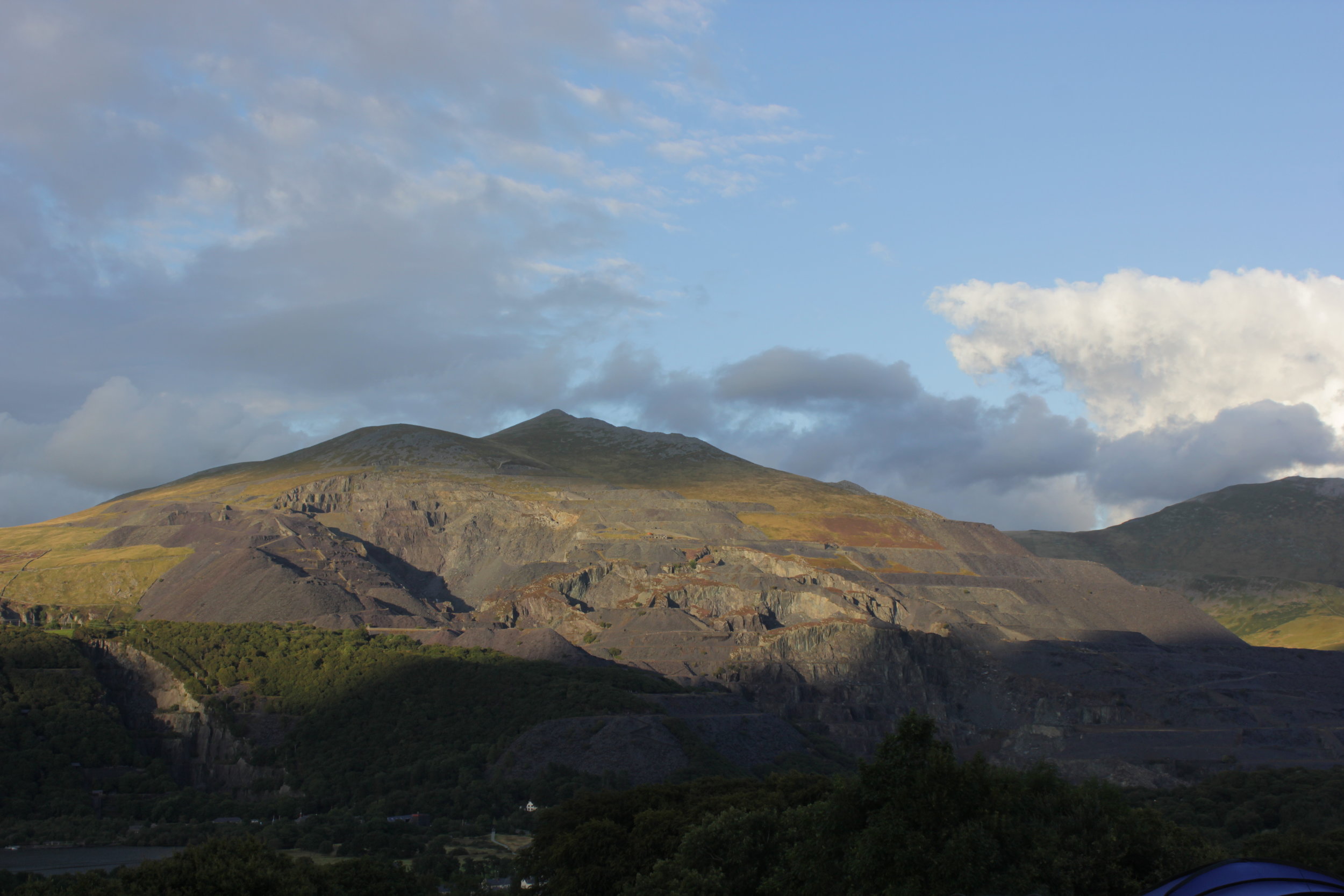
LLanberis Mine Opposite the campsite
Following a better nights sleep due to us not sliding down the hill, we woke to a beautiful morning, unfortunately it was not due to stay that way.
Heading into Llanberis and we hadn't decided exactly where we would head but first thing first was breakfast and sorting out some new boots due to the fact that they had completely stopped being waterproof. Not ideal during the welsh summer. Joe browns outdoor shop turned out to be a great place for kit and advice. We had soon narrowed down the selection on both the boots and our route for the day. We had decided to go for the classic Tryfan ascent which I had described to Laura as not much of a path and a bit of a scramble. The whole thing can be a good scramble if you choose the right route and equally certain parts can be a full on climb or a gentler route up. So there is something for all levels.
Our route to the car was slightly diverted to a shop packed with honey, I had never realised there was so much choice. We found ourselves being given a master class and tasting by one of the bee keepers from numerous different jars that covered the counter. Each one had its own distinct flavour and he could tell where the bees had sourced it from as different flowers had come into blossom. Not being able to resist I came away with some tasty souvenirs. Definitely worth a visit if you are in the area. You can check the place out on the link below.
http://www.snowdonhoneyfarmandwinery.co.uk/
The weather started off not looking to great with a bit of a shower but it soon cleared enough that the heat of being in waterproofs far outweighed the slightly damp weather as we scrambled further up the route. We started at the same point as another couple but within moments had opted for different routes each preferring the look of a different part of the mountain. Its part of the beauty of tryfan there are a huge number of different routes you can take depending on how adventurous you are feeling.
Tryfan a head
Each turn we took we could choose a variety of different routes which made the journey all the more fun, sometimes heading up a section to turn back and sometimes forging on. What became very noticeable was the degree of adventurousness improved as the rock dried out and our appreciation of what we could do changed. We also invariably kept crossing paths with the original couple at the bottom of the hill. Making parts of it seem a bit like a race. I am not entirely sure they were thinking the same thing....
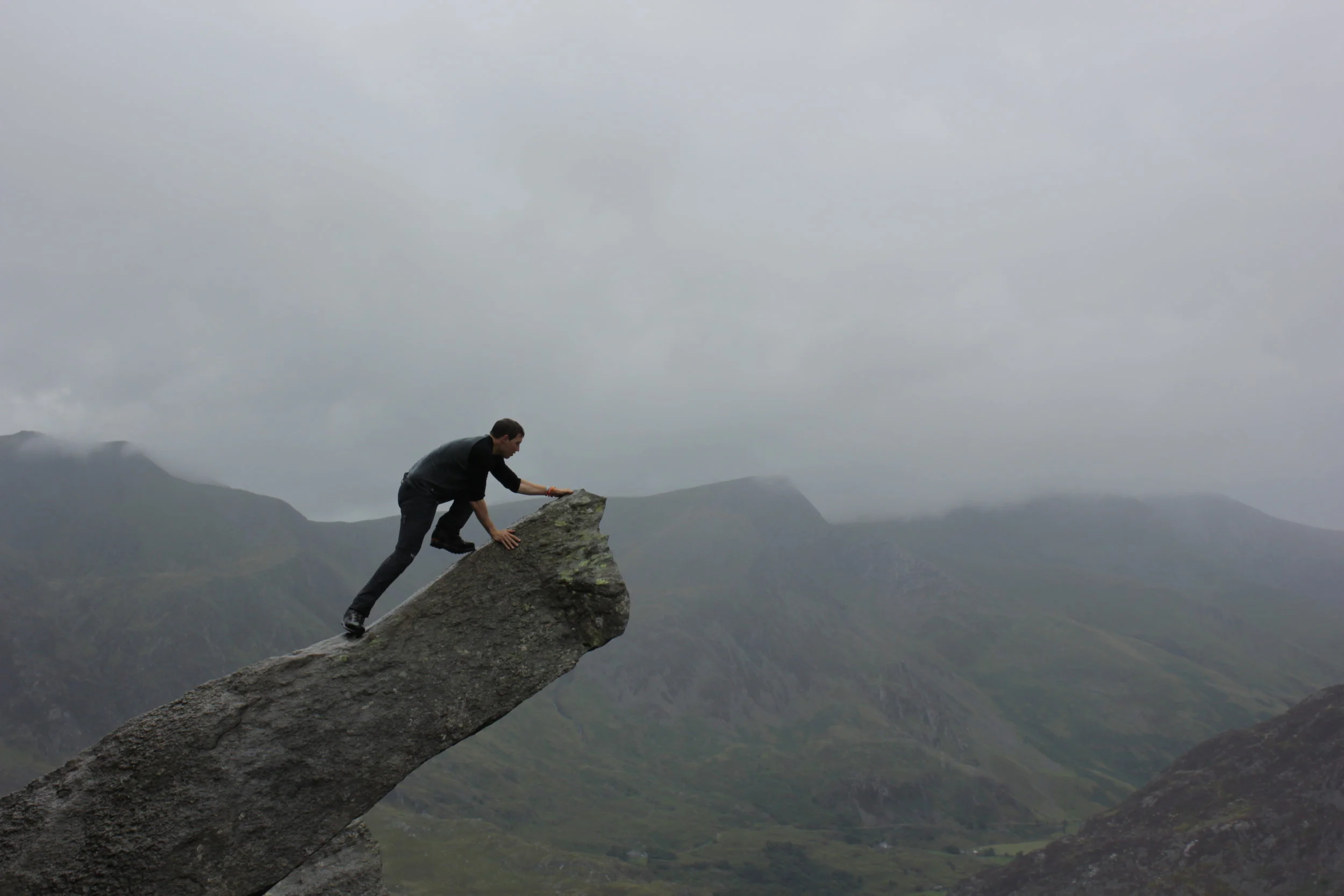
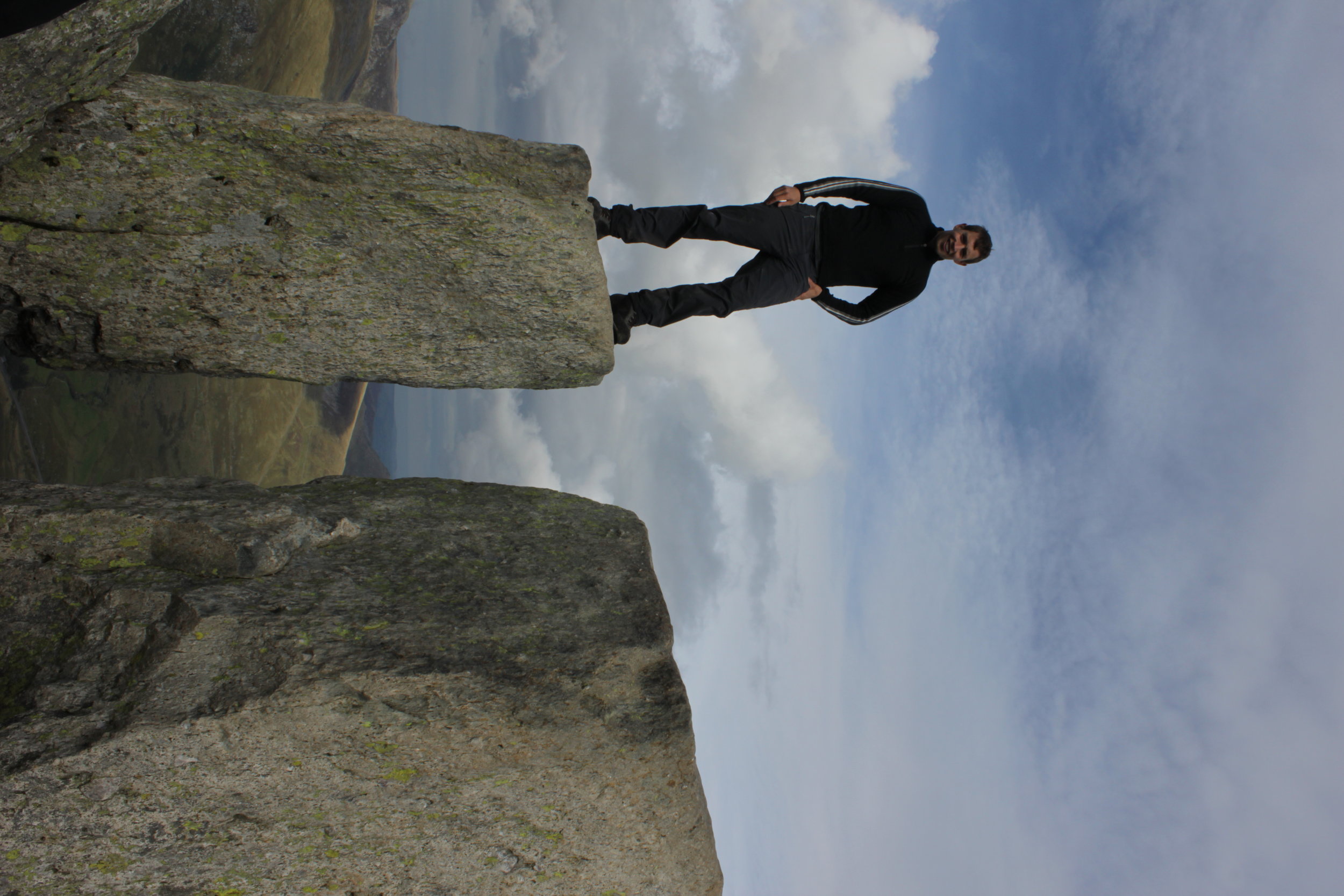
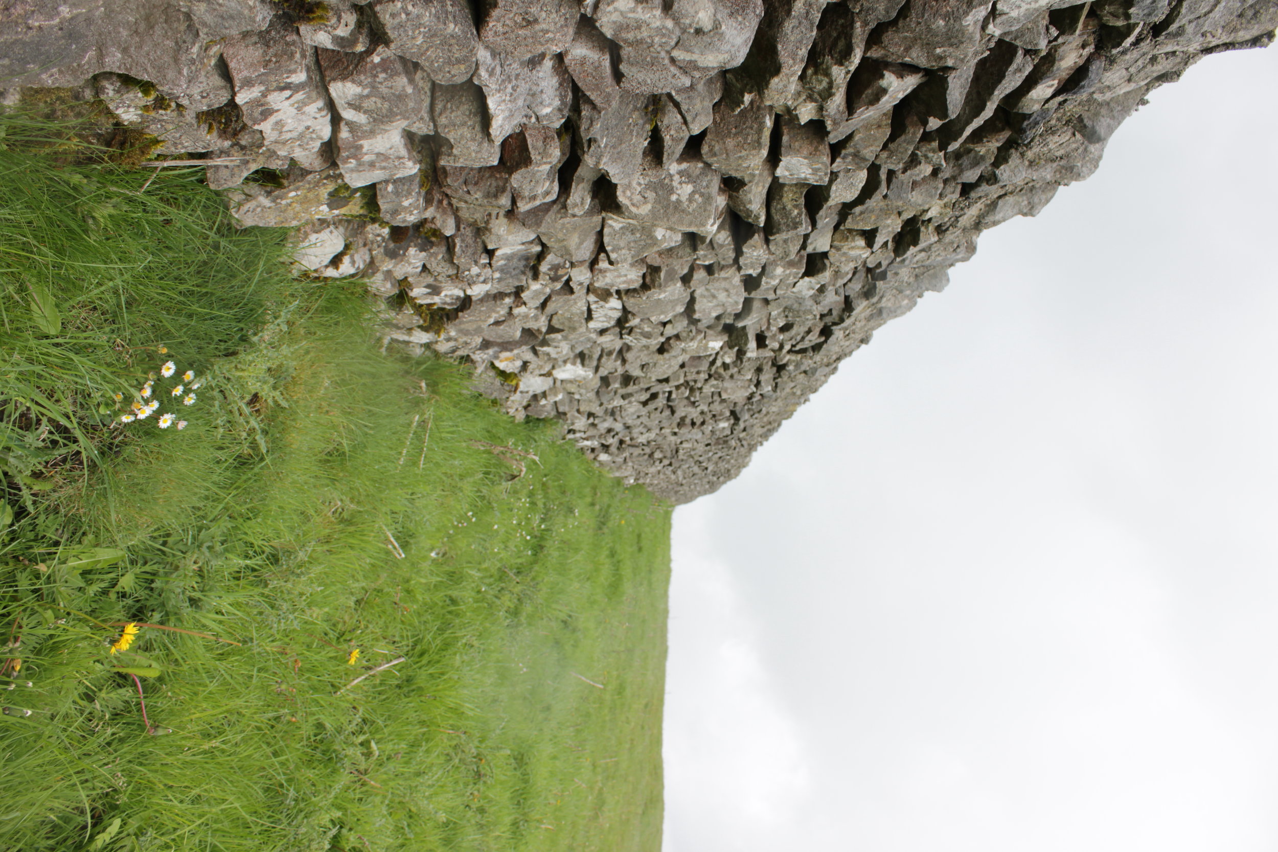
One of the first highlights of the day was coming across this huge sticking out rock that we decided to clamber on (find out what it is called)

Yoga on the Mountain
Having a closer look
Heading on up and the ground flattened out before sharply rising upwards. The route we took skirted round the side of this. It followed a small track round the side with a steep ish drop to our left down grassy gullies. We could watch climbers coming up the side of the mountain which was amazing to watch as the occasional head poked above a rock.

With dog in tow
Weaving our way round we found ourselves at the bottom of a gully with a number of people and quite unexpectedly a Labrador. As we clambered up finally passing them we ended up having to go back and give the couple a hand getting the dog up the route. It wasn't an easy situation with both the route ahead and behind being very difficult for the dog.
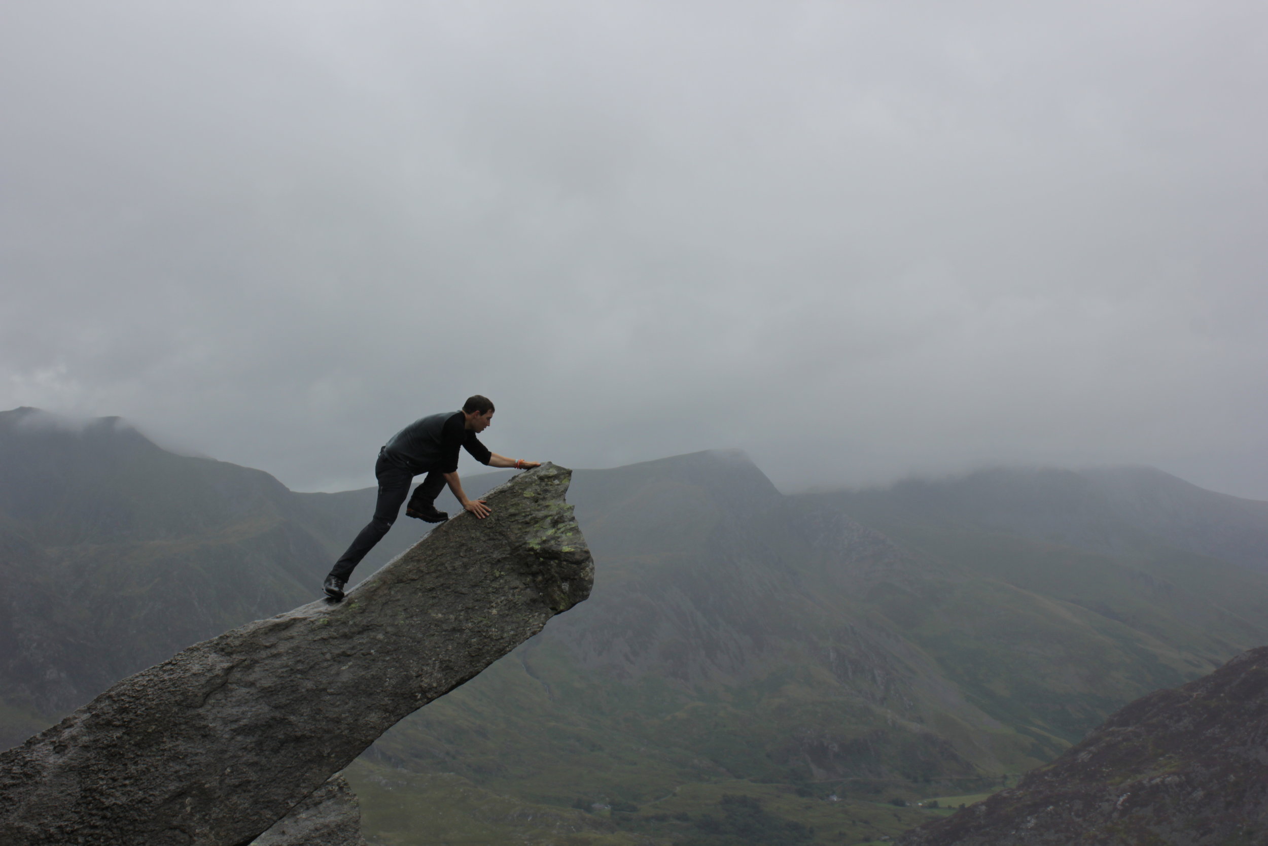
Coming out the of the gully and we were at the top confronted with the stones of Adam and Eve. People were already on top of them and jumping between them. After a drink and some well needed food it was our turn. Looking down from them and they certainly felt a lot higher and the gap wider!
Preparing for the Jump

Adam & Eve at the Summit
We continued on down the mountain scrambling away as we picked our way down to the path off the hill. You can link it together with the glyders which would be a really good walk but that would have to wait for another day. The environment and surroundings constantly changed as we descended; from the craggy rocks, to heather and finally to a well trodden path with streams merging together. We found ourselves coming out further from the car than we had wanted so finished up along the road before that great feeling of switching boots for flip flops.
IMG_0227
Our search for food that night started at pizza and a pint but due to it not being open settled for a fantastic pub filled with people and massive portions.
The next day we woke to a cleared out campsite as people had left due to the weather turning bad. Due to me mixing up the breakfast order we found ourselves on breakfast round two. Back at the honey shop for welsh cake! Certainly not a disaster.
With the rain set to continue and a long drive a head we detoured to the slate mine with some huge zip wires. Unfortunately both that and the tours of the mines were full. We found ourselves wondering around checking out the area before making the long and incredibly wet drive back down south.
Check more of my photos out from the trip below:
https://www.flickr.com/photos/bennorawlinson/sets/72157646928749422/

Mountain Leader Training in Wales

The area for the day
We spent the evening driving over to a hostel called Pete's cafe which has a well deserved reputation for huge breakfasts and a bit of a Mecca for all things outdoors in North Wales. Compared to the last hostel of having an entire flat to myself it was time to go back to a shared room. It was a beautiful evening, a ripple less lake with the back drop of the setting sun basking the hill tops in golden hues. Apart from around the bobbing orange head as one of the group opted for an open water swim. The rest of us chose a cold beer, should have taken my swim shorts!
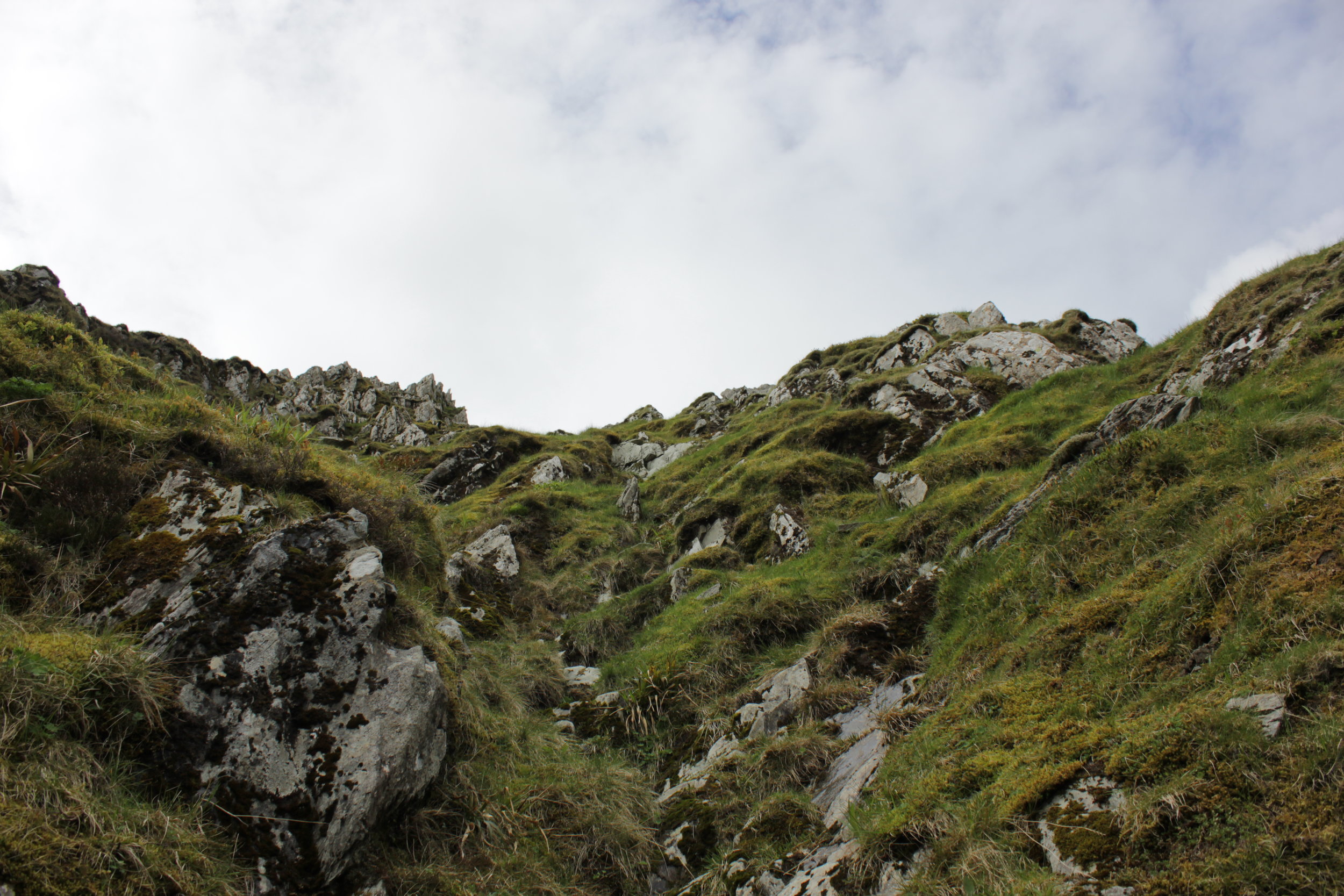
The next morning we sat in the hostel drinking large steaming mugs of coffee and pouring over maps, before deciding on where to go. Parking up outside the National Trust centre at Caneddau and Glyderau with large slate stones marking the start of the path. Heading straight up into the Glyders towards to top of Y Garn.

Views part way up
The objective for the day was to put into practise our risk assessing of groups on scrambling terrain, with the idea being to understand when assistance was required and in its different forms. After a few alterations to our initial route we weaved our way onto the beginning of the ridge. We came to the conclusion (admittedly it had been pointed out to us before hand) on the importance of route planning from a distance by using what you can see of the terrain as well as hints from the flora and fauna. So once you are on a section of it you have a rough picture in your head of any key features or obstacles. So on this occasion if we strayed too far to the one side we would find ourselves off the ridge and if we went too far the other the ground resembled more of a rock climb than a wee scramble.

Supporting Each other up the ridge

Making it look much easier
Making our way up and along the ridge line we stopped occasionally to discuss areas of concern and have the odd snack. The weather had done a complete change and was beginning to warm up as sweat began to slowly drip from us. Arriving to the top and it was time to find the path downwards. For this we opted to find a mountain goat track.
Found the route down, somewhere to his right
From the top it certainly didn't look like a route as we tracked our way down by the side of a stream and taking it easy to make sure we didn't slip or dislodge the loose rock onto those below.
Our route down
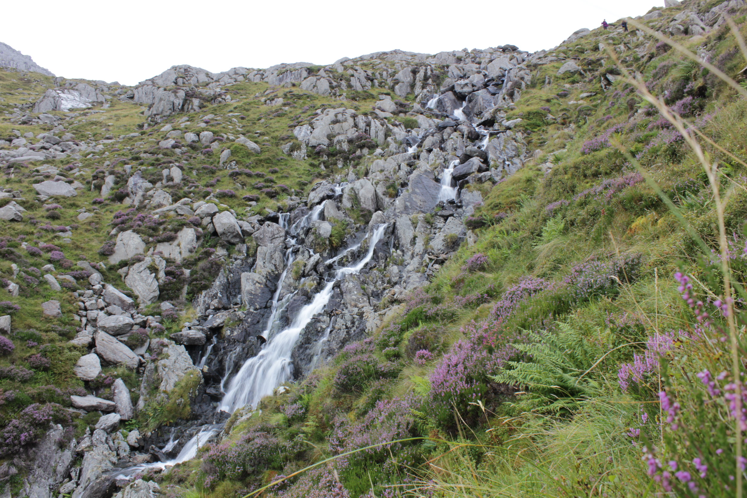
The track narrowed as it followed the slope across the hillside with a bit of a drop to one side and water flowing down it. We finally reached the devils appendix which I believe is an area for ice climbing when the conditions are right. As it was not cold enough this provided us with a quick shower instead. Making it to the bottom beside a crystal clear lake our instructor, Dave, opted for a route that would bring together the skills we had learnt with getting groups up a challenging scramble as well as the risk assessing/ route finding that we had done previously. With some larger steps up rock faces being involved we certainly had to think a lot more and it was certainly not something we envisaged doing when we have large packs on our back. Reaching a good stopping point we turned around and repeated the process down hill. The interesting bit being that heading down the hill is much harder to do as you can't see as easily where to put your hands and feet, which if you had to do unexpectedly really highlight the point of knowing your and the groups skills. We cris crossed a stream over, down and around rocks some of the group making it look far easier than myself. All comes with practise apparently!

Checking out the valley below, it was quite a steep drop!
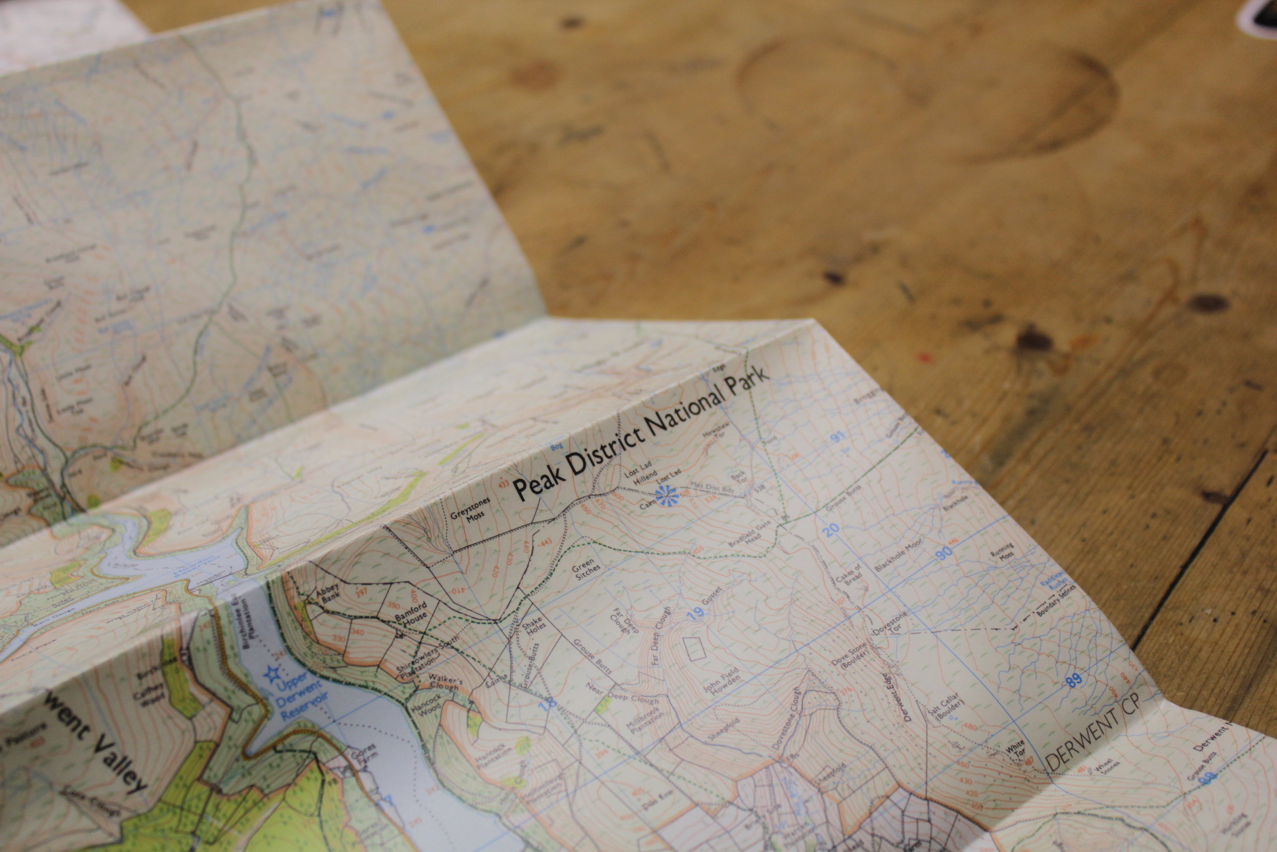
The nights activities was to plan our expedition. With maps, empty mugs of coffee and beer bottles littering the table, fingers traced different potential routes across the grid lines in front of us as plans began to hatch. Ensuring it would be a realistic distance to cover in the time period and give us enough potential to test our navigational skills. Each route was discussed at length as we each tried to sell our ideas. Part of the fun in all these is in the planning. That initial building of an idea into a concept and looking at try to realise it. In the end we decided to present a couple of options to our instructor the following day one of which was Matt.
Mountain leader training stage 1
Having been on the cards for a while I had the opportunity to go on mountain leader training with peak mountain training who are based up in the Peak District. Driving up with forecasts of rain and relatively high winds wasn't the most appealing to be out in the Peak District but it would certainly make for a more interesting experience!
My room in the bunk house, with beautiful views onto the hills
After the long drive I reached the bunkhouse at Pindale Farm where it turned out I was the only one in my room out of a possible 7 others. So with kit spread out I began making myself at home and although relatively basic it had everything I wanted and was comfortable enough. I woke early the next day to get all my kit ready and have a look over the map to see where I could head on my first day. Normally the course is a 6 day course but for a number of reasons outside of my control I could only start it after the first day. My plan for the day was to make a loop around the local hills before heading back. The forecast hadn't improved as I sat with my coffee cupped between my hands viewing the map but with a plan, lunch packed and kit ready it was time to go.
Planning time
The initial section was heading up a valley with a castle overlooking the area; the recent weather had turned the path into a wee stream as water swirled between the rocks and my feet.

The Castle overlooking the valley
The day was certainly one of all seasons with patches of sun mixed with rain, strong winds and hail that stung any patch of skin that was exposed to it!
One of a couple patches of sunshine
While I saw quite a few groups hunkering down behind stone walls avoiding the worst of it.
My turn to hide behind a wall
I made my way round admiring the view from each of the peaks despite it being slightly imposed on by a rather large cement factory. I finished up at a cafe full of cyclists, motorcyclists, walkers and runners enjoying a final blast of coffee and a sugar hit before heading back to make homemade pizza.

another wet evening
The next day was much more classroom focused with us learning about risk assessing both before and during an expedition, understanding weather patterns and looking at emergency situations involving mountain rescue. This was quite appropriate given the wet conditions outside. The afternoon was spent out in the hills to put into practise the risk assessing we had been doing in the classroom into practise. Heading to some of the steeper areas I had been on the previous day where we would consider the potential for an accident and the severity of it. We also practised the art of walking slowly and I mean really slowly to the point where one bystander stopped to witness the event. Stopping for a bite to eat we tried experiencing how it would feel just needing to wait around in a relatively cool day to see how quickly we would start feeling the cold. The results were quite surprising in terms of the speed by which our body temperature fell and certainly highlighted the need for the right equipment in the mountains. Heading back for some cold pizza, soreen malt loaf and setting my tent up to make sure it was all ok ahead of our expedition phase.

Day 1 sunshine

Day 1 rain and hail

Day 1 strong winds
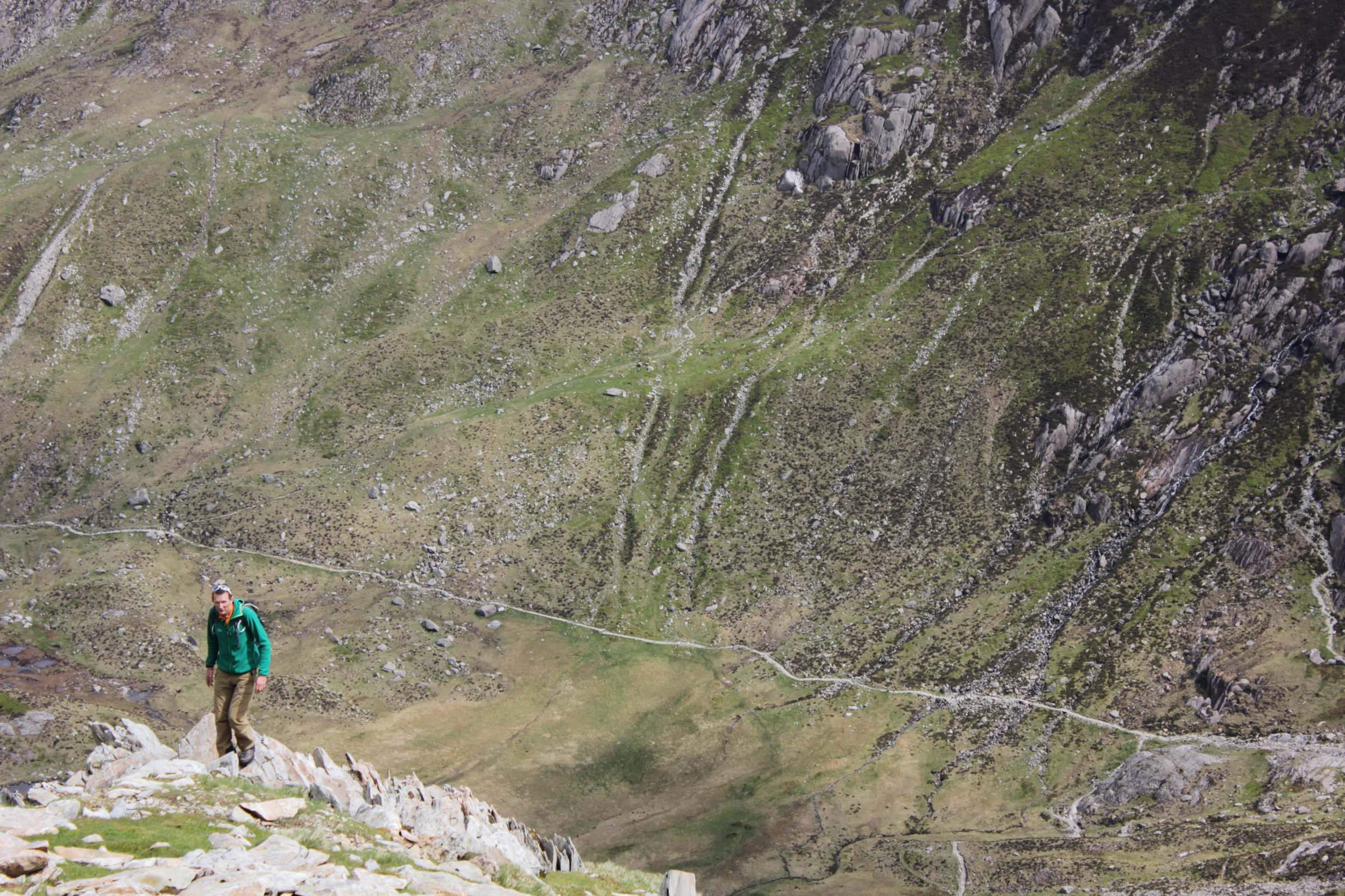
The next day was our last day in the Peak District and it was due to be a pretty interesting one. The morning began in the classroom, planning expeditions before we decided to head to an area called Stanage Edge to do some scrambling and rope work. The emphasis of the exercise was that rope work within mountain leading is definitely a last resort but if the terrain, group and/ or conditions require it then we need be to able to do it safely. Soon we were all tying ourselves in and climbing up and down areas. For those interested it was using the remote belay using a rock as an anchor as it is designed to be safer method if anything goes unexpectedly wrong.
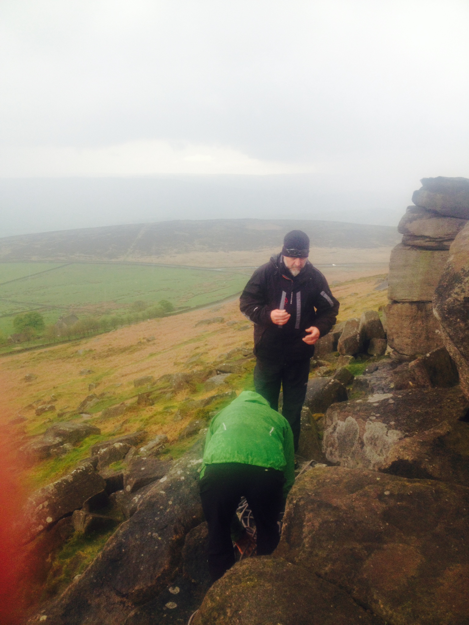
Remote belaying and the challenge of finding a suitable anchor
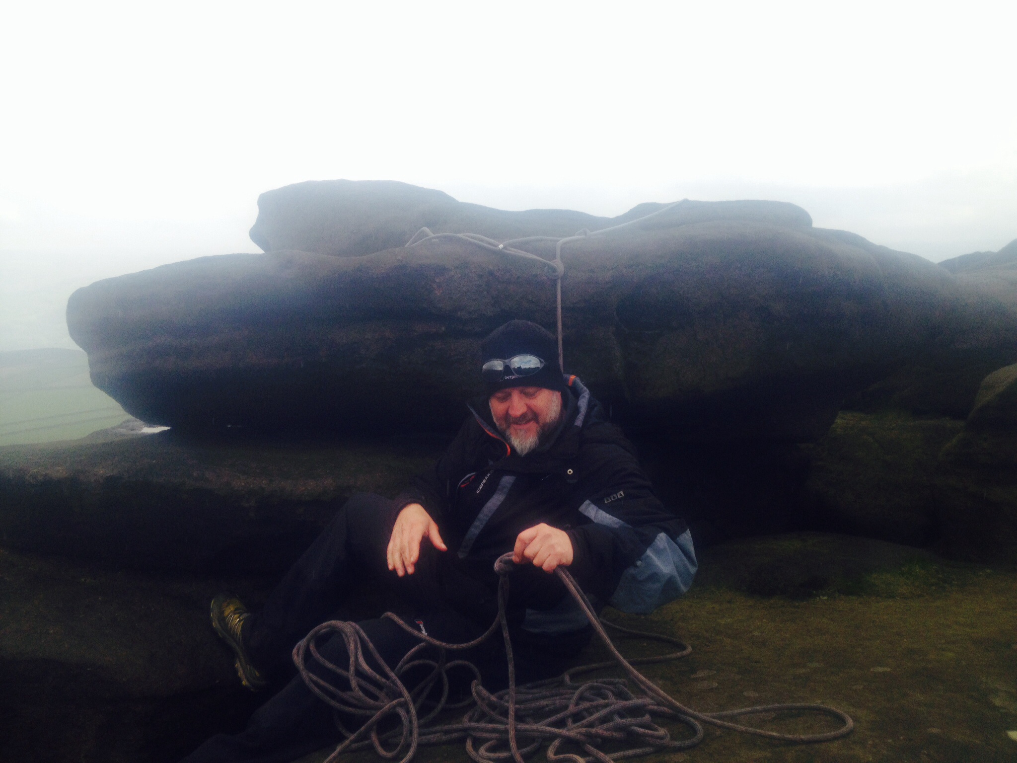
Finally in a suitable spot
Whilst standing admiring the surroundings we could make out bands of rain rolling towards our position as it rain began waterproof trousers and jackets were donned. The area is very popular with climbers particularly in the area and you could certainly see why with options of bouldering and climbing on shorter pitches. The final exercise was leading an individual down and up steep slippy terrain which was now in perfect condition thanks to the recent rain. The idea wasn’t to create the impression of danger but more act as a confidence rope. With the exercises all done it was time for a quick bite to eat and driving over to Wales for stage 2 of the training.
Stanage Edge on my way to Wales
Morocco Bound


Packing for all eventualities
My trip to morocco came round a lot quicker than I anticipated as I was throwing and squeezing all the kit I needed into a rucksack that was either far too small for the trip or I had far too much stuff.
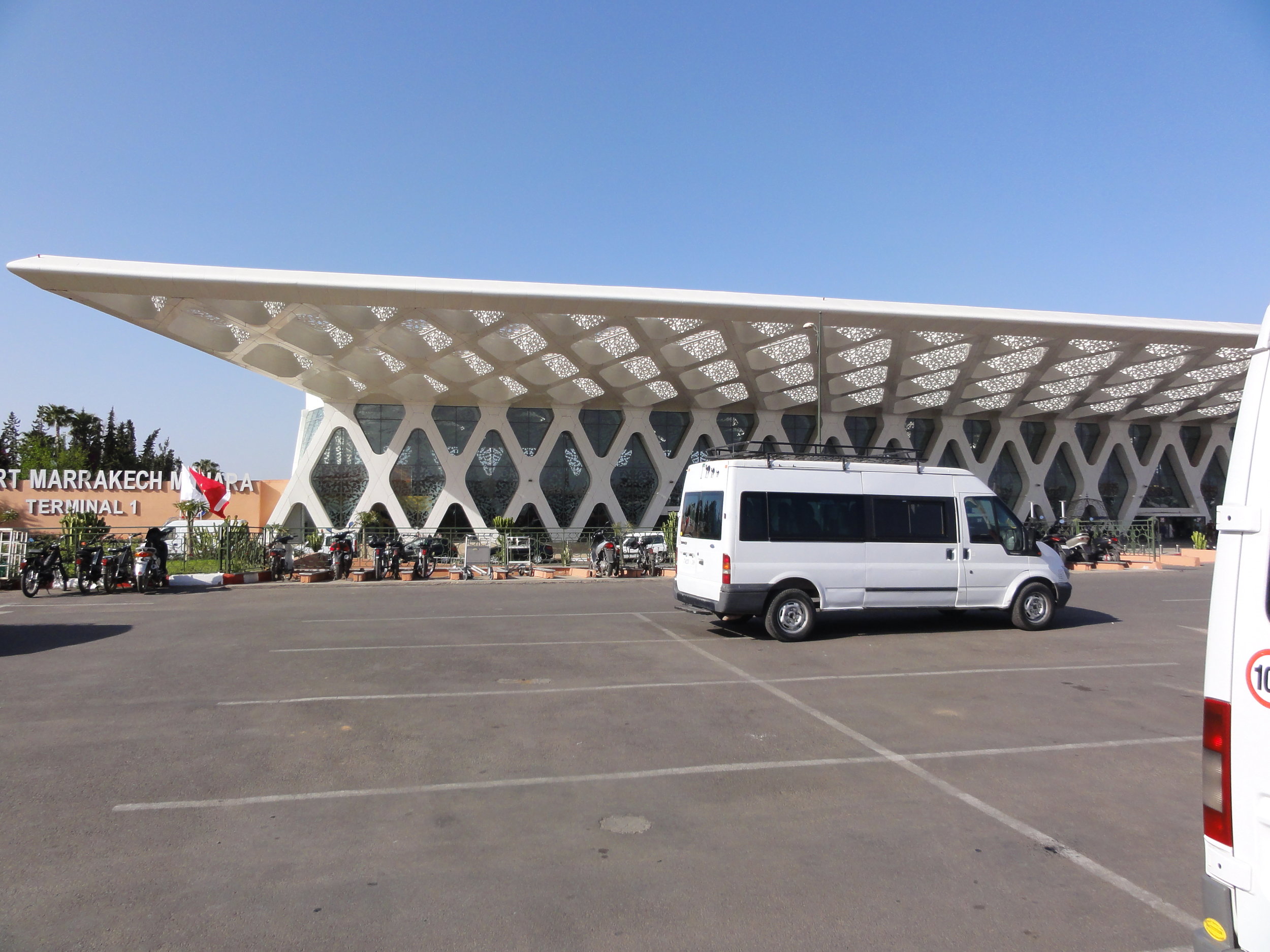
In between this I was preparing (microwaving leftovers) my last meal in the UK or at least until I reached the airport. My previous trip to morocco had been in the searing heat of the Sahara as part of the Marathon des Sables. This trip had the potential for the heat of the desert to the snow up in the mountains, on top of this we were leaving England as a storm was due to hit so I was packing for all eventualities! As I sat on the tube the rain started to come down hard, I was glad I was going to miss the remainder of what was to come. I made my way to Gatwick to meet the rest of the group who had arrived in a timelier manor than me. Despite it only being a 3 hour flight, not knowing when my next last meal would be I thought I would savour a chocolate bar on the flight which needless to say was eaten before boarding the plane. I was clearly in a mood of great self restraint. Arriving in Marrakech it came to passport control and spotting a small queue in front of a booth I opted for this one only to receive a wagging finger and being pointed towards the much large queue that had formed and I had being trying to avoid. Finally making it out, we met Steve our expedition leader and Ibrahim our local guide. This formidable pairing of Steve with a huge amount of experience and stories which made many a famous explorer or adventurer seem very tame and Ibrahim with his local knowledge and connections spreading across the Morocco we certainly had the ingredients for a fantastic trip.
Marrakesh Airport
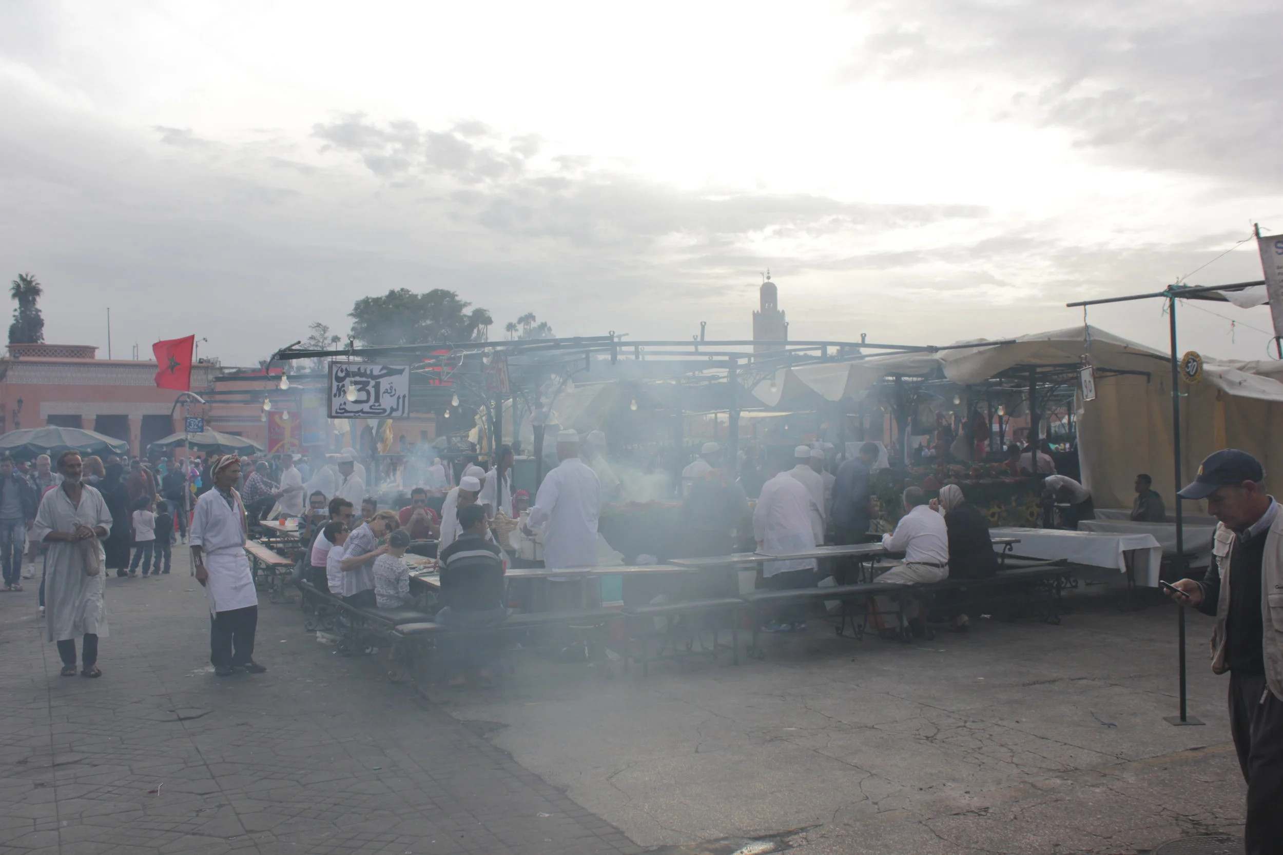
Arriving in the main square and the souks in Marrakech in the evening can only be described as mind blowing with such a contrast to the London we had left behind as our sensors were hit with a rich mix of smells, sights and sounds. Locals and tourists mixed together in one big melting pot. Wondering around you were introduced to every kind of smell from incense to freshly cooked food and the odd whiff of drainage system or lack of.
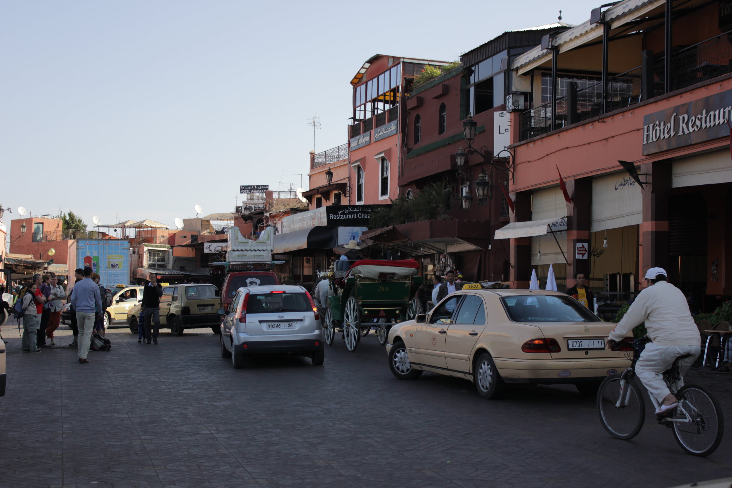
people, bikes, horses and cars all sharing the space

Topping up on supplies
After many offers from different food stalls we were greeted by a cook in his once pristine white uniform, now highly decorated in a variety of colours and food stains, which we opted to stay at. A young couple were mid way through what could have been a romantic meal in Marrakech. This was broken when the waiter realising the lack of space for our group decided without telling them that he would move them along. In his haste he knocked the ladies drink over her and the table. But at least we would all fit now. The meal was really good despite warnings of not eating meat and I assumed that the calamari was probably even riskier given our distance from the sea, all were very tasty. My meal was made slightly more interesting when I felt a rubbing on my arm. Looking round I realised it was the cooks arse going up and down my arm as he bent over to pick up something. All part of the experience. A quick tour of the souk before me and roommate crashed out in the hotel a head of the next day’s trip into the mountains.

Rich Smells of the Souks