Journal

Skiing the Troll Peninsular
After 2 years of planning and delays because of the now obvious travel restrictions for the last couple of years. We finally had a trip lined up to backcountry ski the Troll Peninsular. The conditions in the buildup were looking perfect. The snow had stabilised to a solid pack, sunlight flood the fjords, and we had got hold of some local intel. It was looking to be perfect.

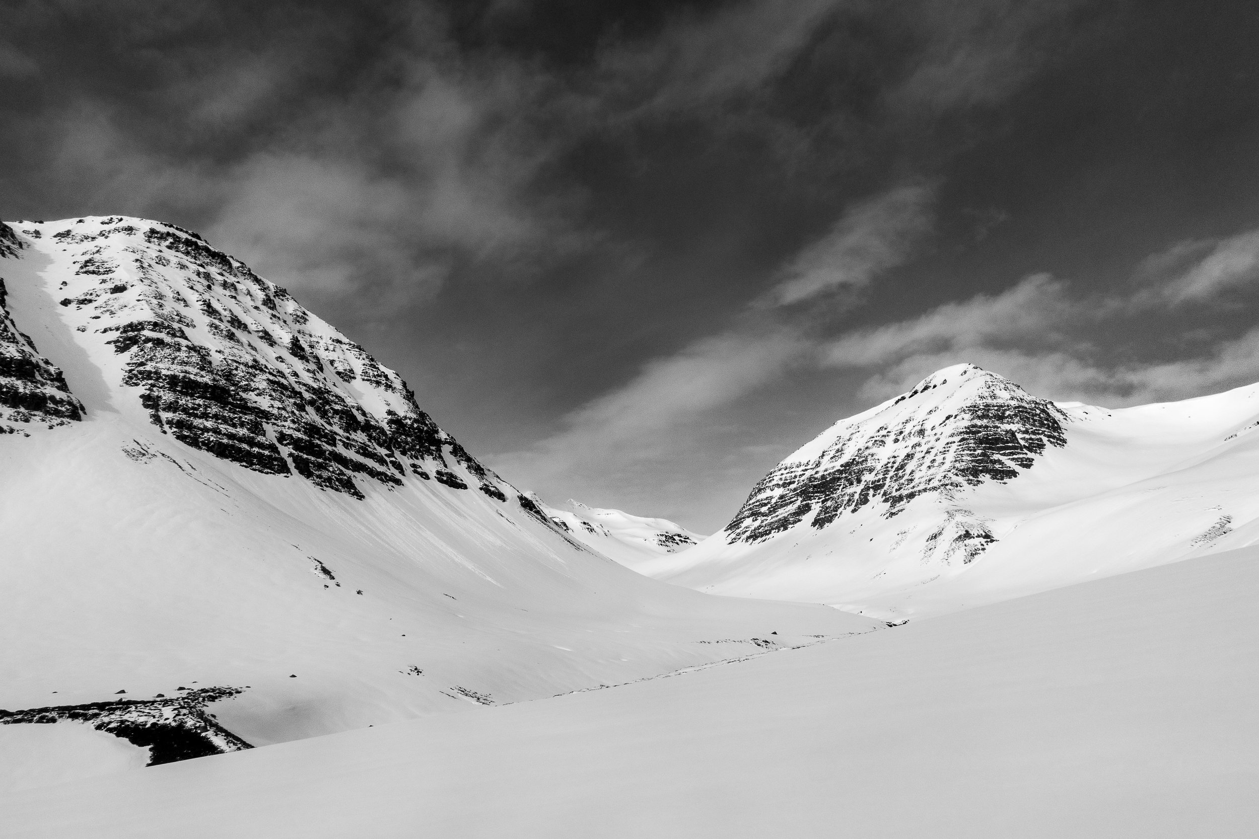
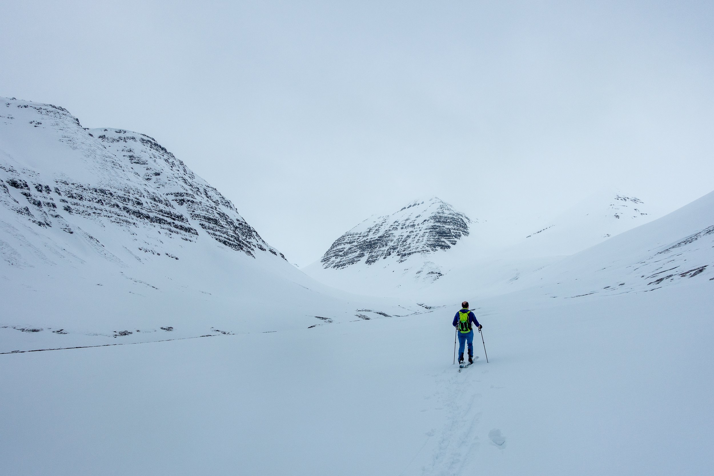
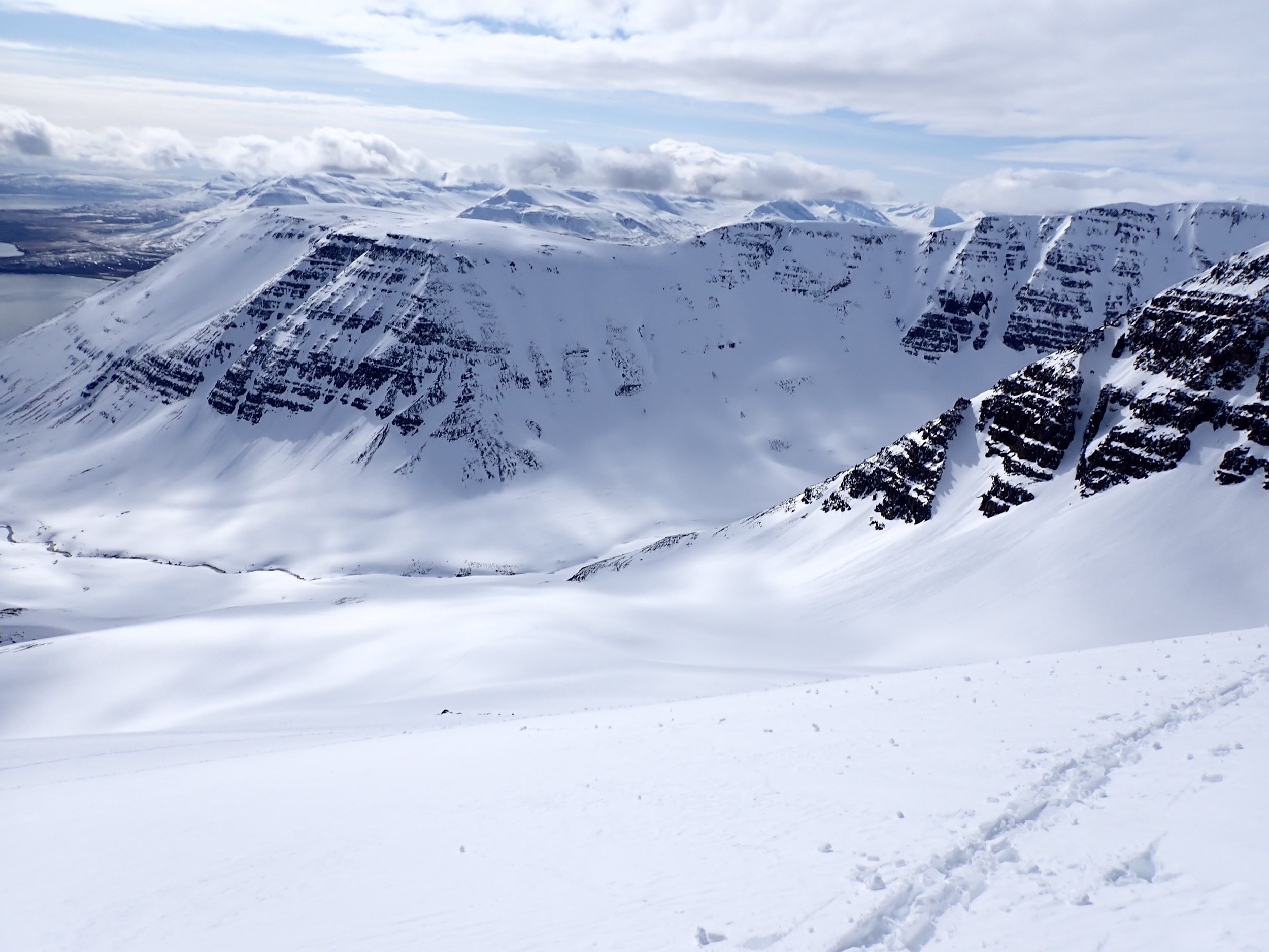
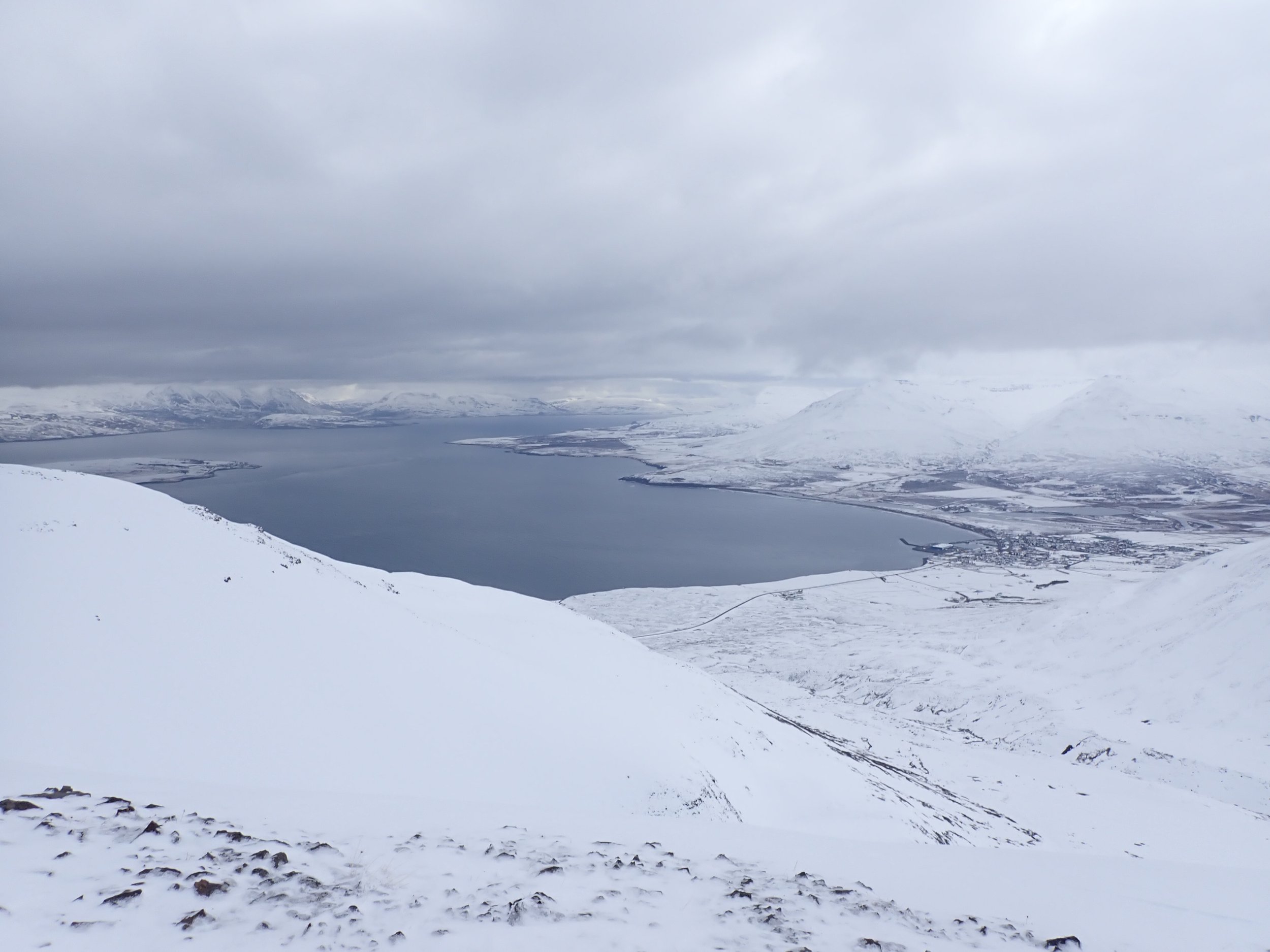
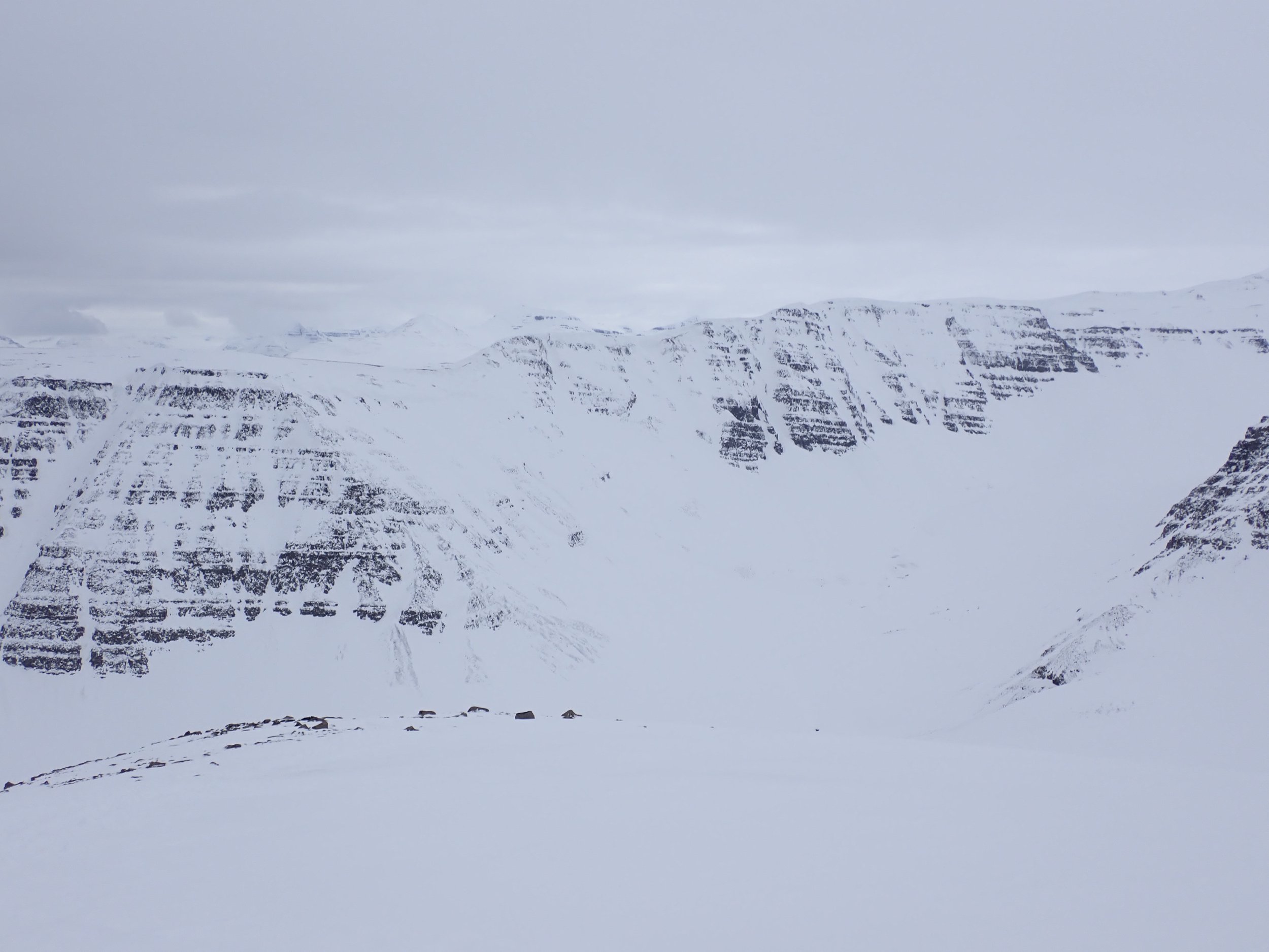
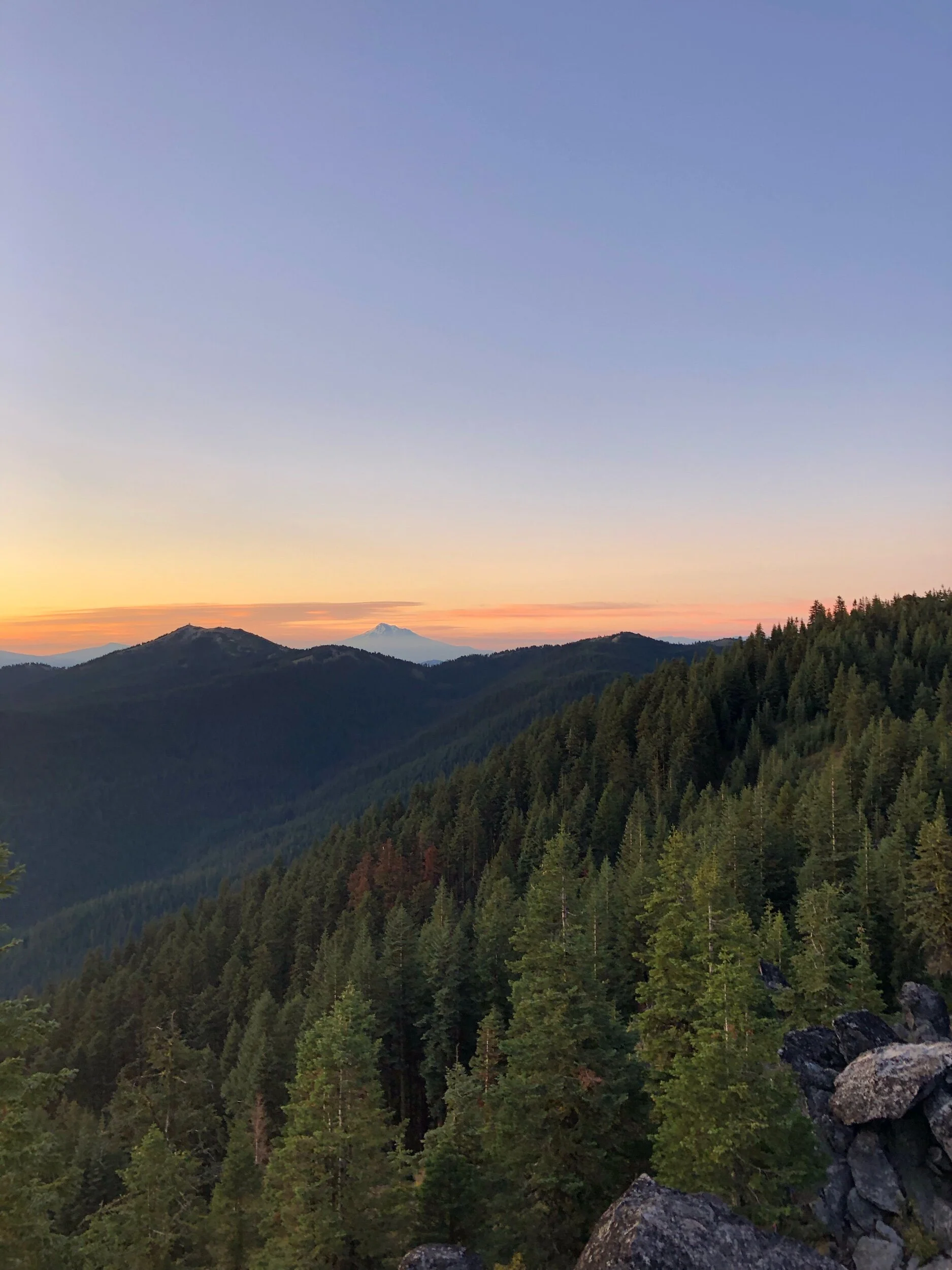
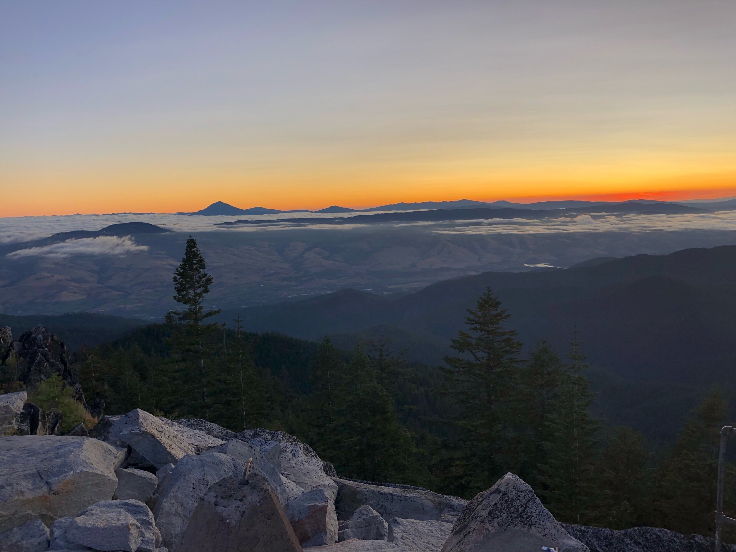
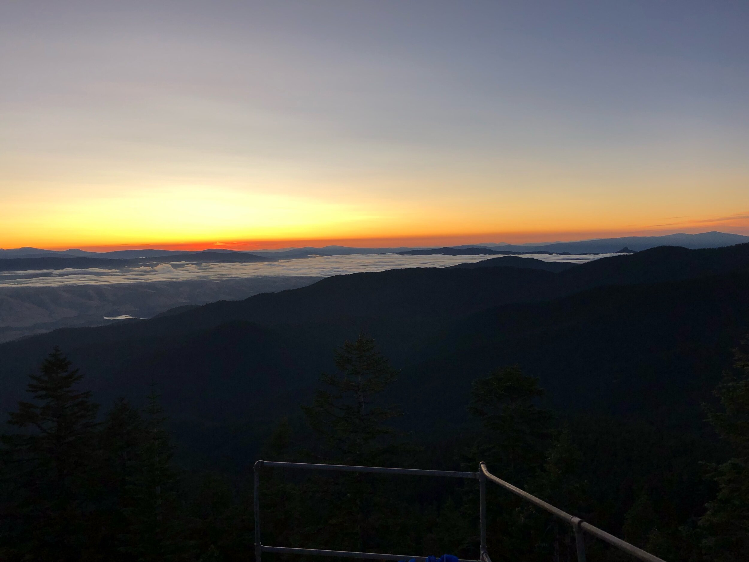
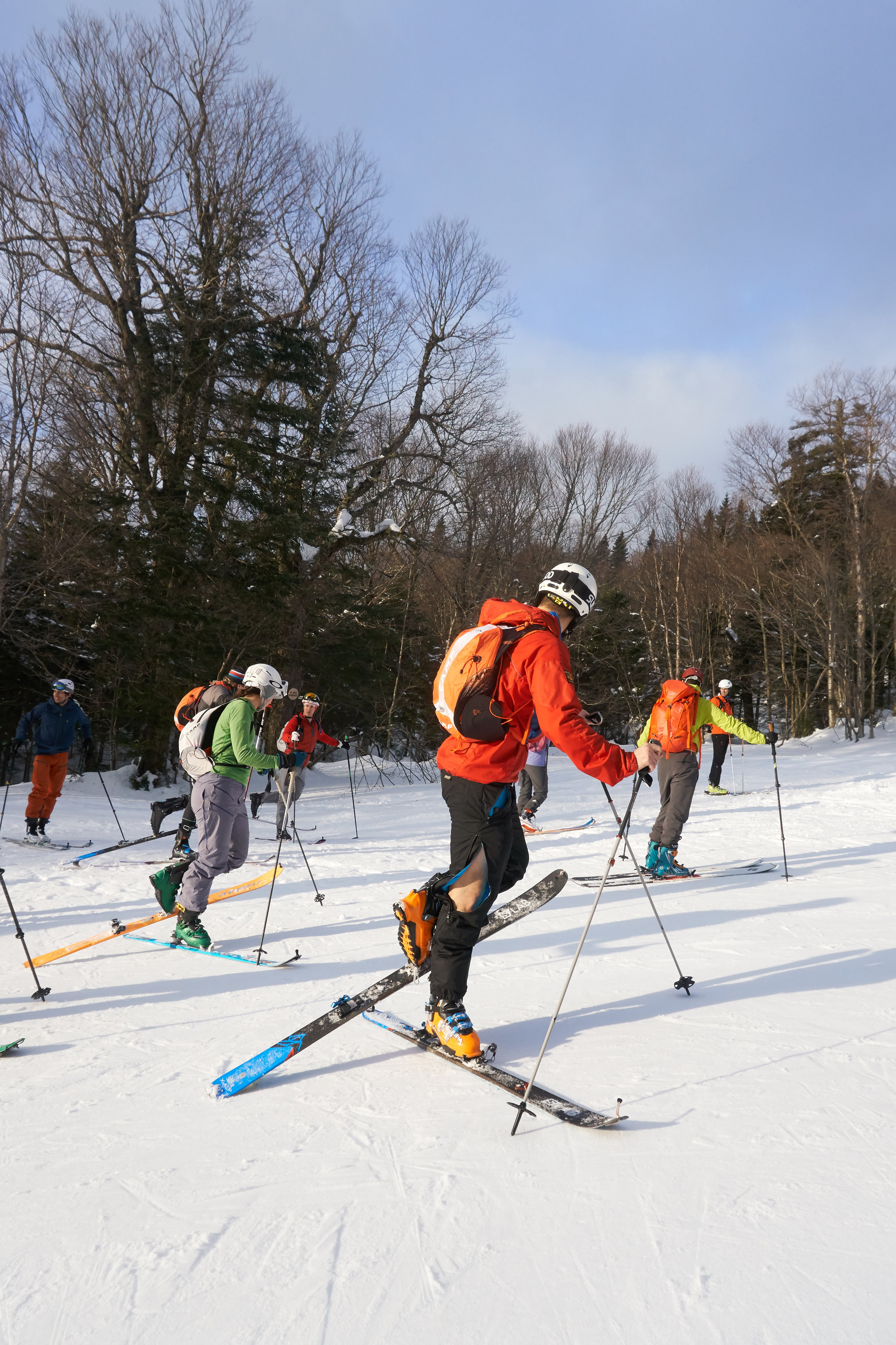
The Troll Peninsular; full of fjords, valleys and couloirs to explore
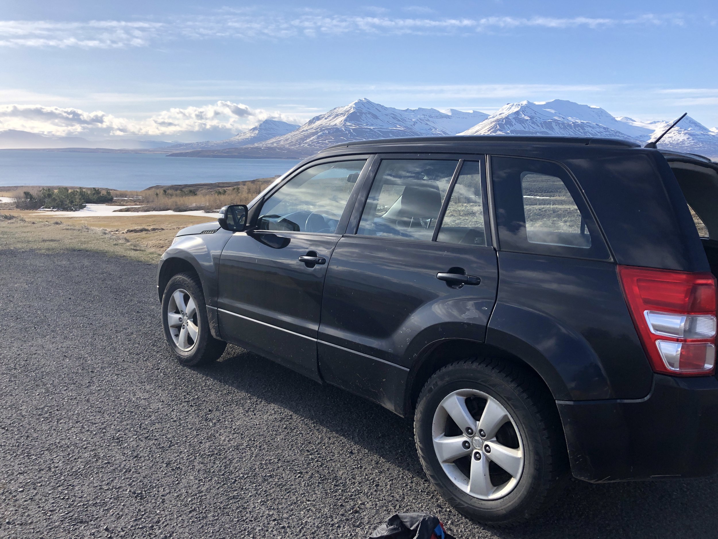
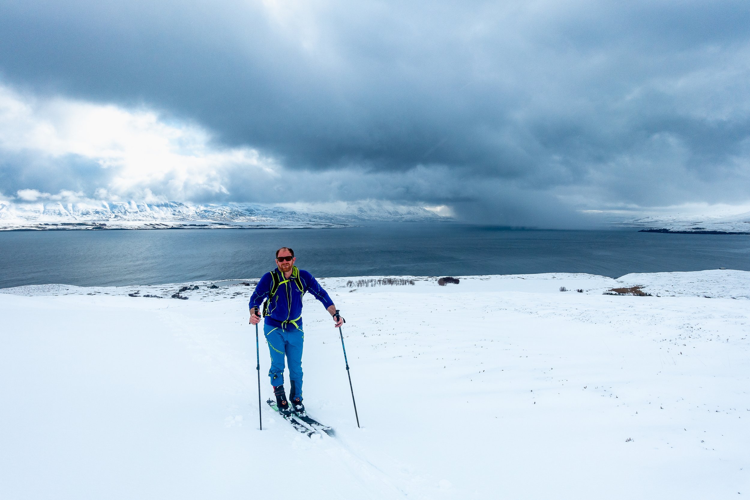
We arrived in glorious sunshine; the sun beaming down on our little black Suzuki with 450,000 km on the clock. With our rental picked up and it was onwards for the 6hr drive north. The city of Reykjavik and the surrounding lava fields making the landscape look other worldly, slowly transitioned to the flats and fjords of glaciated valleys. Making up for the brief night of sleep and early start to the day.Rivers and roads meandering through the countryside with the hints of green transitioning to a greater dusting of snow. The snow-covered peaks becoming more and more enticing as we travelled further north. We stopped briefly for a coffee and a donut on the way.
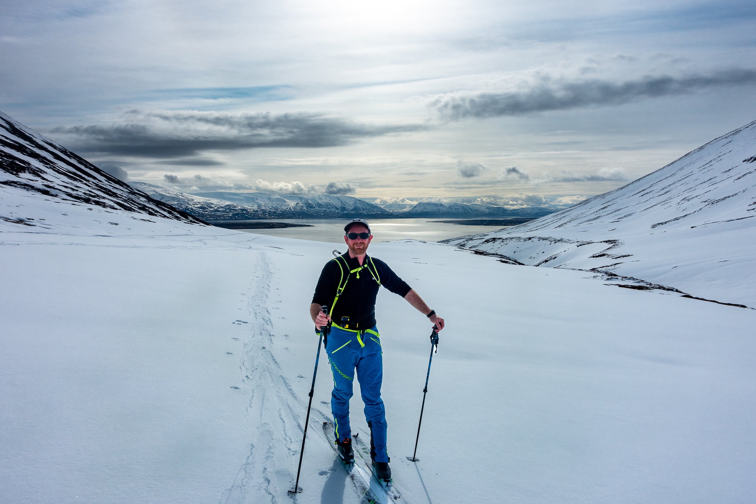
Arriving at the Airbnb for the week, the wood cabin had the smell of hot pine as the sun streamed through its large south-facing windows looking over the valley. We could make out many peaks and options to ski. We spent the evening poring over maps, avalanche and weather reports, deciding over the next day’s adventures. Despite our best hopes, the forecast had transitioned from days of sunshine to an outlook of a cold snap and cloud cover. With it being so bright outside, we hadn’t realised the time, despite having a long day of travel. The excitement of the next day’s adventures was keeping us going. It was time to catch up on some sleep with black out blinds drawn and fortunately a handy eye mask I had picked up whilst travelling. It was time to rest ahead of an early start and the first day of skiing.
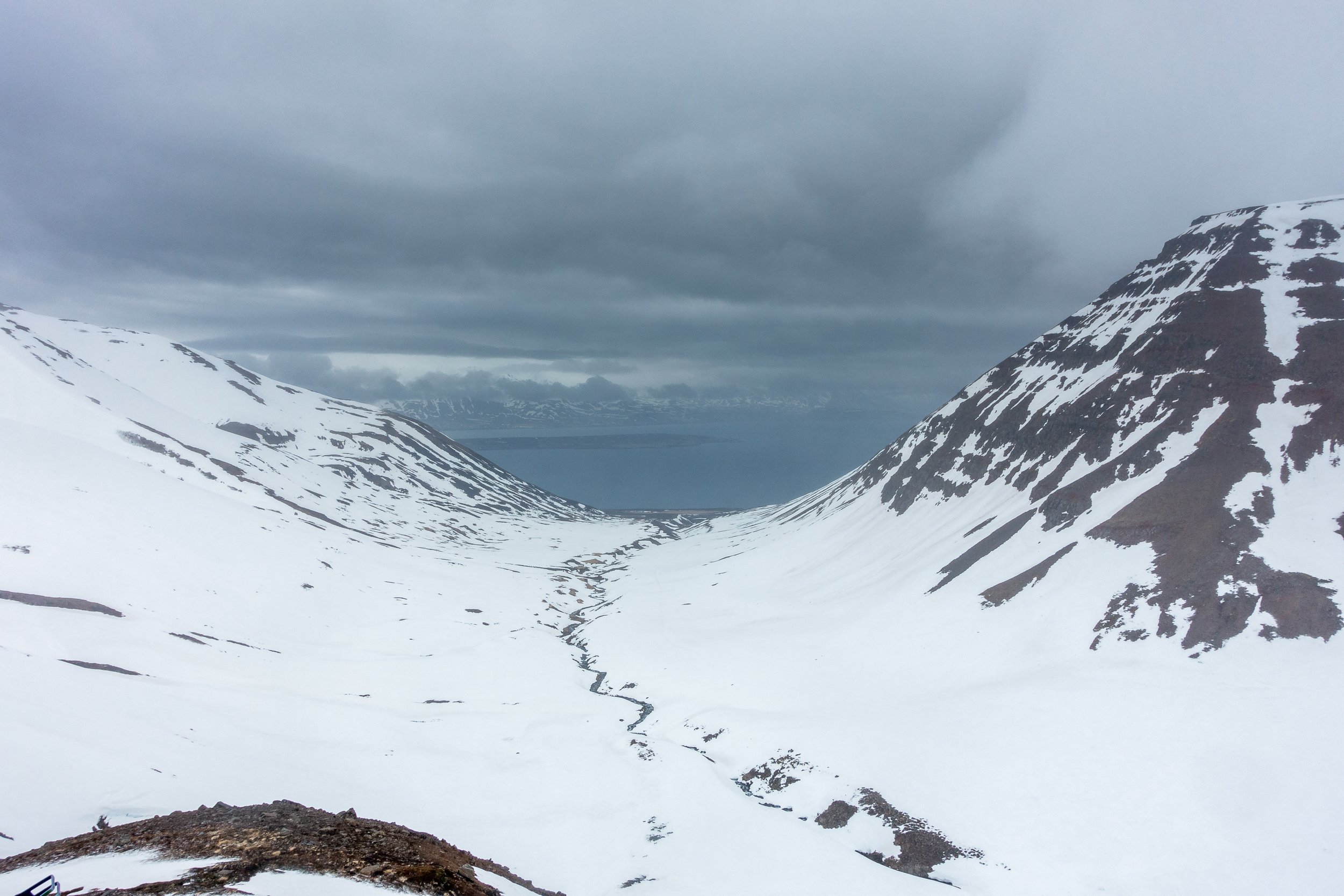
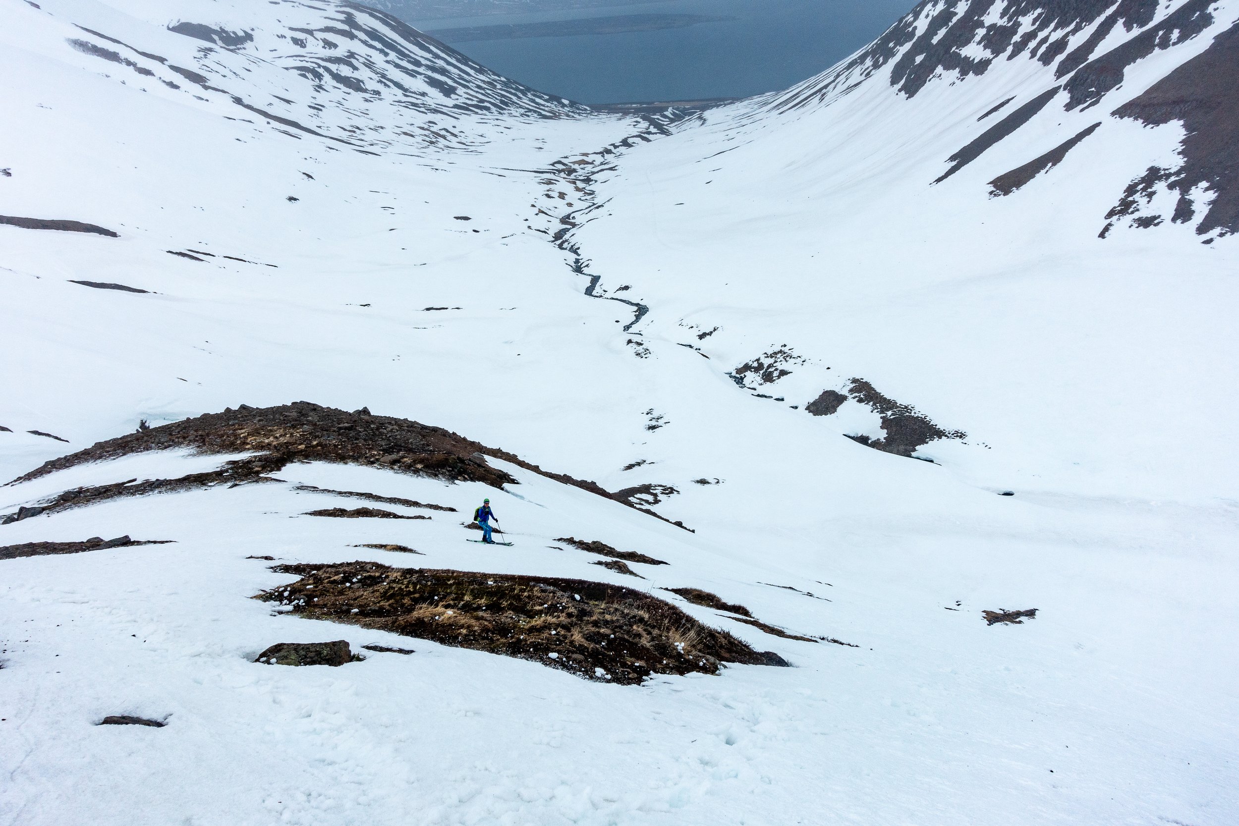
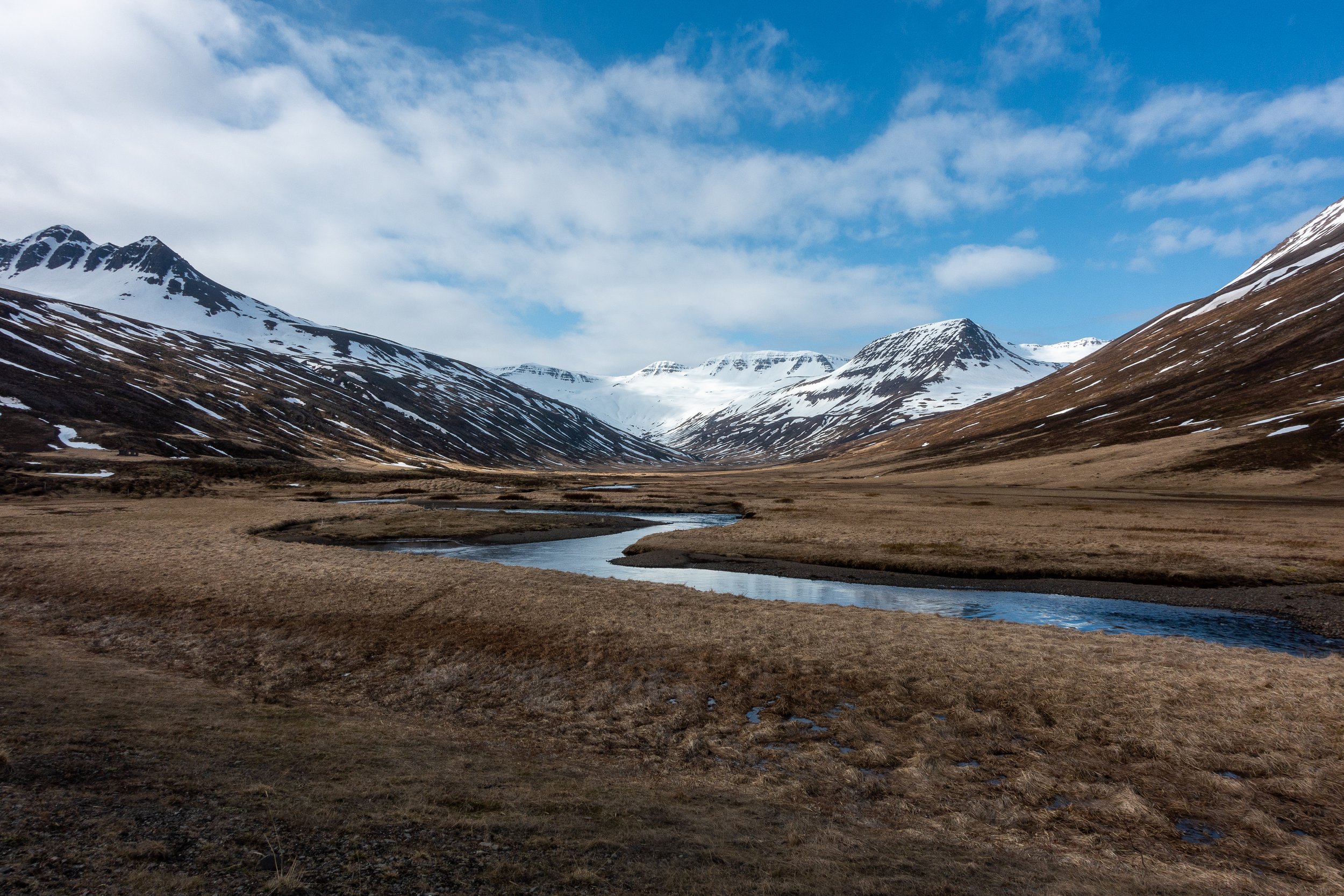
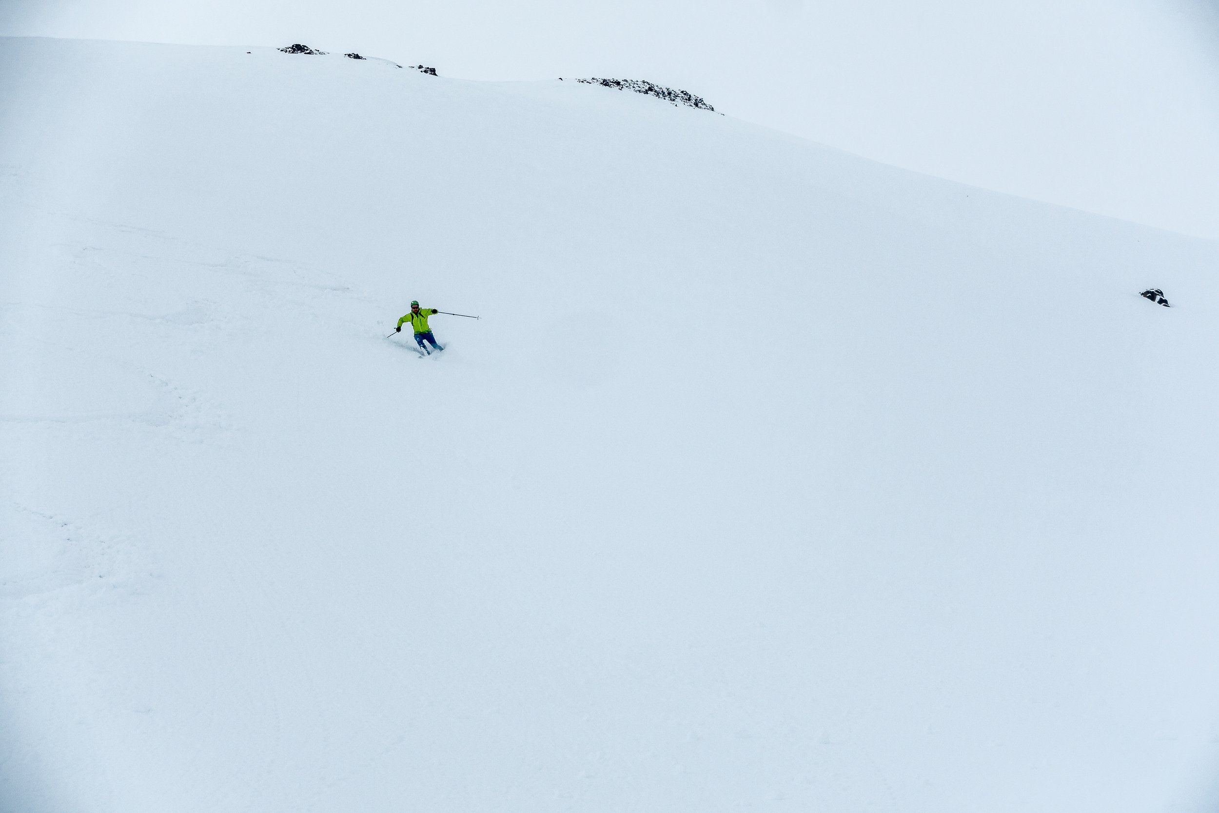
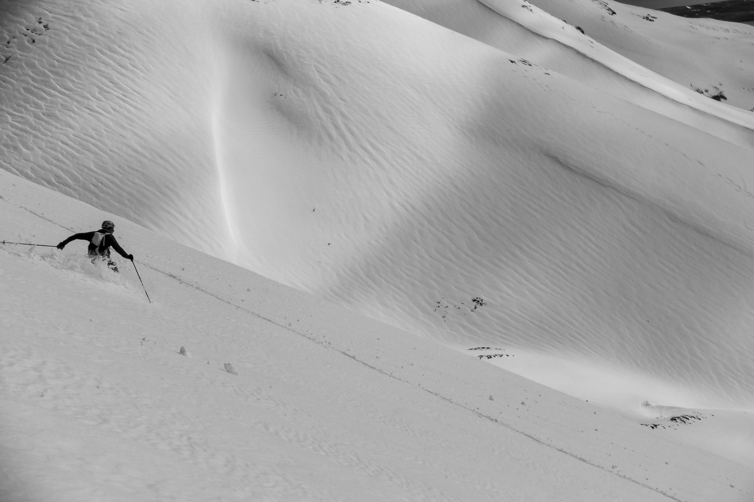
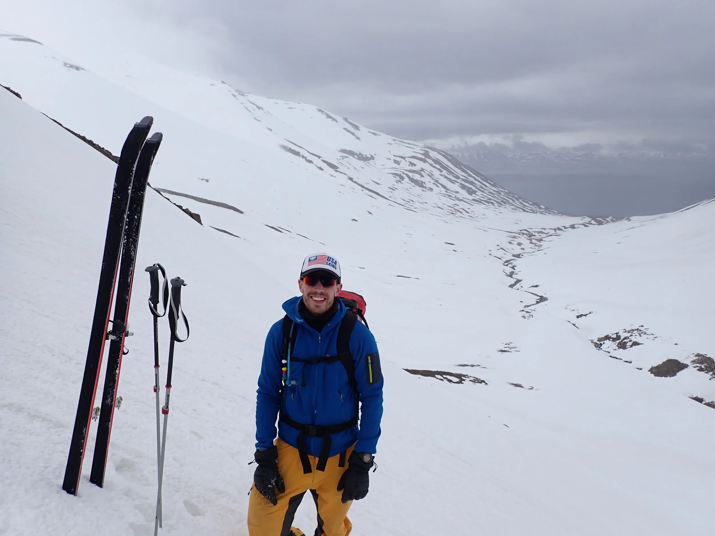
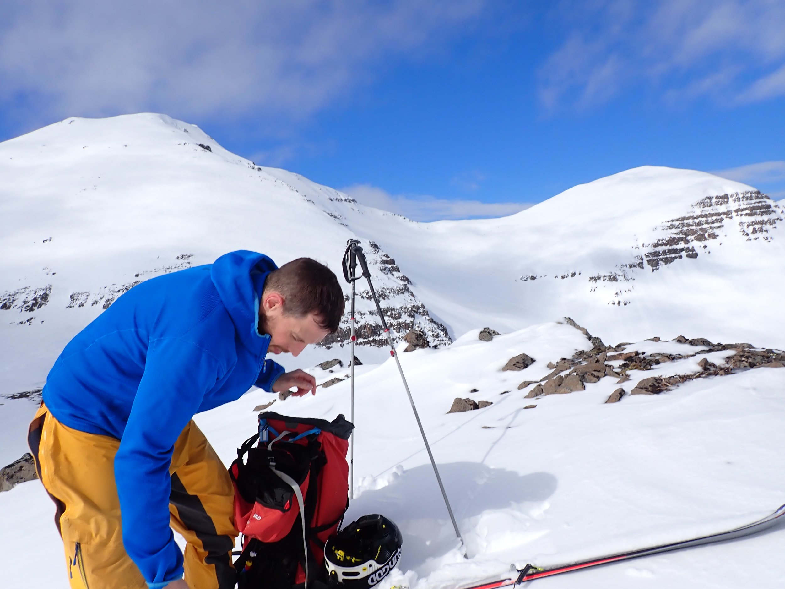
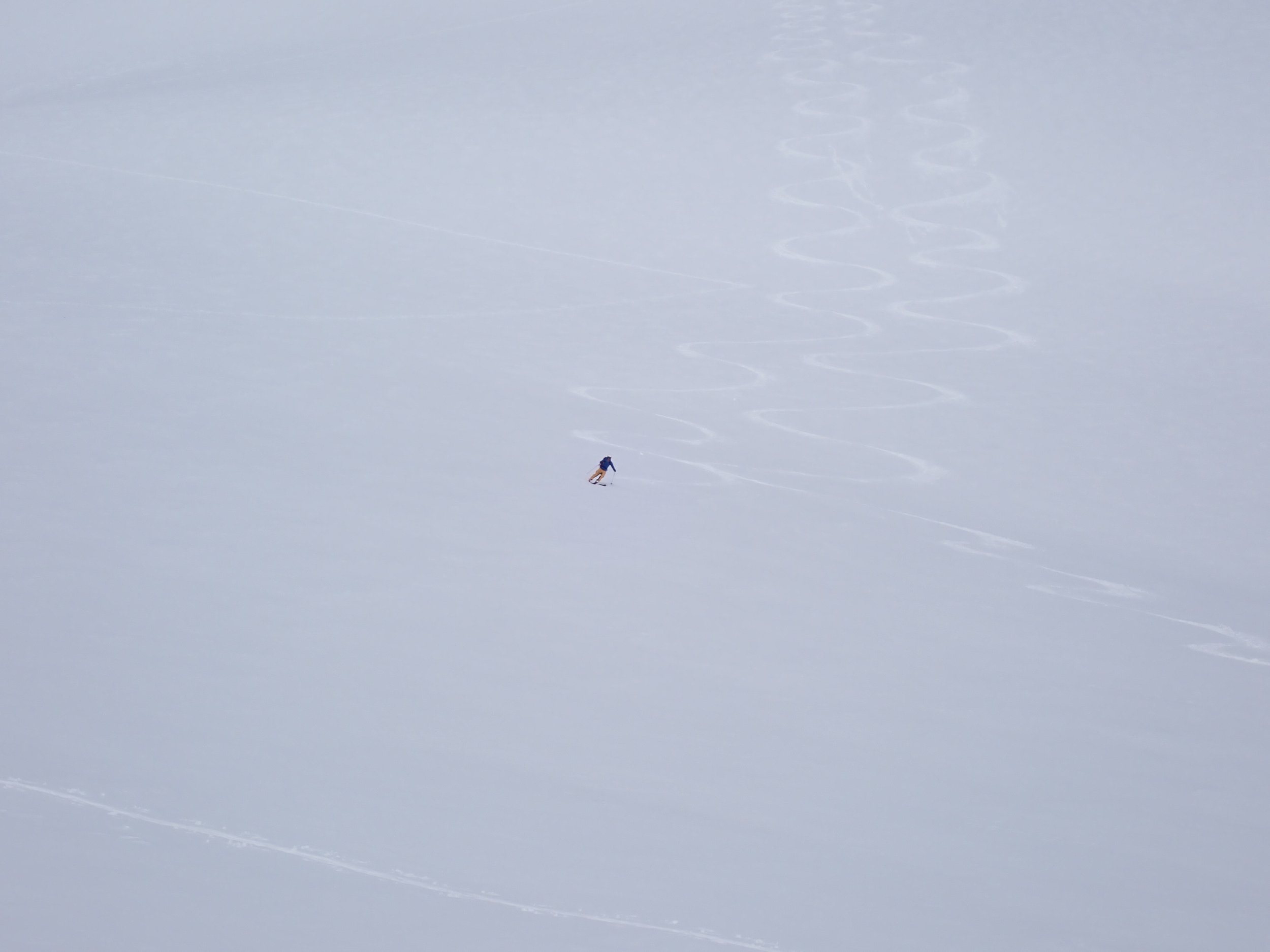
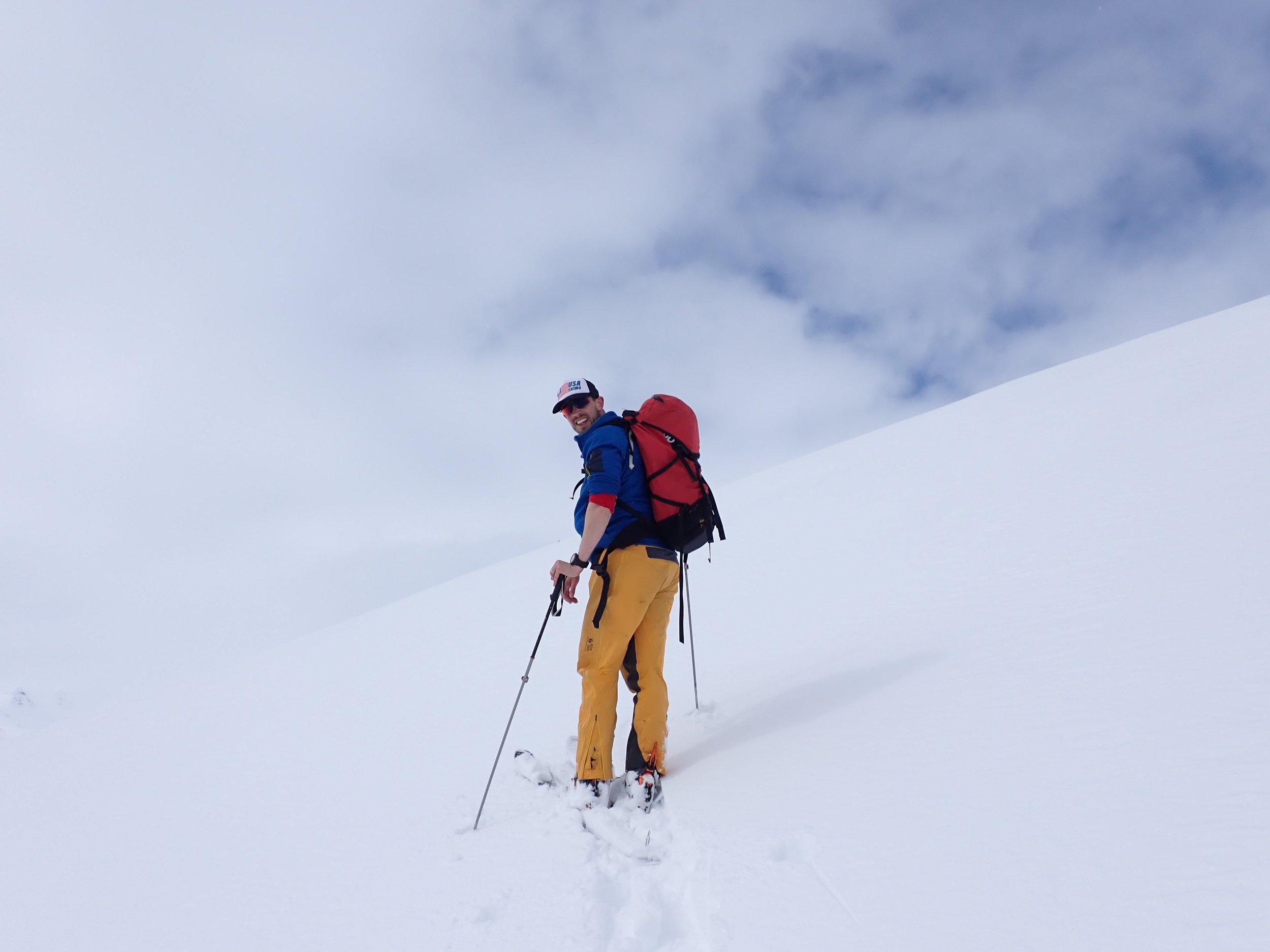
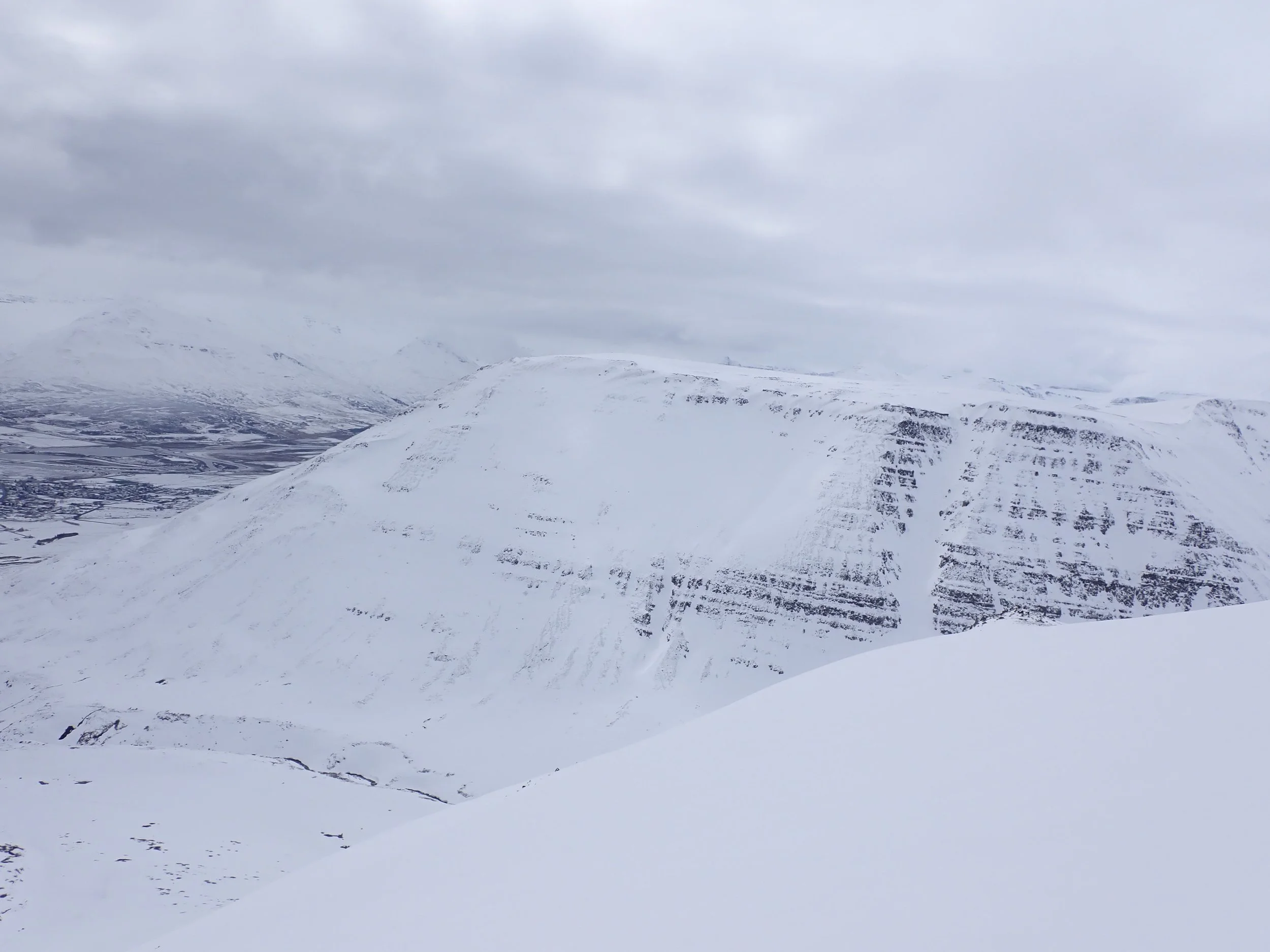
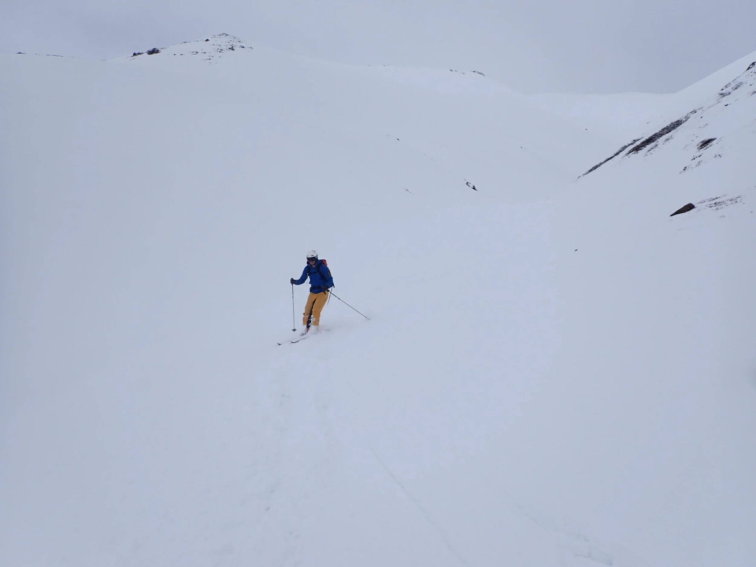
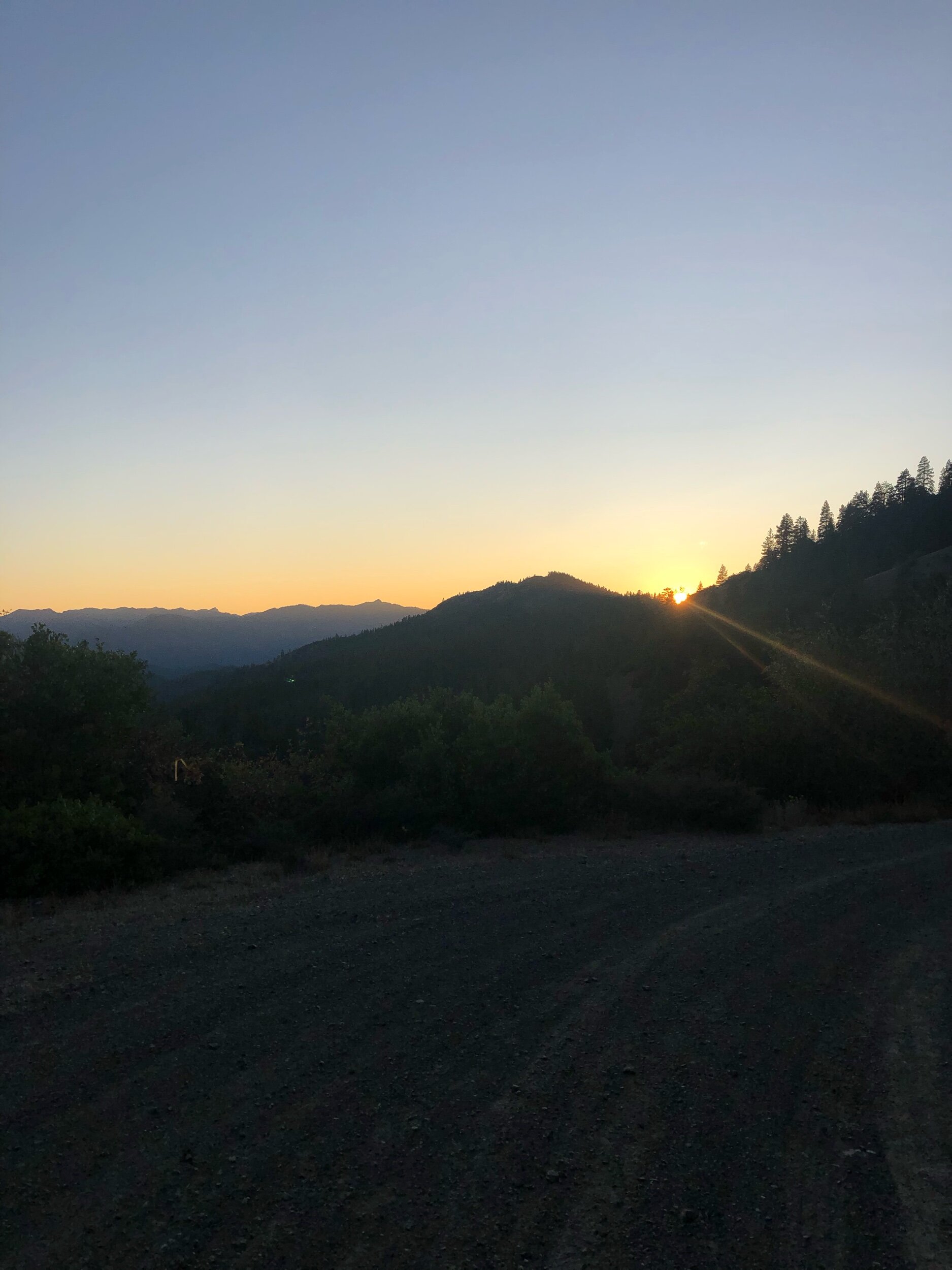
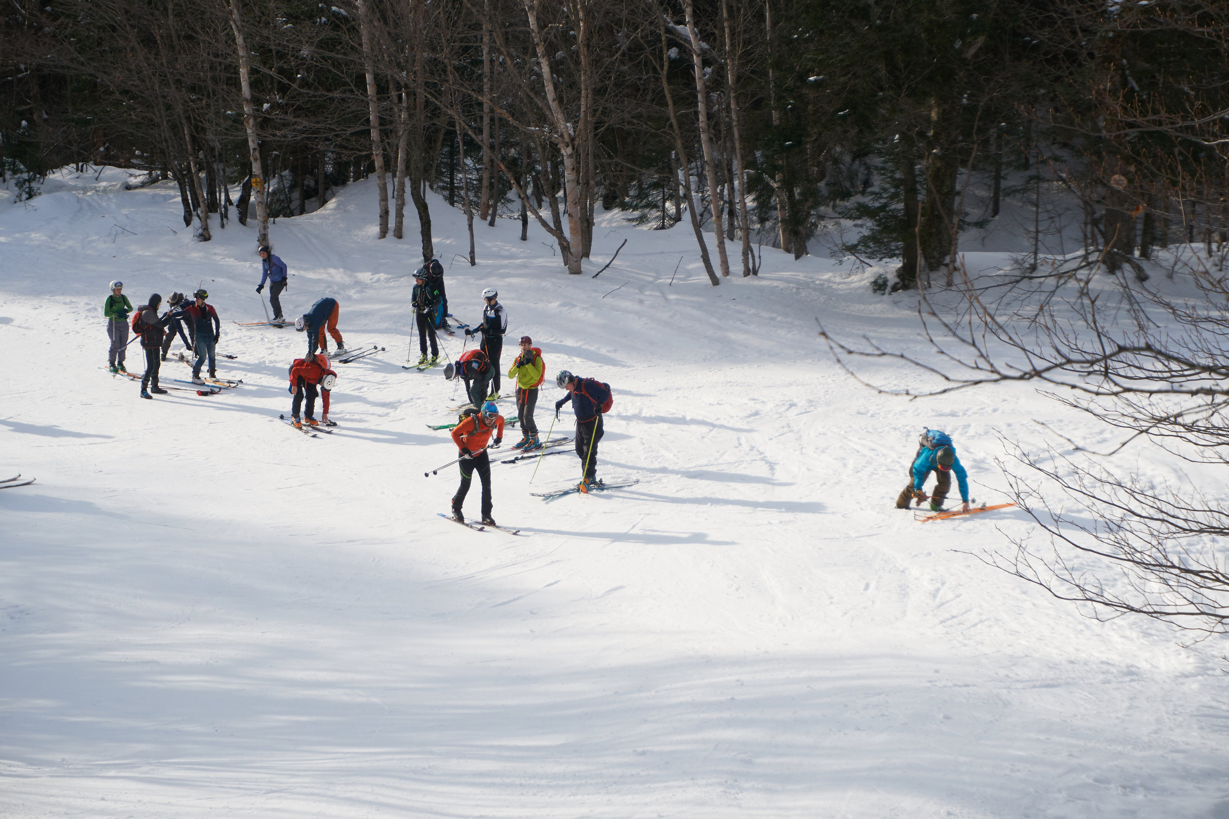
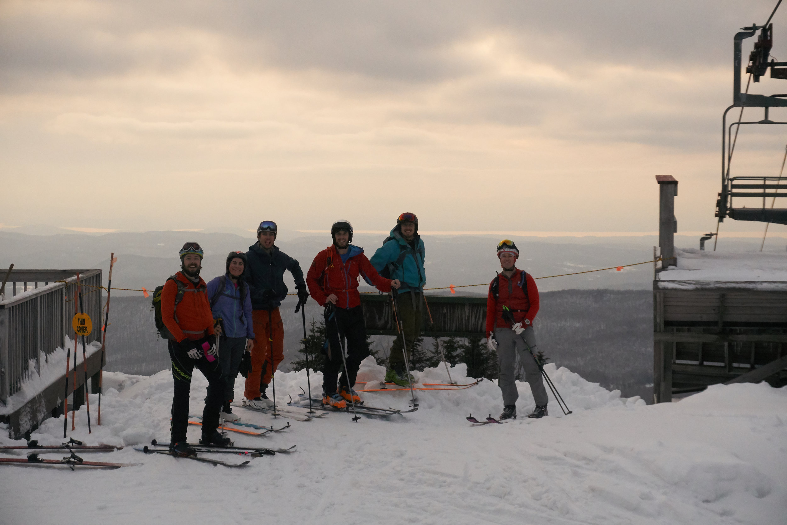
Rising the next day and slowly lifting the blinds to unveil a sea of clouds. They hid the peaks beneath a blanket of white and shrouding the slopes in flat light. Bags packed with everything we needed to hit the backcountry and car loaded up we headed to our trail head. A short drive from where we were staying. The first stage was to hike up to the snow line, up the valley we headed with the peaks occasionally sneaking out from behind the layer of clouds. We arrived at the white of the beginning of the “snow line”. It was hard packed as our skis crunched and cracked across its surface. Seeing a nearby peak, we opted to head up. We slowly inched our way up the mountain. Making it to a false summit and with conditions getting icier, we opted to make a descent. The hard crust providing plenty of grip but not the pleasant spring corn we had been hoping for. Undeterred, we headed further into the valley. After climbing a couple of different areas further and further into the valley, we finally found some soft snow to play in. Boot packing up the line, donning skis and then heading back down the way we had come. The turns felt glorious. There may not have been bountiful amounts of powder, but the smoother conditions were a great finish for the day! Speeding back down the valley, we found a cut through that followed a meandering stream back to the roadside. It wasn’t quite a summit to sea descent, but we were close enough.
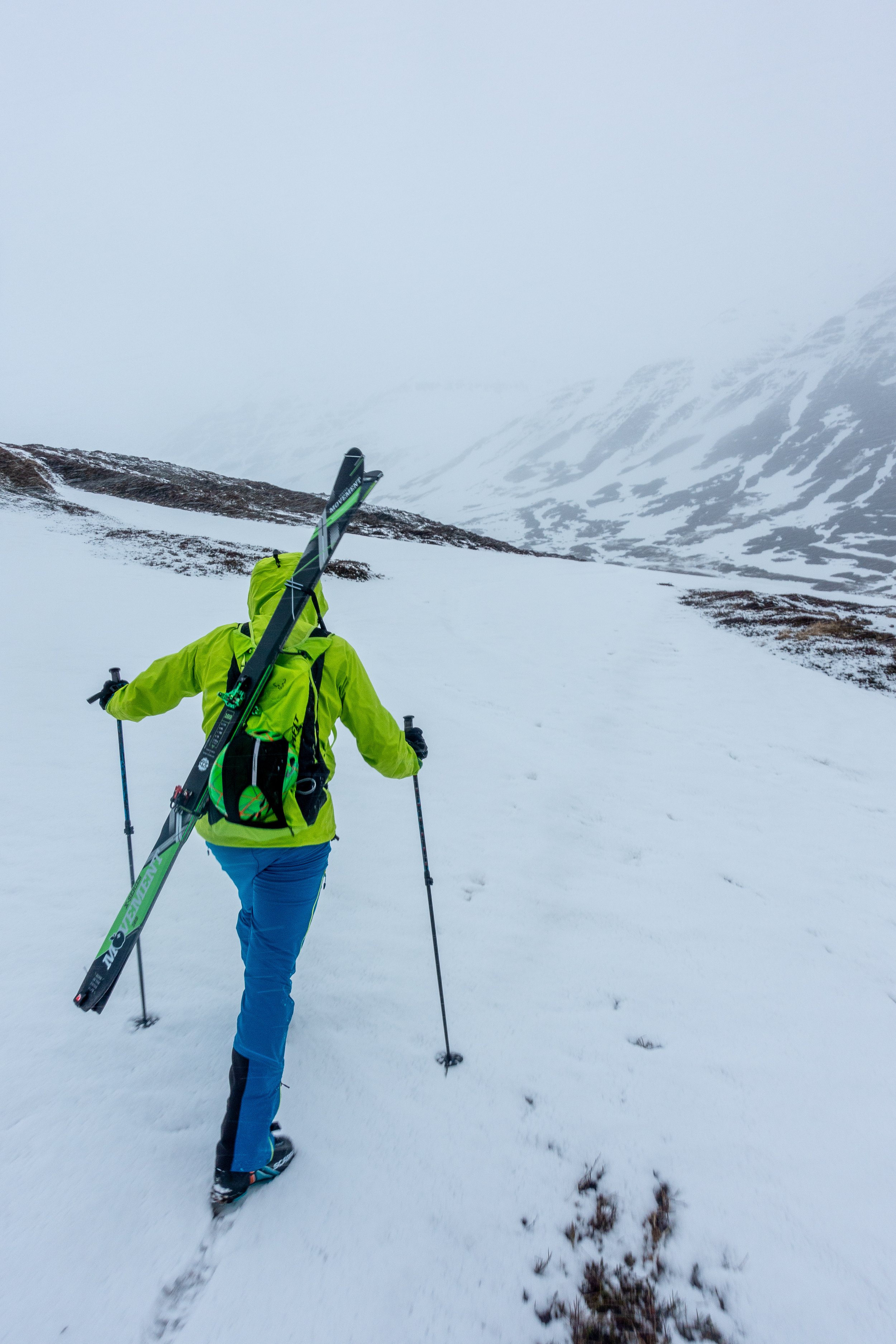
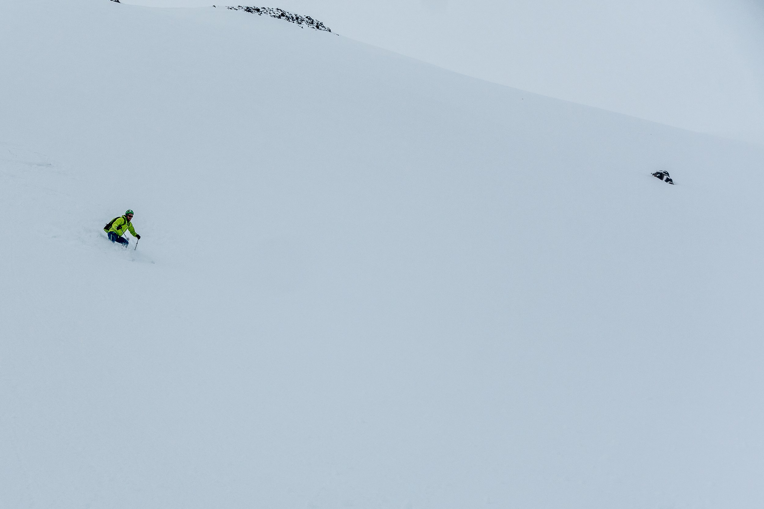
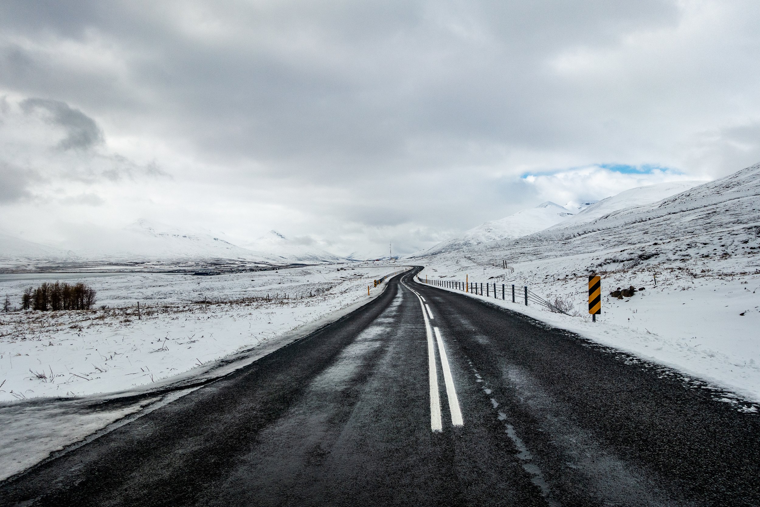
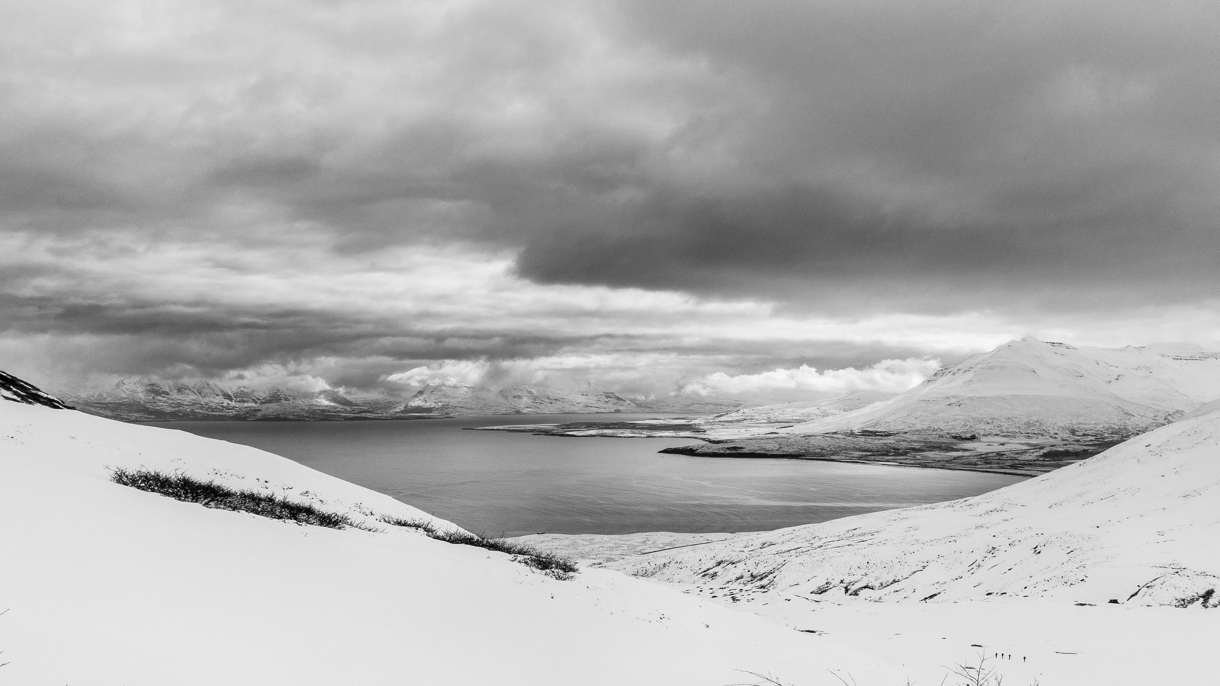
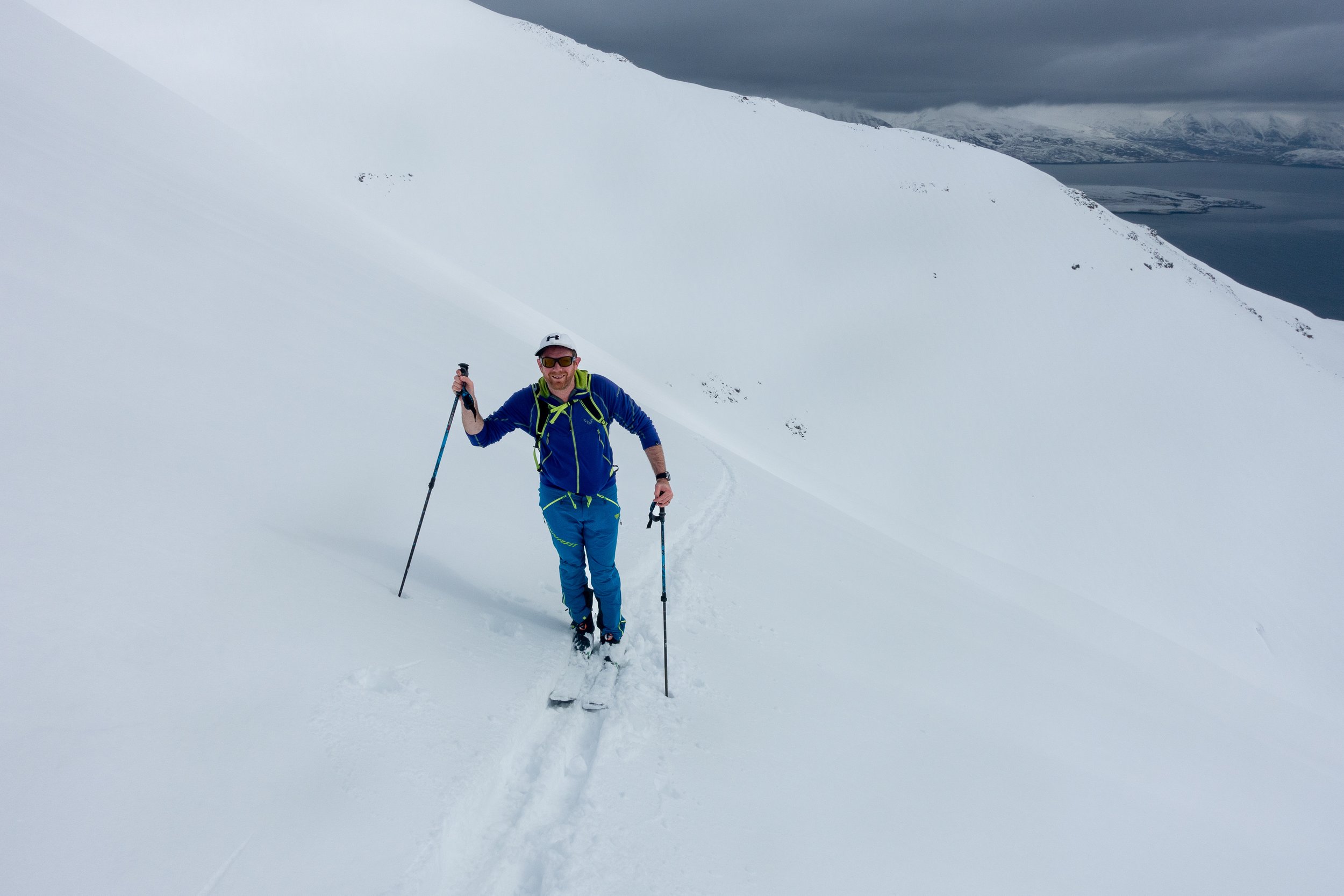
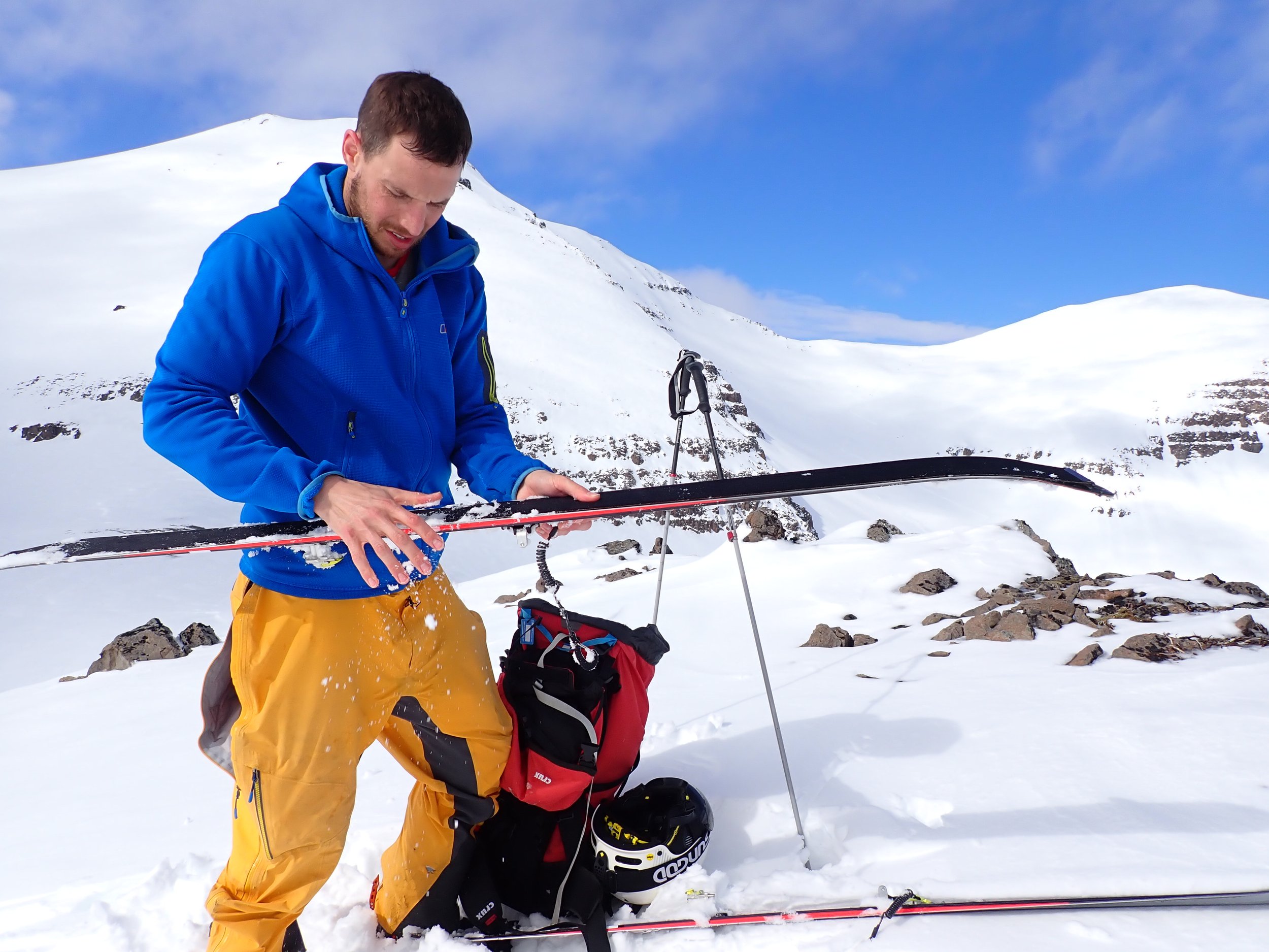
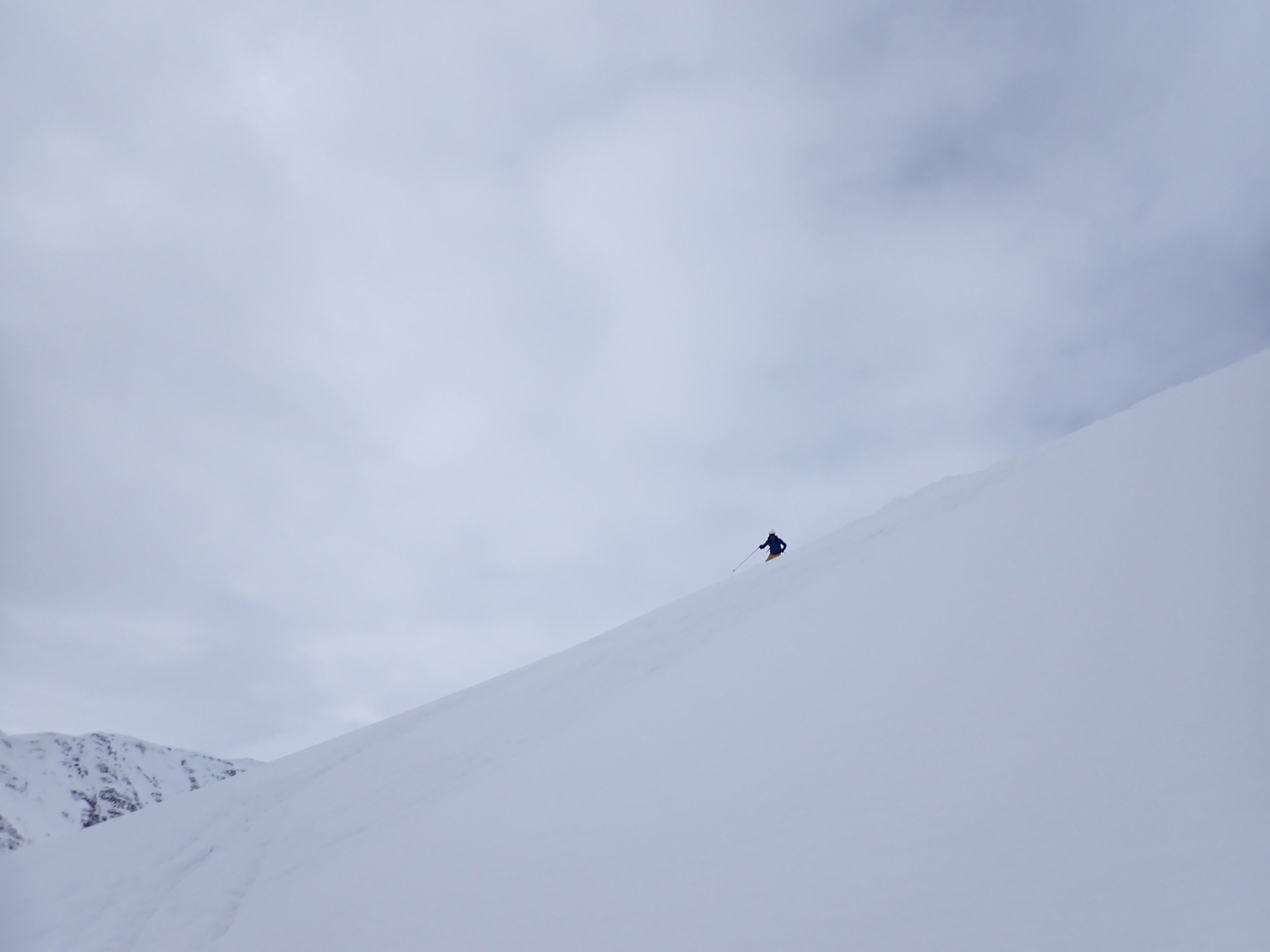
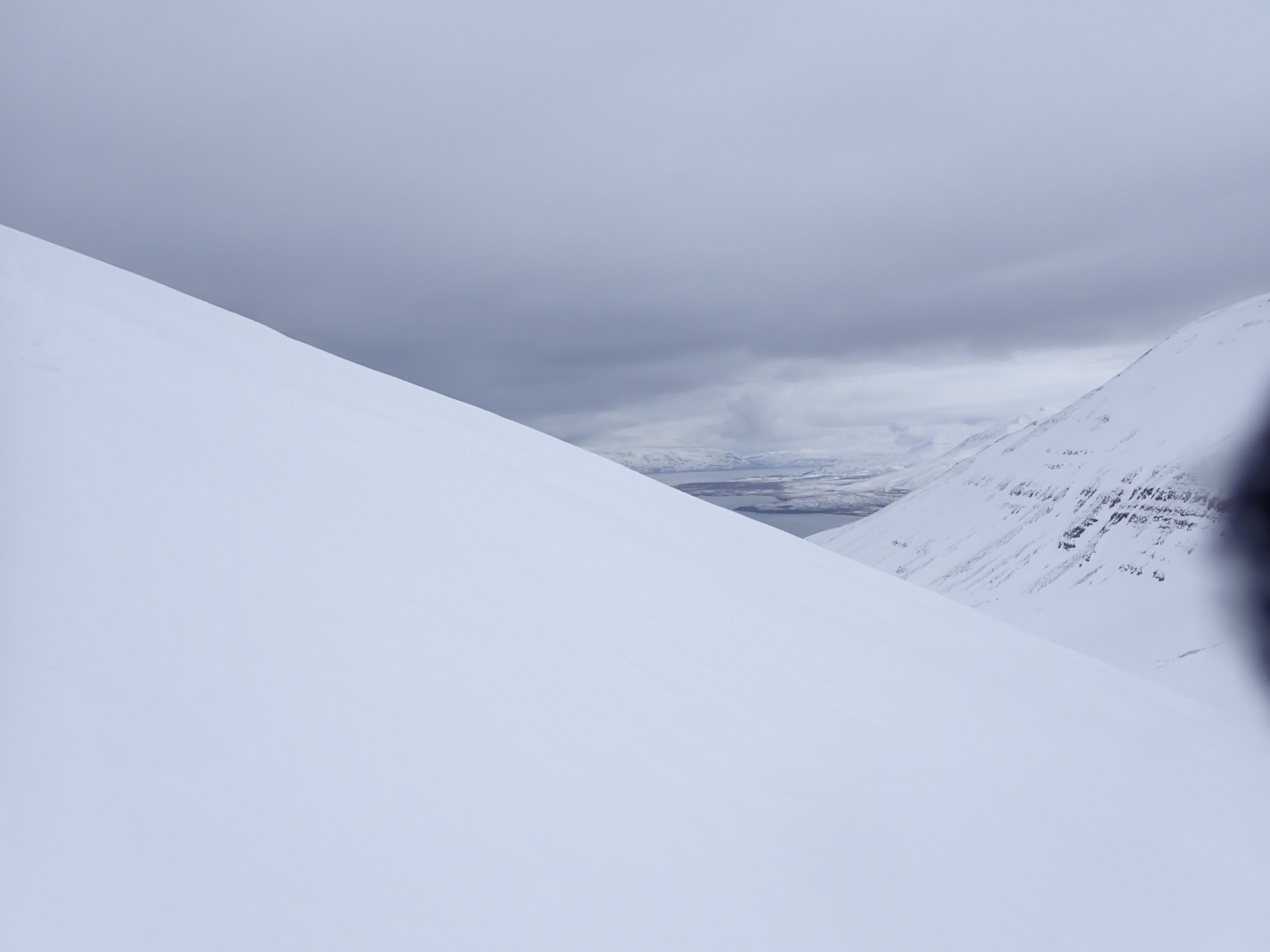
Day 2 brought tougher conditions. The weather report looked to be marginally better in a fjord to the west of us. Chasing the sun, we travelled through the tunnel separating the two fjords. On a side note, the tunnels in some areas are a single lane, a little daunting seeing car lights heading straight toward you and trying to judge when best to pull into a layby. Exiting the tunnel, we thought we had hit the jackpot and travelled to a completely different country!! Perfect blue skies. Spotting a face that was bathed in sunlight and was a closed ski resort, we headed up the track, passing a heli ski port whilst we prepared to hike up the mountain. Ski boots on and a short walk to the snow, we were soon skinning up. It was even harder than the previous day, reminding me of skiing in Scotland. Despite its hard nature, the sun was beaming, and it felt like it might soften ever so slightly. Meandering further and further up the mountainside, we passed a group of ski tourers who had clearly opted to skip some ski time with some avalanche skills, hoping for softer conditions. We headed on up as some clouds rolled in. The once hard surface transitioned on our ascent to borderline solid ice. With our skins hardly gripping, it was time for a change of tactic. Boot crampons came out. Despite a variety of days and adventures out in the mountains, I had never had to put on crampons onto my ski boots. Luckily, I had thought I had correctly fitted my crampons the night before. I gingerly took each ski off, replacing them with a crampon on each foot and skis on my back. It was not the quickest or slickest of operations. And is definitely something I wish I had practised on the flat. I quickly realised something was not right, as I could see a gap at the front of my toe piece. Rather than heading further up the slope to a flat section, I opted to head back down, thinking that if I slipped at least I would have less distance to slip. The descent was certainly not my smoothest, with the crampon falling off one or the other foot. At finally both feet at the same time. Finally reaching the base of the slope and realising the conditions were going to be equally terrible across the range, we called it a day. Quietly heading down the mountain in a depressed state, back to base. The mood being marginally lifted by excess chocolate on the car ride back. It was maybe a great learning day, but it certainly was not my finest. We headed into Akureyri for a spot of tourist time.

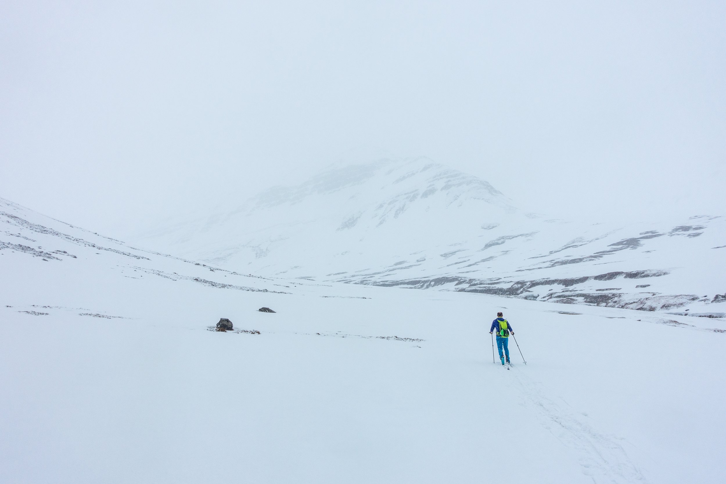
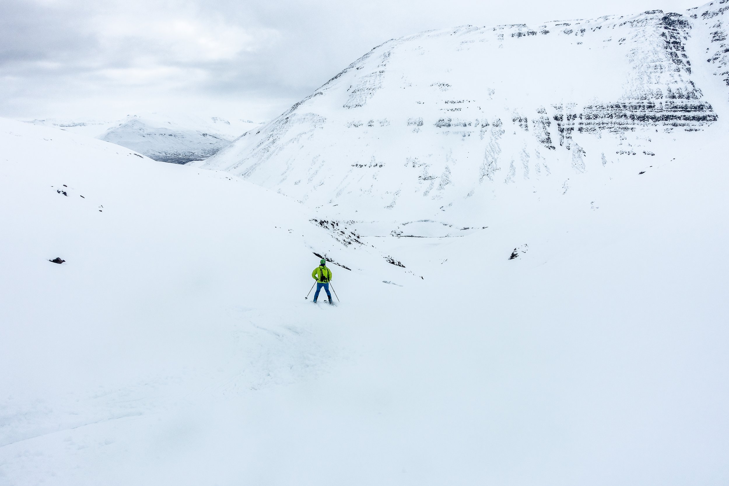
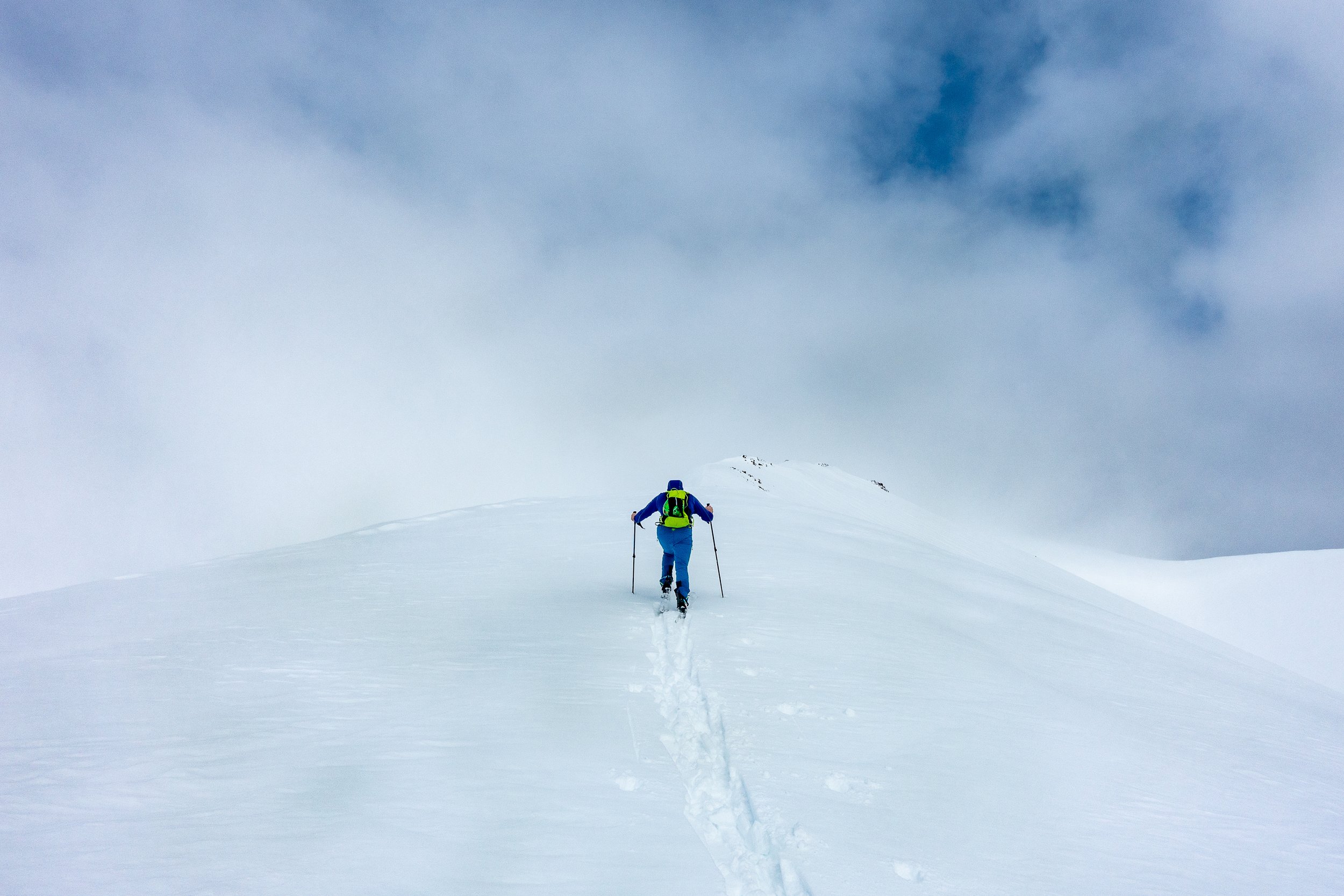
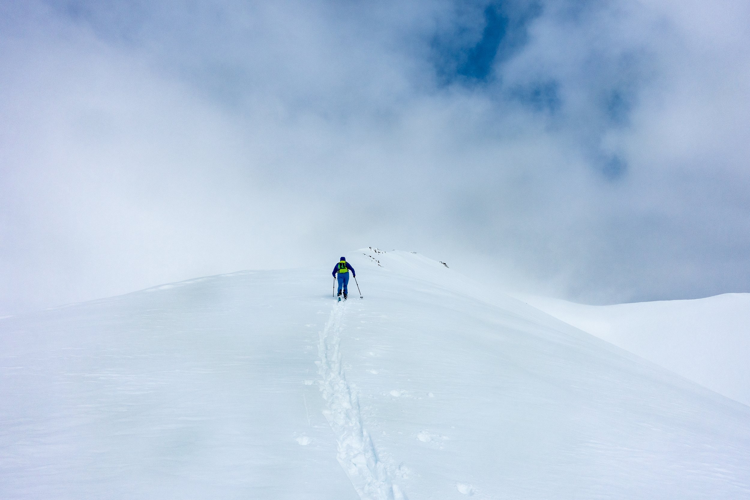
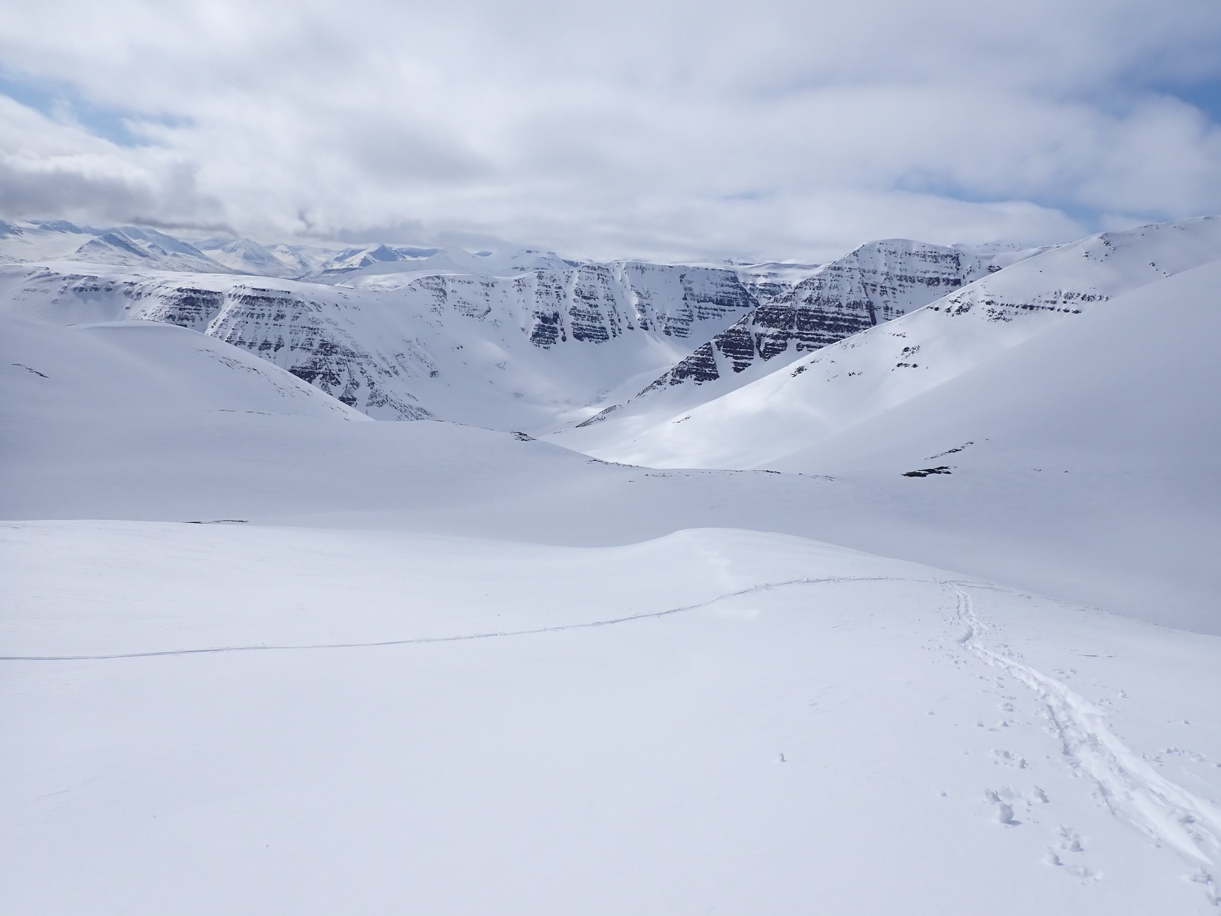
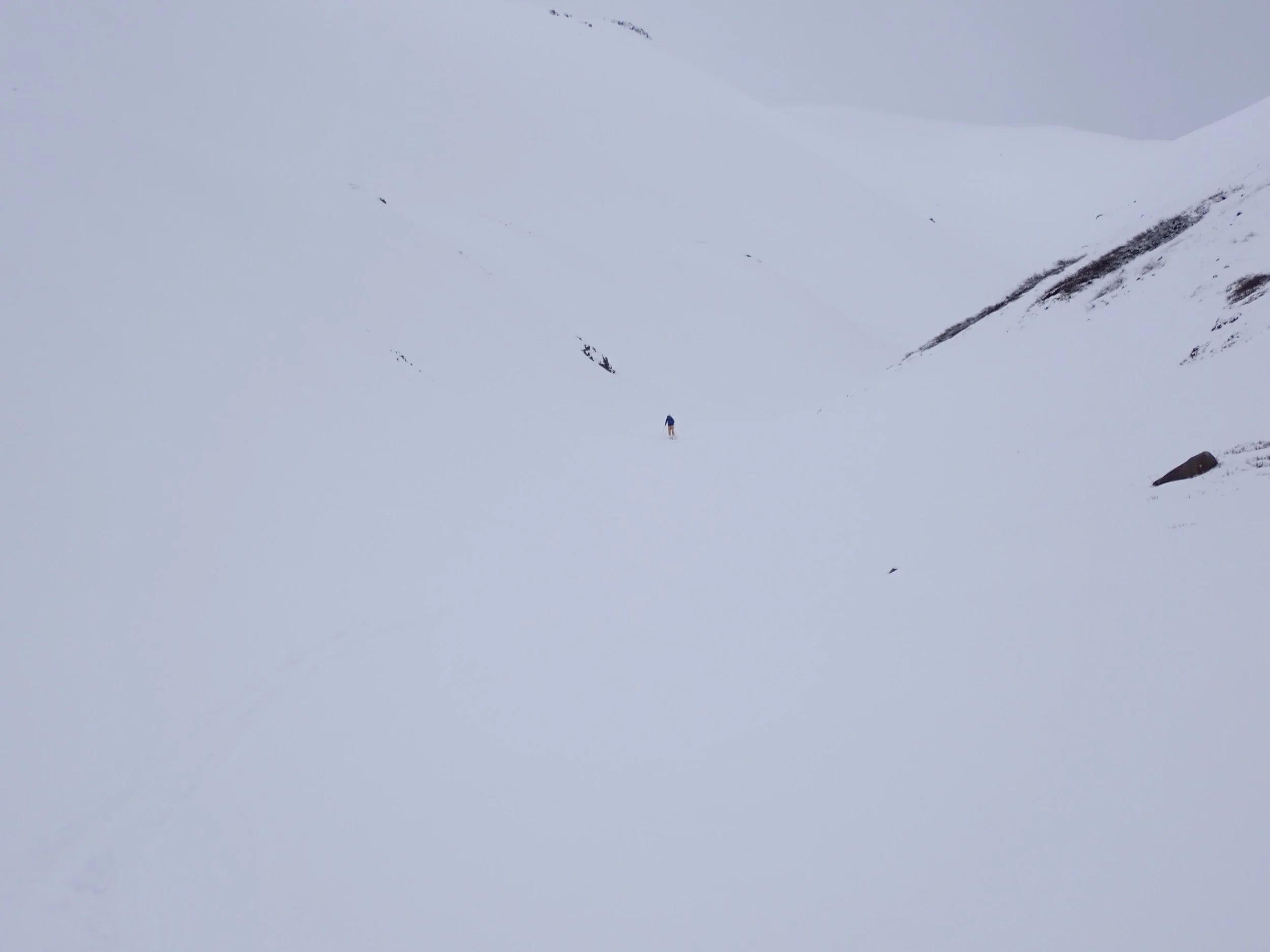
Day 3, with a similar forecast from the prior day and no heat on the horizon to soften up the icy conditions, we opted for a low aspect and exploratory day. It transpired that even exploration was going to be a challenge with an even lower cloud and incredibly flat light. The valley we chose had looked incredible, though, so we headed on up to the start. We drove a reasonable way up to the start along a dirt road before hiking up a path to meet the snow. A gentle breeze blew and occasional snow flakes fluttered about the place. We were soon aligning up the valley, picking our way amongst rocks and heather. Past couloirs which were clearly out of the question in their current state. The snow was, however, softer than the prior day, tempting us to head further back in the valley towards higher elevations. We continued to assess and adjust our line on toward a high ridge line above us. With Brian in the lead, we arrived at a band of rocks and the shoulder before the summit. Unable to see the top, the wind picked up and with no change on the horizon; we took what we had gained and headed back down the mountain. It wasn’t the longest of descents, but the work had paid off to deliver some hard won turns. Arriving at the base of the bowl to debate whether to head up another section and we decided for us as the clouds cloaked even the lower faces. It wasn’t a full white out but conditions were definitely getting worst. It was time to head to the car. Our downhill return turned out to be not so downhill as we spent the next hour poling our way back.
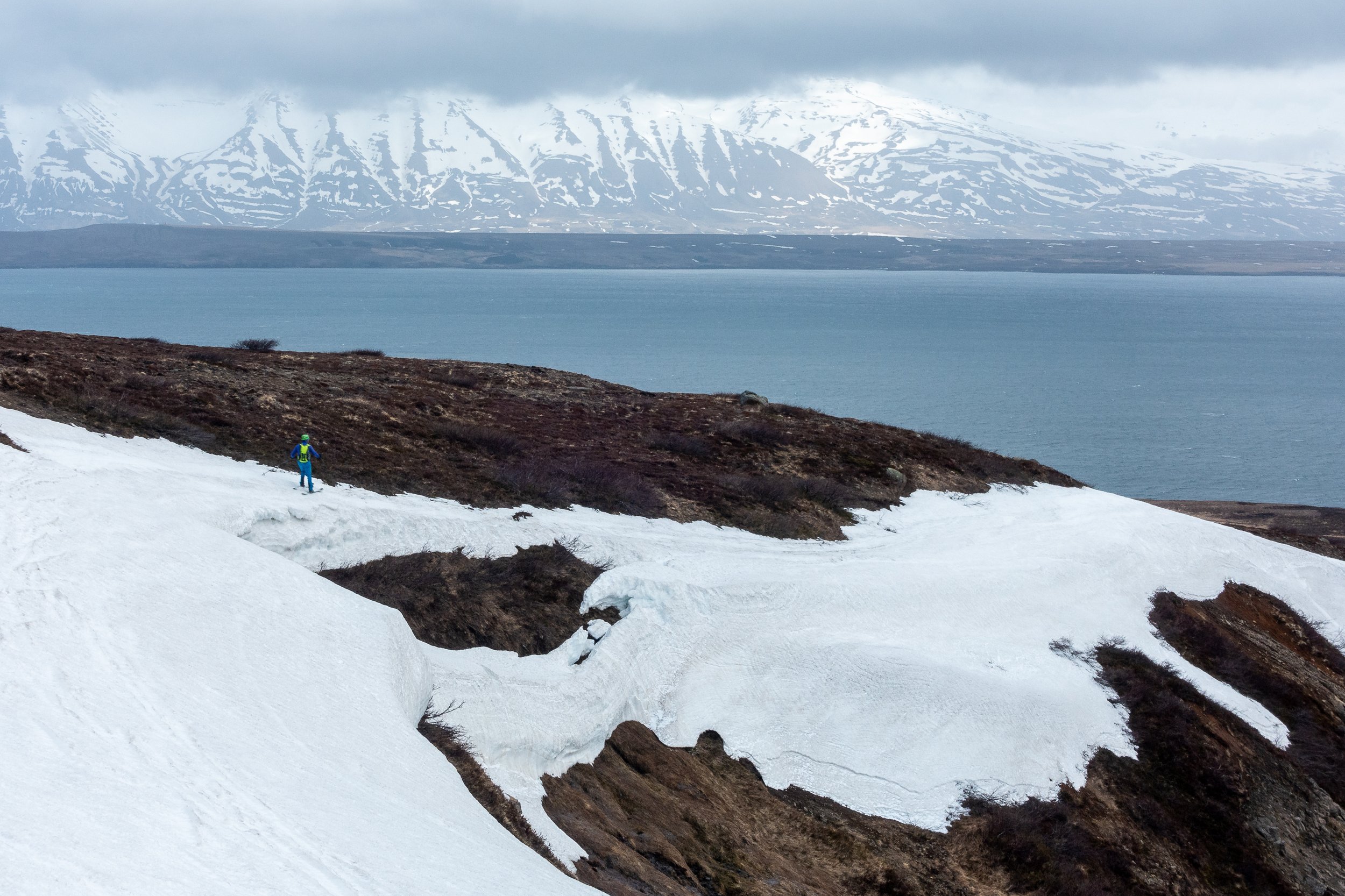
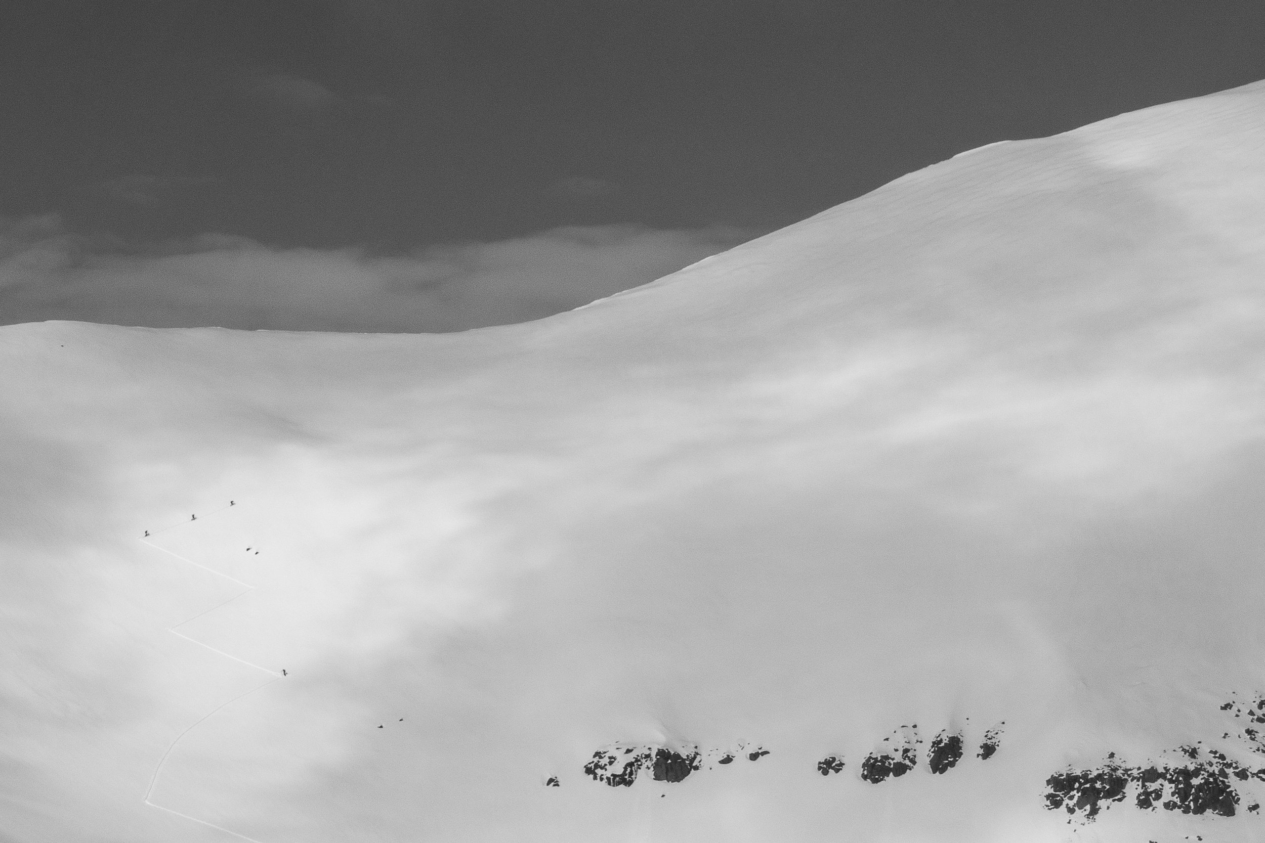
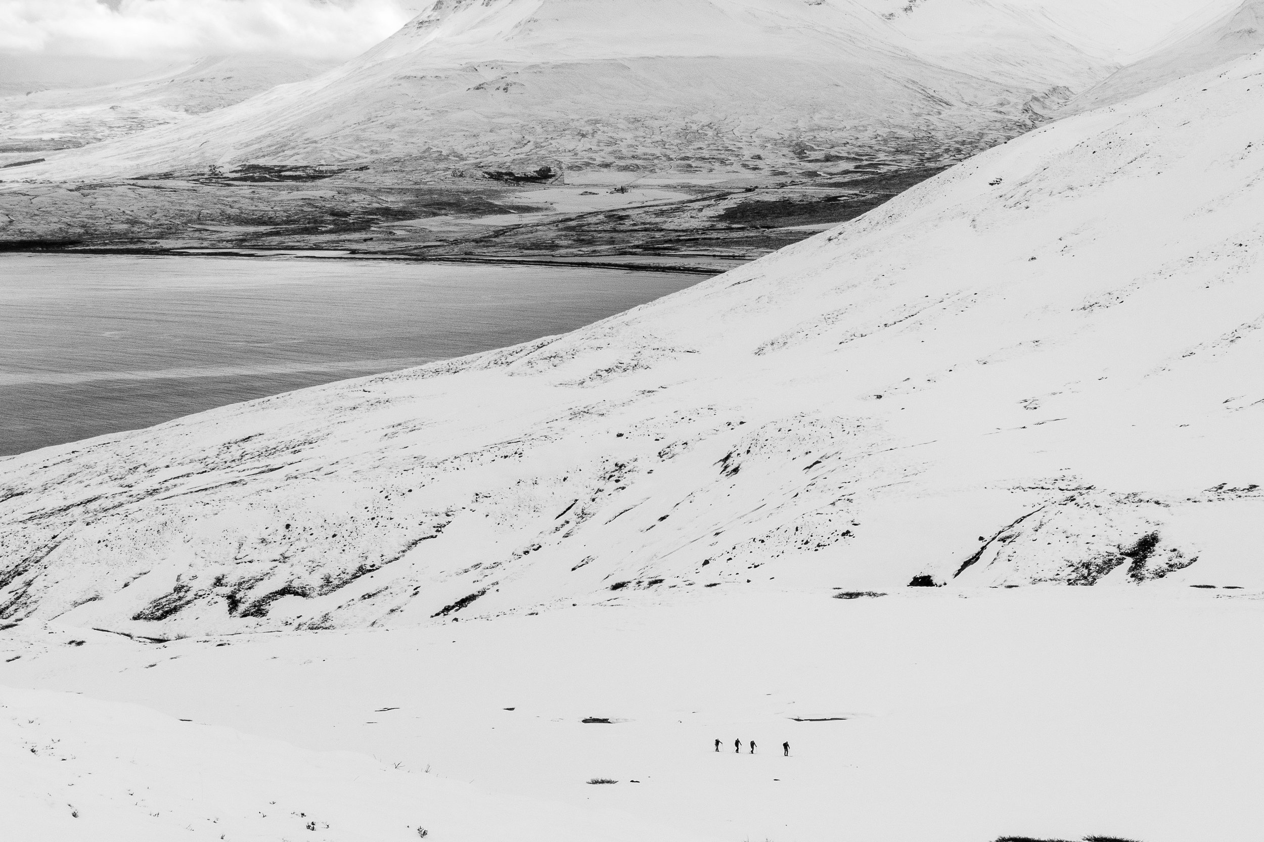
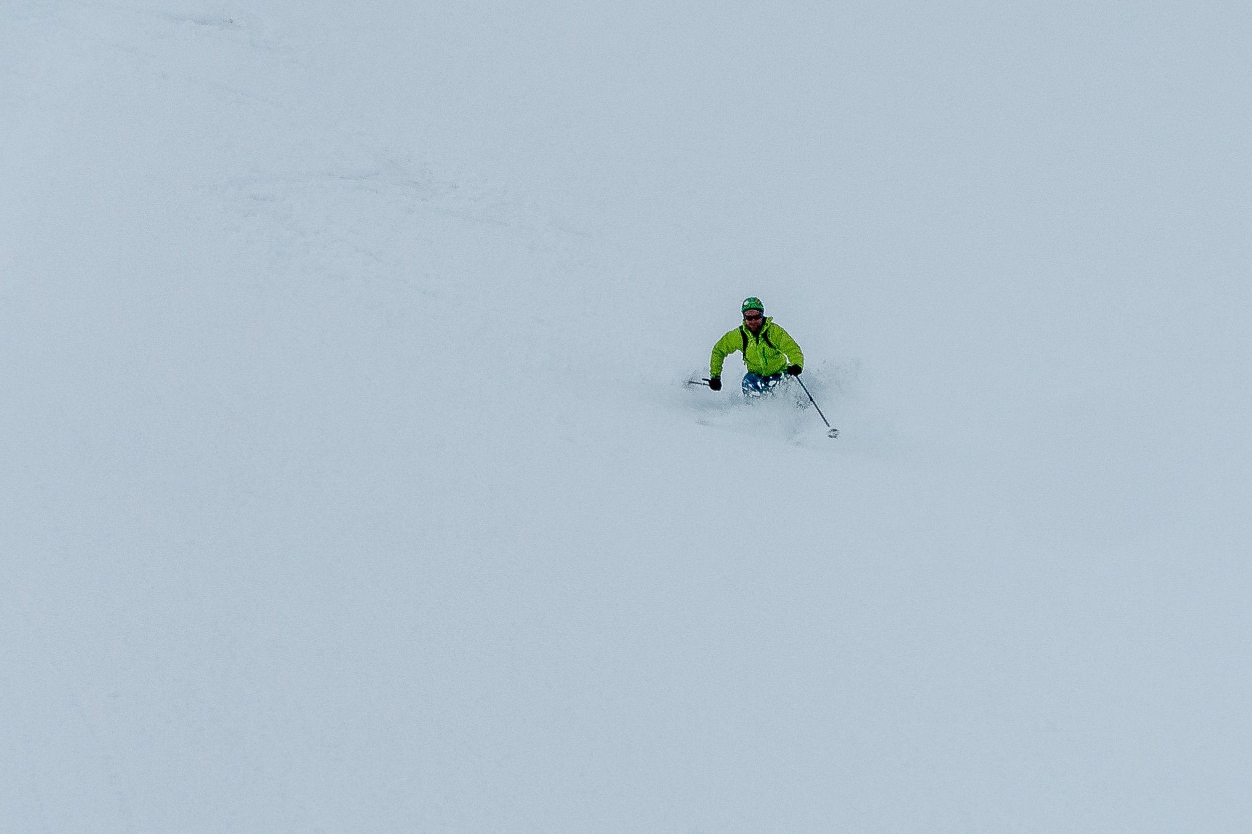
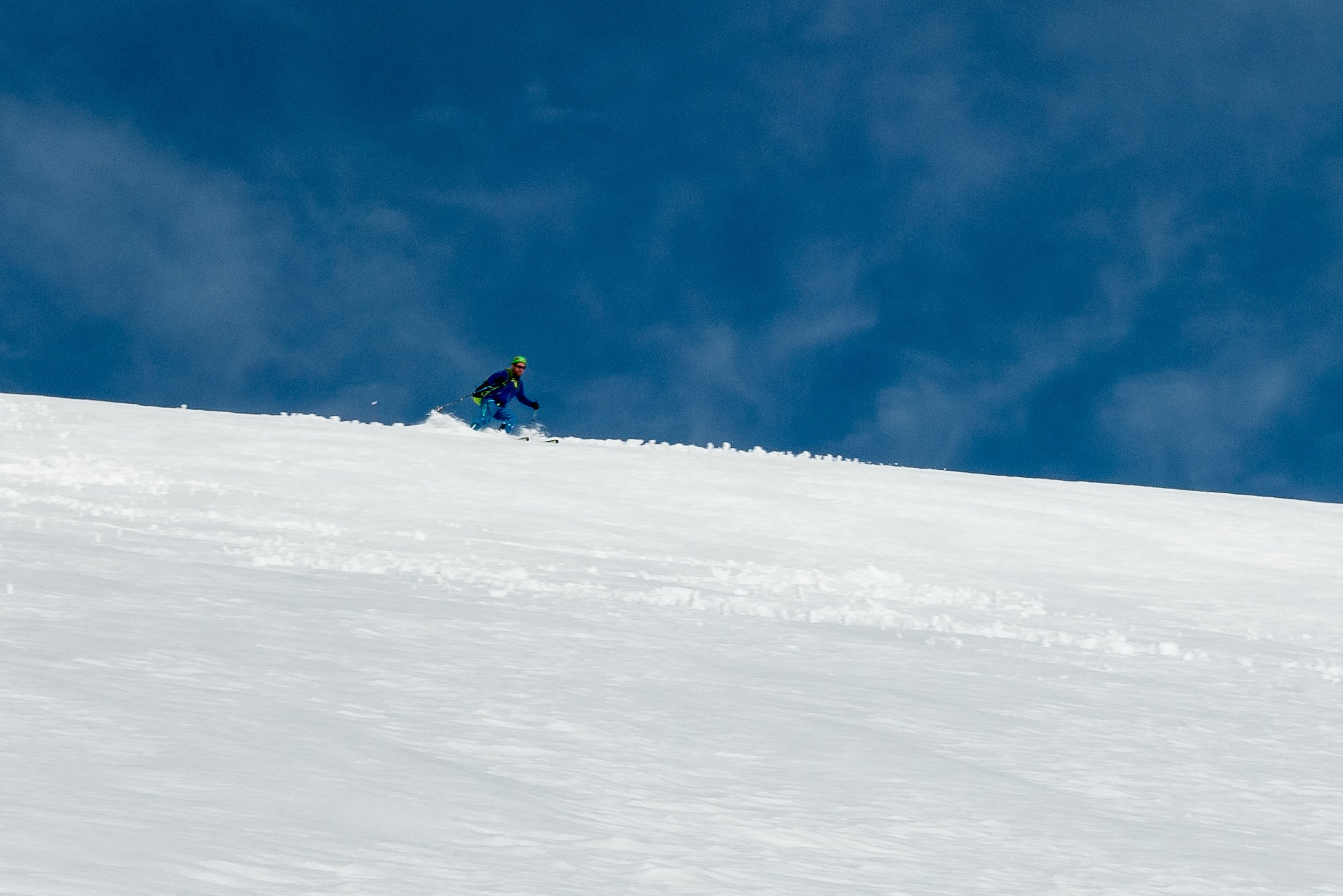
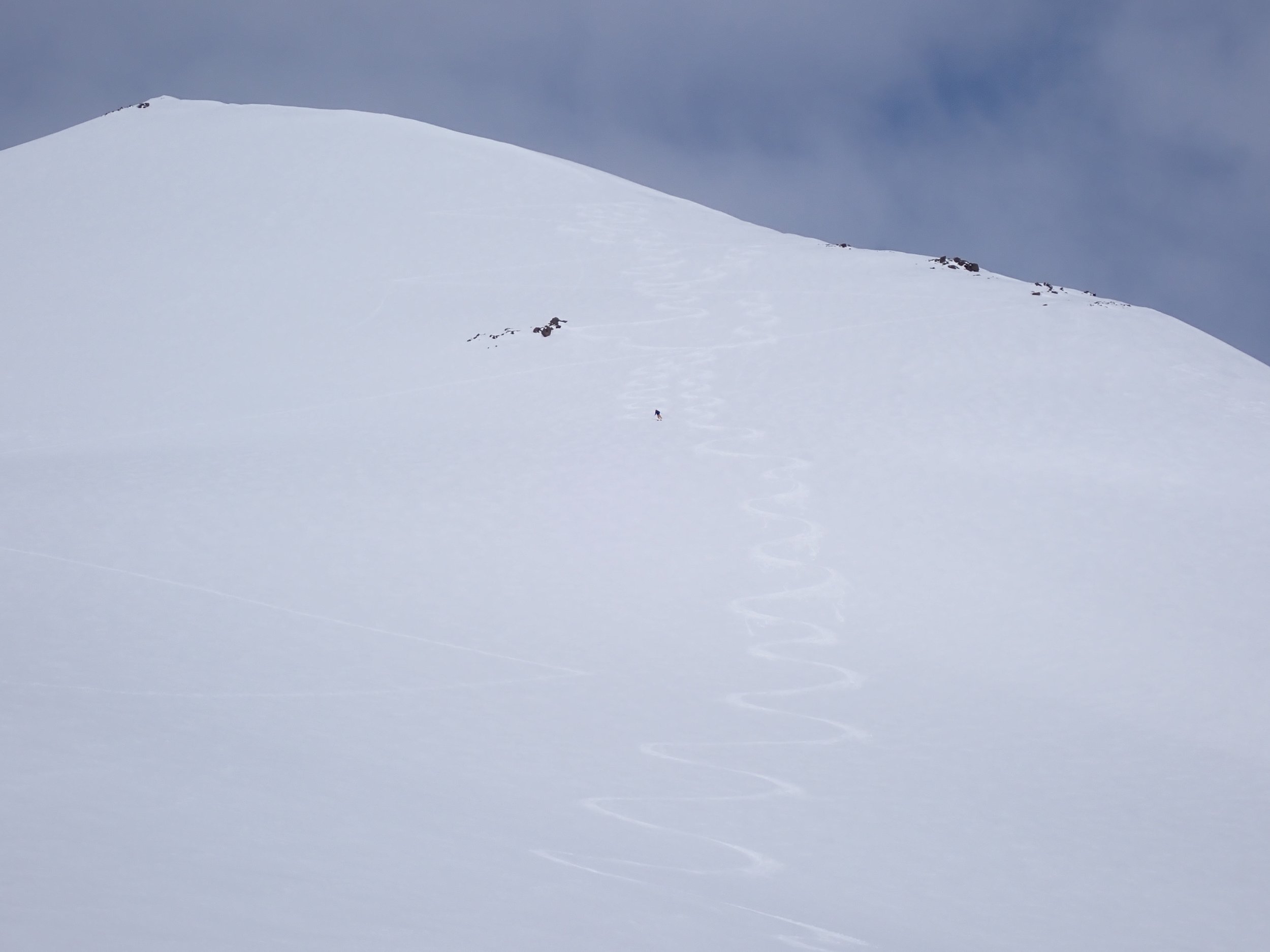
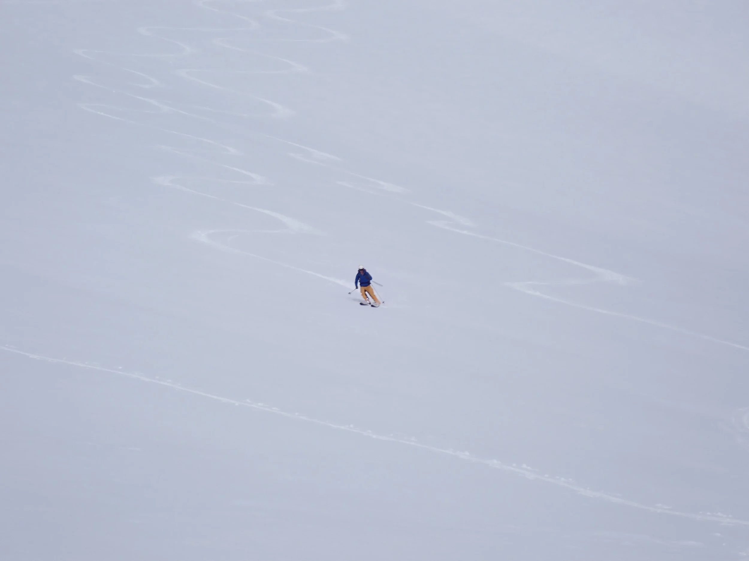
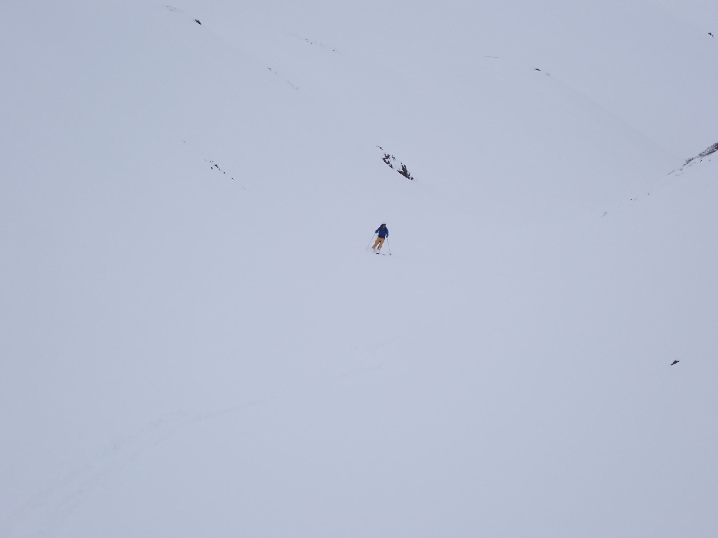
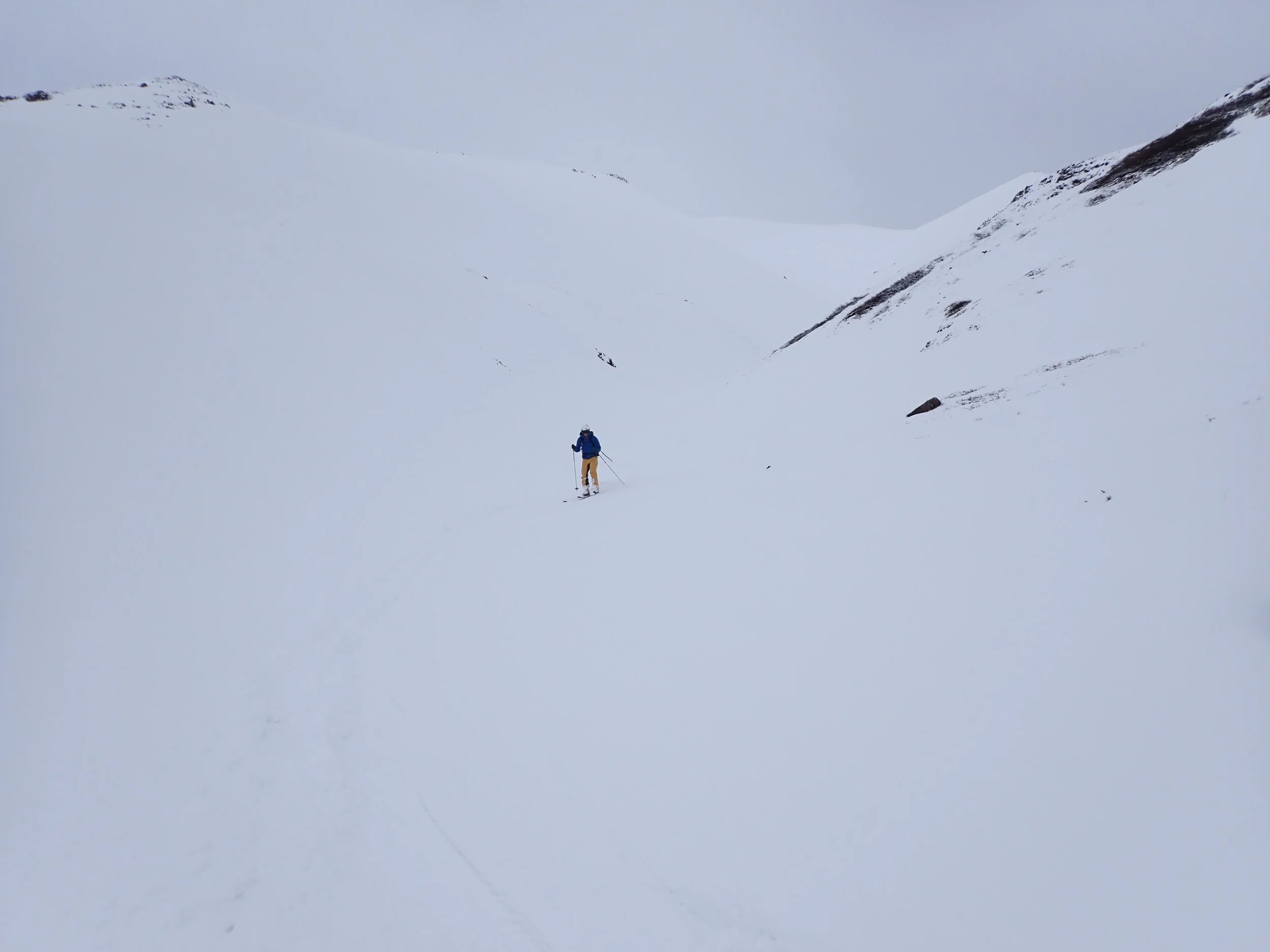
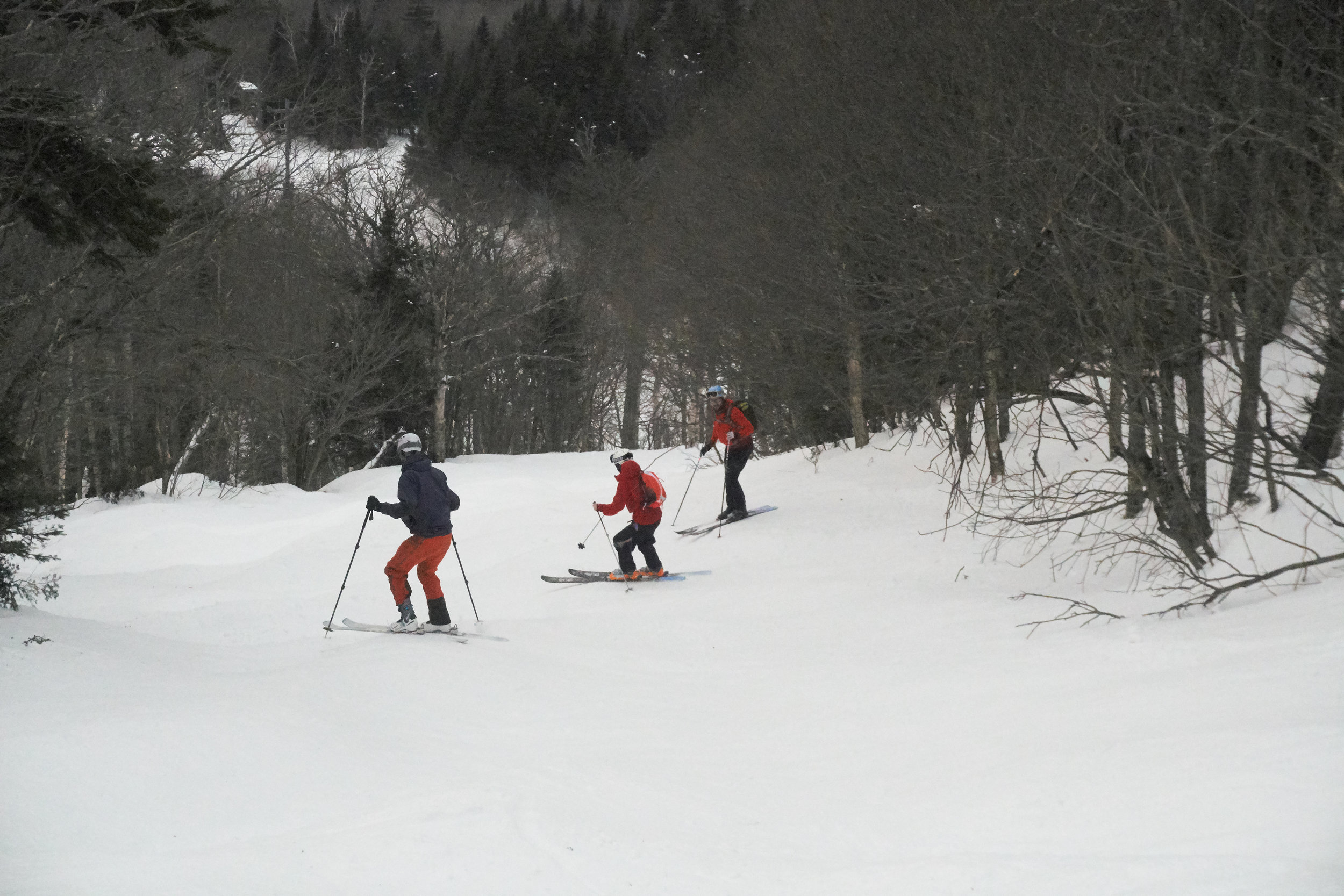
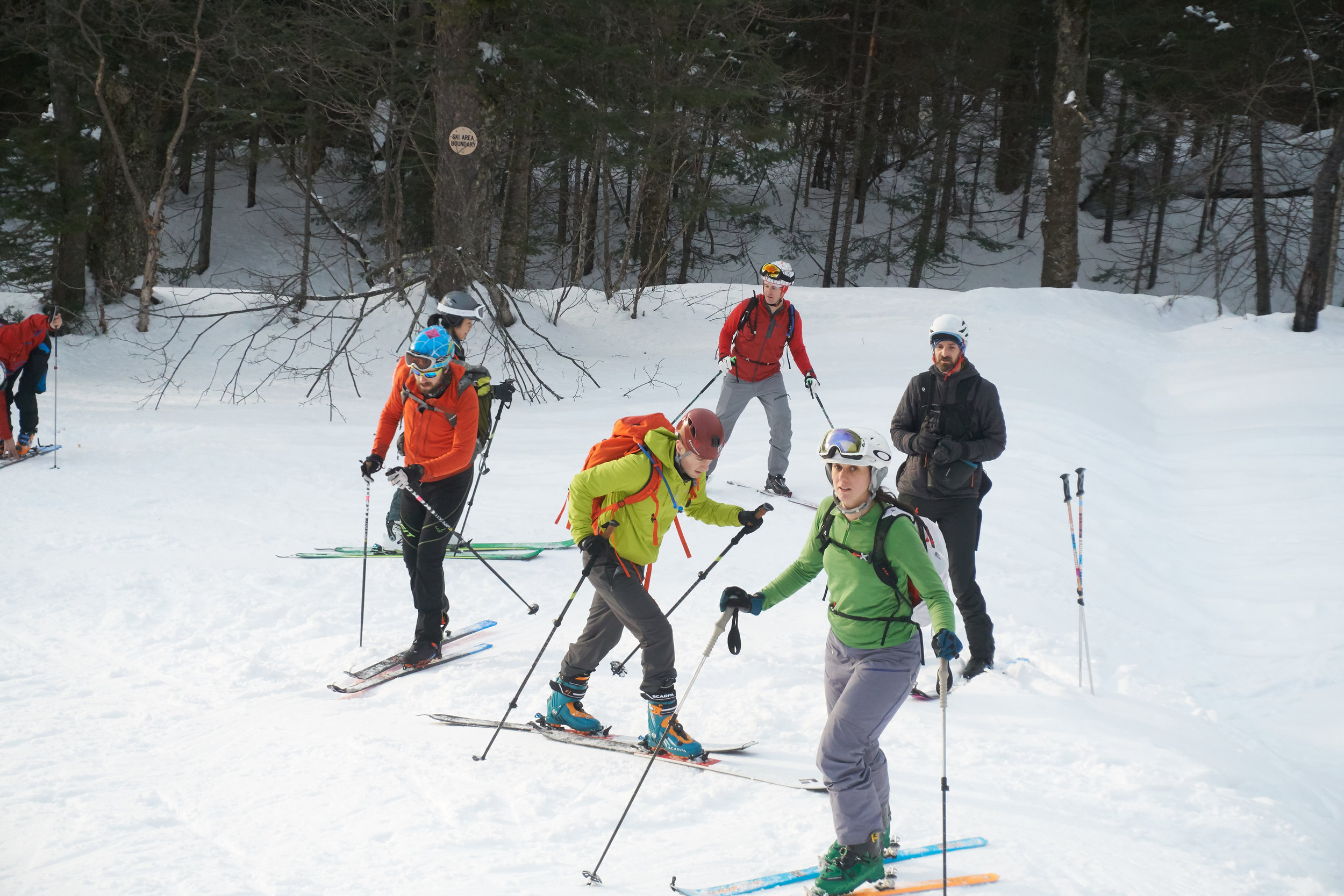
Day 4 we weren’t sure what the day would bring. The forecast was for snow overnight and the day looked very mixed. With forecasts changing from cloud to a mixture of rain and snow. Rising the next morning, we ate breakfast looking down at the valley coated in a few inches of snow. Given our exploration success, we opted to go back to our first valley. We knew the aspect of the slopes and, based on the current conditions, reckoned we could find something safe and skiable. The bonus of the snow was we could ski from the road!! Despite the colder conditions, the valley was alive with the sound of birds and gurgling brooks. We even spotted some white ptarmigans, hoping about some rocks. We quietly skirted past, trying not to scare them. The conditions felt fantastic. We selected our first summit of the day. The ascent was going really well, felt really grippy until close to the ridgeline where the new snow slid relatively easily off the old hard surface. We had reached the best balance in height and conditions. We headed down to some glorious powder turns. The visibility still was pretty terrible with flat light, making it a real challenge to make out the sides of the gully we skied through. With plenty of juice left in our tanks and huge grins across our faces, we spotted a skin track started by some other skiers heading up a nearby peak. With tonnes of lines to choose from, we headed on up the mountain. The skimo racers in us pushing ever closer to them before catching up with the skiers before reaching the top. The ski down was equally epic! Not done. There was time for one last lap. Part of the face looked like an artist’s canvas blank and waiting for the art to begin. Carving S turns down the spotless face before speeding down the valley and a short hike to the car.
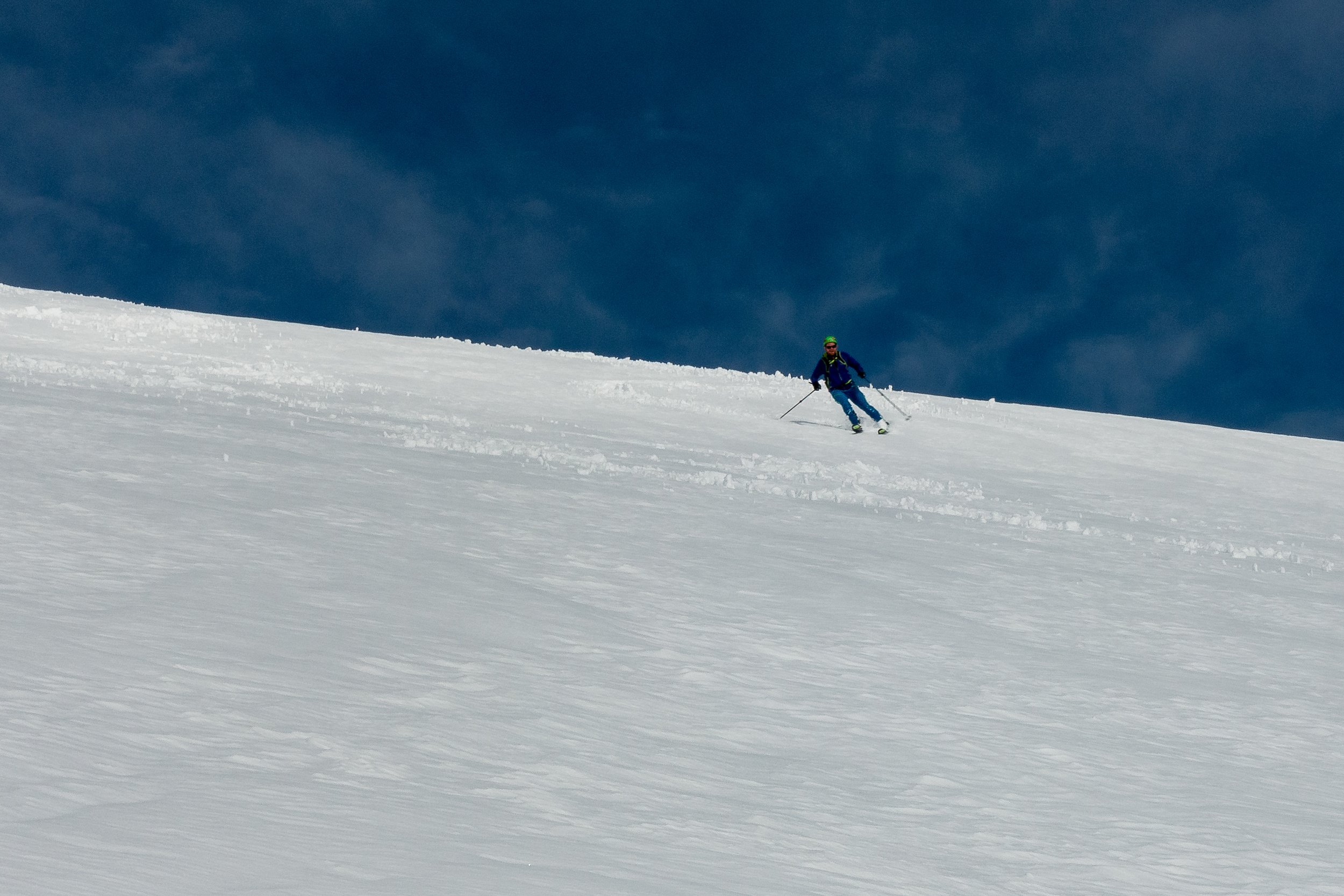

Day 5: our last day of skiing. With more snow forecasted over night and mixed conditions predicted in the afternoon, we opted for an earlier start. Amongst the clouds, in the early morning light, were hints of sunshine and blue skies. Even the animals seemed to be more awake with the valley full of sounds of gurgling brooks and bird song. With higher cloud levels and visibility rising, we could see our prior days ski tracks. Heading up the valley, we selected this pyramid like peak to head up. The sun had come out in full force as the snow softened up much quicker than expected. Reaching a high point where the snow conditions worsened and with clouds sweeping in, we opted to head down. Skis on and we could still feel the hard crust beneath the now heavier snow sitting on top. Creating a parallel snaking pattern on the way down to a mid point before transitioning back to skis for a hike up to a higher ridge line. Meandering back and forth on our way to the high point, we could make out some ski tracks along the ridge before they disappeared into another valley. The sun had come out in full force again and was baking down on us, making for hot work on the ascent. Arriving to incredible vistas all the way to the sea. A head we could make out, the team of skiers who had traversed a head of us and were now climbing an adjacent peak. It looked really quite spectacular. It was time to head down, transitioning back to skis, and we were heading back down the mountainside. The snow by this stage was becoming heavier the lower we got. To reduce as much poling as possible, we sped up and tucked to gain as much speed down into the valley floor as possible. The wind whooshing past our ears, skirting small streams and clumps of undergrowth that poked through the snowy surface. On the way back to the car, a couple of transitions between skis and boots to arrive at the car.


Iceland had been an incredible skiing adventure. Providing infinite skiing options and despite the variable conditions, had given us a real taste of what Icelandic skiing offered. It hadn’t disappointed. The last couple of days had more than made up for some of the earlier days’ trials and tribulations. We woke to a few more inches of snow that had fallen overnight taking the snowline down to the shore side. It has been the one aspect we had both thought of being able to ski from summit to re sea. It would have to wait for another adventure!

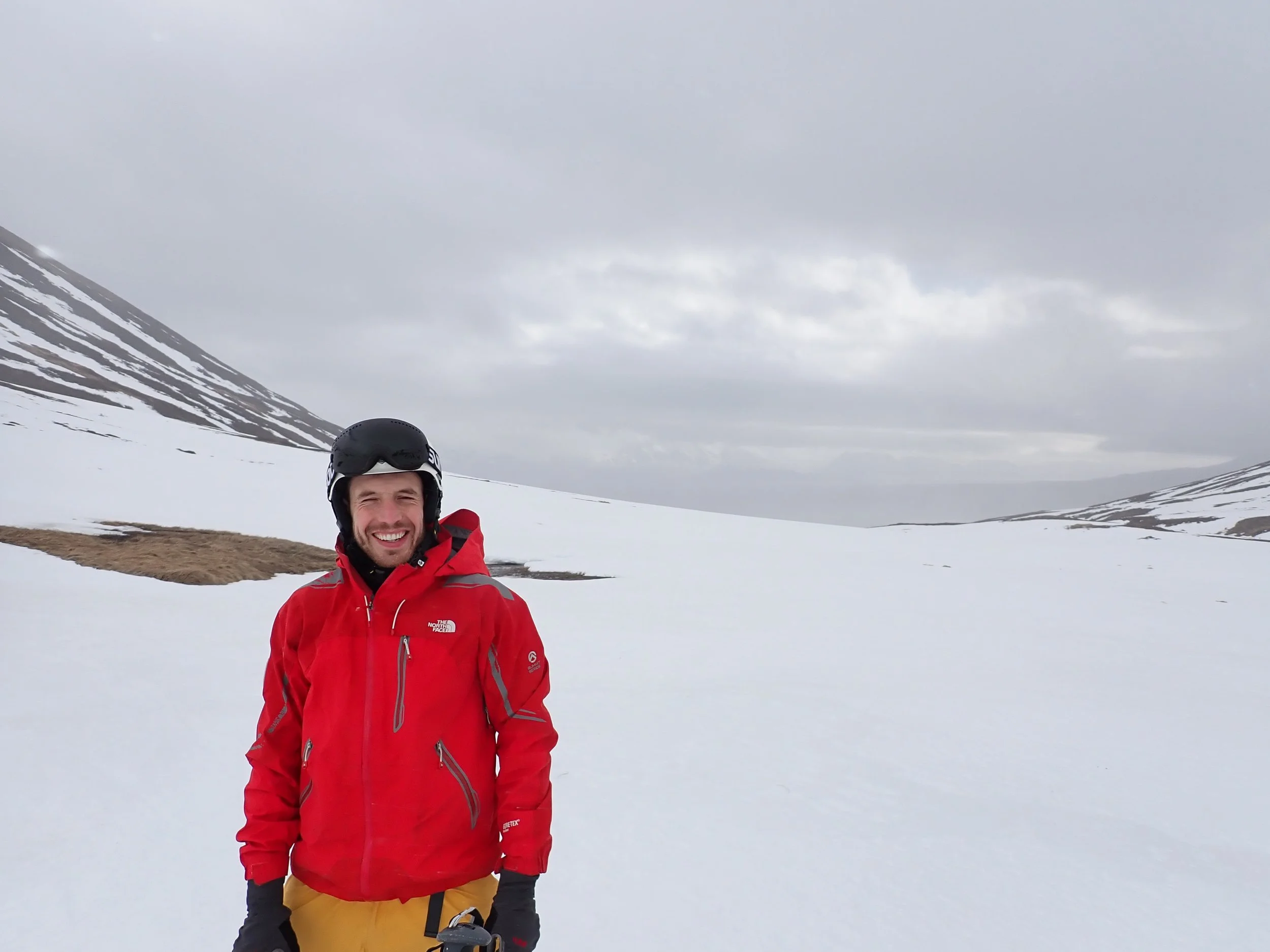
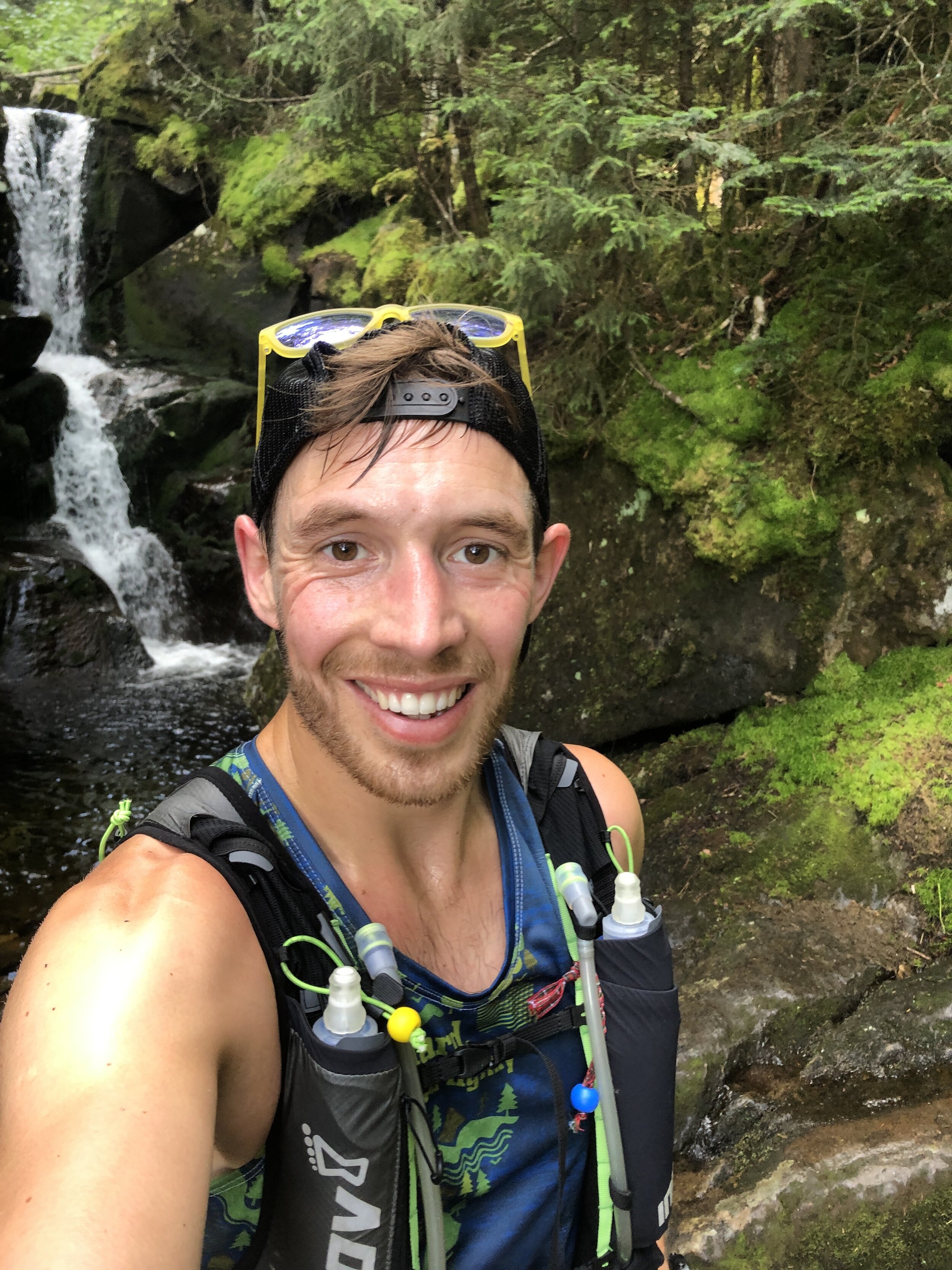
Having fun in Iceland!!!

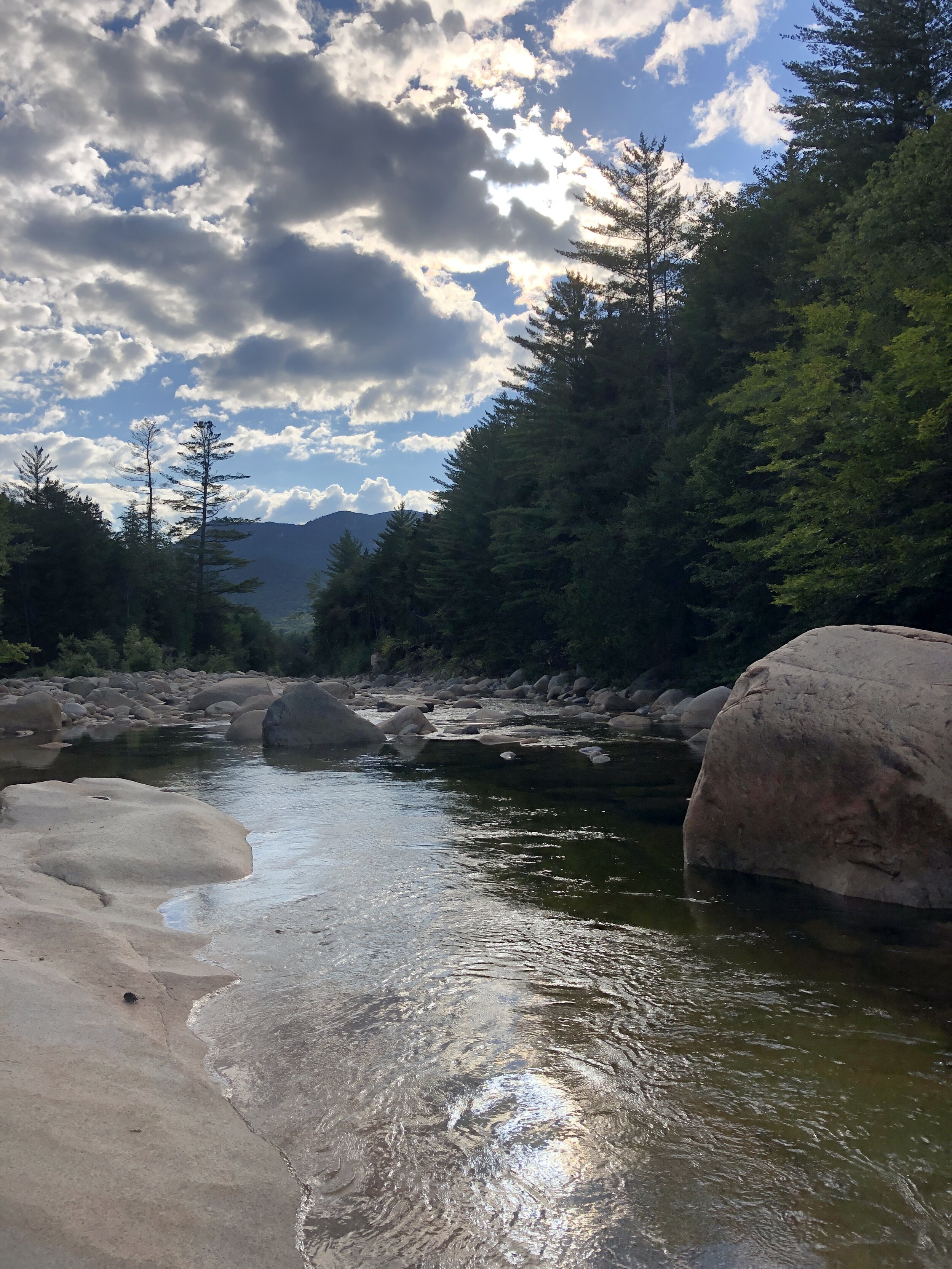
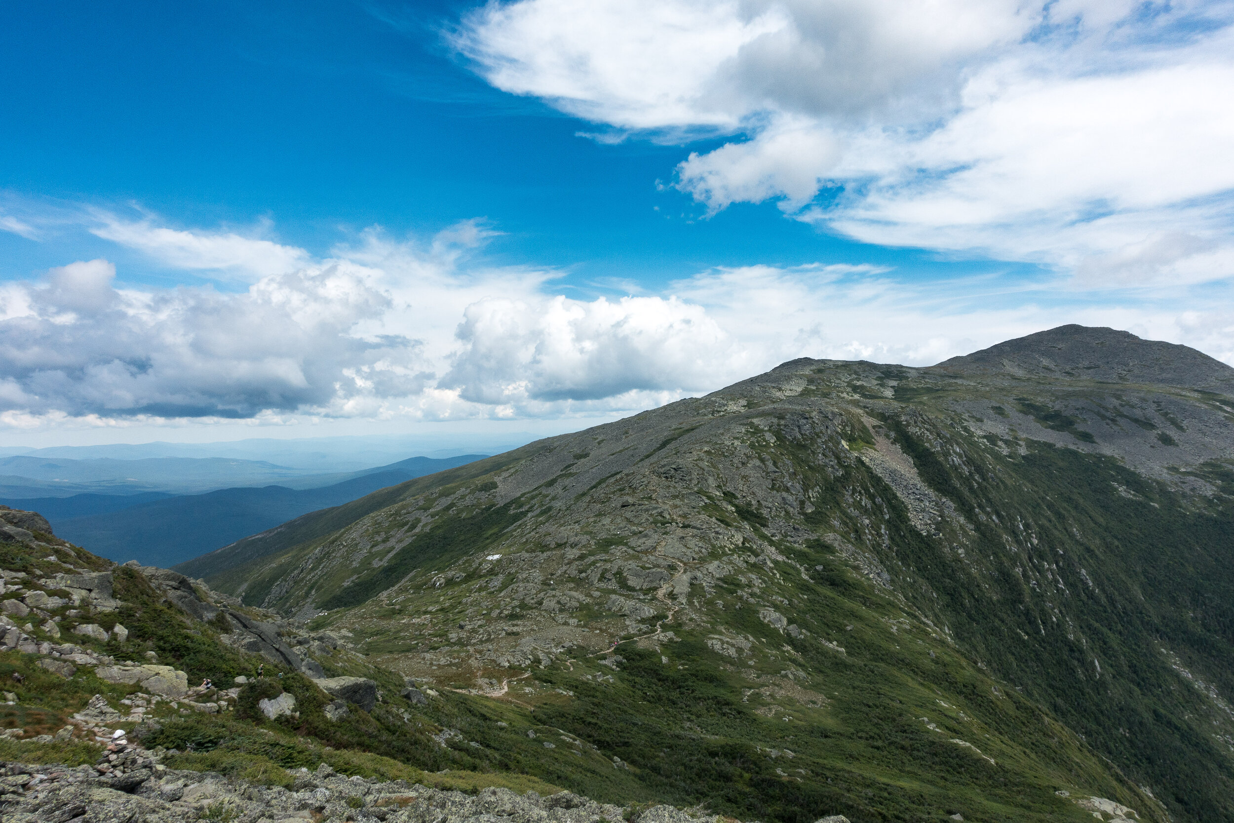
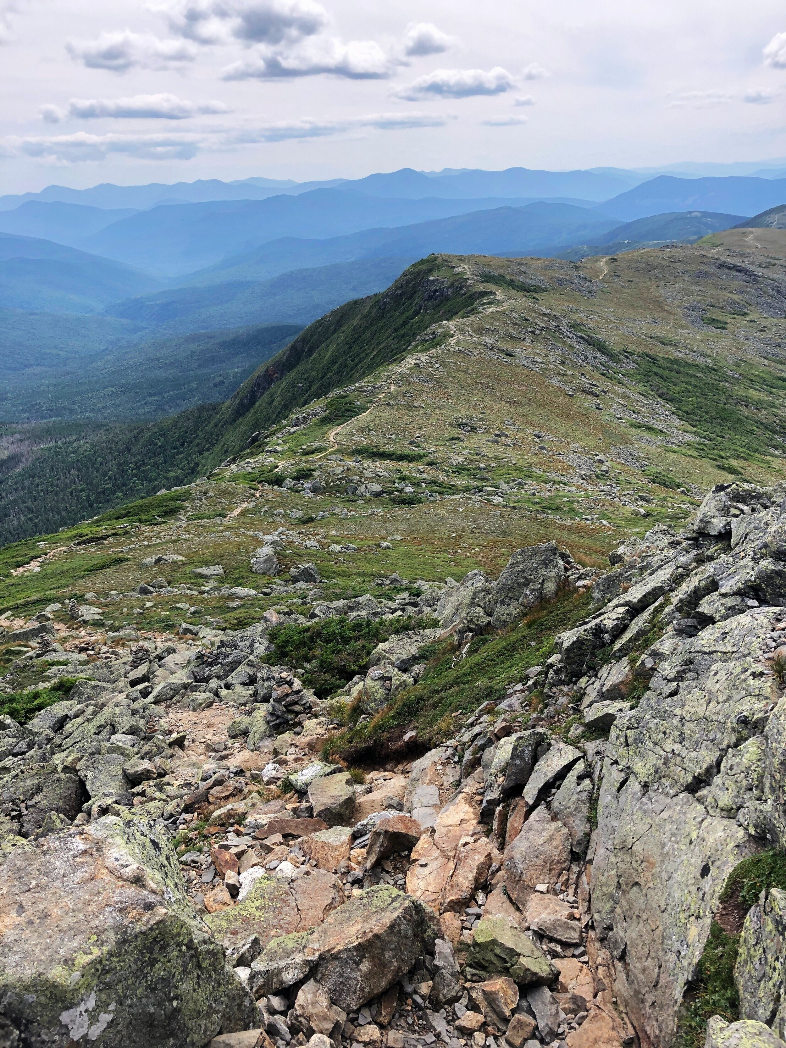
The Pemi Loop
Possibly one of my favourite trails that I have had the pleasure to run along in the US so far. Sitting in the White Mountains and not far from Mt Washington this perfect loop is an epic challenge whether you run or hike. Sitting at 29 miles (47 km’s) and with almost 10,000ft (3,000m) of ascent including eight of the New Hampshire 48er’s above 4,000ft.

The Pemi Loop
After the Press Traverse we had a pretty casual day recovering with a mixture of good food, a couple of beers at Schillings Brewery in Littleton (link to the brewery is here, it was definitely a worthwhile stop!!) as well as a short run along a river for an evening dip. Once back at the house we spent a happy evening with our supplies spread out across the floor as we worked through all the bits of kit, food and water that we would need over the 10 - 15 hours that it might take to cover the 29 miles. The normal guide is that the hike should take 20 hours normally split over 2 to 4 days where as the fastest time currently sits at 5 hrs 27 mins, there are now records for double pemi loops, super pemi’s and completing 14 of the 4000er’s via the pemi loop. If you are interested check the records out on the link Pemi FKT.
After yet more food and an early ish night was in order for the early start the following morning.
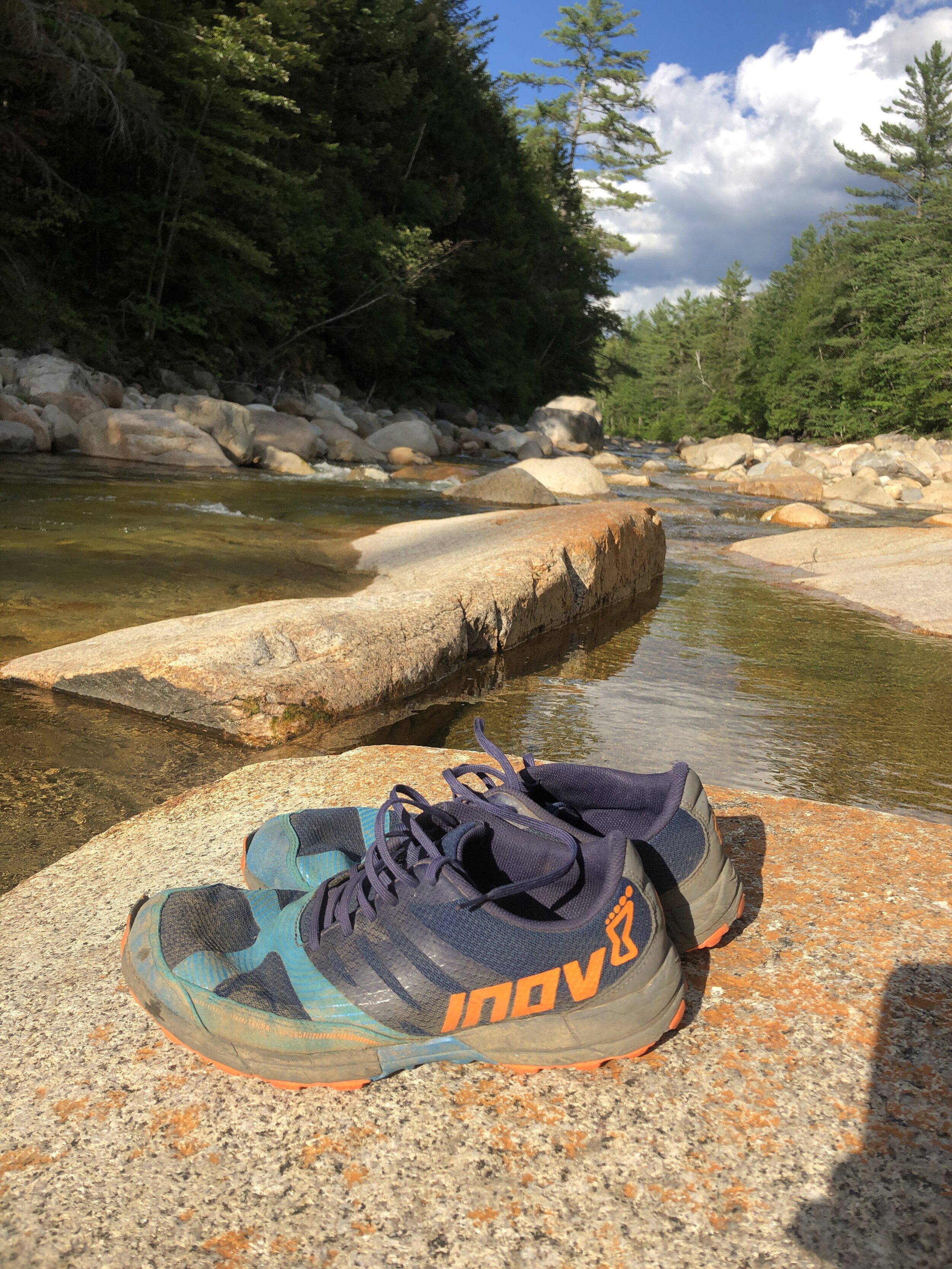
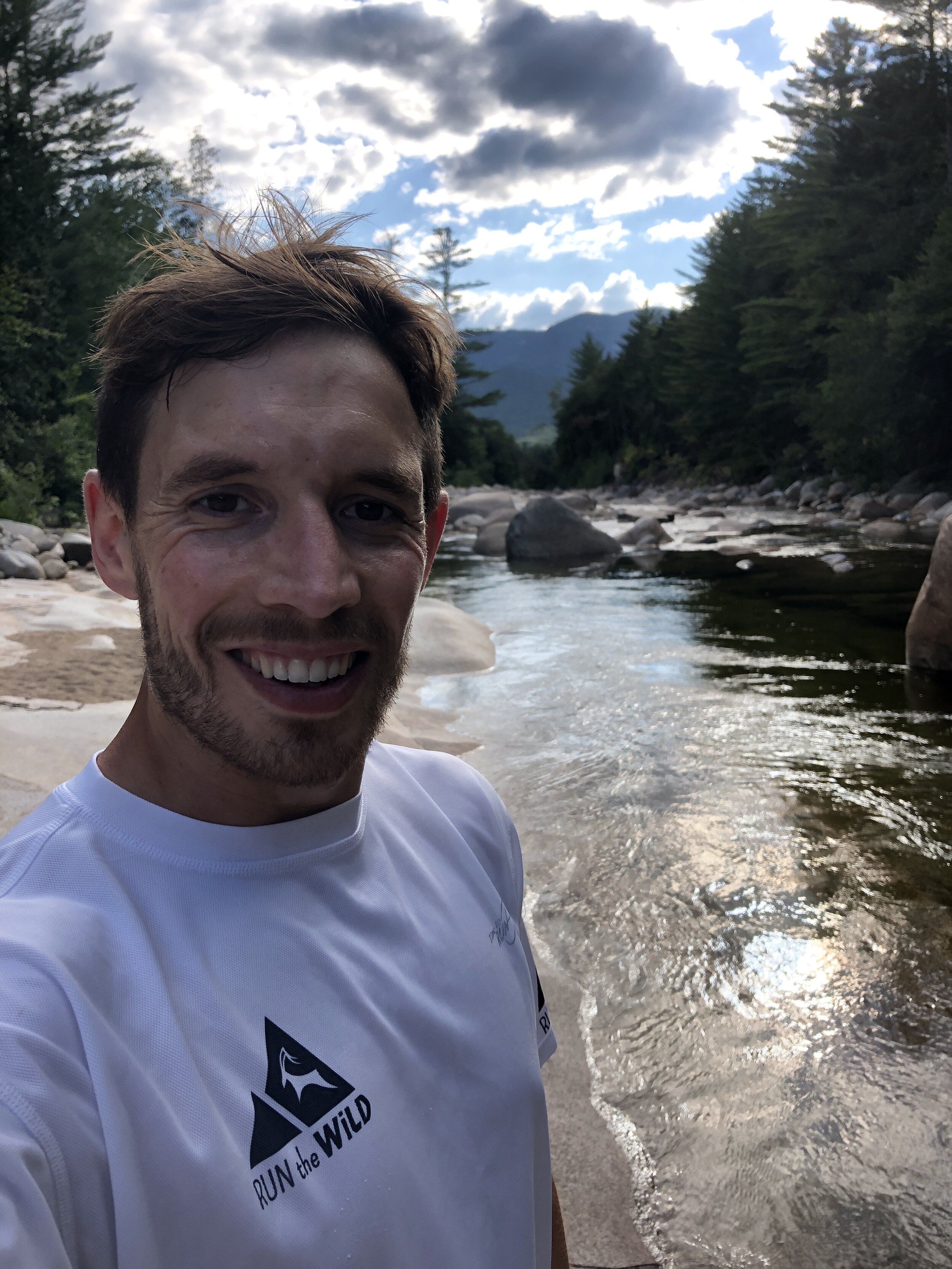
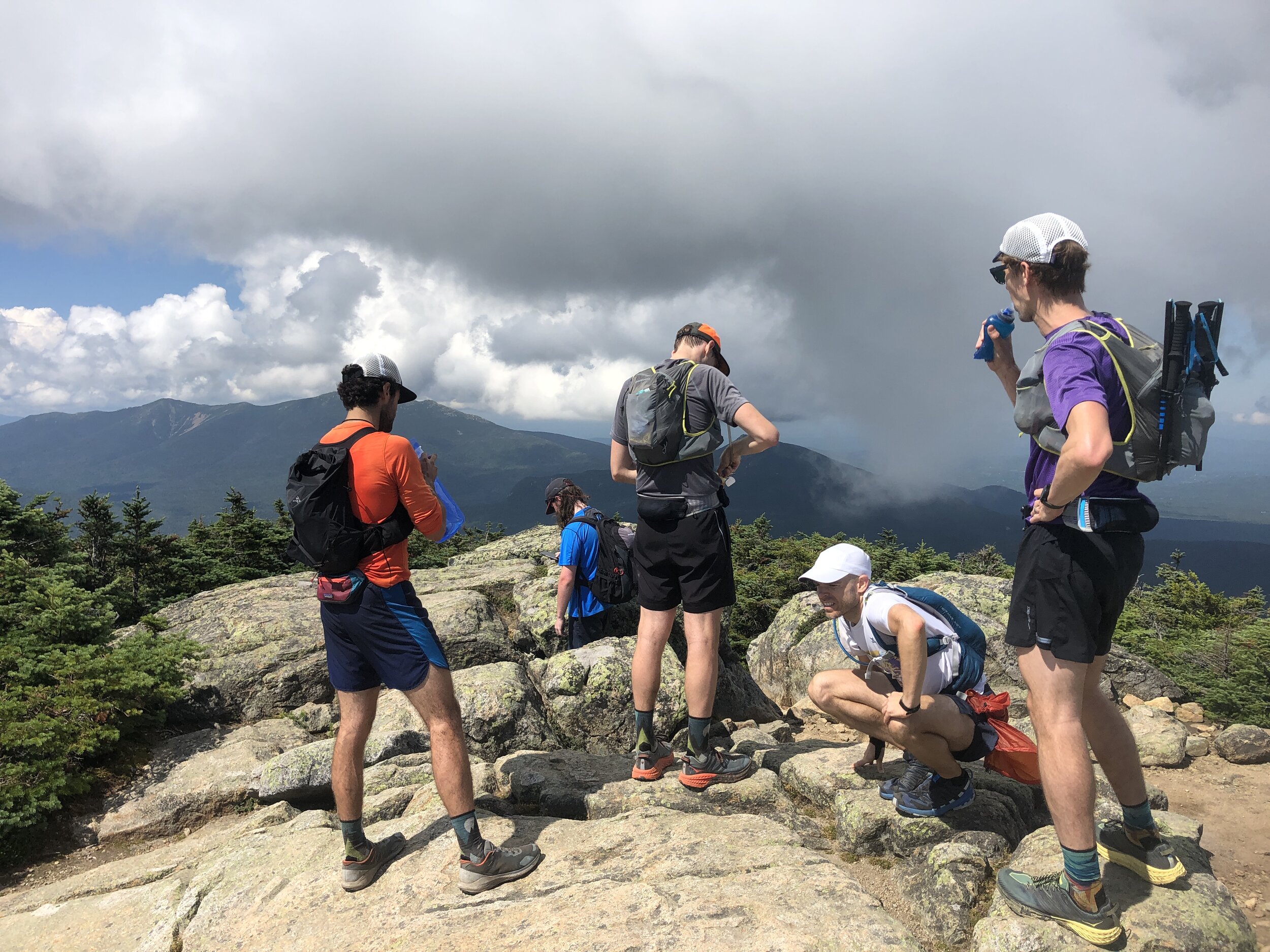
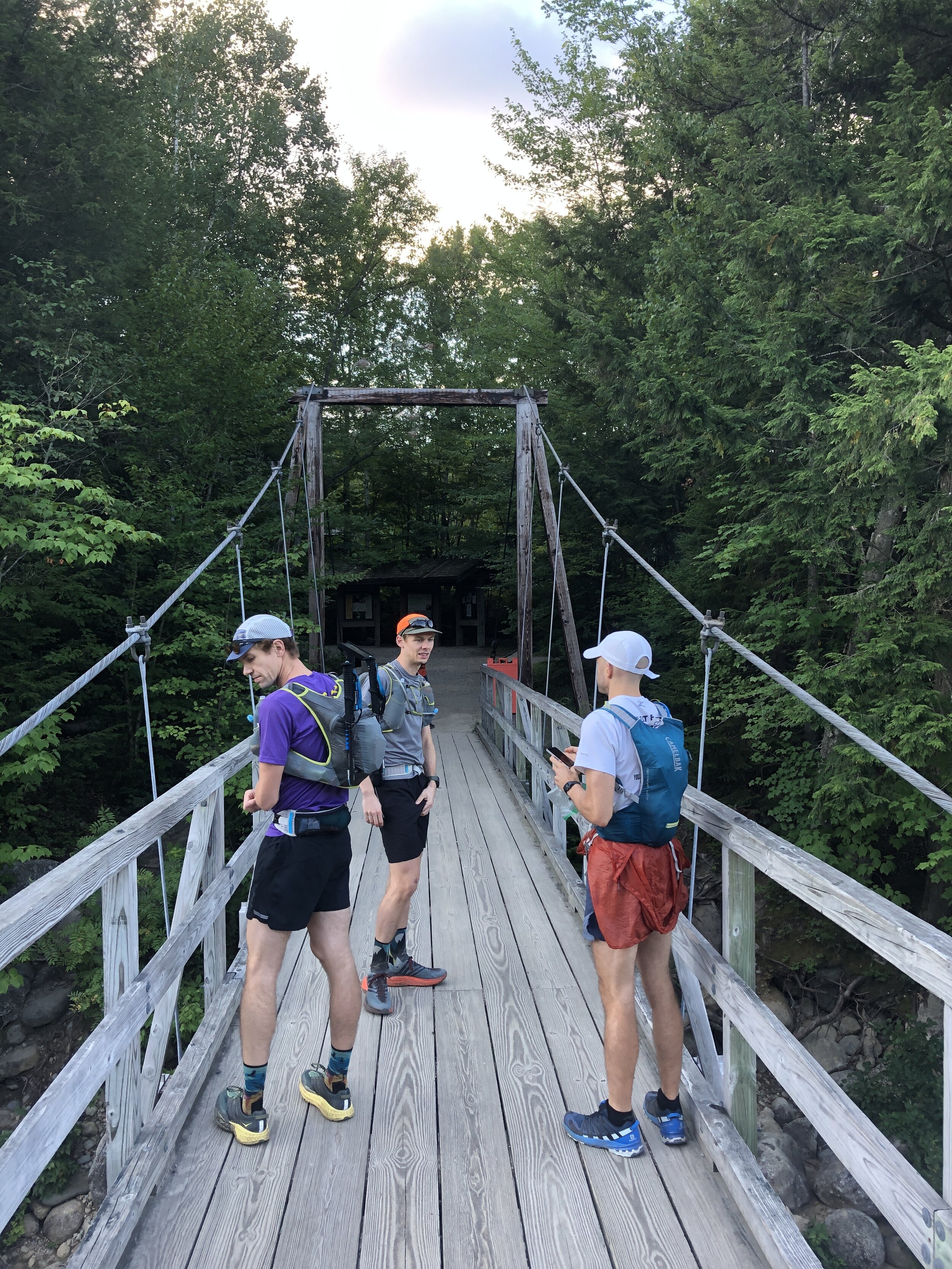
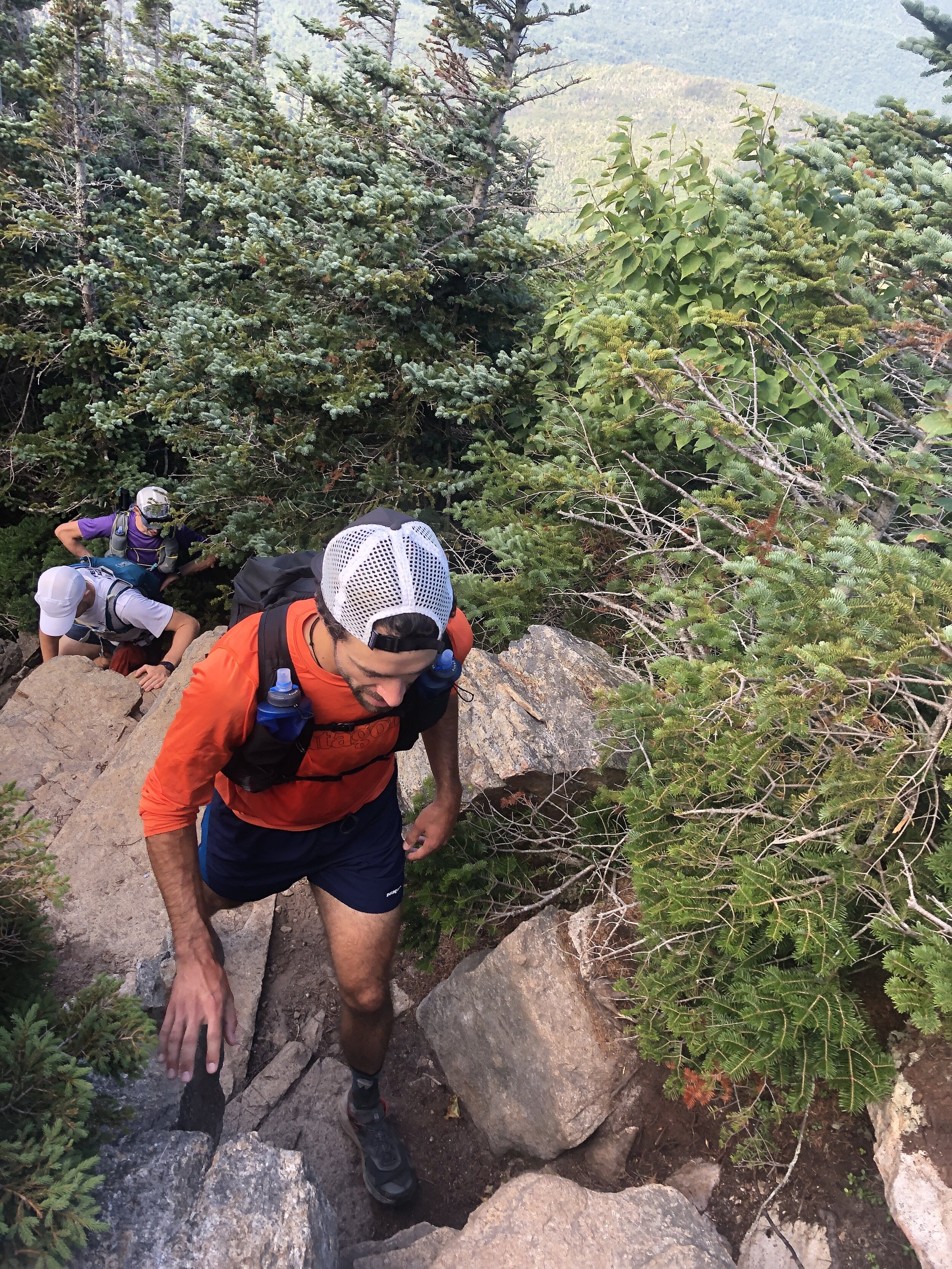
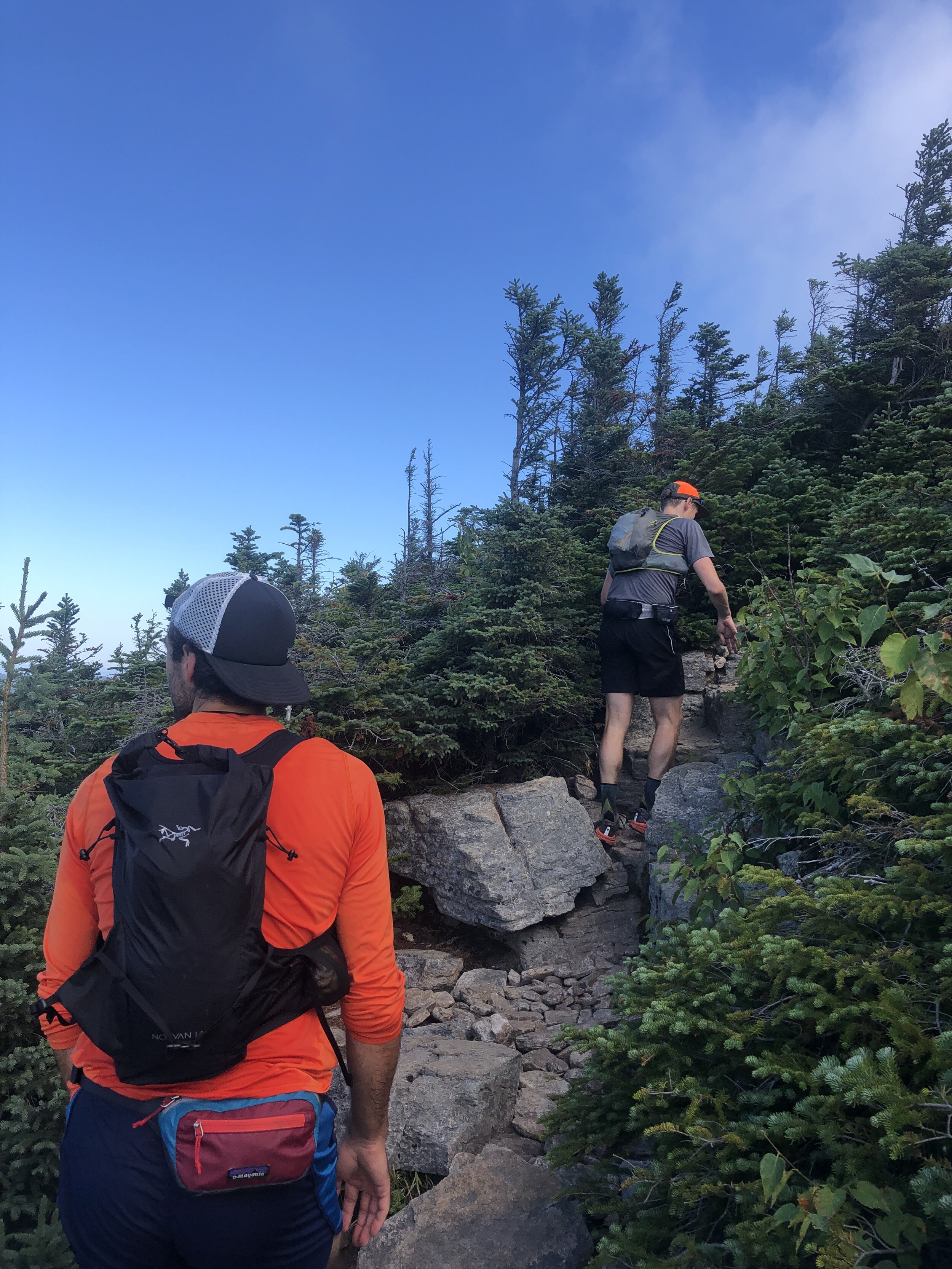
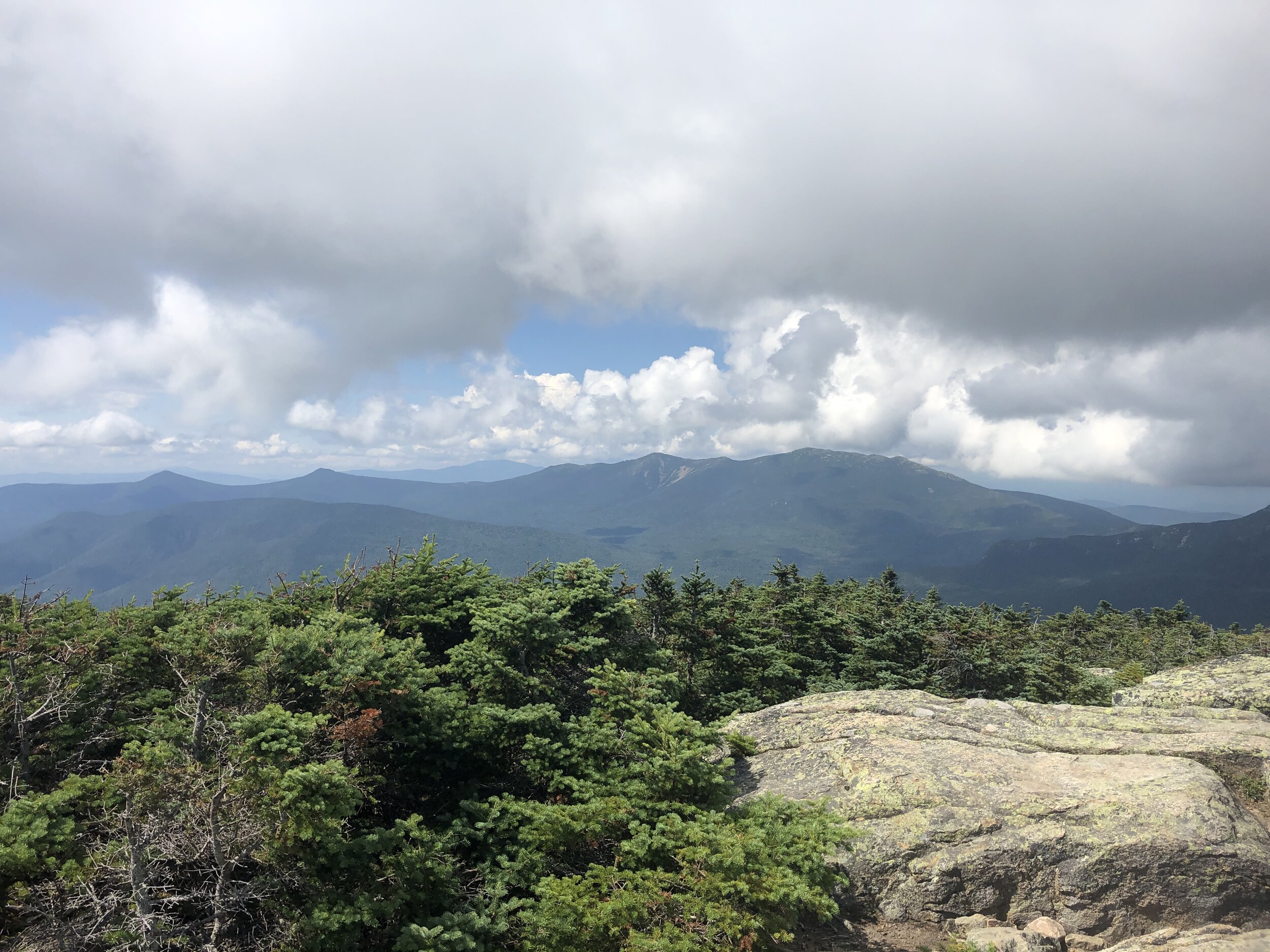
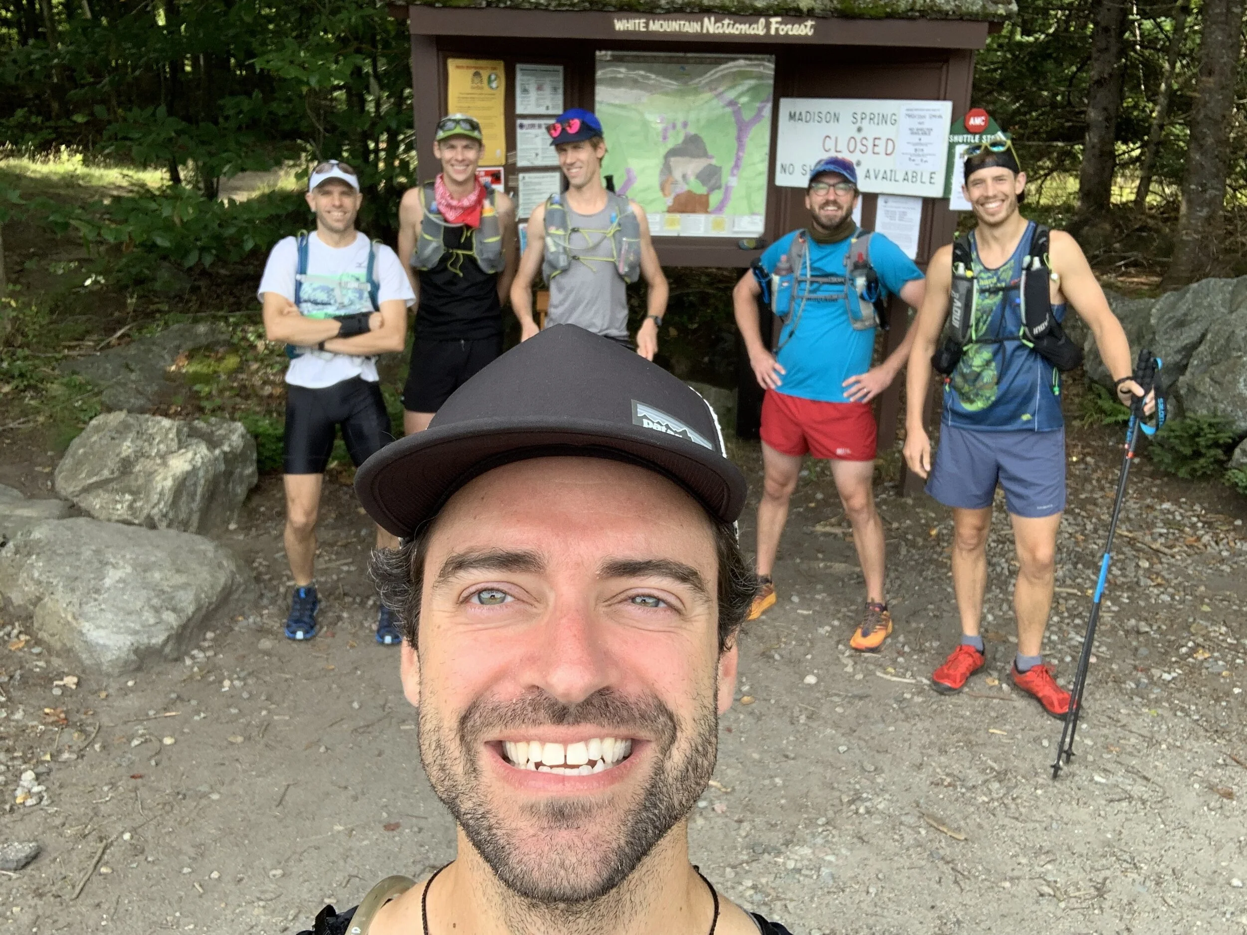
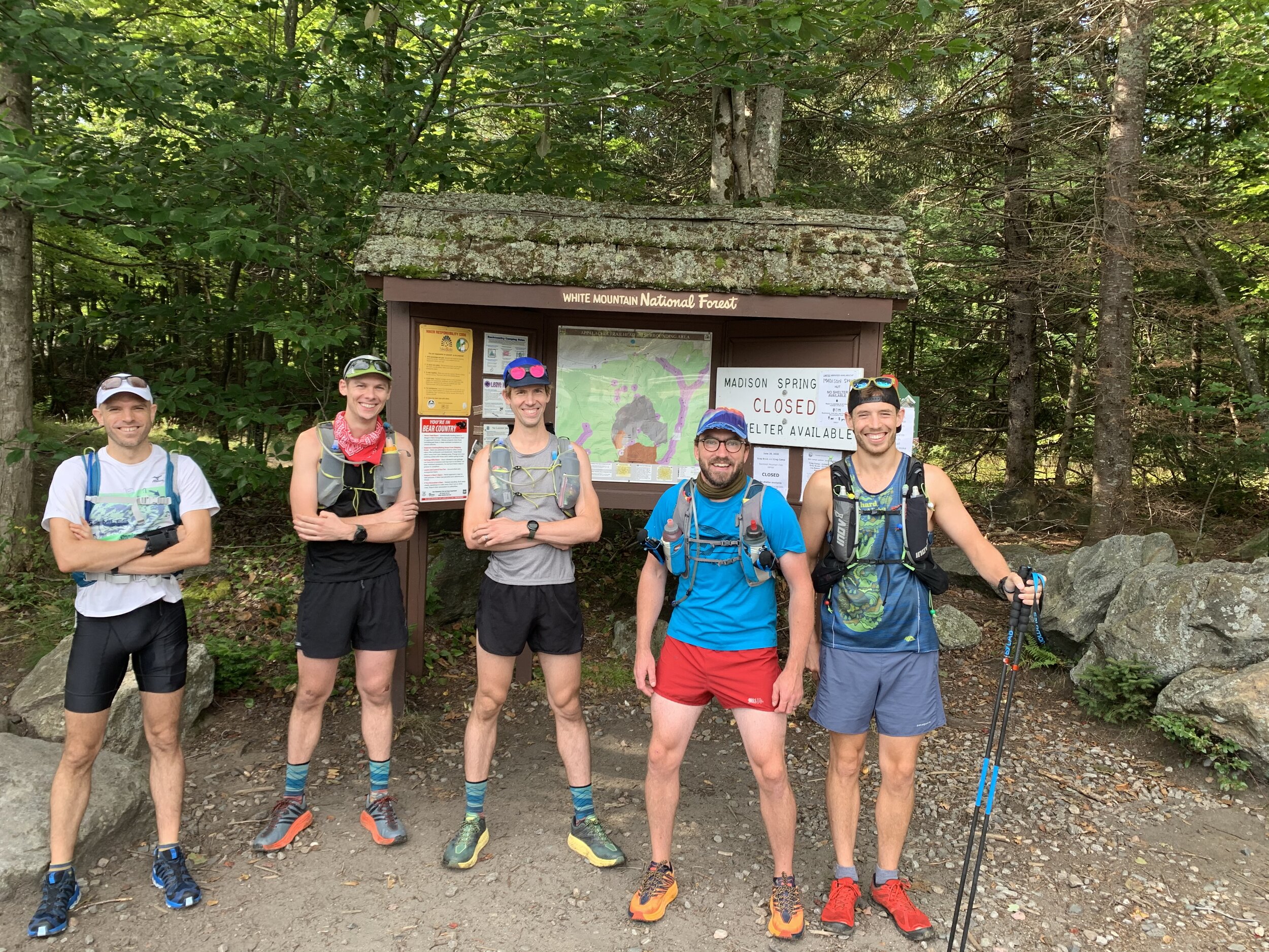
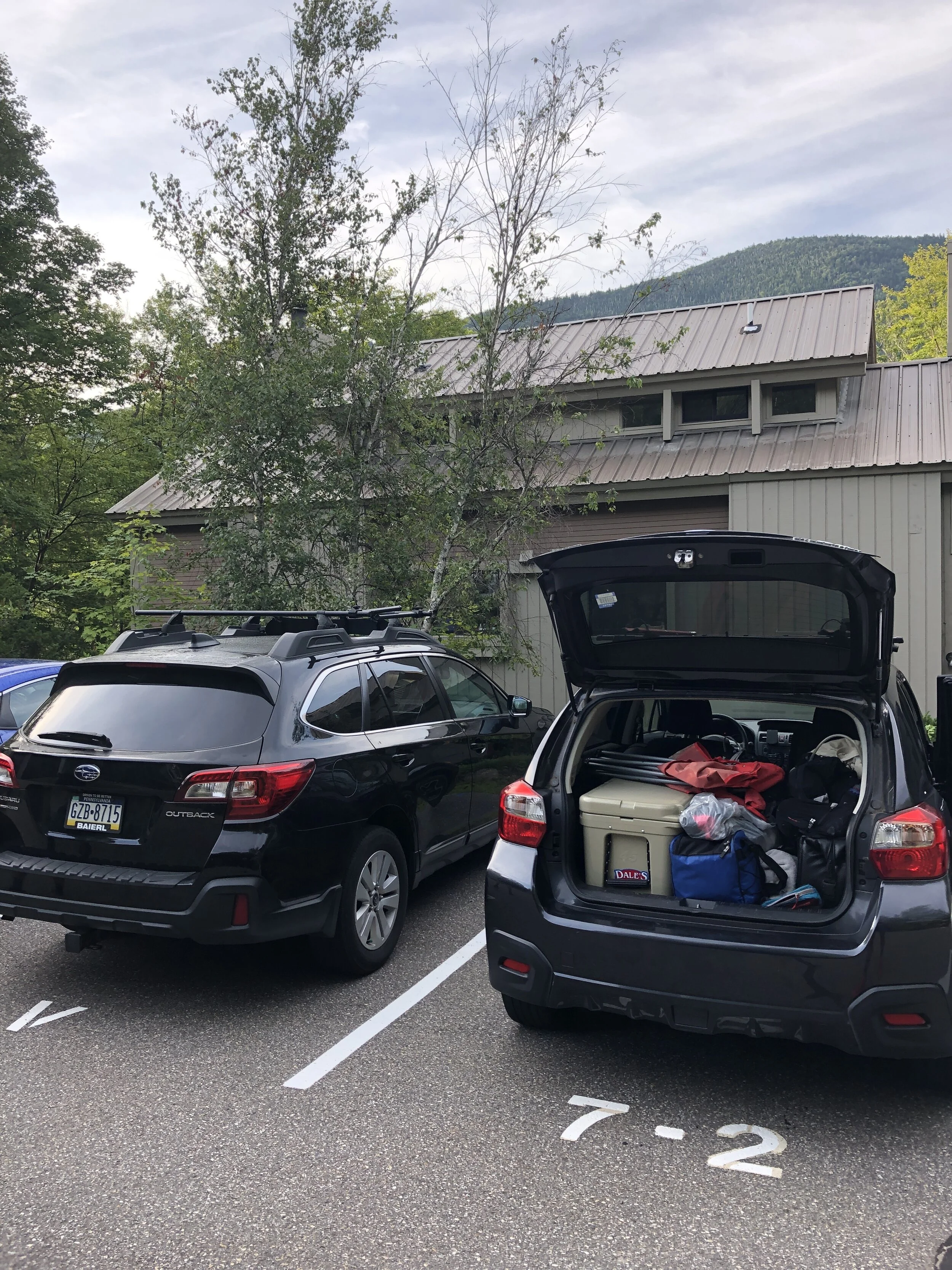
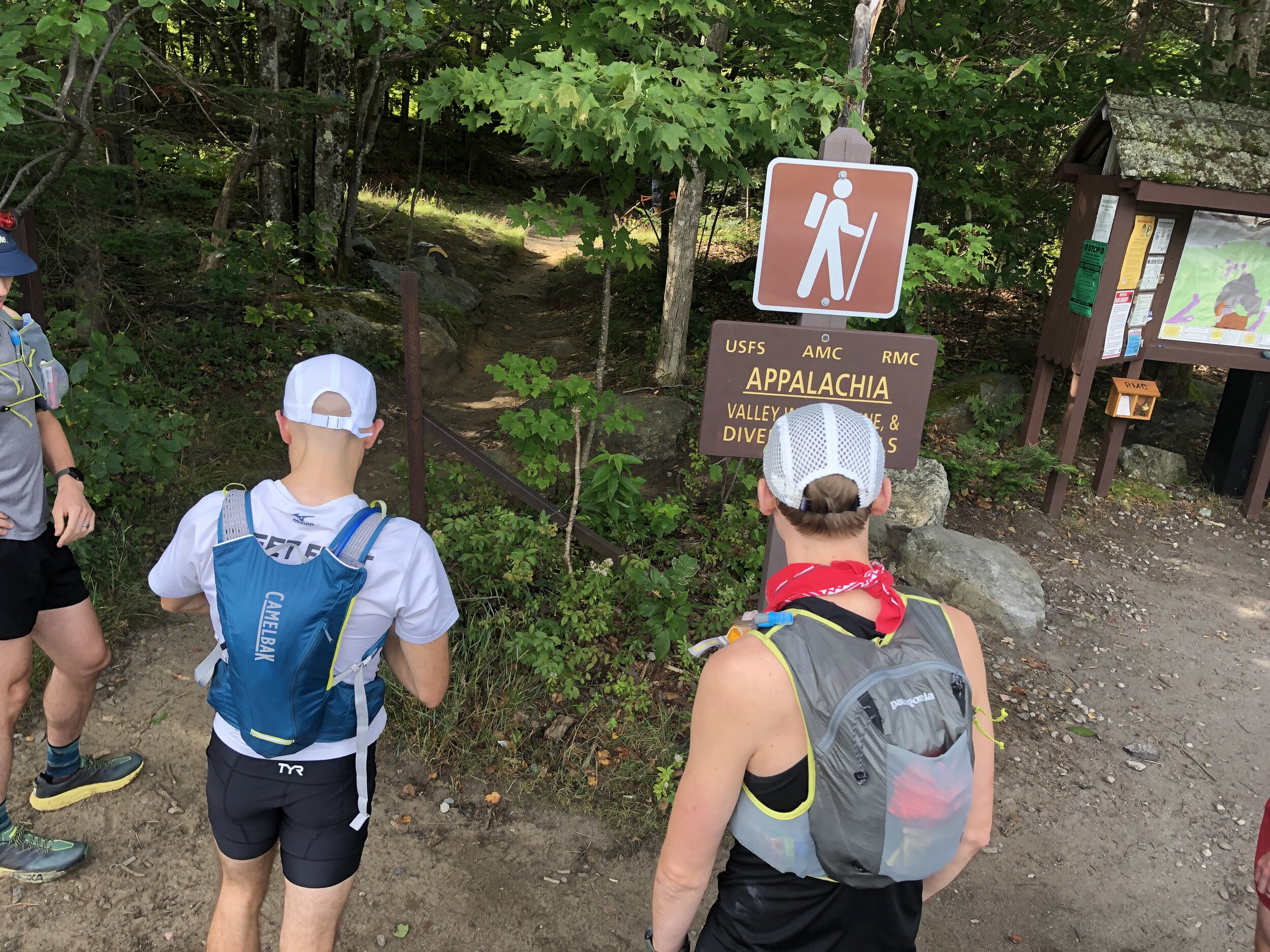
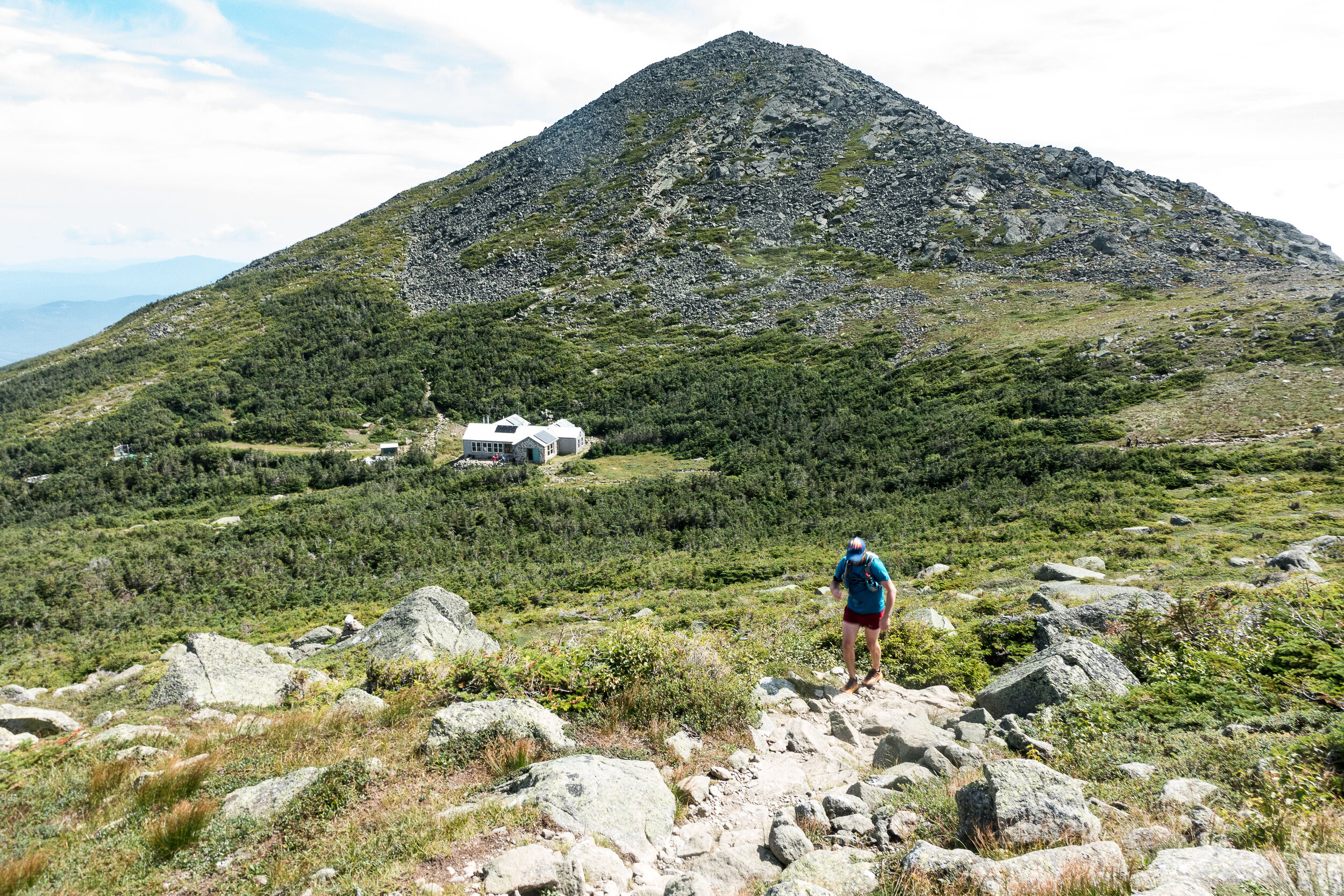
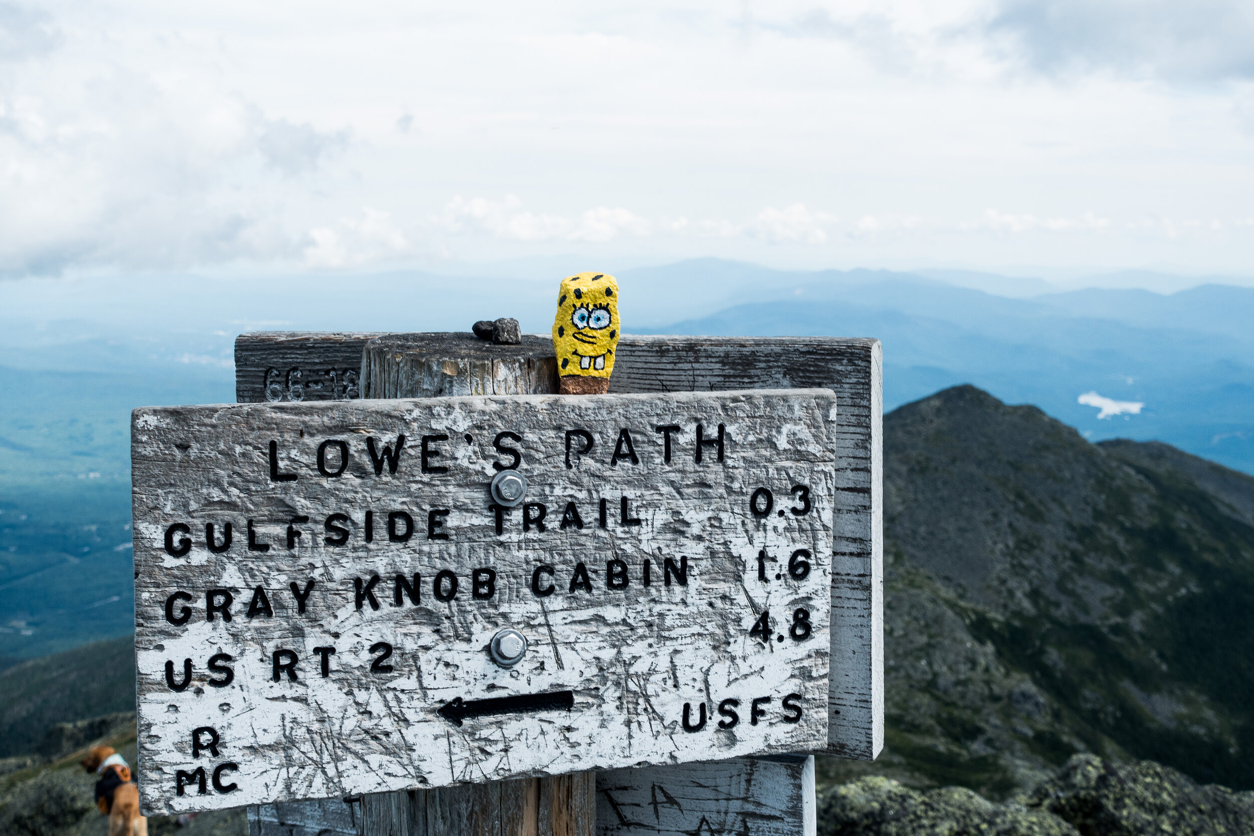
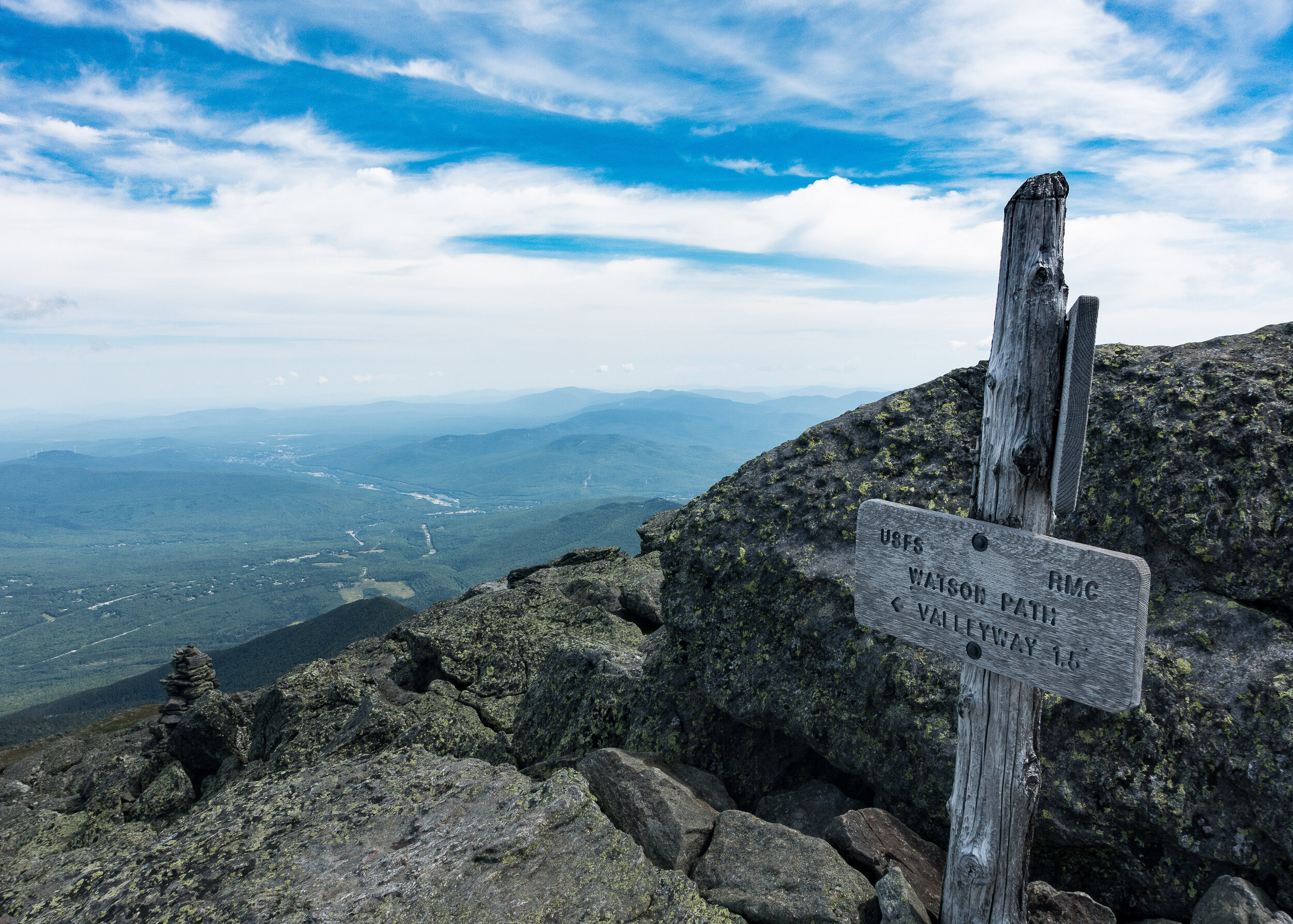
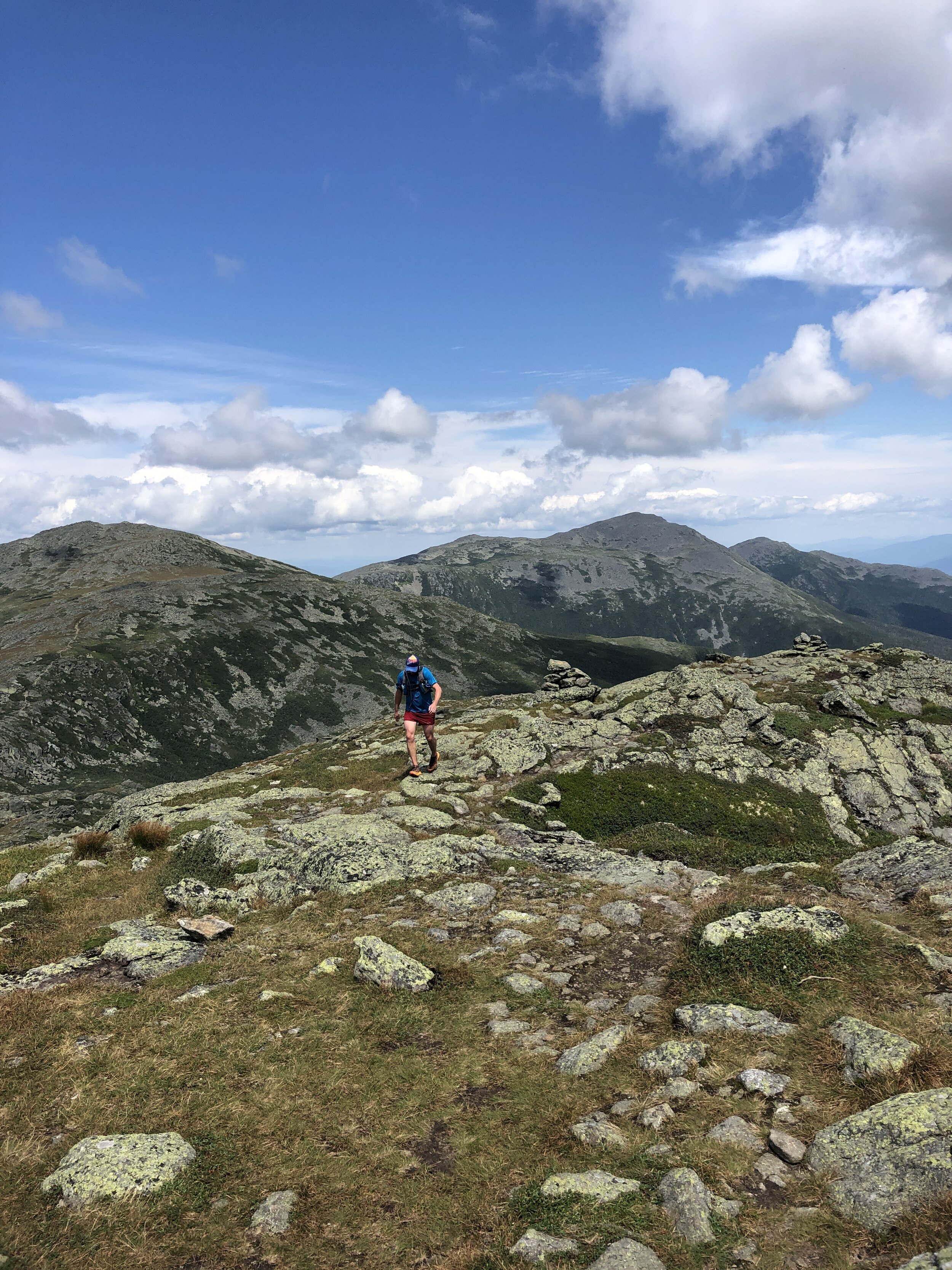
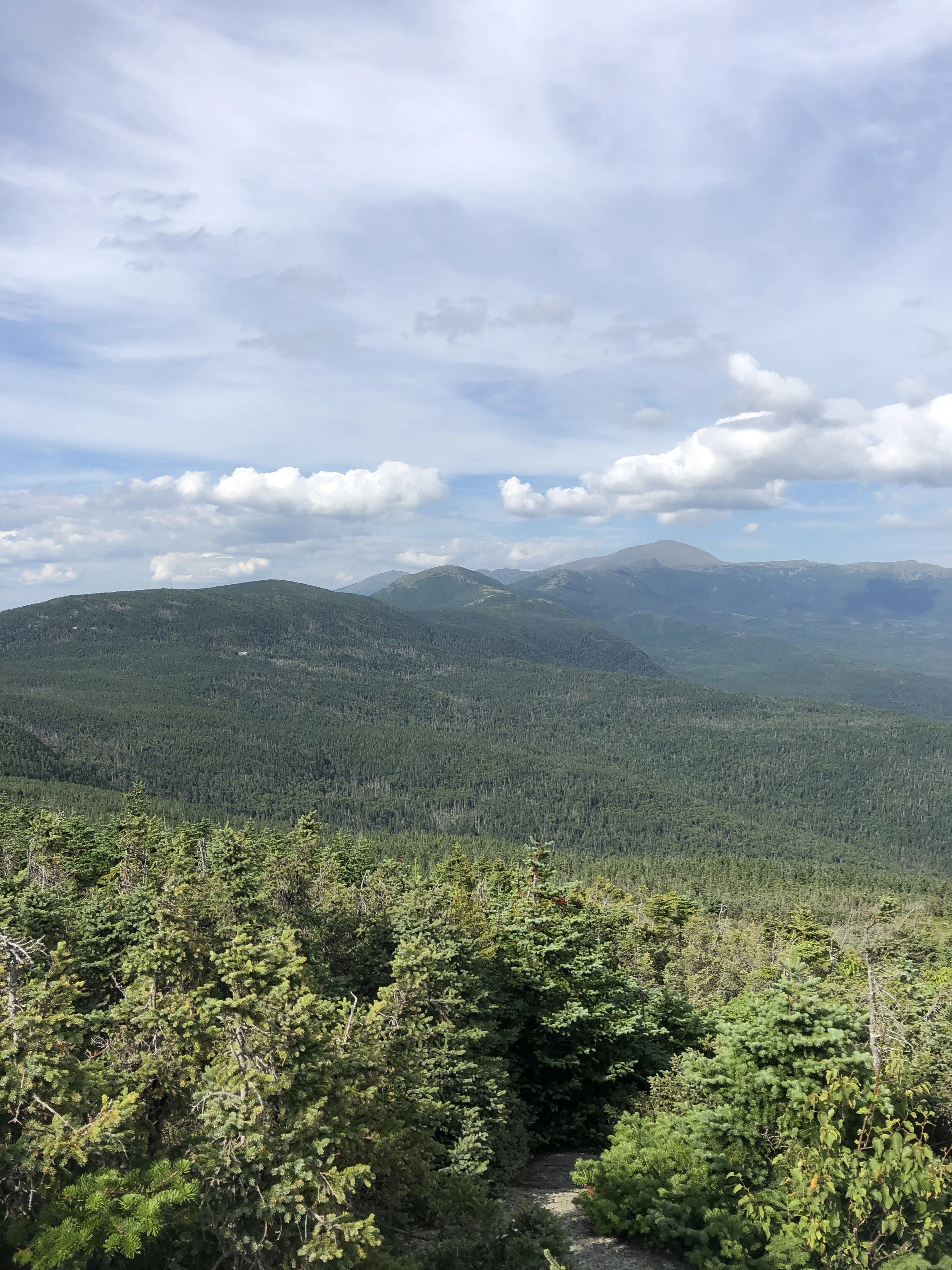
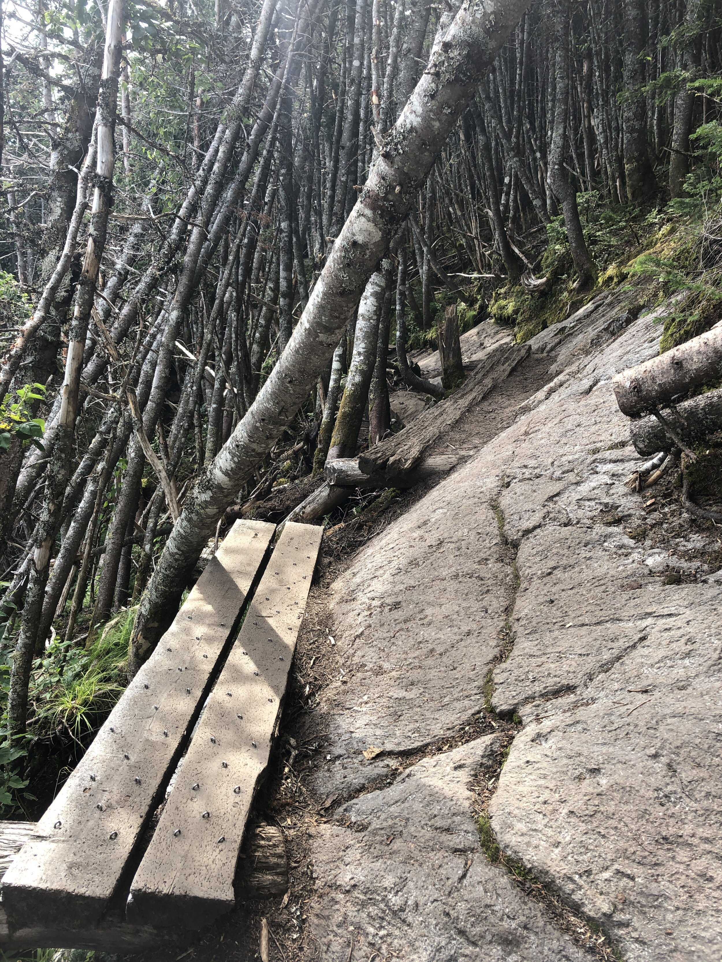
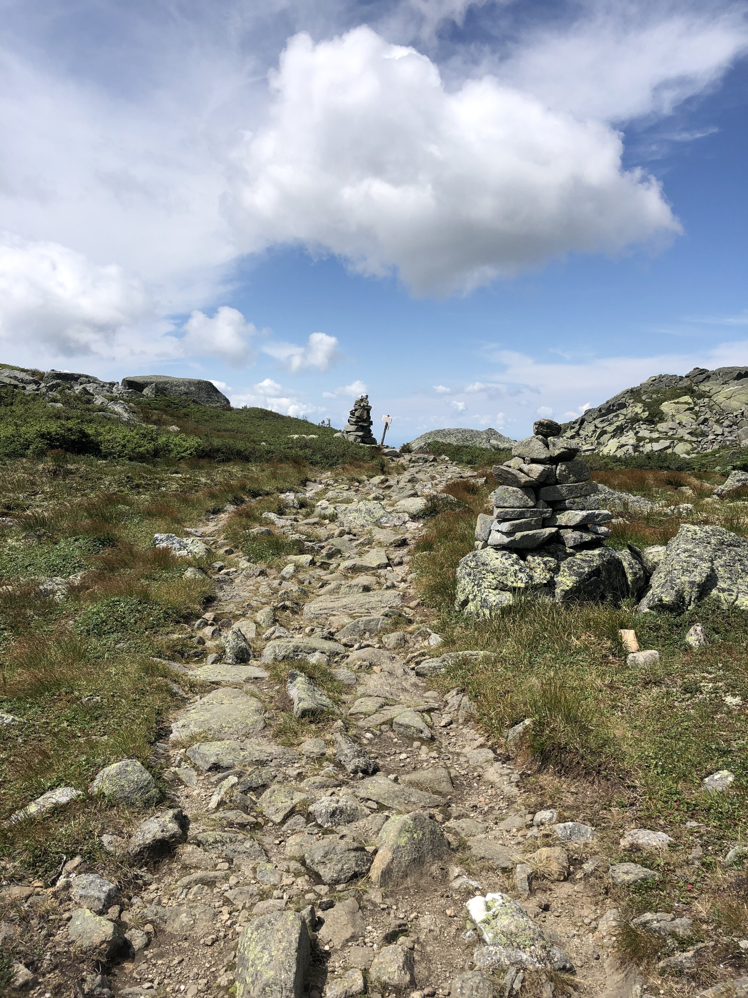
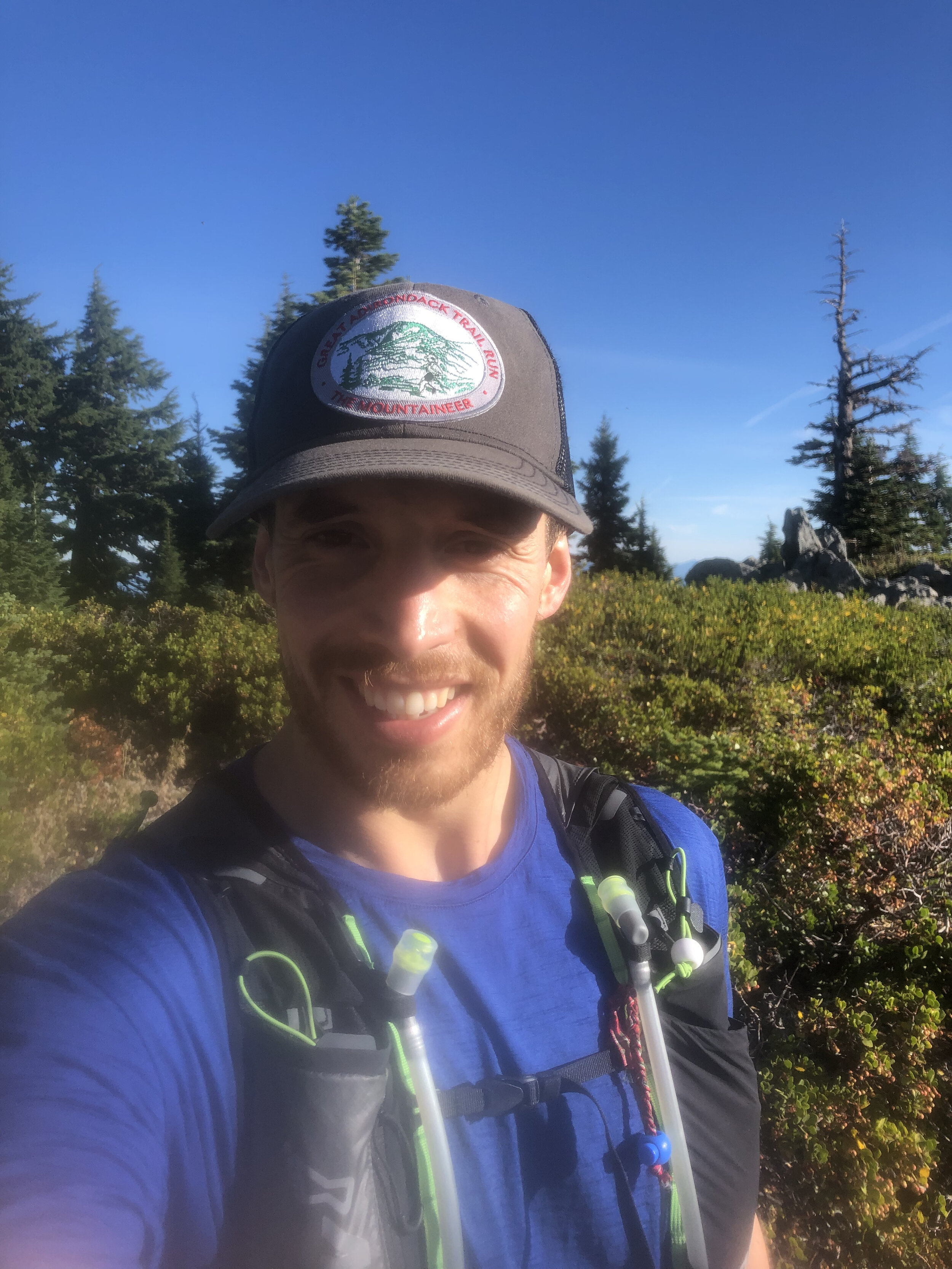
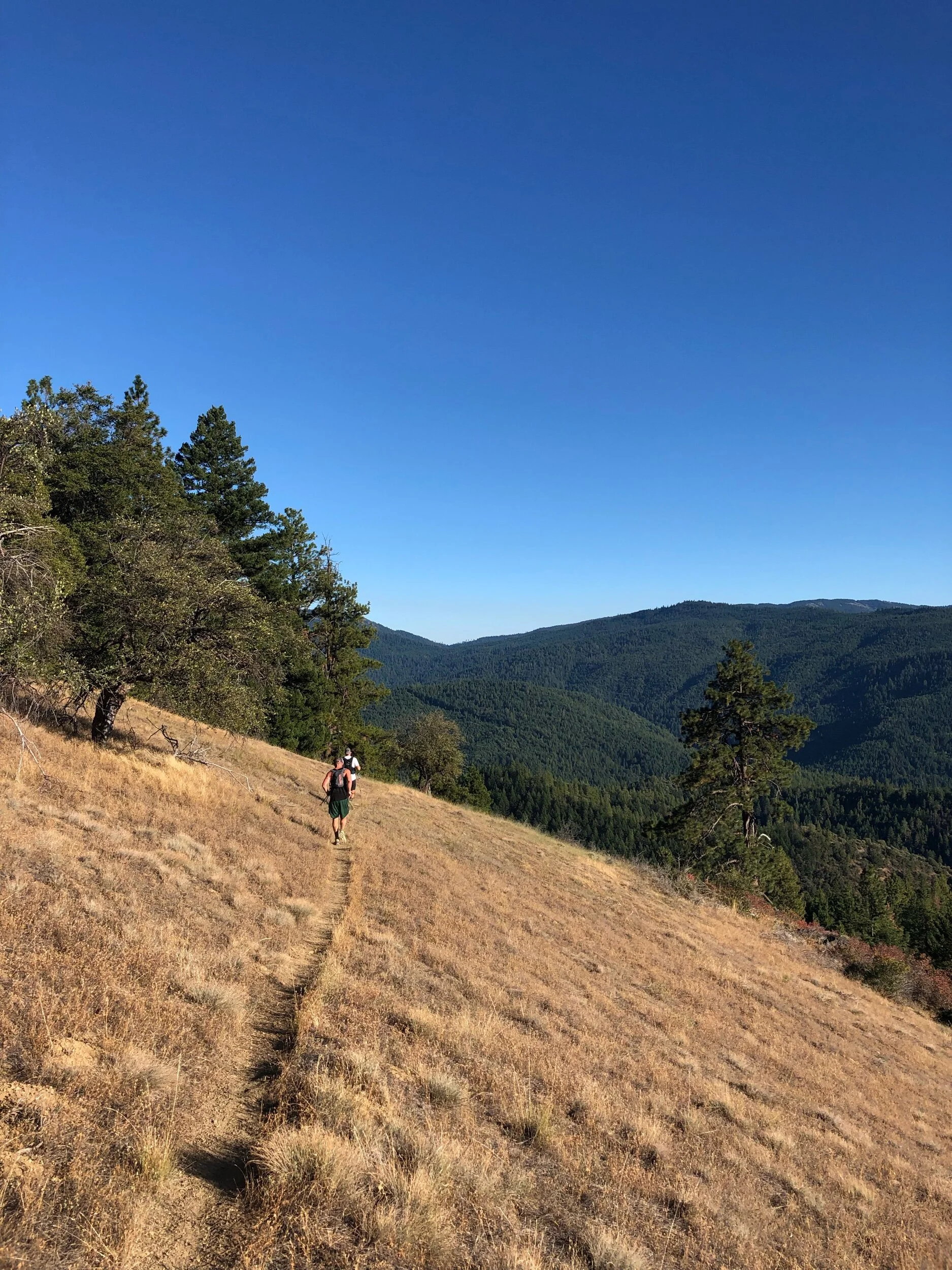
The plan was to reach the trail head around 7 am with us trying to maximise the amount of daylight on the trail. The first difficulty of the day was finding parking as despite our early arrival all the spaces were already filled along with a significant amount of parking going on up the main road. After a walk to the starting area we arrived at the bridge that marked the start of the trail, we took a few pictures before heading on up the trail. We were doing the route in reverse as we wanted to run what we thought to be the more challenging section out the way first. First up was a few miles of no climbing where we made quick progress dodging between groups headed along the pine covered trail, the scent of pine trees in the crisp morning air. The slightly bouncy surface felt like we could run for days on. The climb came to a rather abrupt beginning with a steep and rocky climb up into the mountains. Making progress bit by bit up the mountain towards the first summit of Bond Cliff standing at 4265ft ( 1300m) followed shortly afterwards by Mount Bond 4698ft (1432m). We arrived above the tree line to incredible views, blue skies and wispy clouds drifting over the summits. The views were mind blowing. One of our group made his way towards a cliff edge to check out the climbing potential. Some slightly wobbly runners legs making him think otherwise about going too close to the edge. First summit down and onto the next.

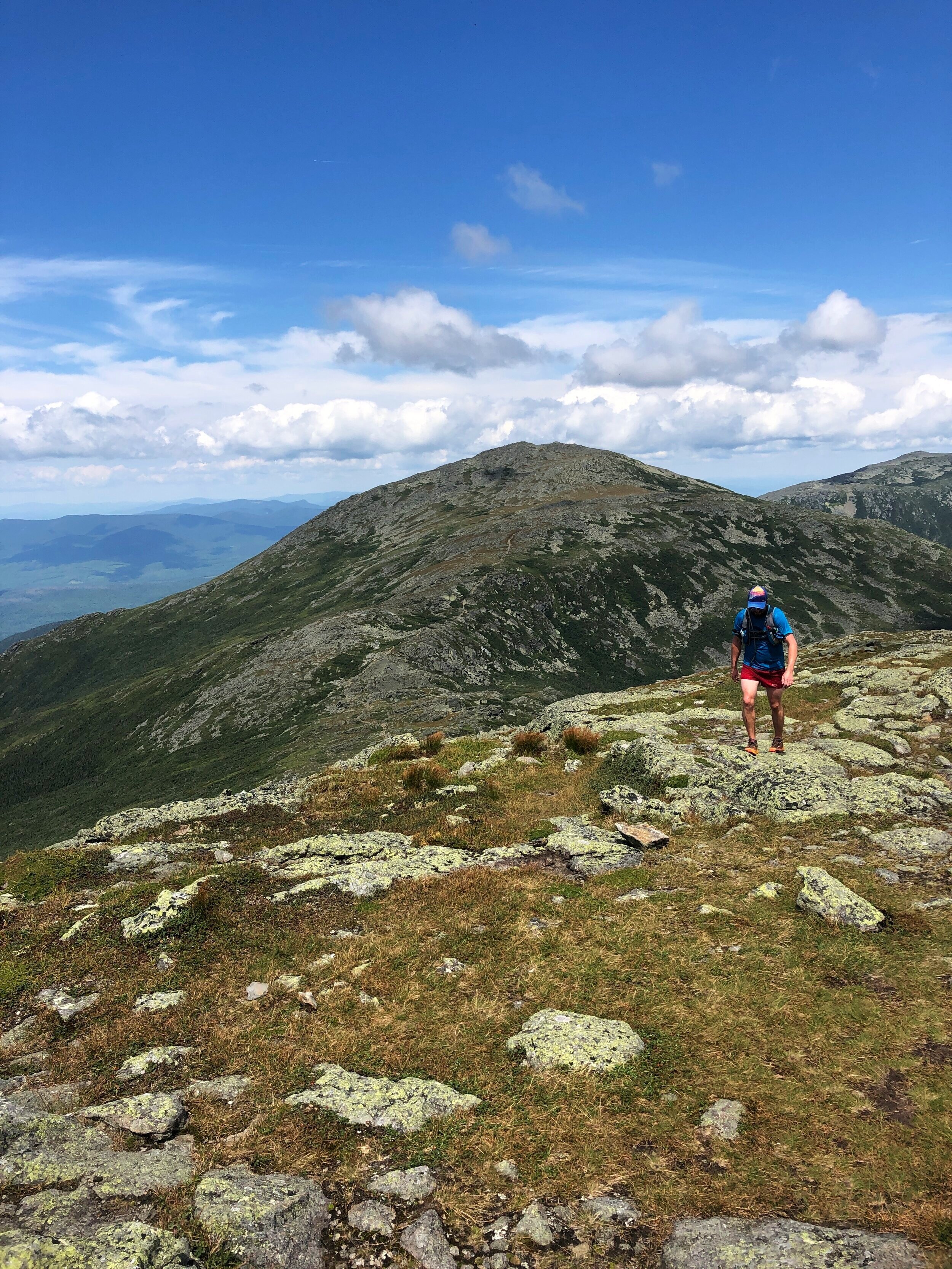
Our Start Line
History: Mount Bond (part of the trio of Bondcliff, West Bond and Mount Bound all of which are official 4000 footers) was named after Professor George Bond from Harvard University an astronomer who in 19th Century suggest the use of photography to measure a stars magnitude. He also surveyed the White Mountains.
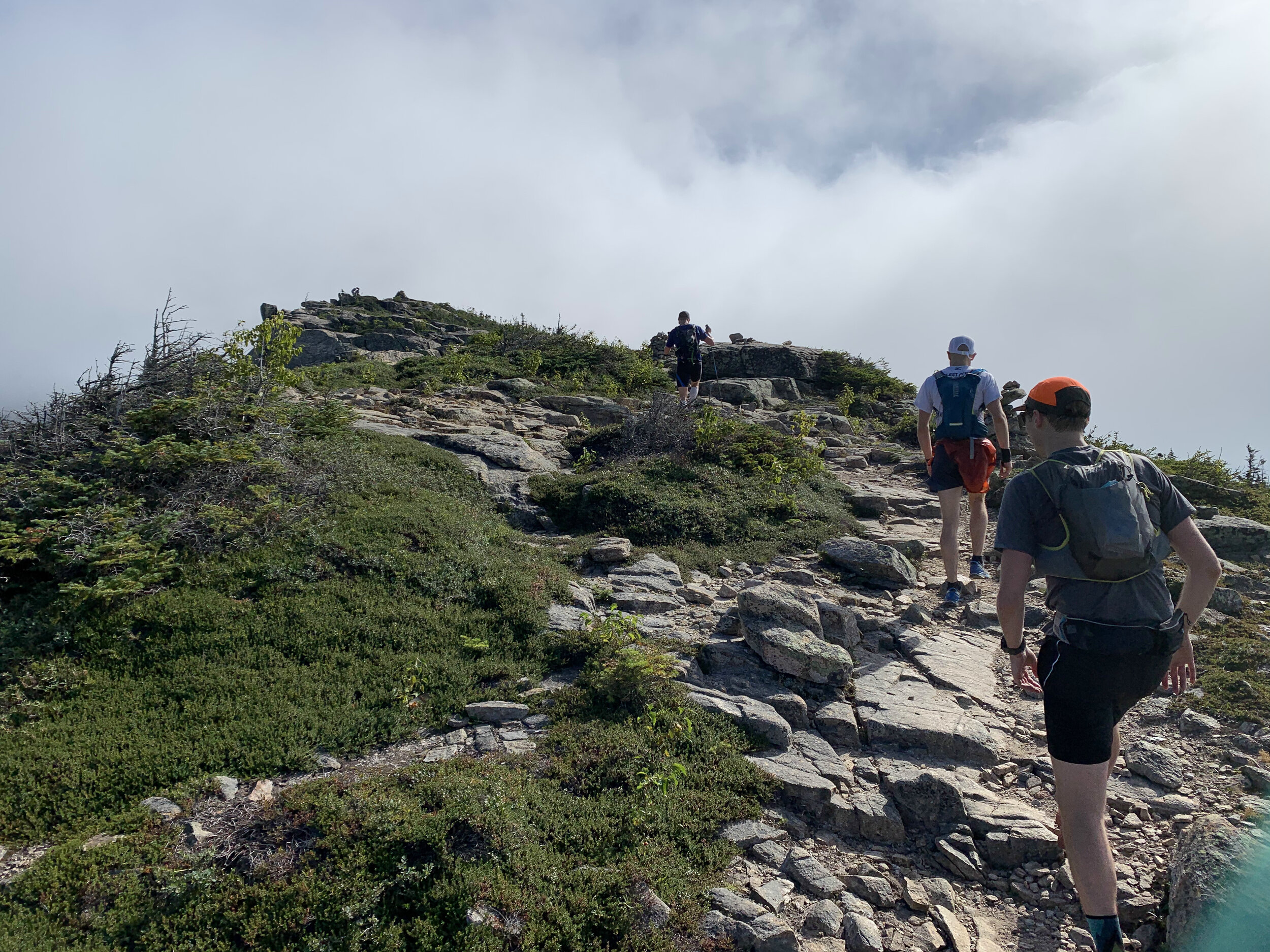
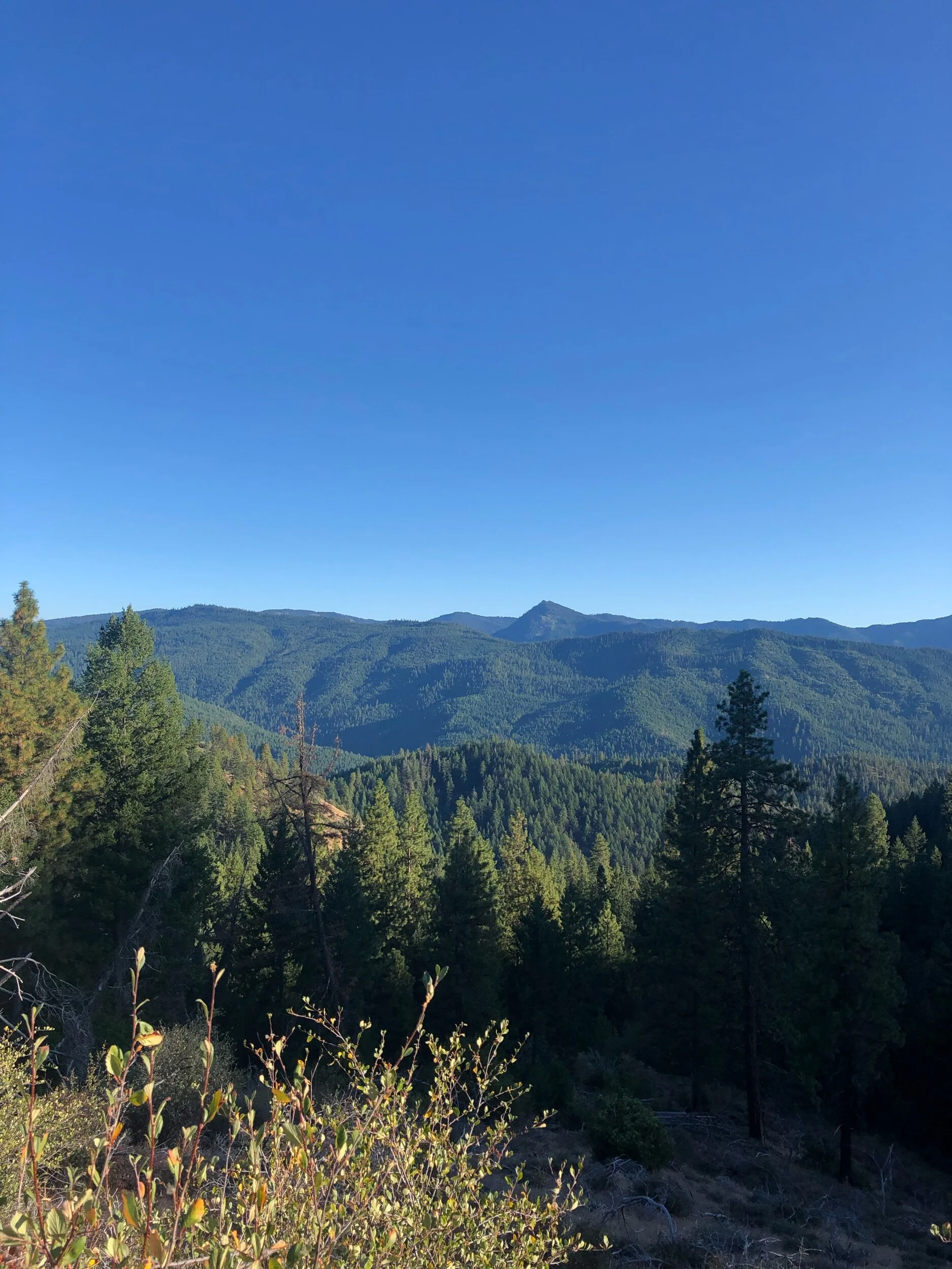
In comparison to the presidential traverse the trail was a beautifully carved out trail at this stage in the journey we moved along at a good pace as a group following the ridge line round the rim of this huge bowl all the while being able to see our final peak of the day. I have historically not enjoyed seeing the finishing point of a run but the spectacular views more than made up for the fact that the final summit teased us with our progress. Our pace ebbed and flowed with the difficulty of the terrain. The route skirted round Mount Guyot 4580ft (1396m), there was a bit of me that wanted to add these additional peaks onto the route for the day, I have since learnt about routes such as the super pemi that do. A tempting challenge for 2021.
History: The mountain is named after Professor H. Guyot from Princeton University who was a geologist and geographer. The mountain is not an official 4000 footer due to its height above the col to South Twin Mountain.
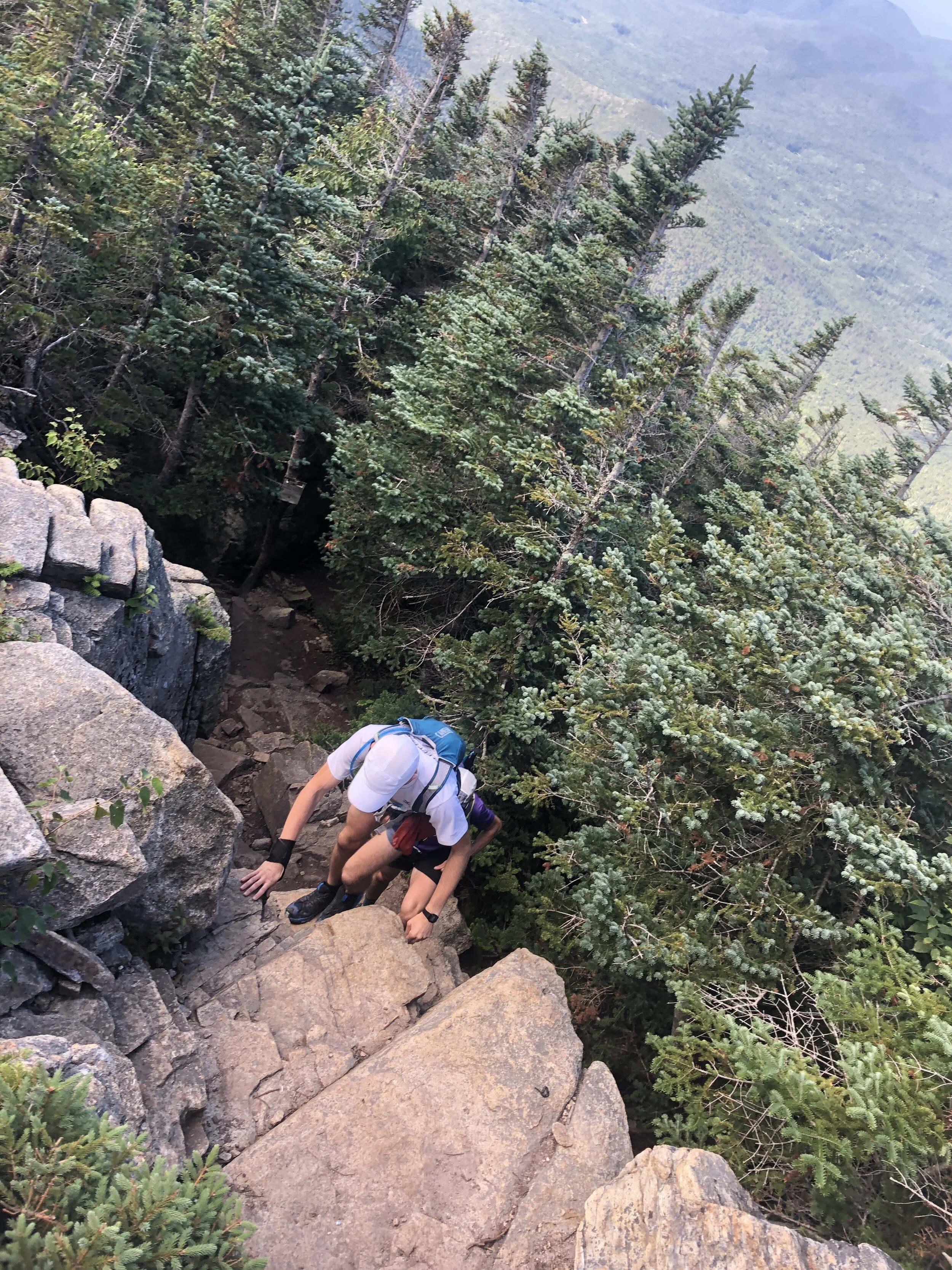
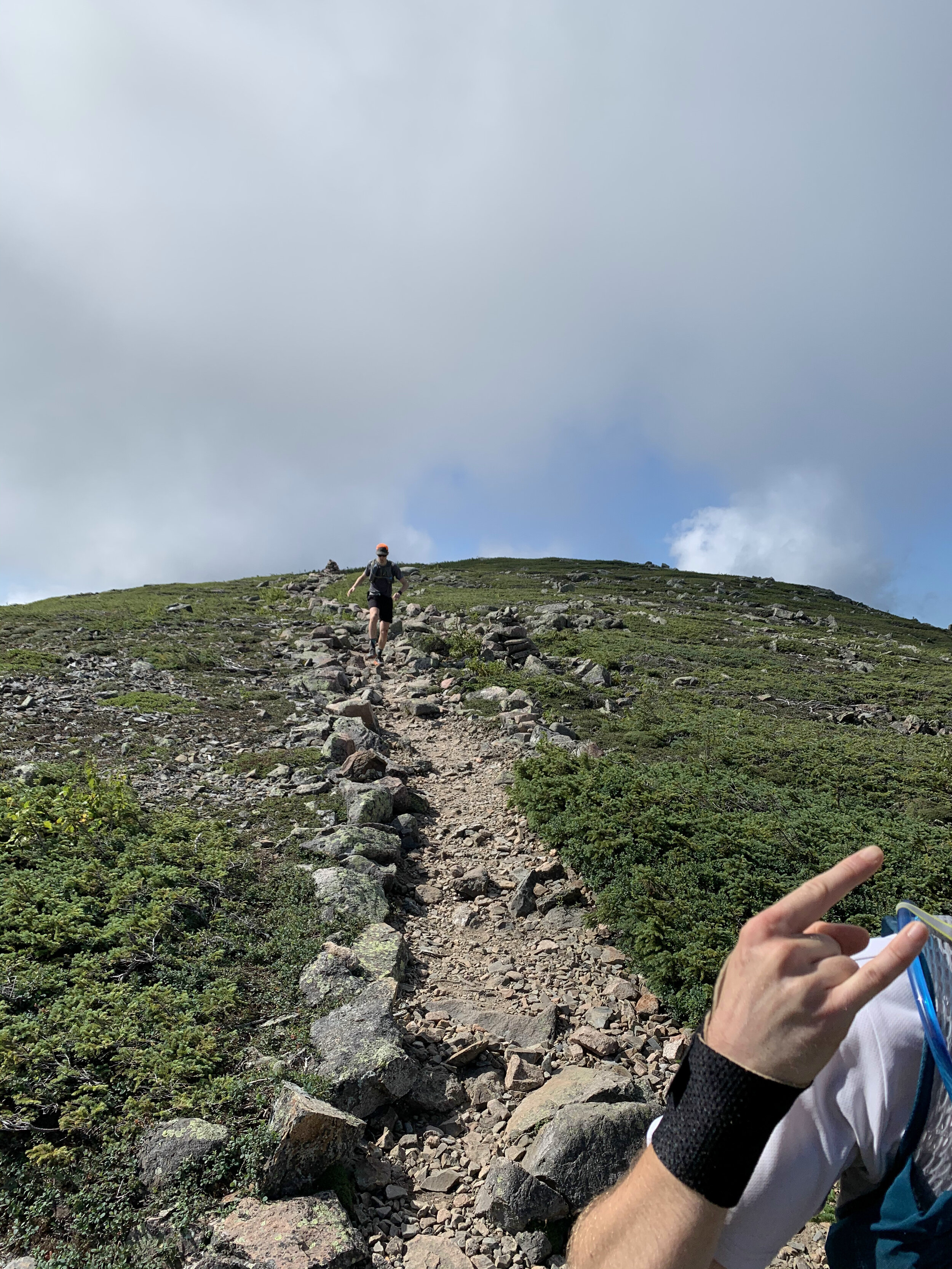
The next section was the make or break for the day with the route becoming more and more technical all the way to South Twin Mountain. Our pace slowed as we tried to be as delicate as possible hoping between rocks and roots. We started coming across more people who had been camping over night and beginning to make their way round the remainder of the trail. The thought of carrying a large pack on some of the terrain made me appreciate the light and fast approach we had taken. We were still making good progress and I was feeling really good despite having run the Presidential Traverse a couple of days before (you can read about that on this link ). We were also running as a larger group which made for a great run and at least for this first half everyone seemed to be happy with the speed and approach to sticking together.
We reached the summit of South Twin Mountain 4902ft (1494m) but given the length of the day we didn’t pause for long and made the dash towards Gale Head hut.
Quick fact: South Twin Mountain sits on part of the Appalachian Trail that runs 2,170 miles from Georgia to Maine. I still have no idea how the likes of Karel Sabbe, Scott Jurek, Karl Meltzer, Joe McConaughy and Jennifer Pharr-Davis completed the route in under 50 days. Mind blowing the speed and endurance these athletes have.
After this summit the route dropped down considerably towards the hut marking our midway point, it was here that the rocks and rugged terrain really took a bit of a toll on the team. I used the last of my water coming into the Gale head hut, perfect timing. We paused here surrounded by other runners and hikers topping up on food and water. Greg grabbed a burrito, I grabbed a brownie for the trail. Meanwhile some of the guys were patching up their feet for the second stage of our run. The sun was out and beamed down on us all as we sat soaking in the rays. It was time to head on and make the most the the day light as we all wanted to minimise risk of spending any time running in the dark. It was this second section where the groups pace differed a little and we naturally broke into two groups as the trail meandered up and down towards the next summit of Mount Garfield 4413 ft (1345m). It was here that the weather started to turn with clouds beginning to build all around us. We had been incredibly lucky with the weather so far on this trip and I was wondering what would be more pleasant sunshine or a touch of rain to cool us down as we ran along. I should have spent my time wishing for the sunshine!
Summit number four complete and now it was time to head onto Mount Lafayette 5249 ft (1600 m). It was here that the number of people out on the trail started to increase and the weather began to really turn. Clouds started to lower over the summits covering them in a veil and as we made our way up a number of false summits the wind and rain started to pick up. Donning jackets to stay slightly warmer, we made our way carefully up the rocky mountain. Behind and below us we were trying to pick out the coloured jackets from Andy and Greg but we couldn’t make them out and in the cold, wet weather we made the decision to continue a head on to stay as warm as possible. Making the summit and there were crowds of people, despite the relatively quite trails to this point the numbers of people were incredible as was the fact that many had minimal gear to deal with the now very different conditions to the beginning of the day.
History fact: Mt Lafayette is named after General Lafayette a french military hero who fought during the American Revolutionary war and was an aide to George Washington.
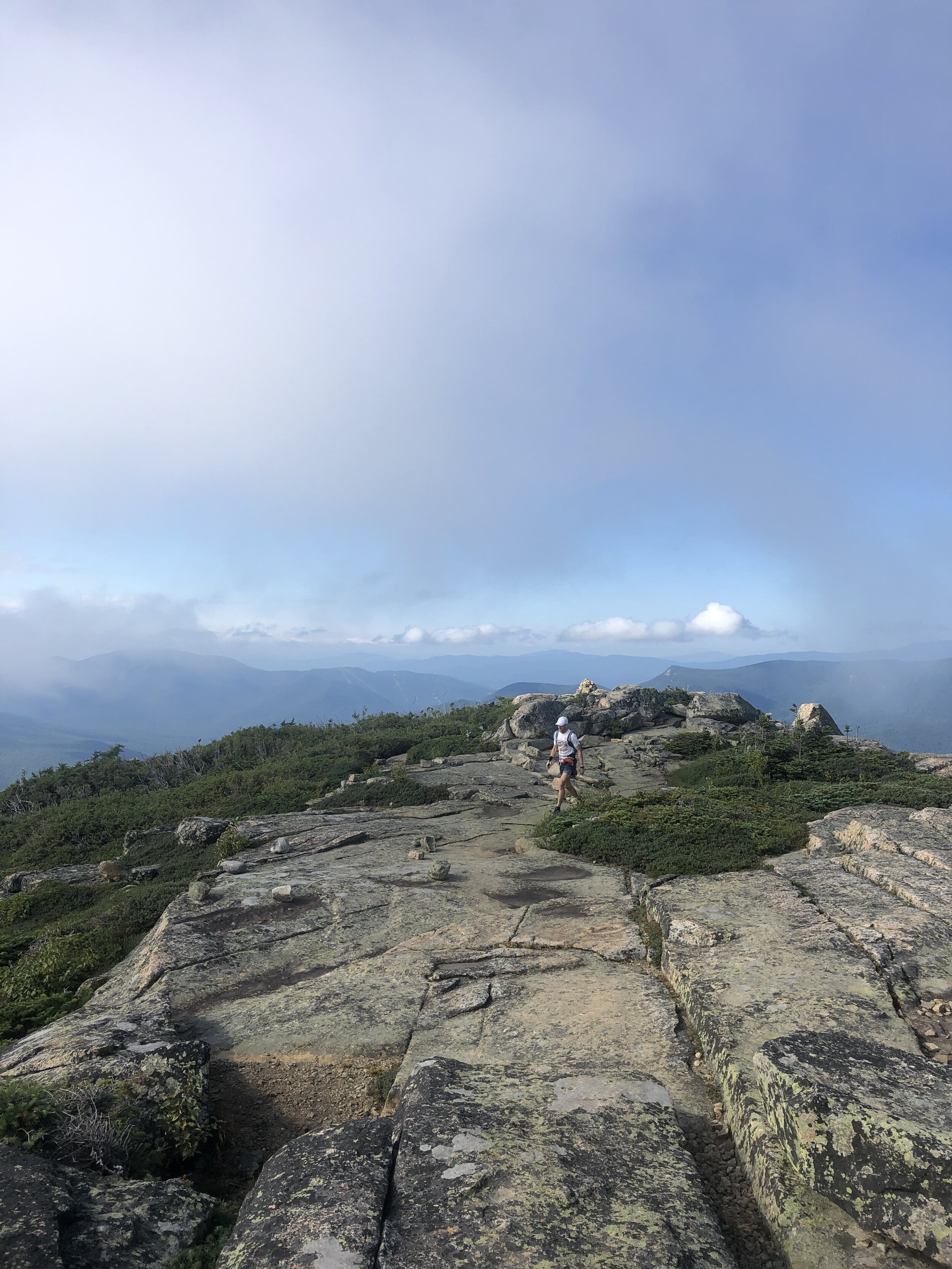
Next up was 3 rolling summits North Lincoln, Mount Lincoln and little Haystack Mountain, the three of us making good progress along the trail. And as the rain and wind started to albeit I could remove my jacket. All that remained was the final 2 peaks of the day. Mount liberty and Mount flume. We passed a few other runners along the way and as we arrived at the top of Mount Flume another group kindly took some photos of us before the descent to the finish.

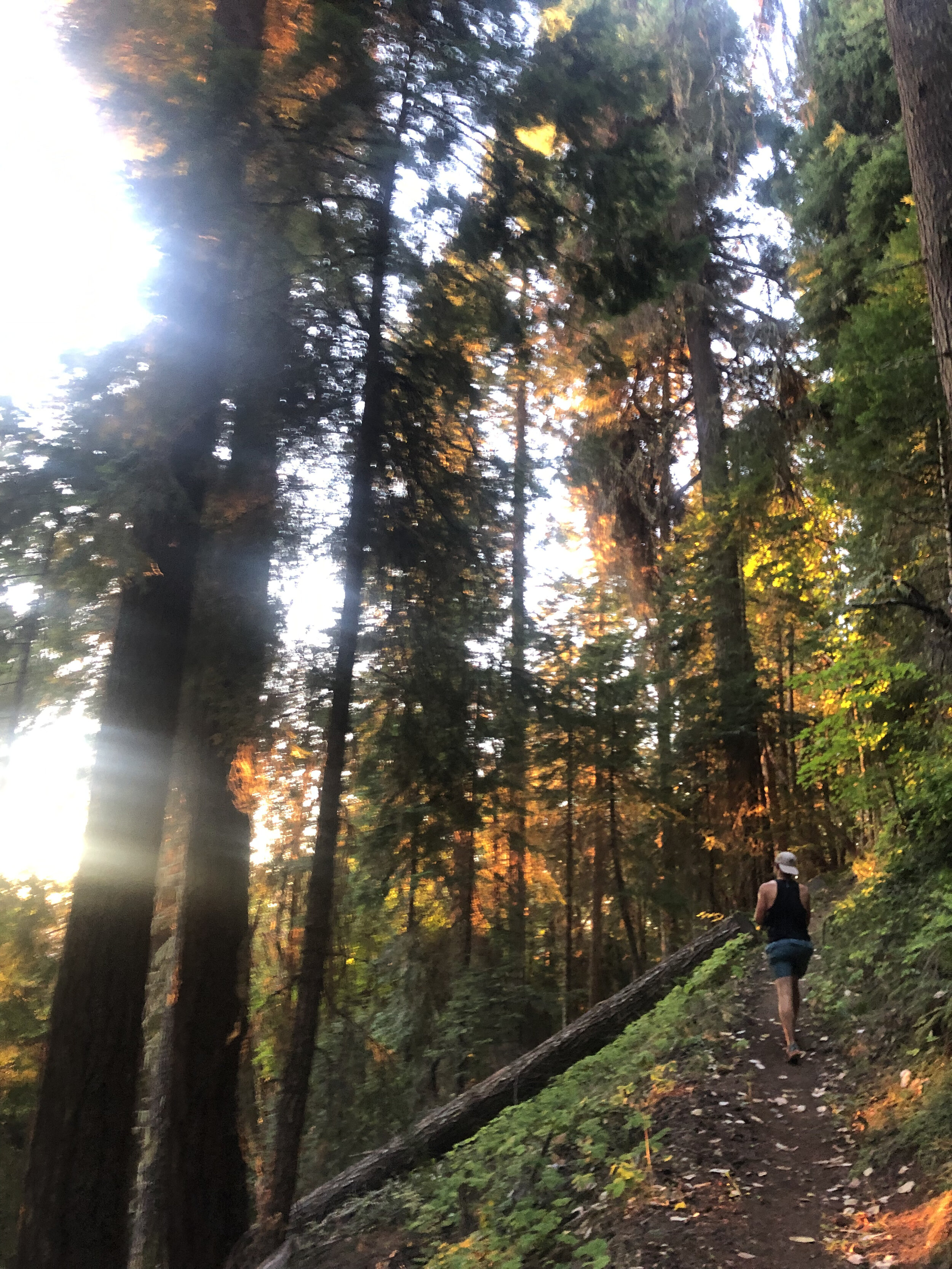
The final descent was certainly one of the highlights of the day. The trail for the most part felt like a perfectly designed trail carved for us down the mountain, our speed began to naturally pick up on the way down as we inched our way to the finish. Ever expecting the terrain to suddenly change and hamper our progress. Instead the trail became better and better all the way down. Broken up occasionally by some incredibly crafted wooden steps that covered the more challenging sections. The trail soon became a hard packed trail more similar to the one I experienced on the Pine to Palm last year (you can read about that experience here). The final couple of miles were pure elation running freely down the pine tree trails and then onto the hard packed route we initially ran on at the beginning towards the bridge and our finish line. Our pace kicking up a couple of notches for an almost sprint finish. Touching the bridge we had done it (watches stopped to capture the all important finishing time, as they say if its not on strava it didn’t happen….). All that was left was for us to bask in our glory whilst drinking a beer and soaking in the nearby stream.
Stats for the long weekend:
Days: 3
Distance covered: 56 miles
ascent: 20,000ft
NH 4000 footers completed: 16

The Presi Traverse
Distance travelled: 20.08 miles
Altitude climbed: 9,469 ft
Total Time: 8hr 7mins
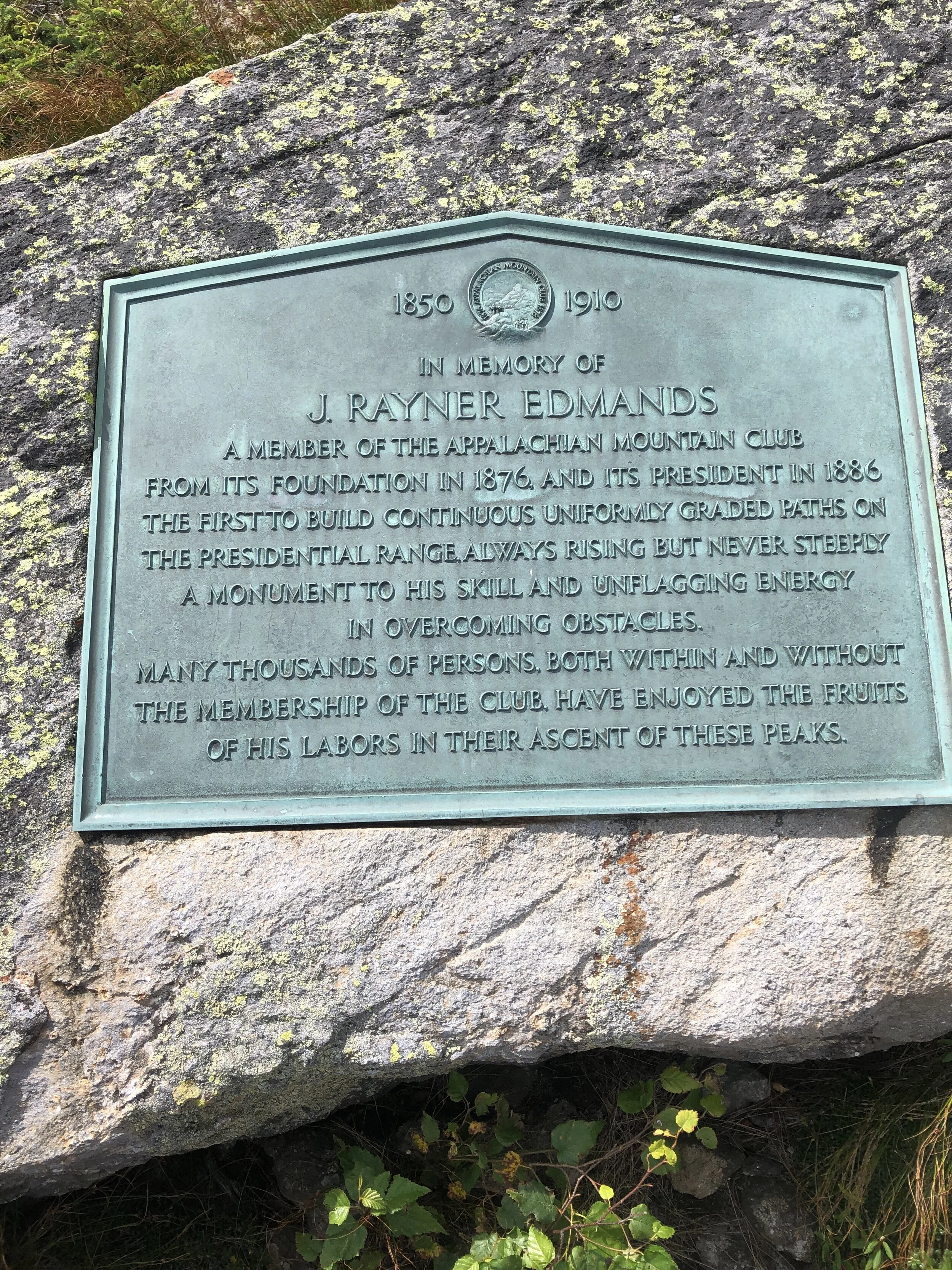
When I arrived in the US 4 years ago I first experienced the wonders of New Hampshire on a cold winters day when I joined the Appalachian Mountain Club for a day skiing trip on the Cog track on Mt Washington. On a side note I would highly recommend joining the Appalachian Mountain Club if you are ever in the North East. My first day with them was especially memorable (link Skiing on Mt Washington) as I had made a very school boy error in forgetting my goggles. My eyelashes froze on the ski down, not convenient.

The Presi Traverse
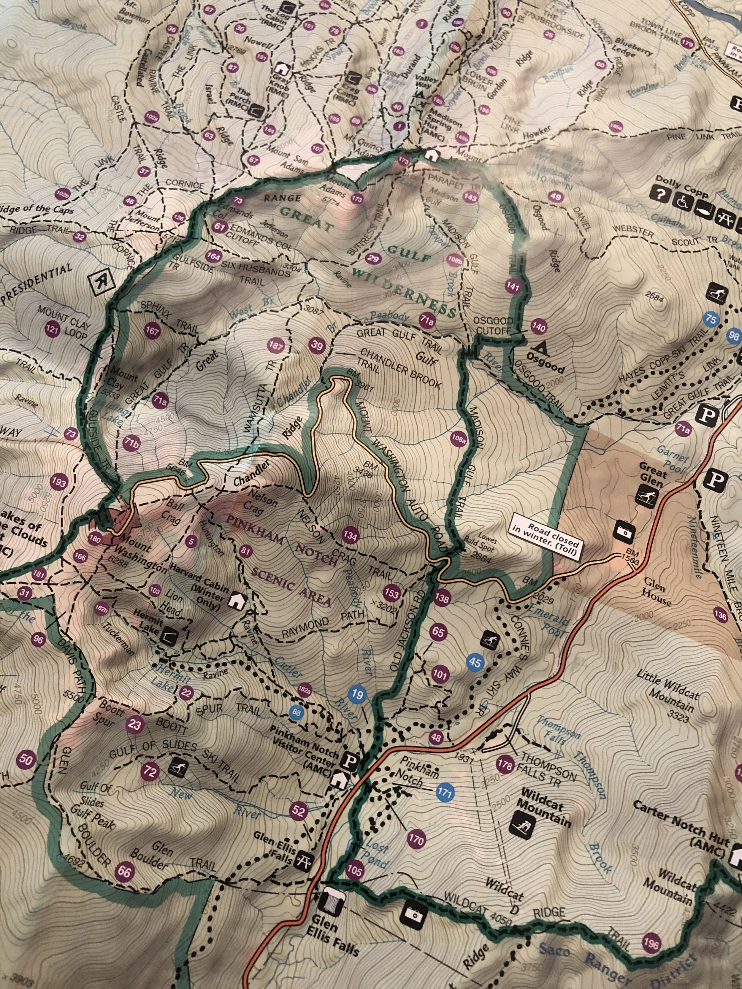
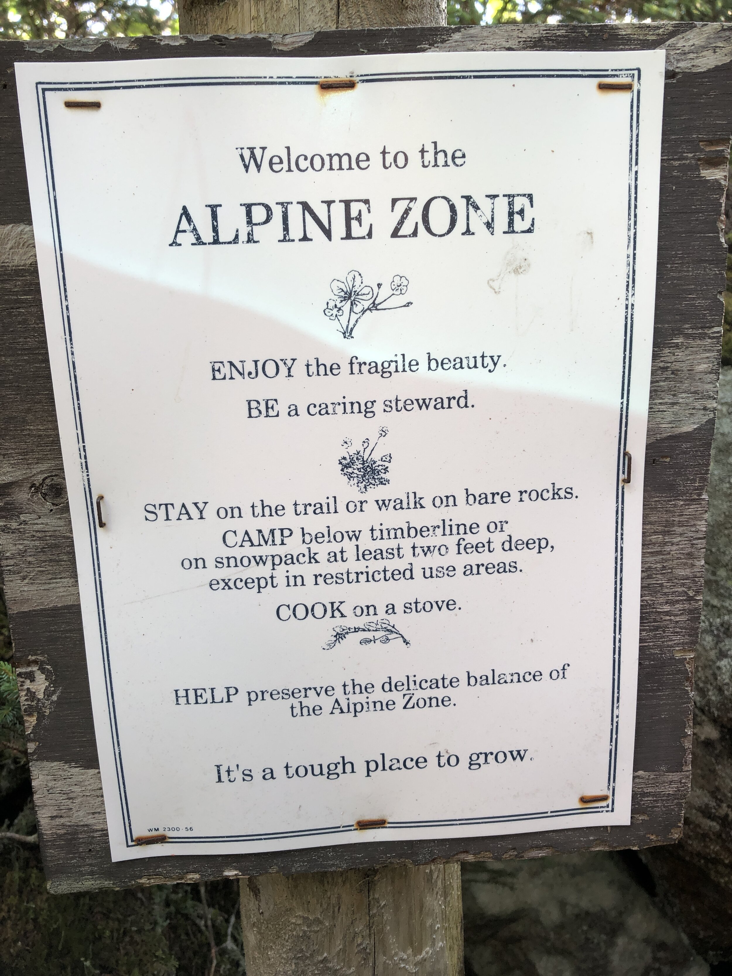
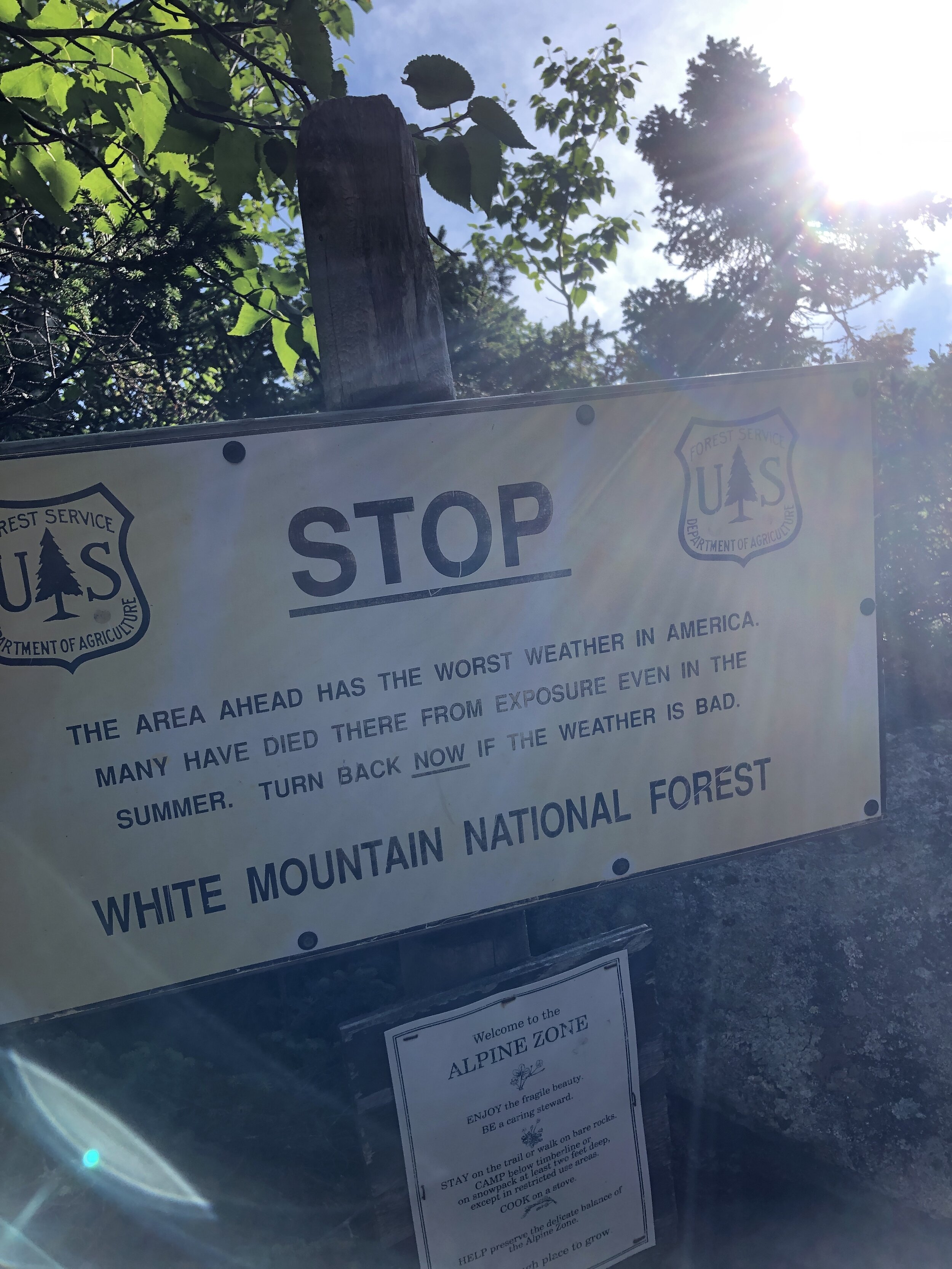
Ever since my first visit to New Hampshire I had been wanting to do a winter and summer trek to the summit of Mt Washington. A place renowned for the highest recorded wind speed on earth outside of a tropical storm. I had heard about an epic running challenge where you traverse length of a ridge line following what’s called the Presidential traverse. At 23 miles (37km) and 9,000 feet of gain (2,700m) it's not for the faint hearted and is rated as one of the toughest running/hiking routes in the north east of the US.
TOP TIP: learn the US President's names and who each peak is officially named after to make sure you don’t accidentally run an extra peak. ***Hint*** Clay is not a former US President. And Mt Jackson isn’t named after former US president Andrew Jackson. I learnt that at the finish when my friends wondered where I had got to.
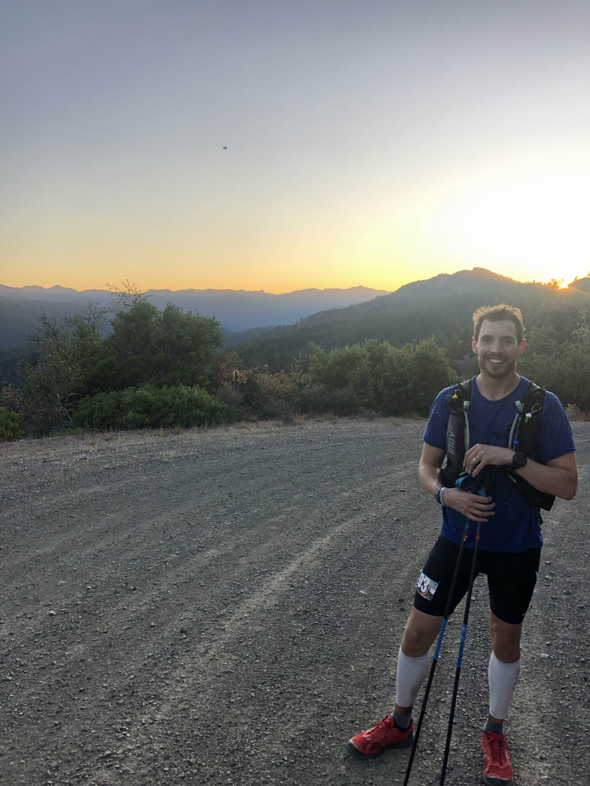
My opportunity to run the Presidential Traverse came when a friend invited me on a long weekend running trip in New Hampshire with a bunch of his buddies. Of course I said YES!! immediately.
First was the journey up to New Hampshire. It was meant to be a fairly mundane day. I was feeling a little under the weather (having fainted in the morning, long story…) and was not looking forward to a long drive up to New Hampshire. I ride shared with one other up to my friend’s house in Beacon NY where we pit-stopped for lunch, burritos! They hit the spot. I was finally beginning to feel normal by the time I finished my second.
After a fairly decent drive we arrived to yet more food - despite not having run yet I was beginning to eat as if I had done a few days of ultras. Let’s call it pre-run prep. The evening was spent munching pizza, assessing the route and packing our bags. There was of course a bit of beer drunk and lots of chatter about how quickly we might be able to run the Traverse.
After the rough morning, the long drive and packing of our equipment However I was too excited to sleep, I tossed and turned through the night until my alarm finally signaled morning. I munched some cold oats and cold brew whilst watching some of the guys working on brewing the perfect batch of drip coffee before hitting the road.
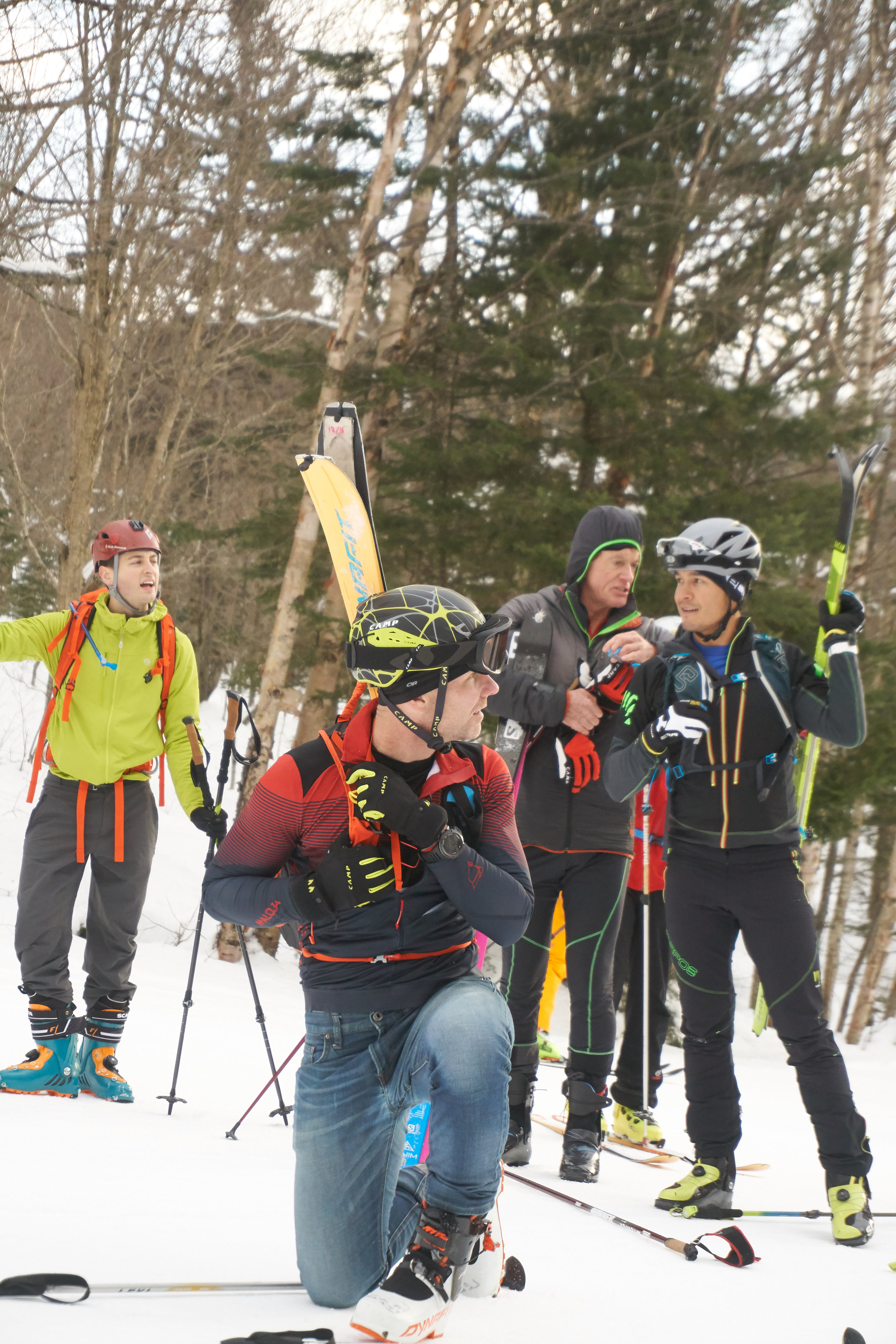
The crew
We dropped a car at the end point before heading back to the start as a group and ready to rock. A quick pee stop, a final drink, photo and it was time to hit the trail.
It has been a long time since I ran in a group that was not part of a race. I was envisioning our small tribe heading along the wooded trail. The trail started relatively flat and untechnical before kicking up the gears. The group soon dispersed and the poles I had taken out were also stashed away as the trail turned to more of a rock scramble heading up Mt Madison (5,367ft, 1,636m). Despite the early start and the mild temperatures I was beginning to heat up quickly. I climbed higher until I slowly made my way out of the tree line. And then it was onto a large boulder field heading directly to the summit. Hopping from boulder to boulder all the while keeping an eye on the cairns that marked the route that snaked its way up to the summit. I tried not to peek at the incredible view before reaching the top. Mt Madison down, 7 more to go! (or so I thought...)
History lesson: Mt Madison was named after James Madison, 4th US President from 1809 to 1817. According to Wiki He is hailed as the “Father of the Constitution” for his pivotal role in drafting and promoting the Constitution of the United States.
From here the route was laid out in front of us, I could see a few peaks ahead before the pinnacle of Mt Washington sitting high above all the others waiting for our arrival. I could make out one of our group just a head of me as I scrambled down. He had come up a quicker route and already made the summit before heading back down a bit to Madison Spring hut to fill up some water. I grabbed a couple of cups of water and together we headed on.
Up we climbed, munching on yet more food - breakfast number 2 or maybe 3 of the day. There wasn’t a huge amount of other people moving about on the mountains at this point allowing us to move freely along the trail.
Soon we reached the second peak of the day, Mt Adams (5,735ft, 1,748m). A quick photo and slightly less time admiring the views and on to the next peak.
History lesson: Mt Adams is named after John Adams, second US President from 1797 to 1801. John Adams was a leader of the American Revolution that achieved independence from Great Britain, and he served as the first vice-president of the US.
After the second peak I slowly edged ahead of my running buddy, trying to catch up with a few of the lads further ahead although I anticipated them being considerably further a head. I ticked off Mt Jefferson (5,659ft, 1,725m) and Mt Clay (5,525ft, 1,684m). Mt Clay was an addition to the “basic” 7 peaks of the Presidential Traverse, what can I say, these lads like a challenge! But it was Mt Washington I was looking forward to, it felt like the pinnacle of the route with everything after it being kind of downhill (or at least less of a climb).
History lesson: Mt Jefferson is named after Thomas Jefferson, third US President from 1801 to 1809. Interesting fact from the Washington Post; instead of having “former US President” inscribed on his grave he chose “Author of the Declaration of Independence, of the Statue of Virginia for religious freedom and Father of the University of Virginia”. Mt Clay is named after Henry Clay, 19th century senator and US Secretary of State from Kentucky - not a US President. But an official peak of the Presidential Traverse nonetheless.

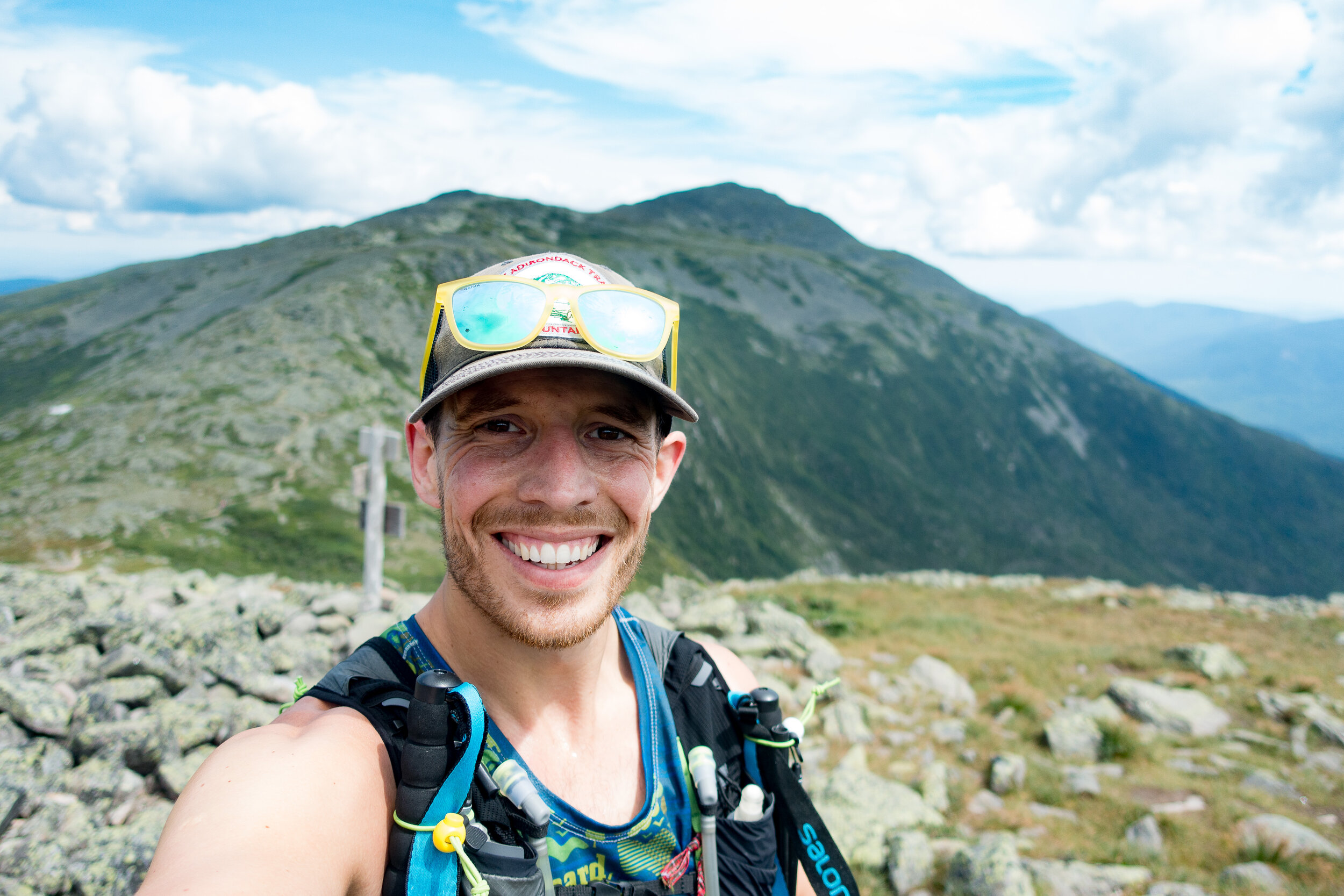
In front of us we could make out the line of cars driving to the summit and the cog train. The track was well trodden allowing for some good progress prior to a small boulder field near the summit. Arriving at the top we joined crowds of people, motorbikes, cars and a queue to stand by the sign marking the peak of Mt Washington (6,288ft, 1,917m).
History lesson: Mt Washington is named after George Washington the first US President 1789-1797. Random fact from The History Channel; “Washington wasn’t just America’s first president, he was also its first mule breeder.
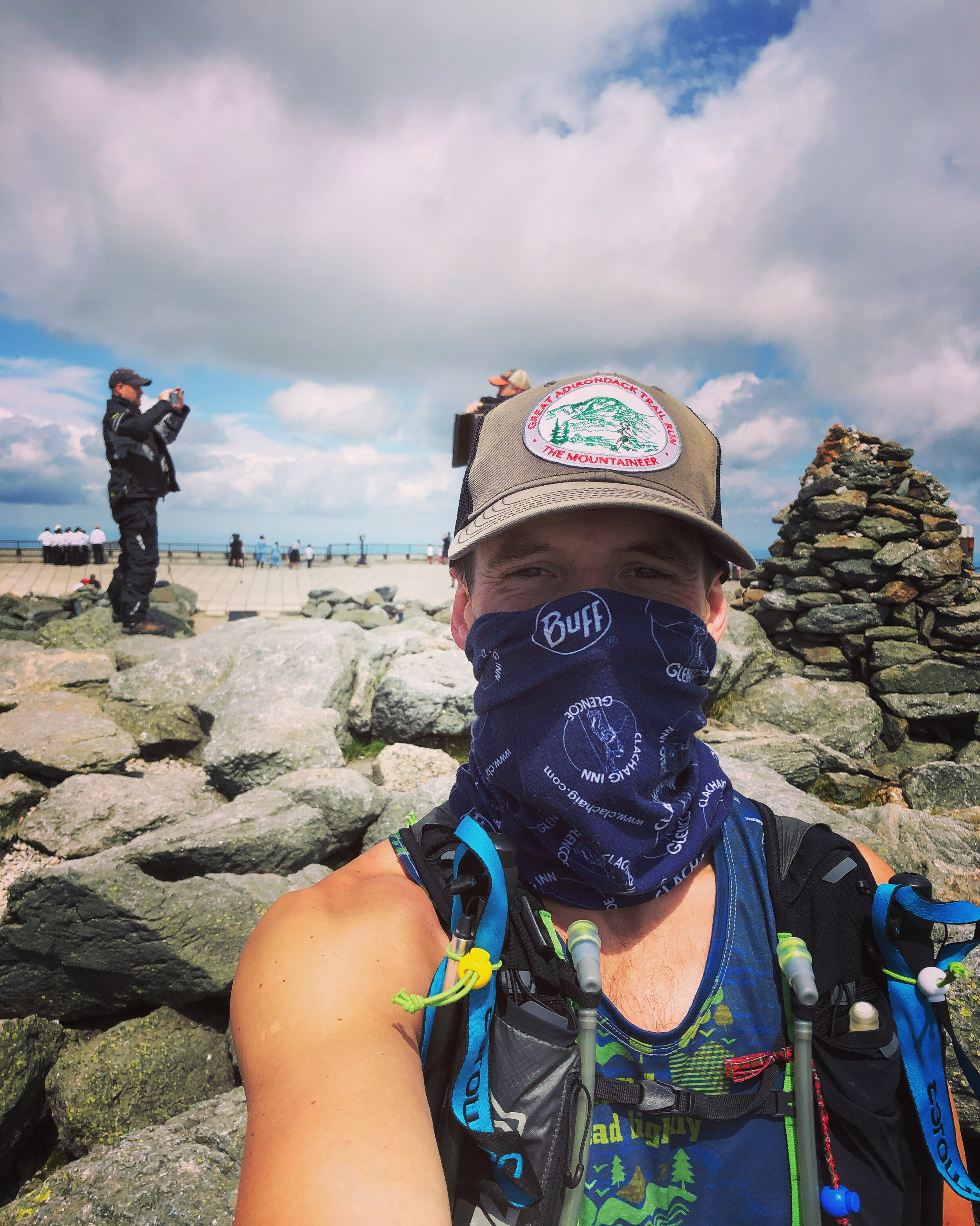
I lost the Shaun amongst the crowds on Mt Washington so I headed on down as quickly as possible. With my buff pulled over my face (thanks COVID) I ran down the perfectly laid stone path towards the "Lakes of the Clouds" hut to resupply. The hut is operated by the Appalachian Mountain Club - thanks guys! A quick water stop and I was on my way.
I was up and over Mt Monroe (5,372ft, 1,637m), the 6th peak of the day, by about 2pm.
History lesson: Mt Monroe is named after James Monroe, fifth US President from 1817 to 1825. When Monroe was James Madison’s secretary of state he bought Florida from Spain for about $5 million.
I headed onwards to Mt Eisenhower (4,760ft, 1,450m), my 7th peak, I was pretty sure I only had one left. Looking at the route I had plotted on my phone there appeared to be two more. The rough and technical terrain was starting to take its toll.
History lesson: Mt Eisenhower is named after Dwight Eisenhower, 34th US President from 1953 to 1961. Eisenhower was apparently the first US President to ride in a helicopter!
Ahead of me I could see a little peak, Mt Pierce (4,291ft, 1,308m) sitting above the trees as I headed along the path. I reached the top knackered and and couldn’t quite believe that there was still one peak to go.
History Lesson: Mt Pierce is named after Franklin Pierce, 14th US President from 1853 to 1857. Wiki notes; Pierce is regularly ranked as one of the worst US Presidents - hopefully in part due to his alienation of anti-slavery groups and enforcement of the Fugitive Slave Act.
Then onto my final peak and 9th, Mt Jackson.
History Lesson: This peak wasn’t named after former US President Andrew Jackson who was the seventh US President from 1829 to 1837. It was instead named after Charles Thomas Jackson who served as State Geologist for New Hampshire, Maine and Rhode Island in the late 19th century. Charles Thomas Jackson is remembered by many for his involvement in a series of bitter conflicts that followed a pattern; a discovery would be announced by someone, Jackson would then claim prior discovery, and a controversy would ensue. Among the conflicts were the discover of guncotton, the telegraph, the digestive action of the stomach and the anesthetic effects of ether.
In short Jackson was a fraud (both the mountain and apparently Charles) - this mountain tricked me into believing it was a former US President when I was at my most exhausted.
A few hikers at the top told me there was about a 30 - 45 min trip down to the parking lot. The initial part was straight down a rocky scrambly route. It felt like a fairly brutal section to finish on. Slowly but surely I started to hear the road up ahead and popped out of the trees all of a sudden to see the rest of the group waiting. It turned out that I added a decent amount of distance to the Presi traverse.
I was delighted to have completed the route and to be finished as I washed down my run with a cold beer and some pickles.

A Big Run
THE NEW YORK APPALACHIAN TRAIL
October is Domestic Violence Awareness Month. Domestic violence is a global epidemic that continues to quietly plague our homes, getting lost in the noise of the daily news cycle, especially during the COVID-19 crisis. Greg (Benno’s trail running partner) felt that he had a responsibility to raise awareness and discuss domestic violence issues, just as the white populous has an increased awareness to discuss racial issues.
A BIG RUN - RAISING AWARENESS FOR DOMESTIC VIOLENCE
Text donation: You can also text (202) 858-1233 and enter “abigrun” to pay via Venmo, Paypal, or credit card.
Some details about the route, and if you wish to follow along our journey on instagram @bennorawlinson or on the trackamap link below
https://trackamap.com/bennosadventures/
Whilst you are out on the trails this weekend use the hashtag to support #NYabigrun
88 miles on rocky hiking trails
17,000’ of ascent and 18,000’ of descent
Crosses the Hudson River at the Bear Mountain Bridge, right after snaking through the Bear Mountain Zoo

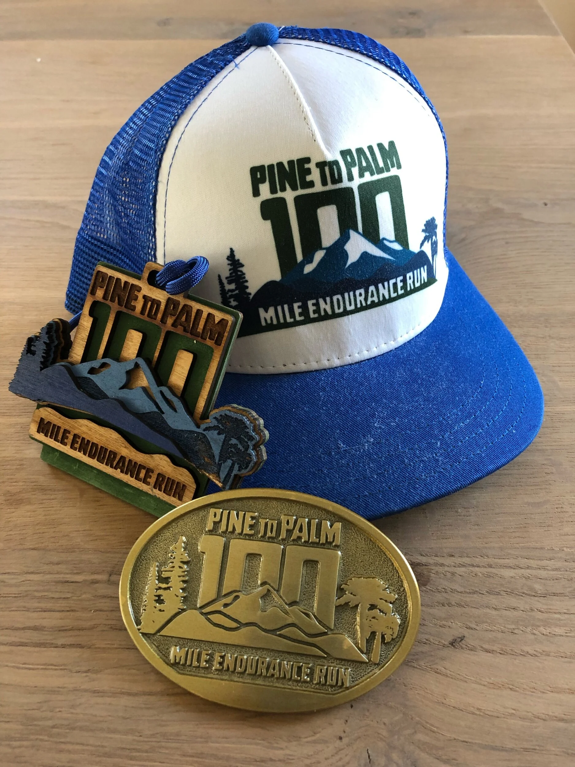
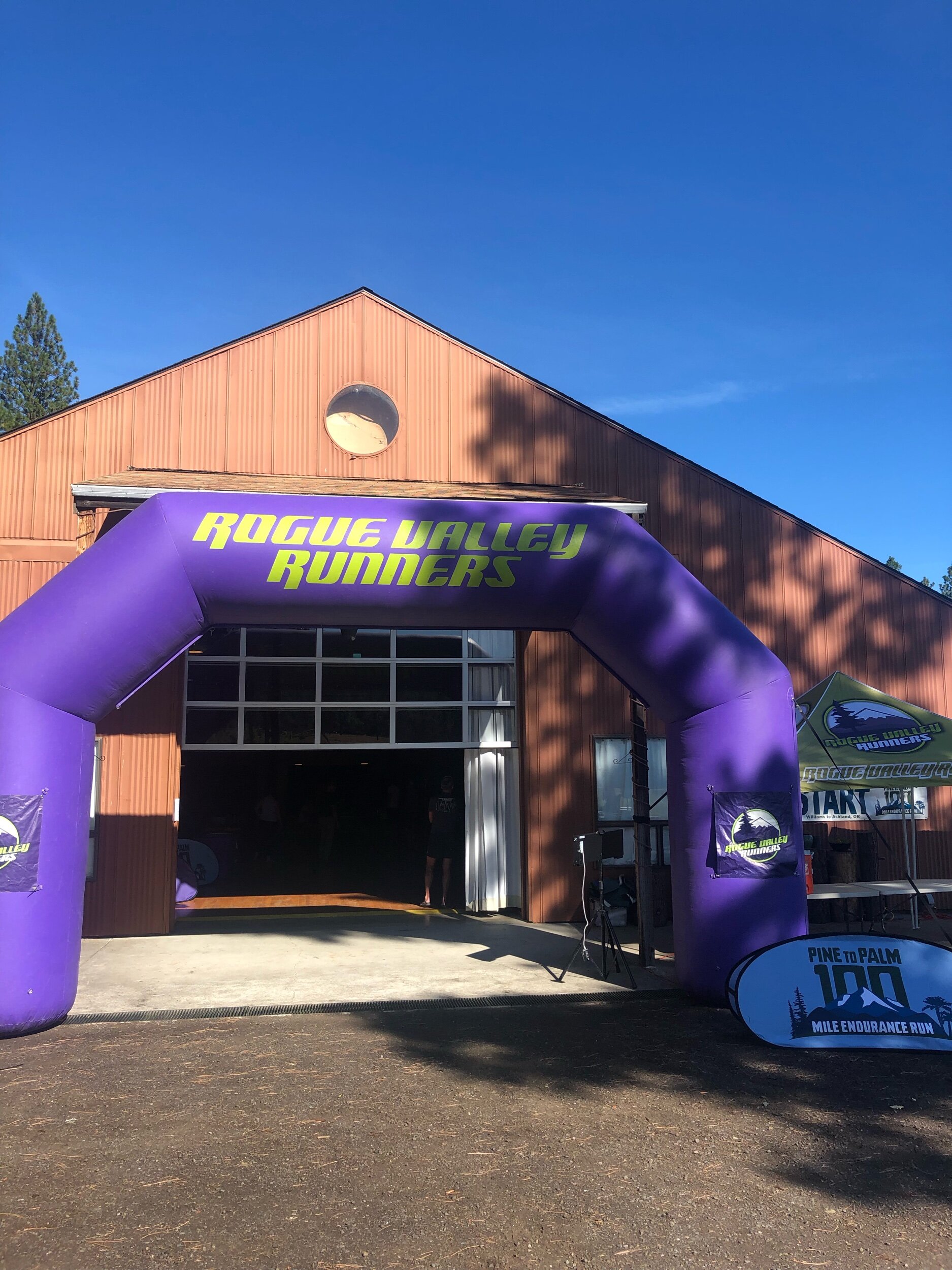
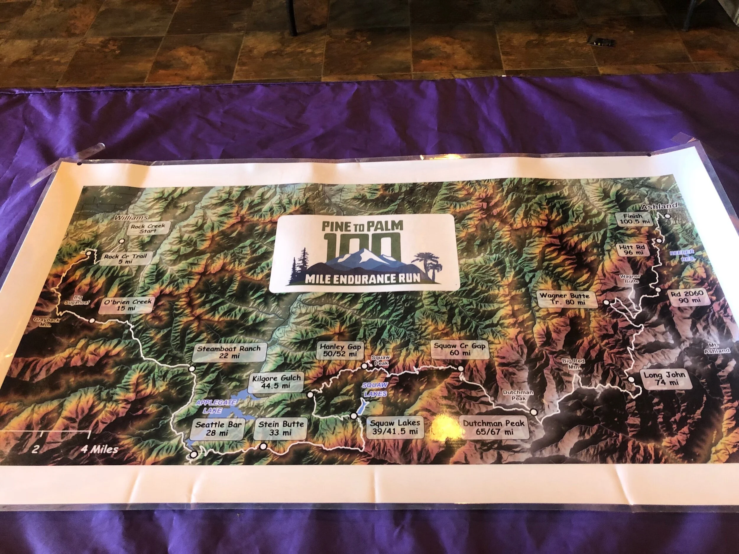
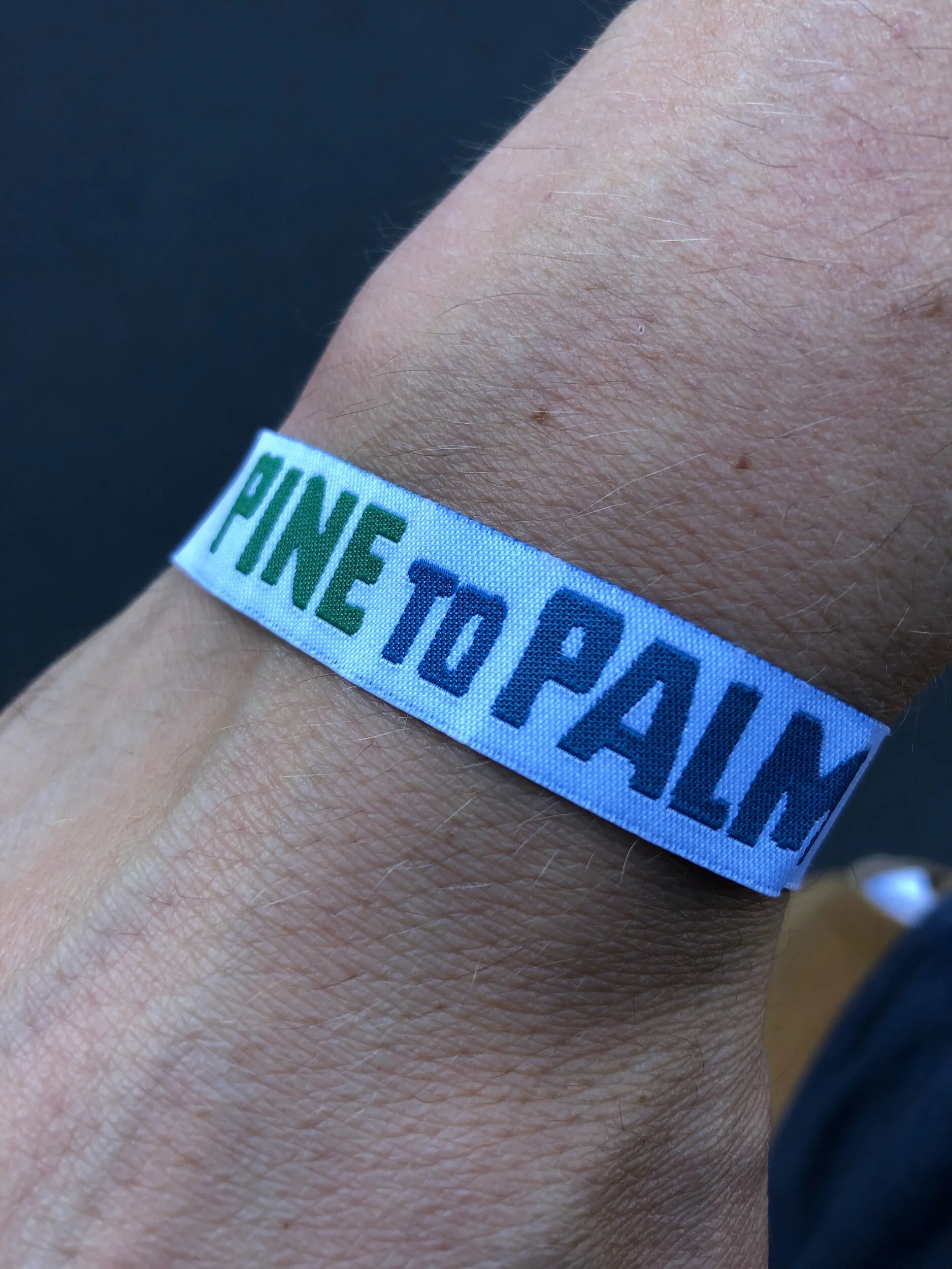
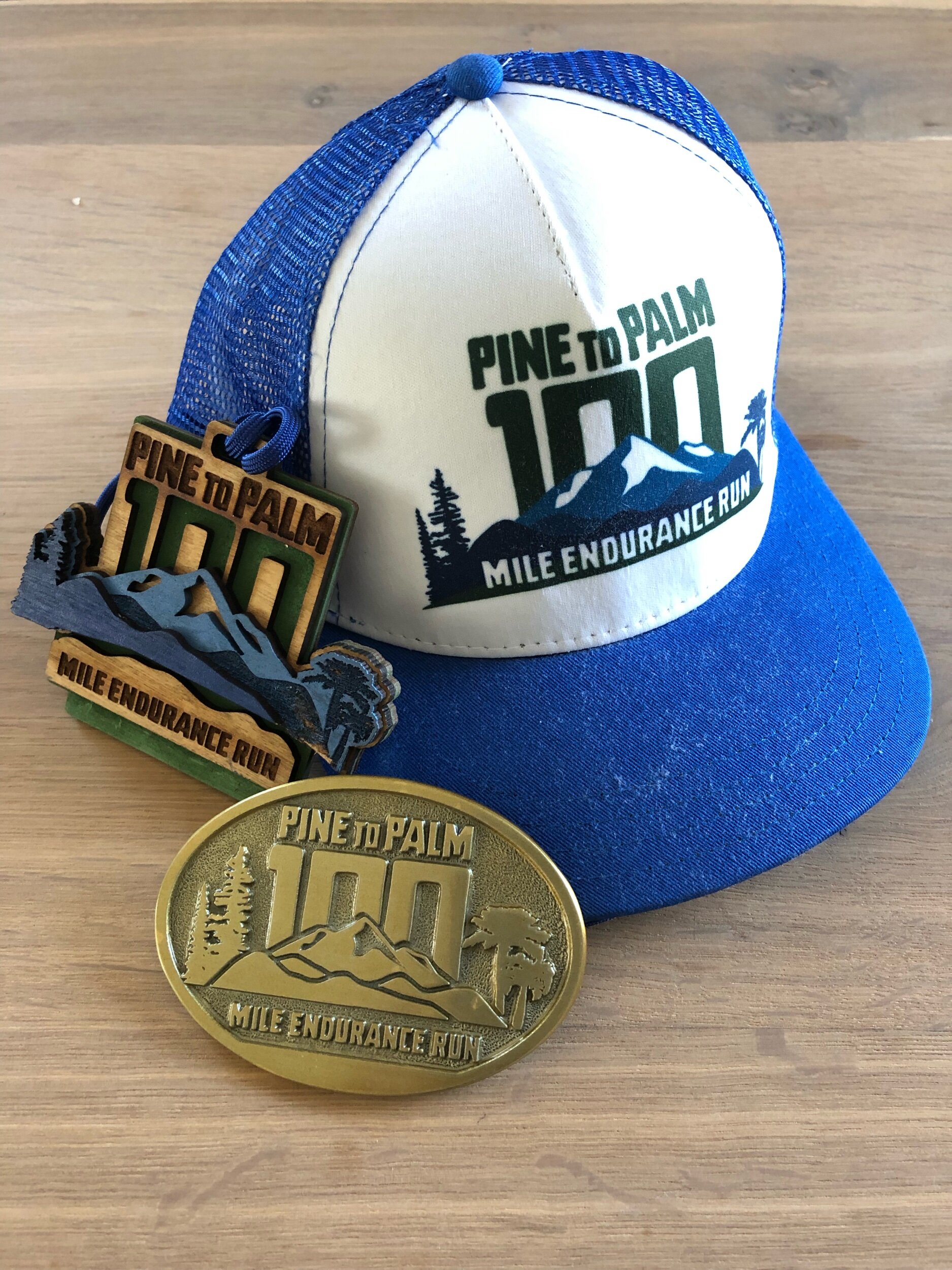
Pine 2 Palm 100 Miler
Location: Williams, Oregon
Total distance: 100 Miles
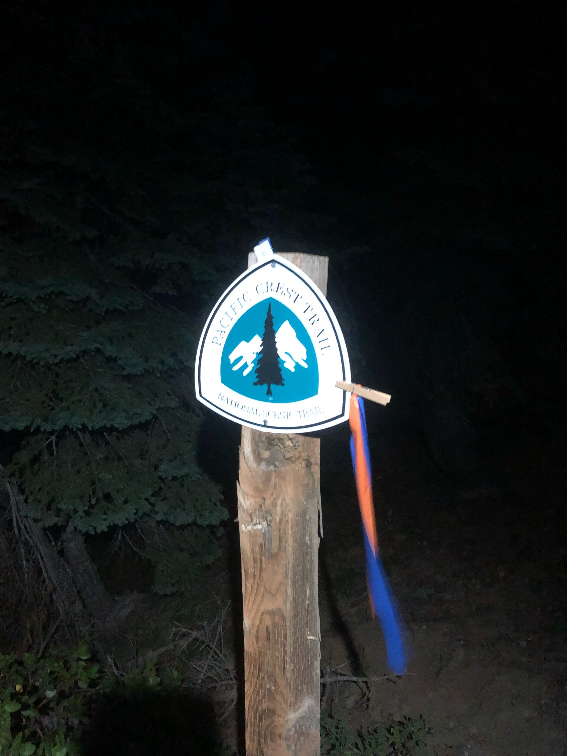
Notable features: Point to point course with lots of ascent and descent; parts on the PCT; rock scrambling.
Weather: 55º at the start, going up to 89º at peak and 50’s during the night.
Cutoff: 36 hours
Total Elevation Gain: 20,000’
Total Elevation Loss: 20,000’
Average Elevation: 4872’
Max Elevation: 7448’
Min Elevation: 2042’
Total runners who started: 110
Total runners who finished: 82
Goal Time: finish (pre-training it started at sub 24 hrs then post a lack of sufficient training it increased)
Finish Time: 28:51:37
Overall Place: 49
https://roguevalleyrunners.com/pages/pine-to-palm
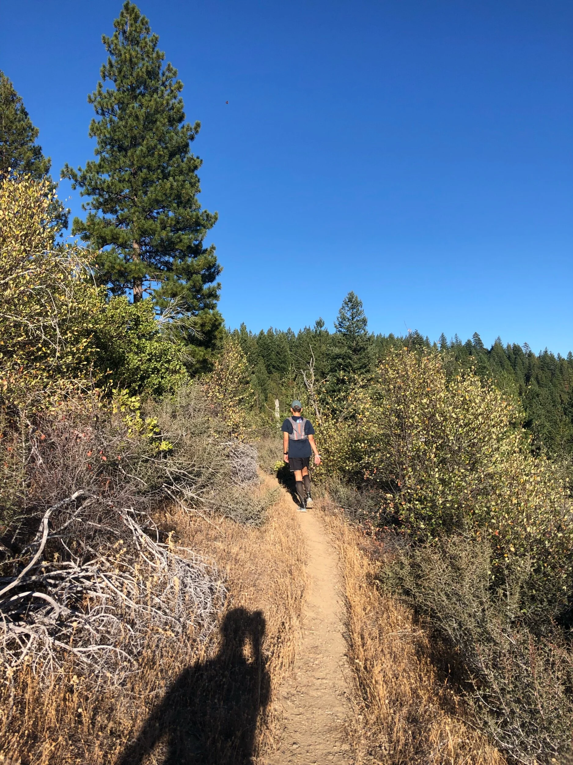
My first 100 mile trail race. I should probably start with how I ended up choosing to do one and equally how I settled on Pine to Palm 100.
Why run 100 miles?
I get asked this question quite a bit shortly followed by did you stop, sleep and what about the bathroom. All good questions some easier to answer than others. In terms of sleeping, no. Stopping, occasionally. I tried to limit this to the aid stations but towards the end of the race or for a selection of the many spectacular views where I paused to take it all in. In terms of the bathroom, when you have to go you go. More on that later. In terms of the why its always difficult to put it into words. There have been some famous phrases such as George Mallory’s “Because its there”. But that would probably be cutting the story short. I got into ultra running on and off for the last maybe 7 years or so but apart from a charity 100 mile road run I hadn’t dipped my toes into the trail running 100 miler range. I had read and listened to countless stories from team mates, good friends, strangers at races as well as many a blog, magazine, podcast or trail running film. Each little nugget of inspiration budging me ever closer. I wanted to experience the gorgeous views, the crisp mountain air and that feeling before the finish line when you know its yours for the taking but not quite over yet. Overall I wanted to experience it for myself. Ultimately to see how I got on as well as whether its something I would potentially enjoy doing more than once. After deciding on entering a 100 miler next was the question of which one. I first set my sights on one of the east coast races like the Vermont 100 or eastern states. Both ended up clashing with another engagement that I couldn’t miss. So instead I opened it up to one in the US. I soon came across Pine to Palm, a race on the border of Oregon and California. It boosted gorgeous views, a bunch of mountains and almost of equal importance it was not limited by a lottery system, waiting list or anything like that. Plus it was a qualifier for Western states. It felt like a perfect option. I even thought in September the North West coast would be cooling down a bit more making for some ideal temperatures for running. With a few clicks of some buttons and I was entered. I have read and heard about the doorstep mile being the hardest. Making that initial first step to commit to doing something being the hardest part of the journey. And in some ways it was, roaming the niche corner of the internet devoted to individuals who want to pay money to join some other nutters in seeing how long and potentially painful it will be to travel 100 miles on foot. The training hadn’t really started at this point as I was still very much thinking of skiing whether it was hiking up mountains or cross country skiing around them. Spring time and summer would be the time for the miles to build up and for the task in hand to really sink in.
After deciding and entering to do the race early on in the year I thought I should at least try to structure and tailor my training to be more focussed on this 100 mile goal rather than my usual of doing multiple sports and activities. Post ski season after a short break I got back into training more regularly, slowly the additions of crossfit were replaced with more running sessions. I tried my hand at using one of the generic training programs through training peaks to help prepare me for the race. Training peaks is an online and app platform for training, in particular making use of heart rate information to gauge how you are developing. Overall the program made it pretty easy for each weeks training plan, which for years I have been working out myself. With all of life’s normal commitments popping up it certainly helped put some much needed structure in place. Despite this the one major challenge I did have was that unlike an actual coach, I wasn’t able to always adapt it to my personal circumstances. Which when I planned on using the program wasn’t much of a consideration but a series of personal commitments throughout the summer particularly over the weekends meant that my plan for regular long runs took the hit. In retrospect I could have opted to compress the mid week training with back to back runs morning and night to try and maintain a balance of quantity and quality. Overall would I recommend training peaks, for me it worked well and for another 100 miler I might be tempted to seek some more advice or input from an actual coach but I was happy enough with the generic program. I think had I followed it exactly I could have achieved an even better result. Saying that if you are using a heart rate monitor during training and with a bit more research you can probably achieve similar feedback through the likes of garmin/ suunto/ strava apps. Feel free to reach out to me or ask questions in the comments.
Onyx a new member to the family
Going back to the run. Despite a slightly more disrupted summer running plan than I originally had planned for, the race was quickly approaching. The ripple effect was that some of my decisions around nutrition and equipment were made quite late in the day. One big decision was I opted to use poles and for nutrition I would be mainly reliant on First Endurance both of which I chose fairly late in the game. In fact due to some travel arrangements I had to take near to the race, I ended up picking up my first endurance gels and powder just before the race for the first time. This is definitely not recommended but after reading a bunch of reviews and looking around at the various options I took the gamble. Fortunately it worked out for the best generally speaking but more on that later.
A friend of mine had very kindly agreed to join me out in the depths of Oregon to provide some crewing. Which I was delighted about, as being able to see a friendly face in the early hours of the morning or the later hours of the race would definitely be a benefit. Having not had a crew before and with it being a far longer race than I had previously entered I realised that there would be additional admin to sort out. Such as being much more organised on what would be required for each drop bag/ aid station, which stop would I require additional clothing/ head lamps and estimated times for each of the aid stations. I will follow up on a blog with my top learnings but overall depending on the race and your objectives I would recommend doing this admin straight after entering a 100 miler particularly if its your first. It will provide you with the time to reflect on what you need to achieve in your training as well as giving some clear ideas on what you will want to test on on various training runs. Doing that at the start of your training whilst the mileage and training time is lower also means you aren’t trying to do this all last minute or whilst trying to balance life along with a heavier training plan as you get closer to the race.

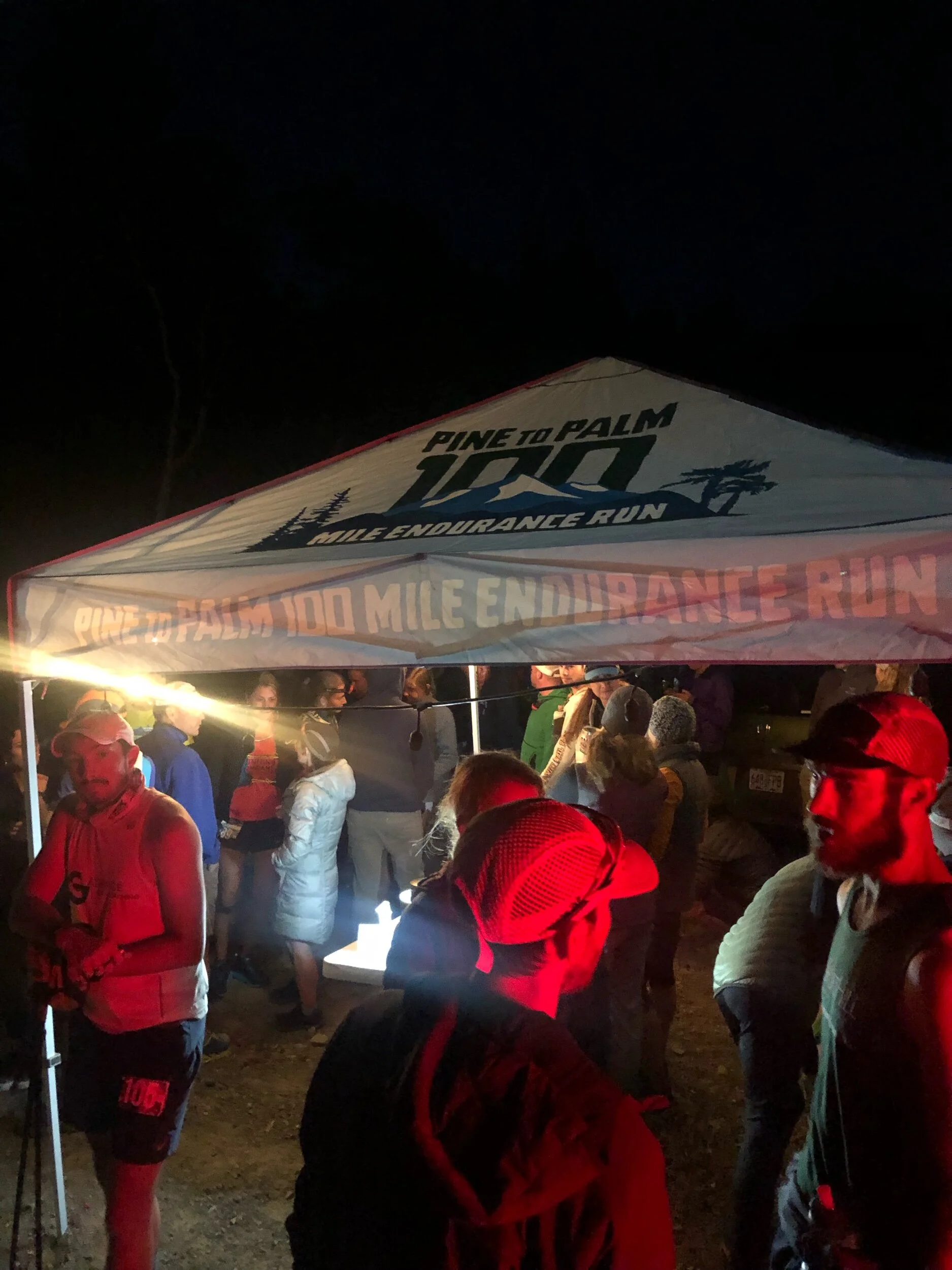
With the final few weeks to go I started getting together various supplies, final bits of kit and bagging it all out with a few last minute pieces before flying out west. Leaving the east coast as autumn/ fall was beginning to take full effect with cooler temperatures I arrived on the west coast to positively balmy 32C/ 93F. It was roasting and certainly a lot warmer than I was expecting for that time of year. After a bit of a lie in, I began getting the final bits of kit ready. Laying out the various drop bags and getting all my kit organised. As this was my first 100 miler as well as being crewed I certainly had brought far too much kit. Essentially everything can be brought along including the kitchen sink. Particularly if you are flying with a huge bag. With various spares and back ups in case something didn’t work/ break etc. With the car loaded and kit laid out for the morning, all that was left was for a pre-race evening meal. A hawaiian pizza and a couple of beers to wash it down followed by an early night was exactly what was required for a good nights sleep. I slept like a baby despite the ridiculously early alarm of 3.15 am. Driving through the town of Grants Pass in the early hours of the morning we were surprised by the number of people driving about in the small hours of the night as well as the prolific number of red traffic lights we managed to hit. We arrived at the drop off point to the eerie sounds of Coyotes howling. The sun had not begun to rise yet with a sky full of stars and a bright moon lighting up the area, to the point where a head torch was hardly needed. The temperature in the darkness of dawn was pretty chilly, compared to the highs of 93F (33C) the day before. If only it could stay this cool morning temperature it would have been perfect. Various groups huddled around waiting in random spots around the parking and drop off point as we debated on where the school bus would turn up. Slowly its lights came up through a swirl of dust off the farm track. We all bundled on board to make the drive to the start line. It turned out the bus would not go the full way to the start line and we end up walking the final stretch up the hill. Which it transpired we were to run back down as part of the start of the race. Nothing like some additional miles for a warm up.
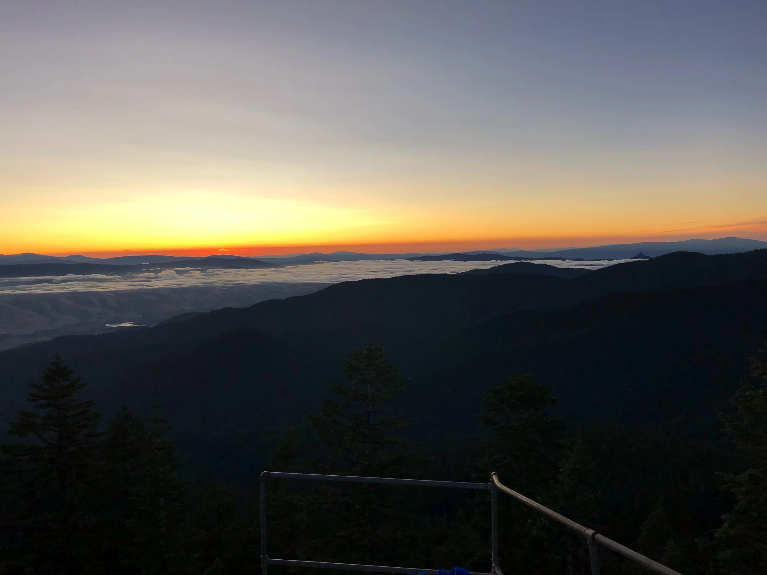
Runners queued outside the port-a-loo’s for their final relief prior to the race start and zero toilets for the coming 100 miles. Head torches shone and swept across the area as runners looked out for friends, support crews, warmed up or looked for an alternative relief area to the long queues of the port-a-loo's. After a speech from Hal the race director we all lined up behind the start line facing down the hill. A count down began, some music blaring and we were off. The start of 100 miles. The initial speed of the group was infectious forgetting that this was merely the start in a long, long day (or two days), at least for those in the mid to rear of the pack. The sides lined with family, supporters, crew and a whole variety of vehicles that had made the drive up. It didn’t take long to reach the bottom of the hill that we had not long before walked up. Rounding the corner and it was on for the first ascent of the day. A series of switchbacks up the mountain along a dirt track to the first aid station of a water stop. Soon the pace broke into a speed walk as racers settled into their own strategy. I was certainly swept along by some of the atmosphere and joy of running with others in a new mountain range to help spur me on. As we reached the top of the mountain and began the meander back down the other side the sun began to rise and night transitioned to dawn in the blue and grey colours of the morning light. Head torches still cut through the semi darkness as patches of dense foliage threw us back into almost darkness again.
As the race continued I found myself with a group where we were all paced fairly well. Across the ups and downs we would leap frog one another as we chatted away, the path continually rising up a series of switchbacks up and up the mountain all the while surrounded by towering pine and red cedar trees. The second set of switch backs was where we got to witness the first sunrise of the race. Glorious rays of gold cut through between the trees. Runners would be momentarily bathed in gold before heading back into the shadows.


Its safe to say the morning kind of flew by, my legs and body felt strong. The pace felt good and my stops at the aid stations thanks to Mark who was crewing me were significantly quicker than if I was doing it by myself. The first surprise of the day was running towards what I thought was a field of rather stumpy looking Christmas trees. However as we got closer and the wind started blowing in our direction the aroma that hit us was surprisingly strong one guy described it almost like the aroma of a hoppy IPA. The aid station was situated right opposite the entrance to the field of marijuana as we paused to take in the views, a quick break and some much needed cooling thanks to an ice bucket and sponge. Once brain freeze was achieved it was time to continue running.
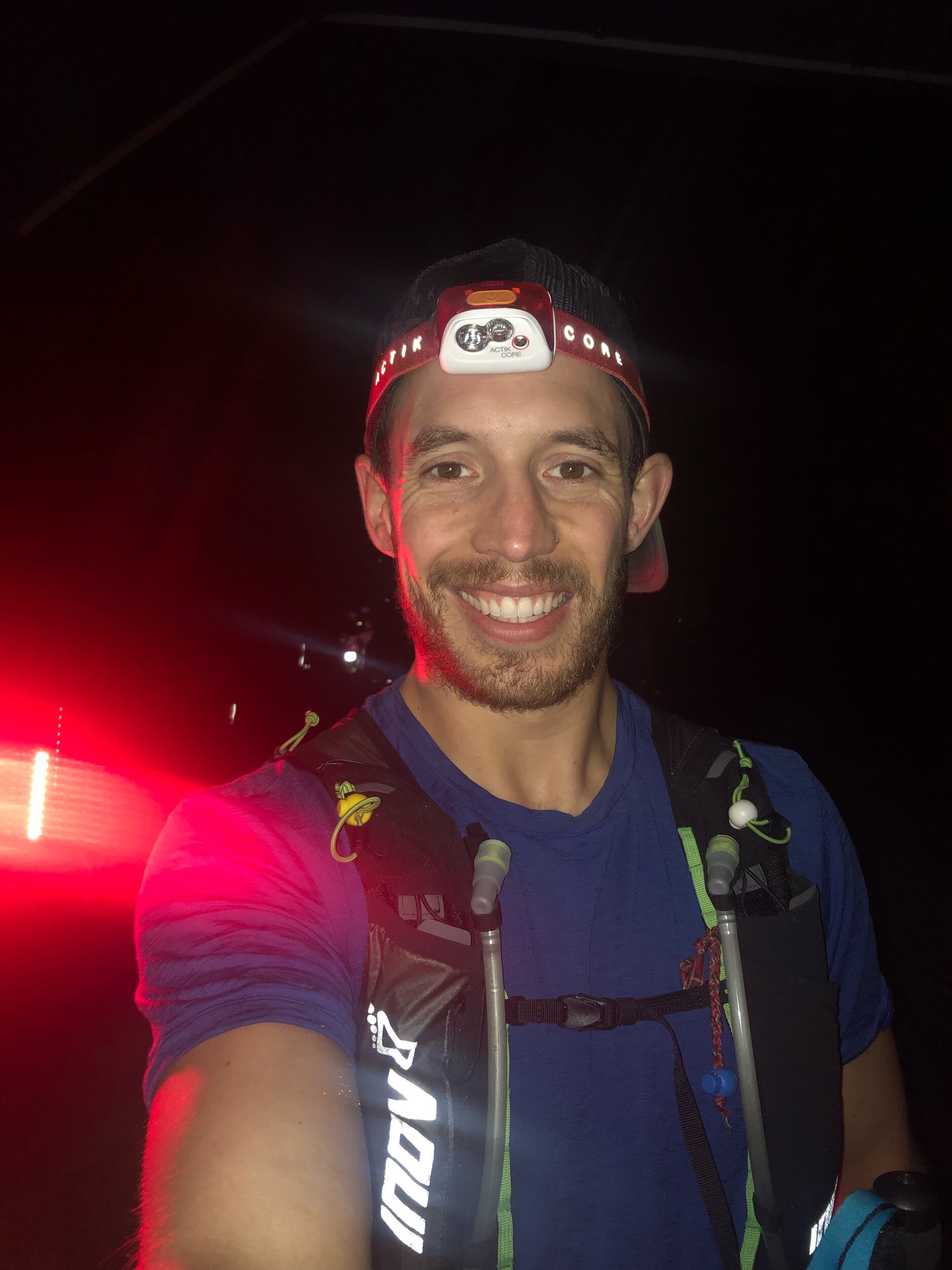
After a relatively flat section along some baking hot tarmac and trails we finally arrived at the check point. A quick transition thanks to Mark before being ushered by him to a kid with a water spray gun. Sprayed down in cold water. It was so refreshing! Like starting the day from scratch (almost). It was time to continue climbing. Heading up to Stein Butte. The day was heating up and the climb seemed to go on and on. I found out later this particular section alone had a 2400 ft elevation gain. The sun was beating down on us to the point where it appeared we weren’t even sweating, it was evaporating so quickly. As we neared the top of the ridge line we popped out from the trees. Running along the mountain we could see all the other peaks around us. The sun at this stage was baking down on us. I hadn’t appreciate that I was not feeling 100% until I arrived at the check point where there was a huge bucket of ice cold water. I grabbed the sponge and doused my head several times with the icy water dripping down my face, neck and back. Instantly cooling me down. I felt far more refreshed and revitalised. After grabbing some water, electrolyte and some food I headed on down the path. I didn’t get far, realising I had left my poles back at the check point I headed back the way I came. Fortunately it was not a large detour. Poles in hand and it was back down the path again. Second time round and slightly further down the track I missed the turn off for the runners. Spotting what I thought was one of the runners markers I ran down the mountain. Despite the route being in my watch the warning signal of being off path did not go off. But something did not feel right. Checking my route on both my watch and phone I quickly worked out that I had gone wrong. Time to run back up the mountain. Nothing like a bit of extra mileage in a 100 mile race. After the joy of running down hill in the shade, turning around and running back up the hill was not what I wanted to be doing. I arrived at the junction after maybe 5 - 10 mins of running and spotted one of the guys who had arrived in the checkpoint after me who was now a head of me. I also realised the stupidity of my mistake with sticks across the road and another marker further up the path I was meant to head up. It was certainly my mistake. The next section was mainly downhill to a lake, it would also be the point to pick up head torches for the next section of the race. I ended up joining a few other runners for this section as we ran towards our next checkpoint. Having a bit of company was fantastic and a good opportunity to pass the time. Arriving at a packed check point with runners and support crew members littered everywhere. With a variety of kit and food laid out waiting for their runners. I stopped off with Mark to grab a few bits and top up on some much needed food before heading on. In retrospect I definitely could have left my vest at the stop given we were doing a loop round the lake before continuing on. It did give me the opportunity to properly top up on some much needed nutrition for the trail a head. Back at the stop it was time to grab torches and head on. We were still a long way from darkness but this was going to be one of the final stops before darkness would set in.
Time for some more up hill. This did give the opportunity to admire sunset from the mountain tops. With the temperatures beginning to cool I managed to keep the pace with one of the other guys as we headed up the mountain. Coming round the corner and we came across a runner who had minimal supplies and was clearly in a pretty tight spot as he sat down for a rest. We checked he was ok, offered some food and water before heading on into the darkness. Not long after my tracking device beeped as the battery finally died, my watch time gave up due to low battery around the same time defaulting it to resort to time and date only rather than tracking. For a while a bunch of us ran together our headlights bumbling in the darkness. Occasionally we would go close to the various dirt roads which were being used all night by the crew cars running between check points. Dust was being kicked up with each passing car as they slowly drove into the darkness. Their headlights cutting a path up and along the mountainside. At points it gave us hope of being near a check point while at others when we could see them miles a head of us was slightly de-motivating with these pin pricks minutely winding a head of us like lit up ants. After a while the group broke up and I headed on into the darkness by myself. My head wondering amongst the discussions of mountain lions, coyotes, bears and snakes that had been mentioned just before the race started…. I felt like peaking behind every tree and each noise that came out from the darkness got my heart beating faster.


The highlight of the night was heading up towards Dutchman peak. Headlights of runners meandered a head and looking up I could see this string of lights heading up to the summit. As I got closer I could hear the music blaring out. It was incredible. I got in, found Mark having transported kit up the mountain. I grabbed a seat for the first time in the race. My body sinking into the seat and enjoying the weight being off my feet. I could feel a hot spot on my heel so I got some tape out to prevent any blister forming. The rest of my feet looked clean and blister free amazingly. After a much needed break it was time to head off. Back down the mountain I passed a runner and his wife who had pulled all of his supplies along with one kid on her front and side. It was inspiring to see and certainly my race was significantly easier In comparison.
The darkness dragged on and my pace slowed. Finally the miles had caught up with me. My initial speed over the first 60 - 80 miles slowed down. Night wore on running with my light bobbing away and cutting into the darkness amongst the trees and trails. I was counting the time down to reaching Grouse Gap. Reaching grouse and I was definitely feeling it. The offering of a beer or a shot was equally tempting yet equally a terrible idea. It was at this point that my stomach gave up with the gels and powders I had been consuming. Grabbing some toilet paper from the car I dashed to the bushes. This was not how I envisaged finishing my first 100 mile race.
With my vest filled with supplies it was time for the last 20 miles. Just 20 miles. I knew I could do it. I also knew it wasn’t going to be pleasant. My foot that I had tried to patch up from a risk of a blister was now aching on my achilles. In retrospect I should have pulled the tape off and sucked up the hot spot from the blister. Ultra runners shuffle had certainly set in. First up was an out and back to grab a flag from the top of Butte. I slowly made my way up. It felt like snails pace as I painfully made my way up and up. Pausing to try to suck in some more air into my tired body. Arriving at the top of Butte with the sun rising gave me a burst of energy. I knew I could make it to the finish for the time I had set myself. The rest of the trail was down hill. Step by step I was getting closer to the finish. Despite the distance it was amazing to be so close to so many of the runners I had spent a large portion of the race with.
With the sun rising and the heat beginning to rise we ran amongst the red woods, these huge towering trees and these tight trails down towards the final check point. After yet another bathroom break and it was on for the final miles. I imagined the loops and trails I had ran back home in New Jersey, Scotland and the rest of the UK. With the end in sight I felt more relaxed to pick up the pace for the final miles into the finish. Coming through the town we could hear the occasional cheers coming from the finish. Suddenly round the corner and there it was. After months of training, hours of running and it was all over.
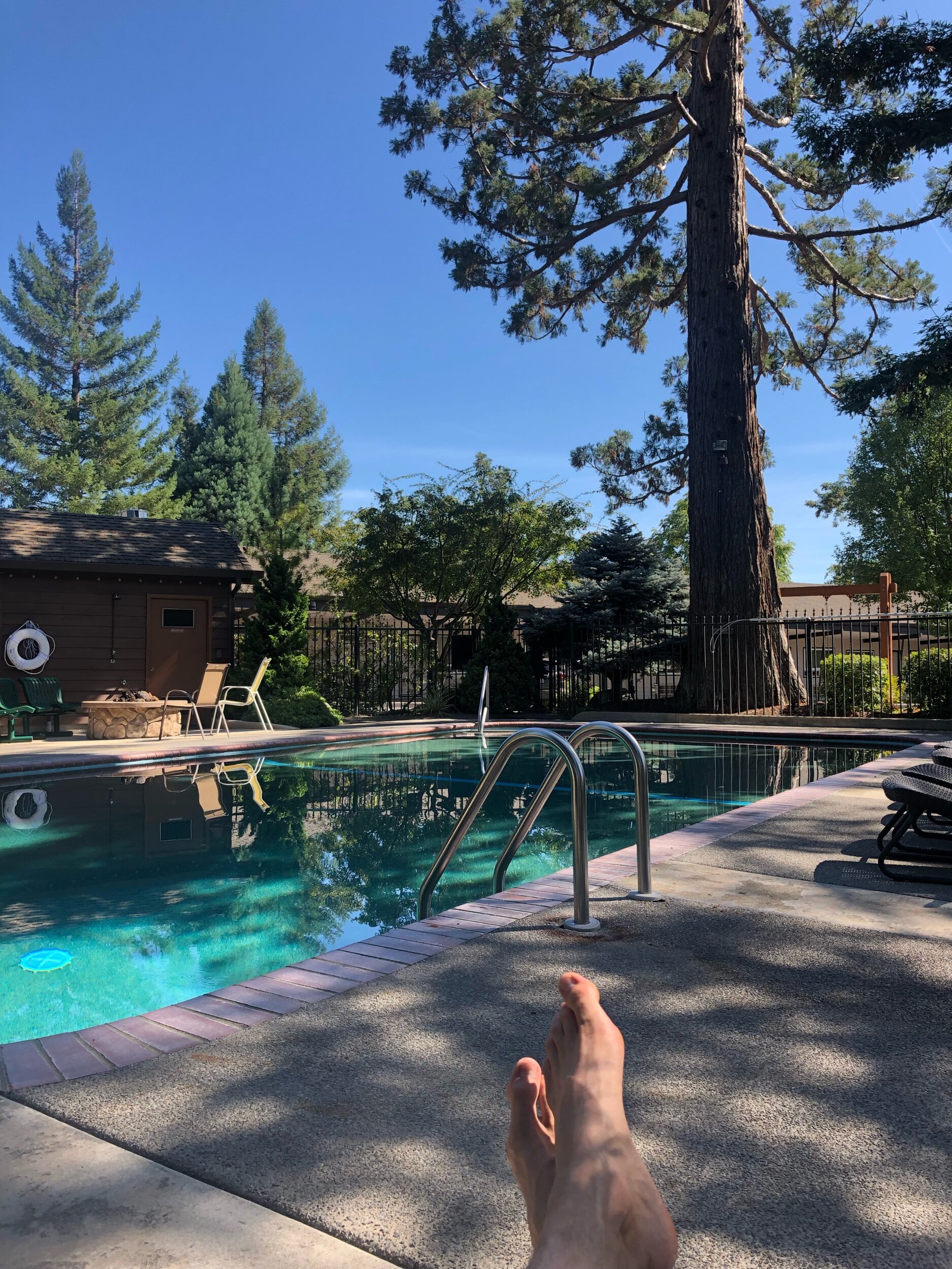
Slumping on a seat I soaked in the moment, feet up to help start the recovery.
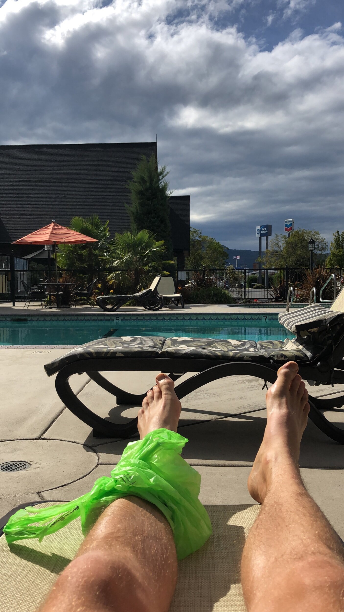
Relaxing by the Pool whilst icing my foot
Attending the prize giving that evening was a special time, each runner was given the chance to stand or hobble up to say a couple of words about them and their race. Getting a quick snippet into each persons story from those charging at the front to following up at the back of the back was equally inspiring each in their own way.
All that as left was a short and very slow limp to the car and to celebrate with some food, a couple of beers and a warm bath to soak in.

Finding Mt Ascutney
I was up in Vermont for the Martin Luther King weekend and it was turning out to be an epic weekend to be up north. Saturday had been a skimo race. Then overnight there had been about a foot of snow in some places of some fairly wet and heavy powder. The first day post snow dump turned into a fairly heavy day of moguls with a touch of powder up at Killington. As the day wore on the it slowly became mission impossible to find some clean untouched pow. A lot of the area had been tracked out by the time we got to the mountain.
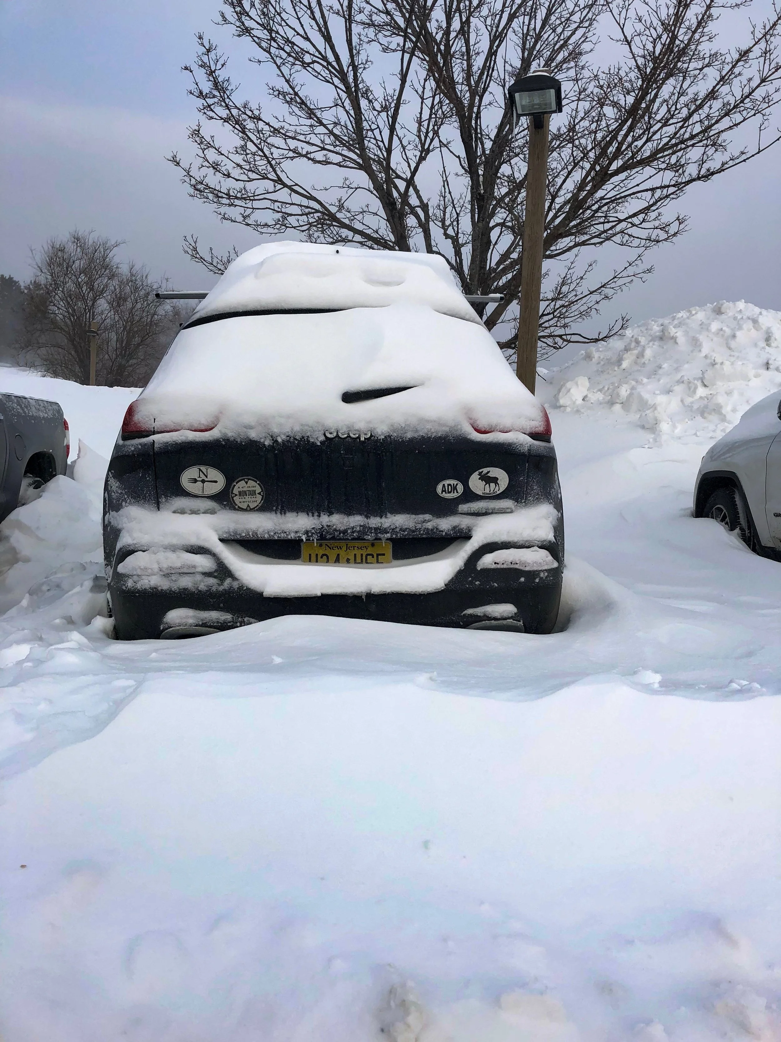
I had Monday off for Martin Luther King day. After asking around as to where to go and looking at the various options I decided on checking out a place called Mt Ascutney. That morning I was not feeling my freshest the after an evening fuelled by chicken wings and beer. This is not my normal go to post ski day food. Due to the restaurant we being overwhelmed (we think because of the lingering bad weather) we ended up eating whatever was on offer which turned out to be some guests food who had left due to an inexplicably long wait. Slowly but surely I dug my car out with snow pilled high up the wheels, over the roof and it was bitterly cold. I hadn’t managed to get into the car or seen a thermometer to know how cold it was. I could feel the cold stinging my face particularly when the wind blew, whipping up the snow in great swirls. Even with some thick gloves on my hands were chilling pretty quickly when I paused between a few shovel loads. It brought back memories of decamping up in the Arctic.
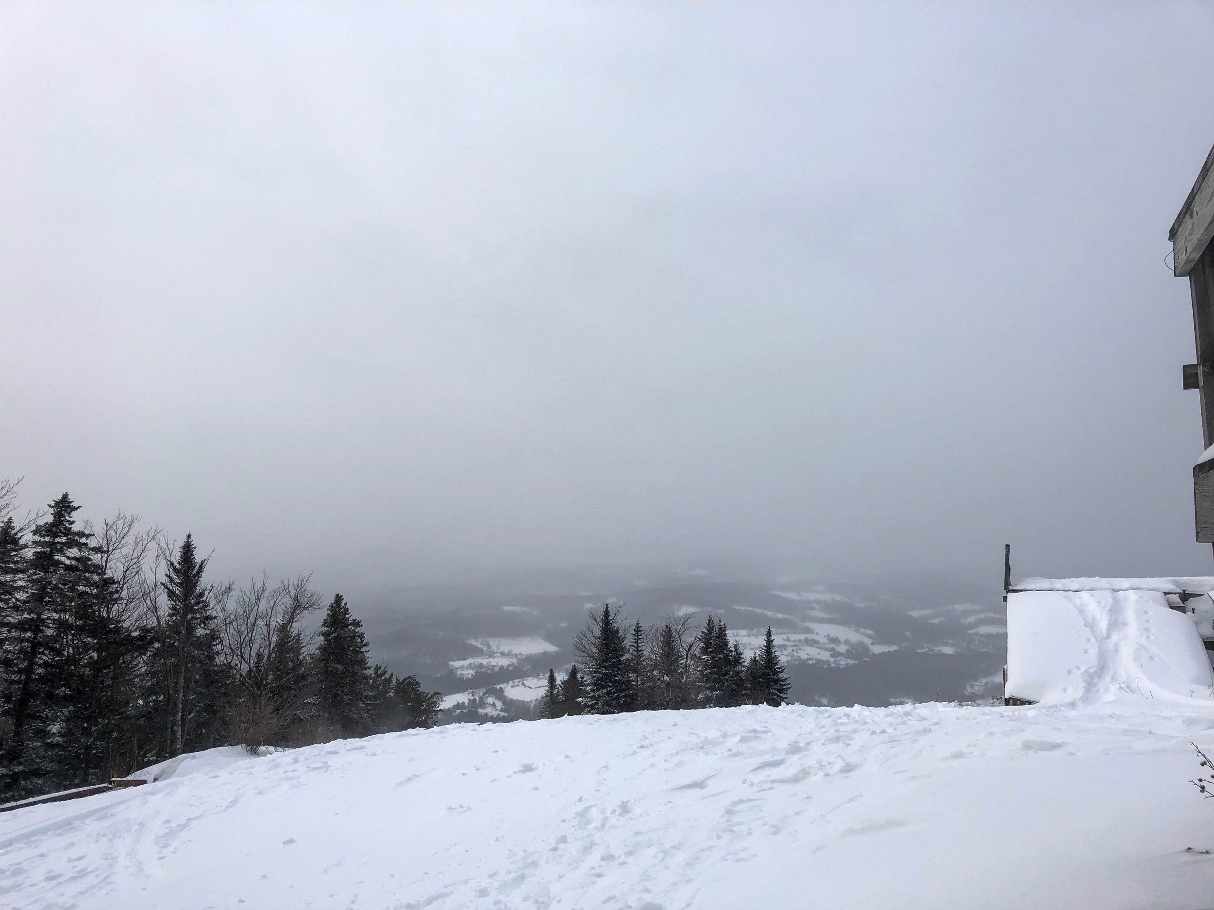
One of the buses carting skiers up to the mountain pulled up and informed me Killington was delaying opening due to the high winds and low temperatures. All skiers and boarders apparently would need full facial cover as it was getting down to -40F (-40C) with windchill on top. Given the delay I was pretty happy to be going and checking out a new ski area.
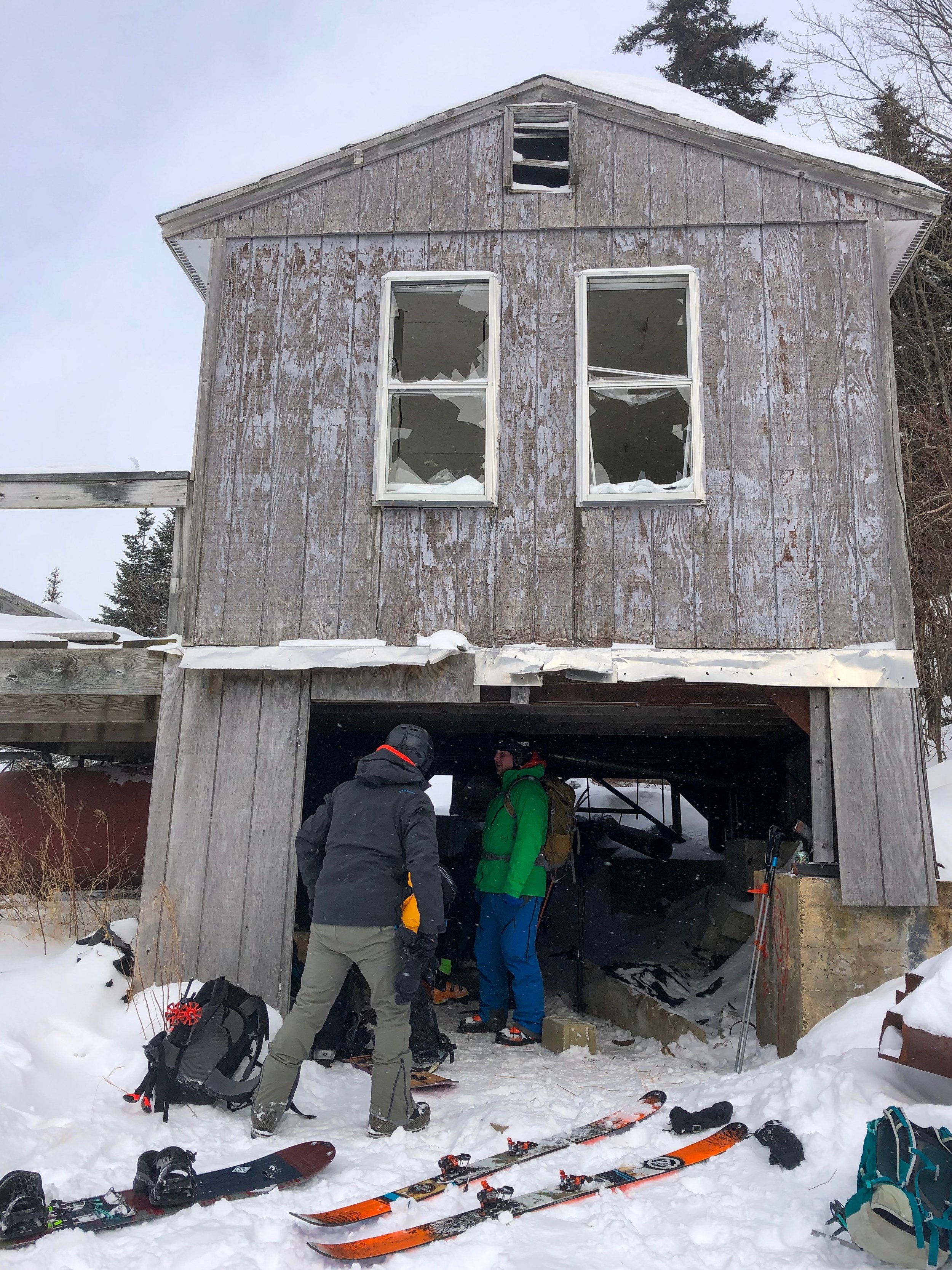
Mt Ascutney is an old ski resort that shut down in 2010 after running for 80 years. Since then most of the infrastructure that supports a ski mountain from the lifts to the buildings have been stripped away. The woodland has begun to regenerate the once stripped slopes as it slowly returns to it more wild state. That was until it was recognised as a great spot for some back country skiing. With the trees already cleared for the most part it just needed the relatively recent growth to be slightly more controlled. Since then a whole bunch of volunteers have been banding together to help maintain the trails during the summer which also helps make it a perfect playground for hikers, runners and mountain bikers. As the snow begins to fall and the trails fill up with snow its become a little back country haven. Since the early days where it was just a bunch of cleared trails there is now a seriously impressive warming hut at the base. Which given the temperatures had risen a bit and were in the range of -10F to -15F (-23C to -26C) before wind chill made for a fantastic starting point before heading up the mountain. Check them out on the link below:
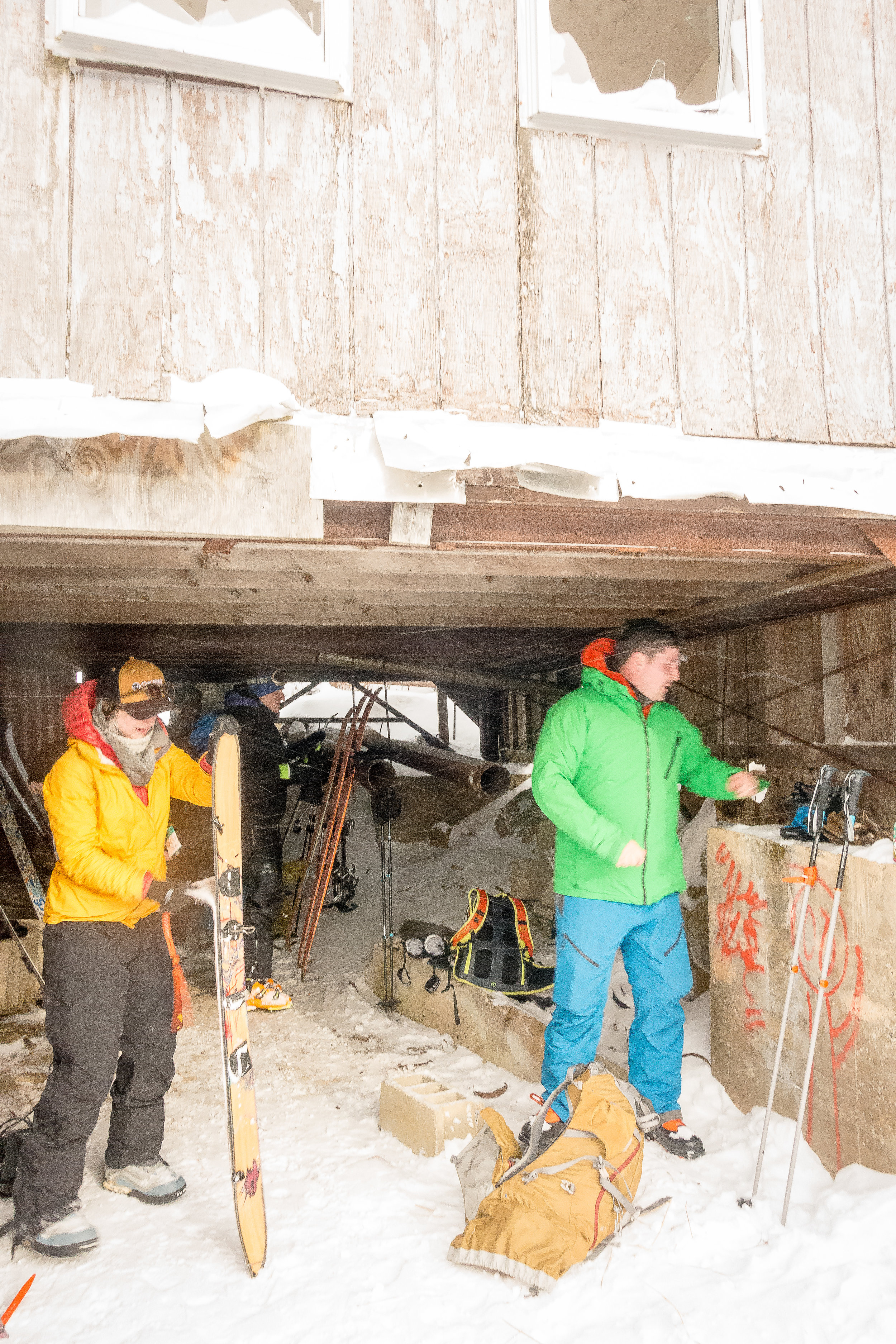
I didn’t realise there was a warming hut prior to arriving as I got my skins on outside my car in the freezing temperatures whilst they flapped around sticking to anything apart from where I wanted them to. Trudging up the slope to the base I spotted the hut at the base and meandered in. I was welcomed to a whole bunch of skiers and split boarders chatting away and getting ready for a days in the mountains. Having not been to the mountain before and looking for some good trails to ski I asked if I could tag along. It was a complete mix of guys and girls, skiers and split boarders and ages which was awesome to see. It also transpired that a bunch of them had been on a bachelor party/ stag do that had made it through various news channels local and national including BBC world service online. You can read about that below:
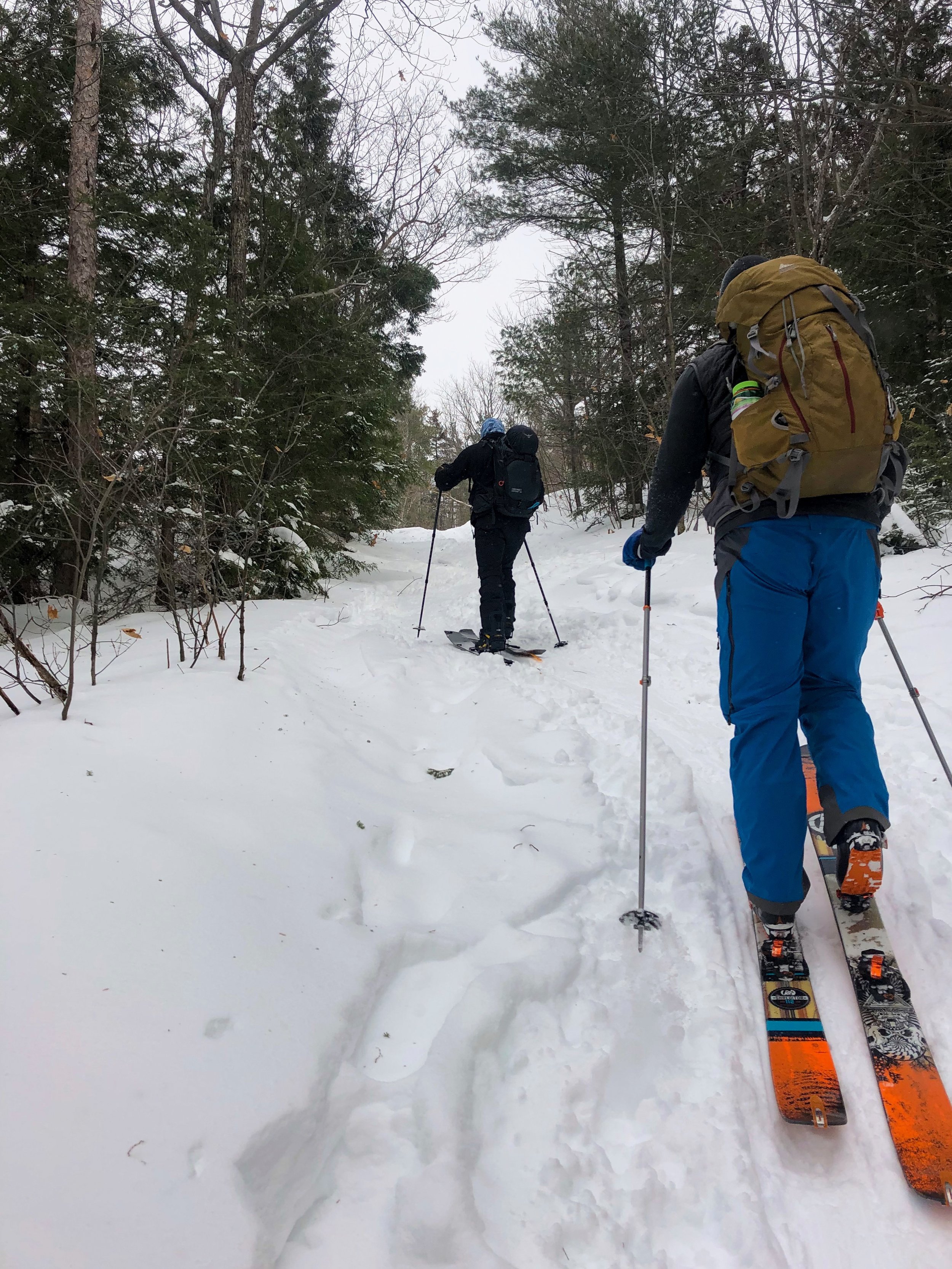
The first few strides up the mountain I could already feel the effects of the past few days mileage that I had put my legs through. They had certainly felt fresher. The hike up actually felt pretty warm as we were in amongst the tree line with a spot of sunshine and what ever breeze there was was on our backs helping keep us cool on the ascent. As we headed up you could still make out some of the structures used by the ski mountain before. The cut trails being the most obvious and then the occasional building or piece of metal work. A couple of the guys had skied the area when they were smaller and could remember and discussed the various cut throughs and secret ski spots that only the locals would know. As we got closer to the summit we could feel the wind picking up through the tree line. Coming out at the top we immediately felt the full force of the wind blasting our backs. Fortunately there was the remains of what I assume was the old mountain patrol building at the summit which we hid on the lee ward side of whilst removing skins and preparing to head back down. Having trekked up it was definitely time to get a whole bunch of layers on for the downward journey.

Heading down and we picked our way through powder snow and some small undergrowth. It was this first lap when I began to wish for some fatter skis. Occasionally my backcountry days have involved powder but the vast majority has been more like hard pack with a splash of ice and rocks. In some of the less steep terrain I was just sinking in the heavy snow and occasionally being driven to an almost an immediate stop on other sections. Which certainly added to the odd fall or ski loss. Nevertheless getting in a bunch of powder day turns was great. Having seen photos and videos from friends up north getting midweek morning powder sessions before heading to work it was great to have a shot at it myself.

Previous days summit photo
After warming up at the base in the hut to let some of the facial hair icicles melt it was time for lap two. The hike up went surprisingly quickly once I knew the route, meandering our way back up the mountain. Arriving at the summit and with a bit of a larger group we bundled into the open basement of the old ski patrollers building to remove our skins. The temperature had dropped a bit so we made the most we could from what remained of the building whilst the bitingly cold winds roared on. It was a touch of luxury sheltered from the elements whilst having a quick bite and getting some layers on.
For this lap we chose a different trail in search of more powder. It is safe to say the combined factor of the previous days skiing and the prior lap I could definitely feel my legs burning on the descent. I think before next season I need to spend a lot more time on the bike and doing some leg weights to get into a better ski shape but I wasn’t about to change my ski fitness over night or mid lap. Coming round the corner and hitting a slightly flatter section I suddenly ejected from one of my skis. Fortunately after a short hunt I found it buried beneath the snow. Clipping back in and I was back on my way down the mountain to join the rest of the group. It made me think about the old ski tracers we used to use years a go for powder days back in Europe with my family. A bit old school but maybe worth bringing out for the next season either that or some new fatter skis….
Reaching the end of the run my legs felt done. Back in the hut and grabbing a seat I decided it was time to hit the road. After a chat with the guys I was told about a great spot for some post ski grub down at the Brownsville Butcher & Pantry. If you are in the area I would definitely recommend making a stop with delicious food it made for the perfect pit stop. They also have a fantastic beer selection, perfect for post drive when I finally managed to get home.
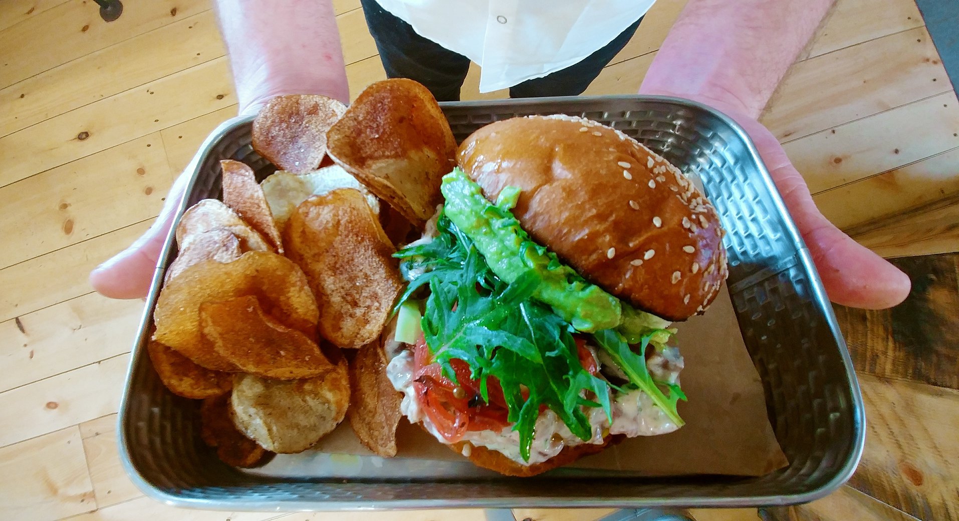
Photo courtesy of the Brownsville Butcher & Pantry, Vermont
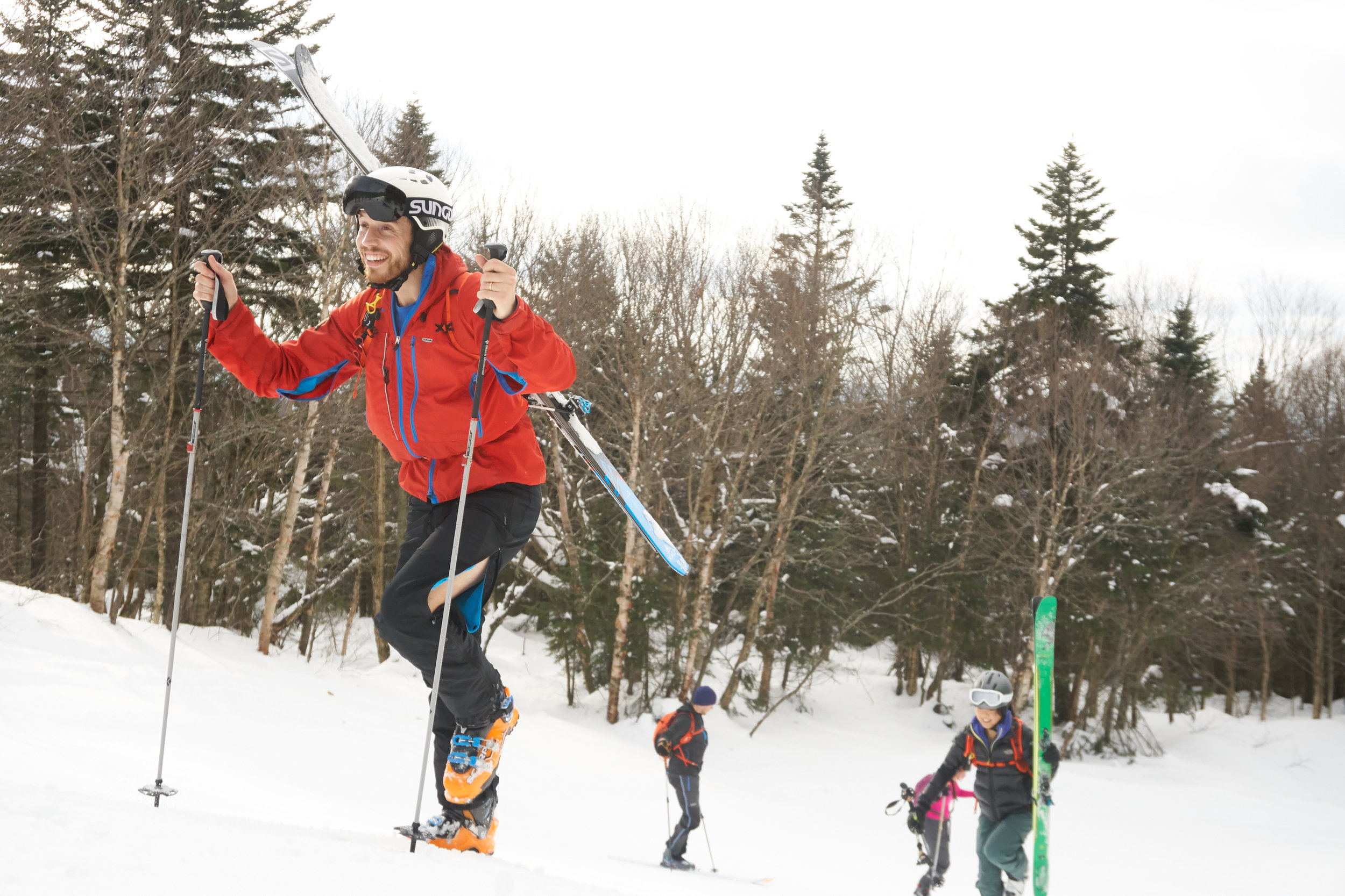
Return to the Beast
Amazingly this was my third time doing the Berkshire east beast skimo race. I say amazingly because since near the end of my university time I have not really stayed in one place for any particular length of time to do the same race twice never mind three times. Equally when it comes to other types of racing I also love the excuse to do different races in part to see new places along the way. Skimo races I have found to be different though as the conditions each year can totally vary adding to the experience. First year I did the race one guy was racing in shorts and a t-shirt, second year we had enough snow to have a bit more of a backcountry experience and this year you can read about below.
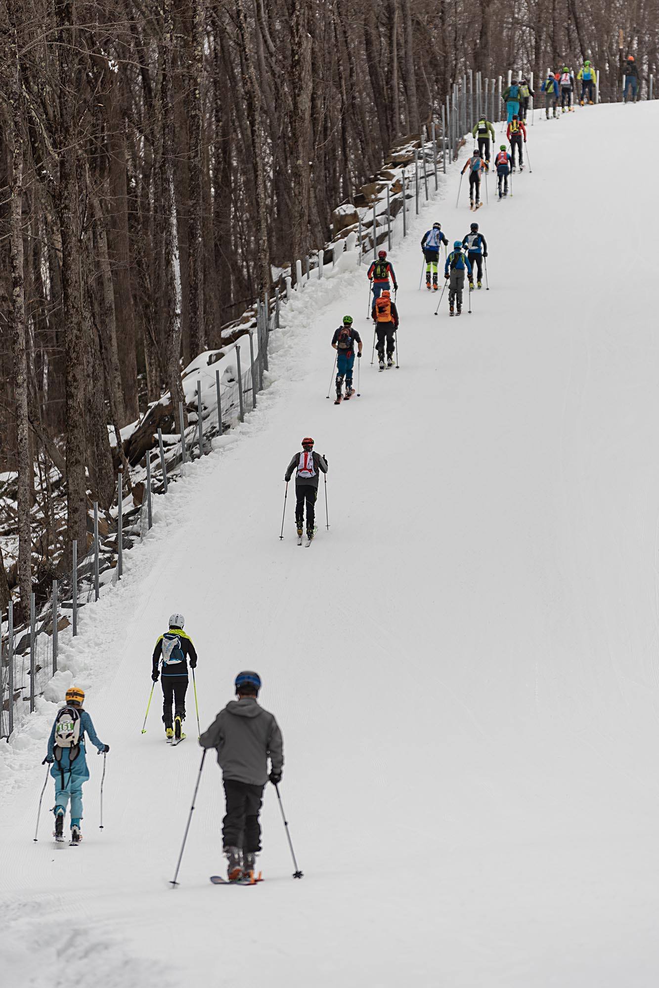
Despite growing in popularity and the growing number of Skimo races on the east coast of the US, especially the night time series, skimo has yet caught up with the level of running races with events all over the place every weekend. The races themselves tend to be held in Vermont, Massachusetts and Maine. All of which are a decent drive from New Jersey. If you are closer to these areas then lucky you!! Apart from the physical challenge of the skimo races, the camaraderie at them is a real pull to keep coming back. You have a complete mix of guys and girls or all ages and abilities nailing it up and down the mountain. On top of this it is great winter training and there are a whole bunch of cyclists, runners, climbers and triathletes amongst, I’m sure many other sports who are getting in a solid base before the summer season.

Skis at the ready
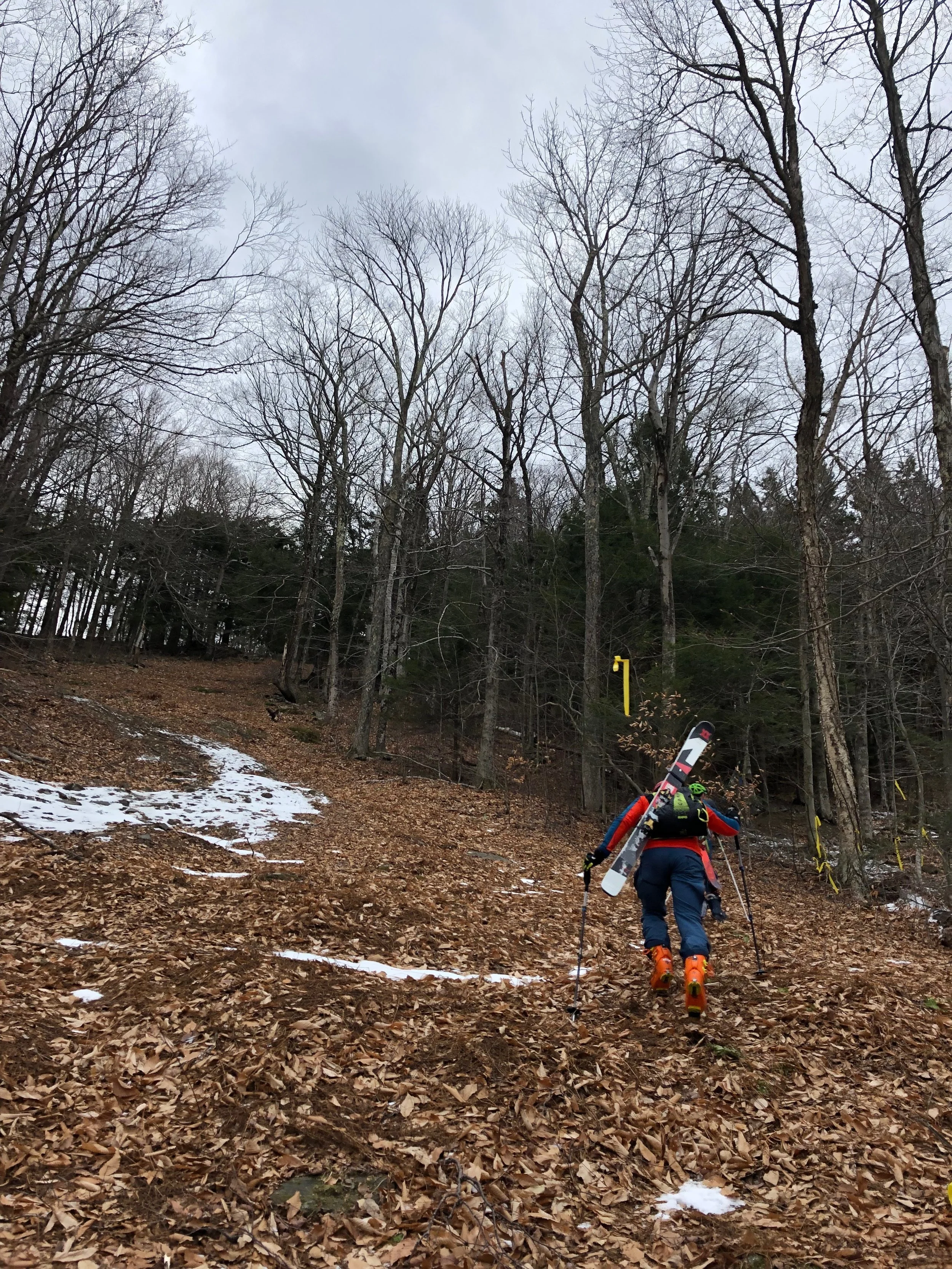
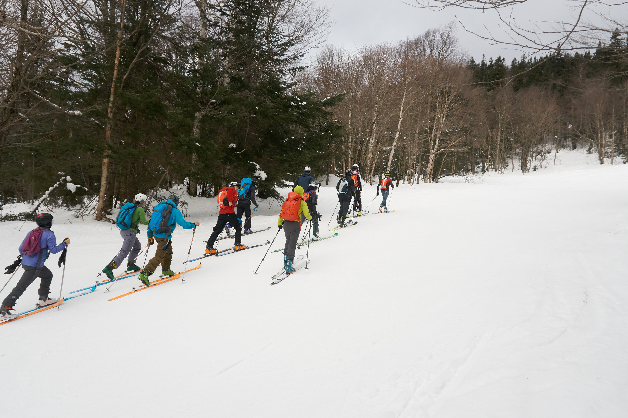
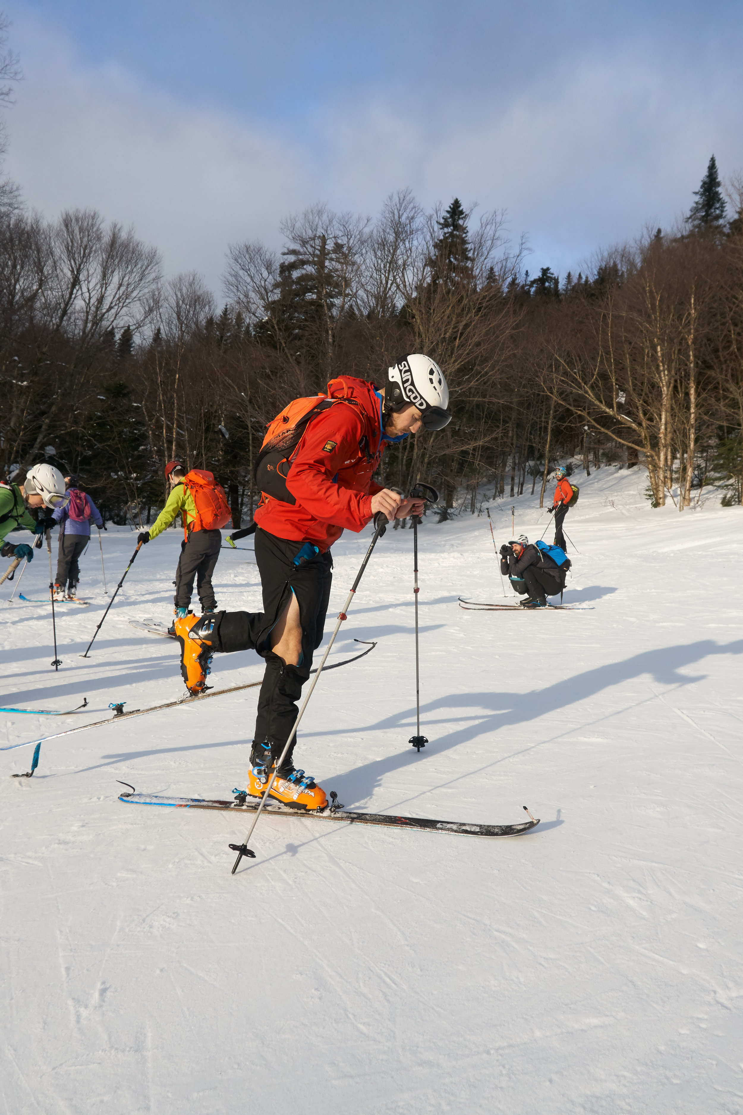
This year I was staying up north for a long weekend. So Friday night was spent making the dash north with many others who love the winter season. It was Martin Luther King weekend, so a long weekend for those that got it off. Our progress was slow, as our expected time of arrival o the GPS slowly ticked in the wrong direction. Following the guidance of the Skimo and backcountry touring workshop I went on and my evening preparation for a good pre-race meal was equally not going to plan. Pulling into a service station a choice of McDonald’s, pizza or quesadillas were the options. I opted for quesadillas hoping that it would be marginally healthier. I did however manage to get my pre-race hydration going well with no beer on the cards and plenty of water for the drive. By the time we got in for the evening it was a relatively quick turn around as my alarm went off in the early hours of the morning. Kicking off the day with coffee and pastries before driving to Berkshire east. Over breakfast I read through the pre-race notes on the snow conditions limiting our route to skiing and skinning up the piste. The boot packs were to be in amongst the forest, with the potential for some ice mixed in amongst the rocks and tree roots. The conditions had been relatively warm this year, despite the early and ridiculous large snowfall that kicked the season off back in November. After a relatively quick drive south, I pulled up into the carpark which the previous year had been packed as well as all white. I was welcomed to a far muddier car park. The slopes were still gleaming white and looking very inviting!

After over heating the previous year I finally transitioned to racing in pretty much what I would run in. Leggings, shorts and a cycling jersey. Cycling jerseys are pretty handy with the extra pockets in the back. I did however forget my water bottle and energy gels. On a sunny day this would have not been great but with overcast and cool enough conditions I thought it would just about be ok.

The start line - photo courtesy of Mark Trahan
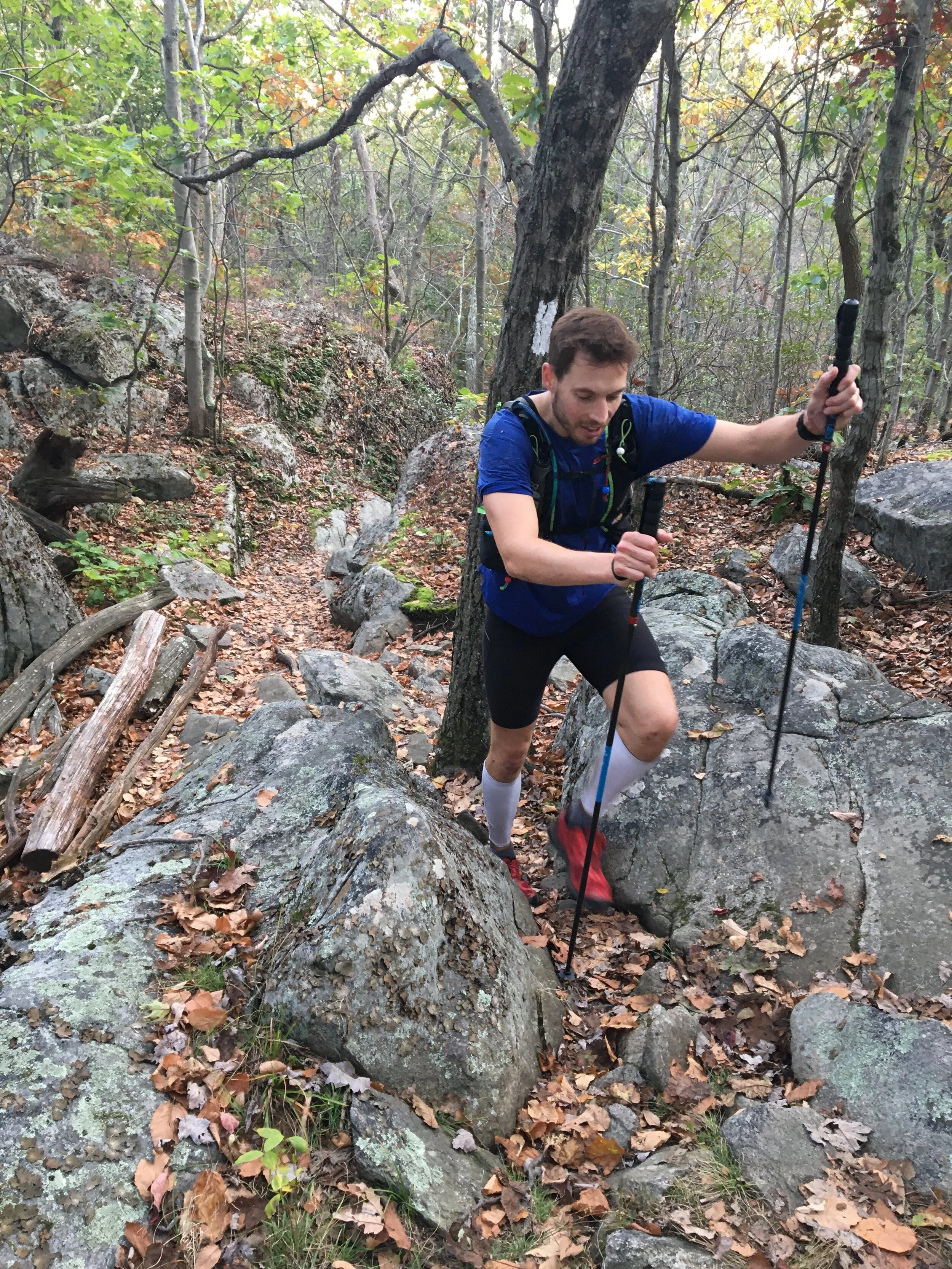
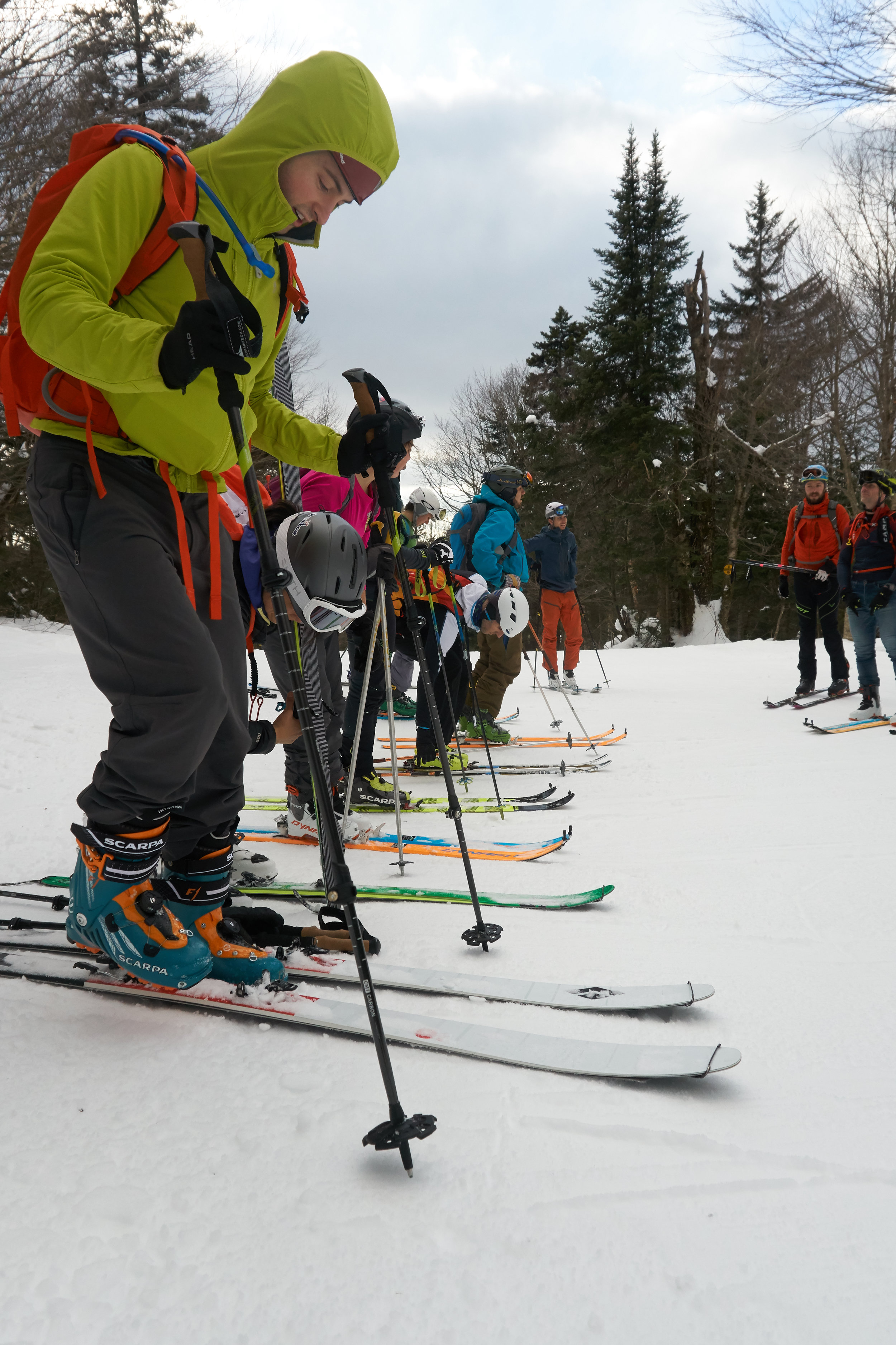
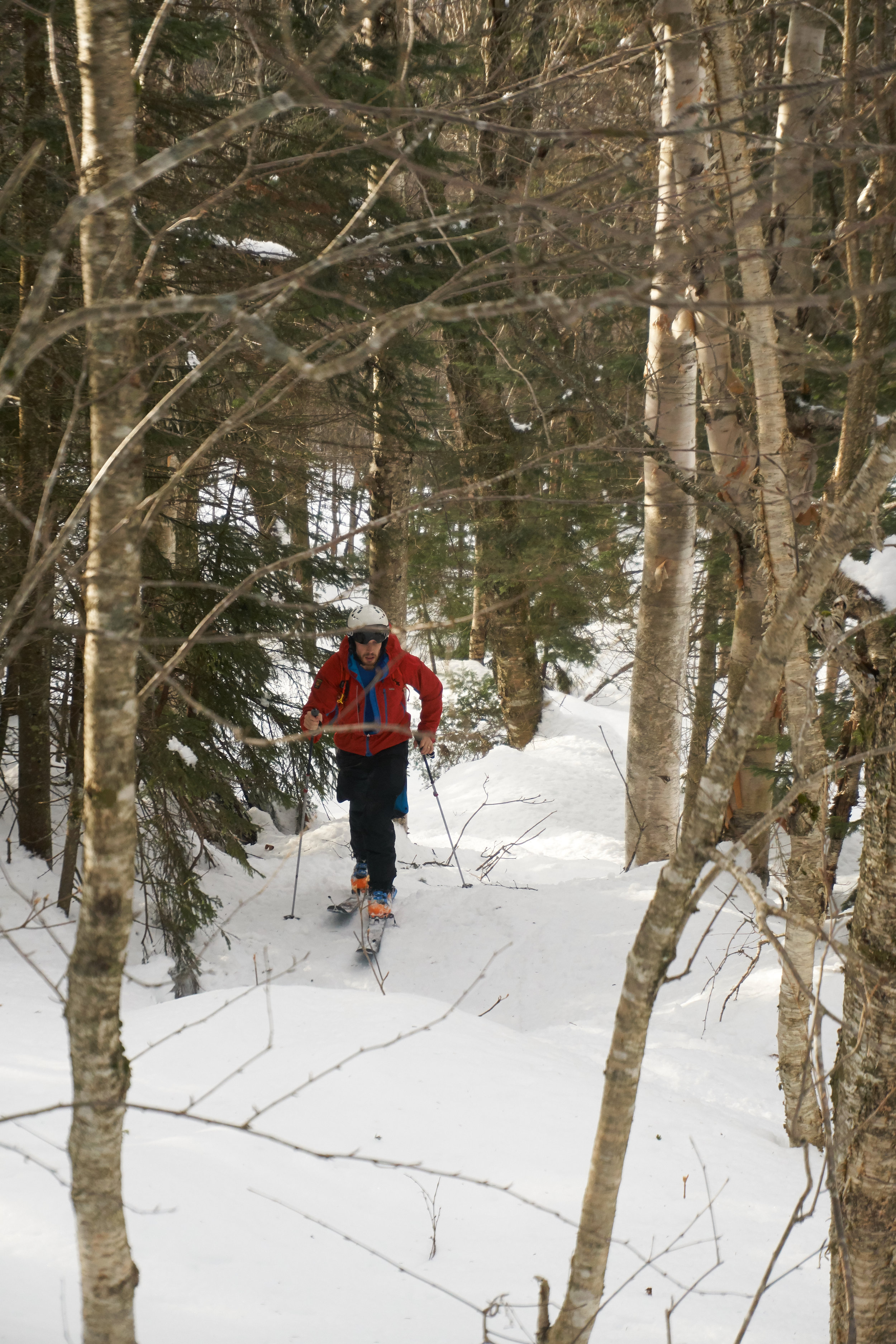
Heading to the start line a bunch of us did a little warm up doing some very mini laps up the mountain. The count down began as racers greeted those they had not seen for a while and then we were off heading up the mountain. Very quickly the group spread out up the slope. The initial skin up and ski down went pretty well. My first transition to boots from skiing down I don’t think could have been much slower without loosing a ski down the mountain as for some reason trying to get my boot out of my binding for one ski seemed almost impossible. After that hurdle I entered the woods. It was here I found along with all the other racers the ice that was sticking to the rocks and tree roots making for a challenging climb as each of us tried to pick our way up the mountain in a quick and relatively controlled or safe manner. Occasionally the sound of something sliding on the undergrowth followed by some expletives would sound out through the forest as another skier slipped.

Above photo’s courtesy of Charlie Batman.
After the first lap, I knew how I felt and what the conditions were like I started to put my foot down making some steady inroads into those in front. Unfortunately a lot of these were completely annihilated by my slow transitions. Something to work on for future races. I was still lapped by the winner of the race but I felt this happened slightly later in the race than previous years which was a marginal success.

Hiking up into the woods
Crossing the finish line and I felt pretty good. Desperate for a drink but I felt i finished strong at least.
This years race was by far my best performance. I didn’t get lost for a start so that was one big benefit and it was also not my first days skiing and ski touring of the season having managed to hit the slopes in December. I would definitely recommend skimo or randonne competitions. There a great way of getting into the mountains and staying fit during the winter months.
Check out the links below if your at all tempted
East coast US & Canada
http://nerandorace.blogspot.com/
UK
http://www.skimoscotland.co.uk/
Europe
North America
https://ussma.org/events-list-view/
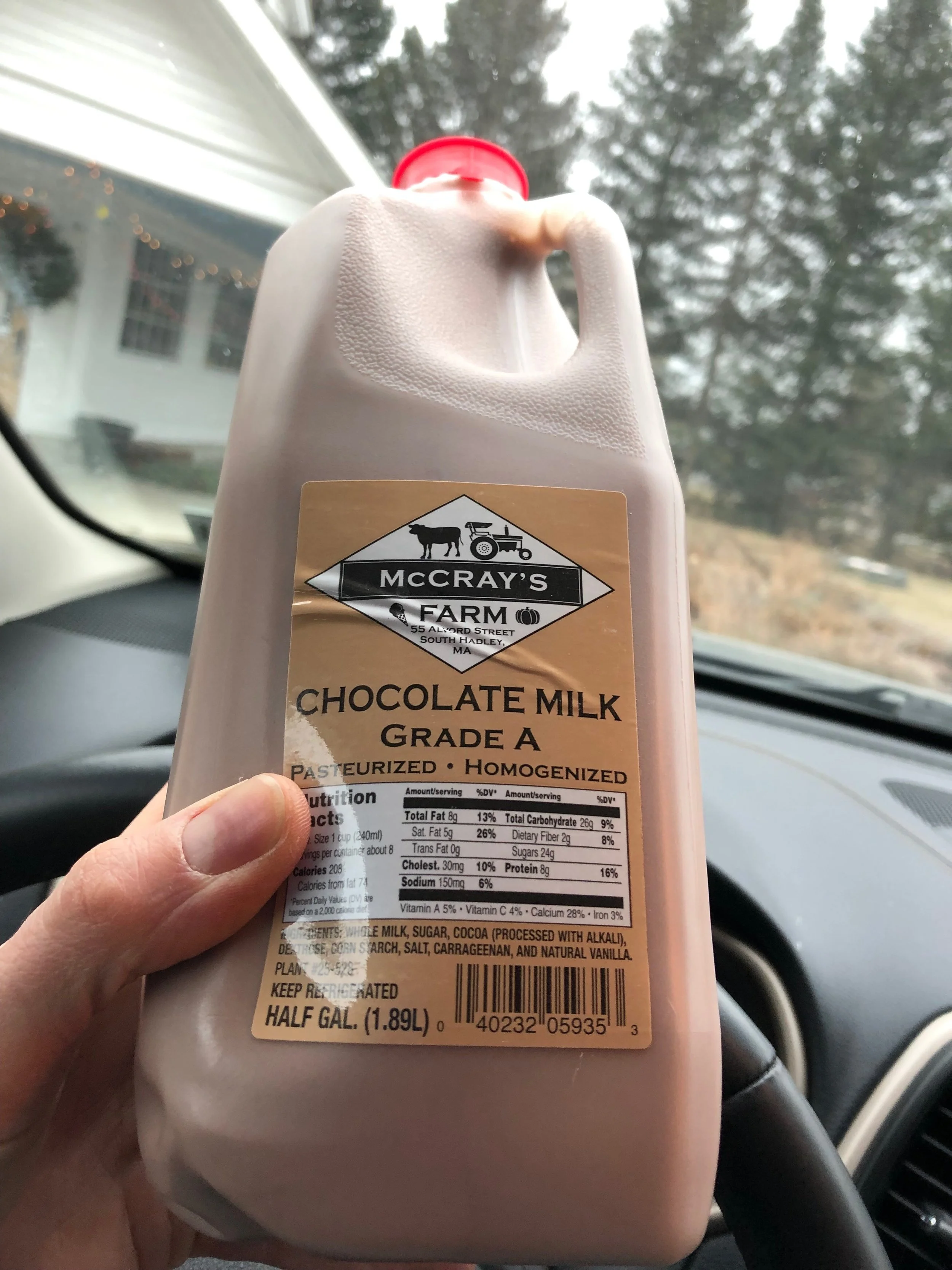
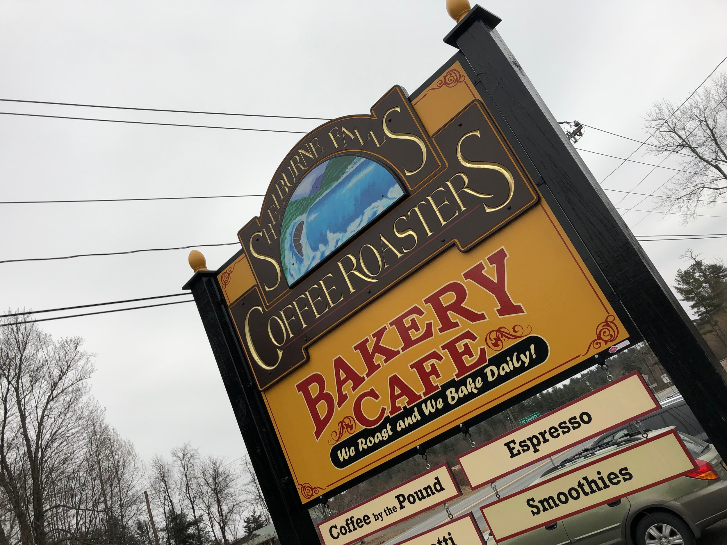
Post race recovery chocolate milk, bakery stop and an evening beer inspired by Scotland. Couldnt have asked for much more!

Catamount Trail Skimo Camp
Thank you Aaron Rice for letting me use your photos in this post. On a complete side note he is an awesome guy who climbed and skied 2.5 million feet in a year. Check him out at
I’m a bit behind writing up about this but back in December I found out about the Catamount Trail Association who not only organised a skimo and backcountry ski camp but also hold a number of ski touring days. There is still plenty of snow out on the trails and trips going on this season. If you are interested in ski touring, backcountry skiing or even for the summer there are options for various tours and routes to check out.
Anyway we headed up late on a friday night. It’s safe to say between work taking slightly longer than expected, as did the drive we arrived and got to sleep a bit after midnight. An ideal bedtime prior to a 5 am wake up to get over to the ski area for a morning tour up the mountain. I rose the next morning trying to be as quiet as possible before Laura my wife kindly drove me over to the venue before heading back for some much needed sleep. The excitement of the day a head certainly helped overcome the tiredness of minimal sleep. As did a spot of a sugar rush as I grabbed a cereal bar to eat on the drive over.
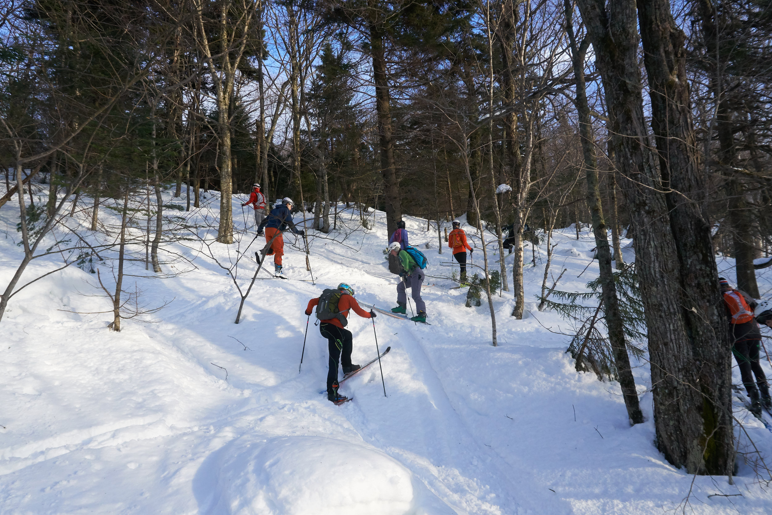
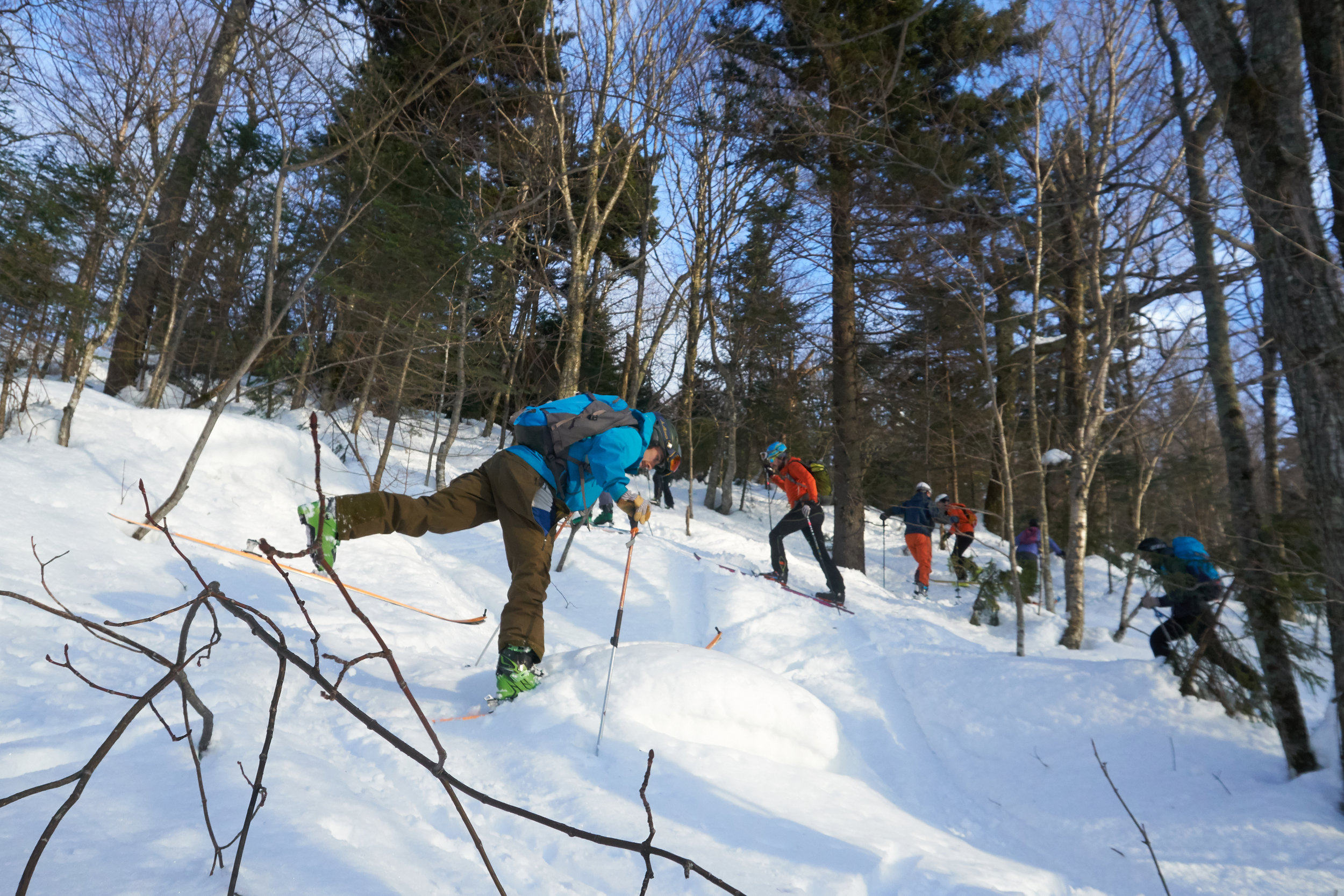
After a quick briefing in the morning twilight with the other skiers and a few split boarders before we got underway in the blue light of the morning. Although it was just light enough a few people opted probably more sensibly to bring out a head torch as beams of light cut across the trail as we started to hike up. It felt great being out on the skis for the first time of the season. I had unfortunately not been able to make the most of THE snow dump that happened back in November. Many of the skiers regaled tales of some of the best snow and powder days they had seen in seasons. Despite the crisp cold conditions we all soon heated up as we picked up pace heading on up the mountain at Bolton Valley. Having never been there it was a great spot to see with some dedicated uphill trail routes to skin up. This was the warm up of the day and for me a great re-introduction into ski touring, everything kind of felt a bit familiar yet rusty. We headed up past a mountain hut that you can stay in overnight during the winter which looked like an awesome spot for another day! The trail took us further up the mountain weaving between trees and over frozen streams as the sun began to rise. It was a cloudy morning unfortunately, so there was to be no golden sunrise. Rather an overcast blue grey glow. The group slowly spread out up the mountain as micro groups found their rhythm heading up the trail.

Starting off in the morning twilight
Reaching the top and it was time to strip the skins from the base of our skis and ski down. Helmets on, skins off and we were flying down the mountain side. Having mainly done skimo races where you don’t necessarily take in how everyone else is performing their transitions it was great to start seeing the varying levels of efficiency and proficiency at the top. As we got closer to the base we began passing a number of other ski tourers heading up for their own first lines of the day. Arriving back at base camp we came through the doors of the classroom area to a row of donuts and coffee. Despite the earlier breakfast in the car the caffeine and sugar hit was exactly what was required. This was not to be the breakfast of athletes or champions I expect but it was certainly a welcome treat.
It was then time for class.
The day was broken down into 2 sections, the morning for some indoor teaching, Here there were a couple of options. Essentially 2 sessions were more focussed on an intro to ski touring and backcountry. Then another 2 which were orientated on performance and race perspective within a ski touring setting. A lot of the principles are completely transferrable to a backcountry setting. I opted for the two focussed on performance.
First up was transitions. Regardless of the mountain being able to switch from boot packing, skinning or skiing in any combination as quickly as possible it’s hugely beneficial. In a race it allows you to not loose precious and non valued adding time. When you are not in a race it is safer and allows you to stay warm as you keep moving. For those that might like to take photographs, grab a quick summit bite to eat or something this time saving buys you some additional time whilst your mates are faffing to get ready.
The biggest and most memorable point I came away with was the mantra of boots, bindings then skins. And always doing it in that order. That in itself has made my transitions more organised, deliberate and smoother.
There were also some tricks of the trade for removing skins as quickly as possible. Below are some examples of some great transitions.
The second part of the morning was more into discussing training and nutrition as part of your training or race day program. There is loads of nutrition advice out on the web and with there being so much I often find the information contradicts one another when it comes to which is the best diet to perform on. Regardless of diets during any activity staying fuelled and hydrated is key and this came through in the presentation also. I haven’t always been that great with specific evening and pre-race nutrition regimes but when I have eaten properly the night before, drank a load of water or sports drink the morning of and then continued to fuel through the race. Unsurprisingly I have felt and performed better. This presentation was quite fitting though as my evening meal had been grabbed on the go and wasn’t exactly nutritious while breakfast had been a cereal bar, coffee and a couple of donuts.
If you are interested here are some resources (i am not affiliated with them nor an expert, if its something you would be interested in me doing more about nutrition then let me know!)
https://www.uphillathlete.com/high-fat-low-carb-diet-ultra-endurance-performance/
https://feedzonecookbook.com/
The afternoon was spent testing out equipment and putting into practise what we had been discussing in the morning around up hill technique and transitions. Having the day structured like this so we could hear about how to do it in the warmth and partly see some demonstrations before practising outside was fantastic for really practising good technique. I managed to borrow some Salomon s-lab skis. The comparison to my all mountain skis with a particularly heavy touring setup made a huge difference. I also learnt some key points. Such as them not having brakes to save weight. It is great but when transitioning on a slope you need to keep hold of your skis. In the event of running after them grabbing new skis by the edge is equally not a great plan. I ended up cutting a finger which was a pain but fine. It however then bled everywhere and on everything I touched. The conditions were really quite warm on the day so I had opted to not wear gloves the whole time. So if in doubt always try to wear gloves even if they are incredibly lightweight ones. And always hold onto your skis!

We finished up for the day with a raffle and some epic prizes! I cam away with some gloves and managed along the way to pick up some second hand skimo skis. Missing bindings but I will come onto them later.
All in all I would highly recommend this workshop. I will definitely be checking it out next season. You cant ask much more than to meet a load of super friendly ski touring buddies along with learning some tips and tricks.

Thanks Aaron Rice for letting me use your photos!!

Mt Mitchell - North Carolina

This was the first long holiday of the year and after much debate we had settled on exploring Asheville and the Black Mountain area in North Carolina. Renowned for outdoor activities and a lot of breweries! The first task was for a casual 11 hour drive down to the area from New Jersey. With a car full of people and kit. Loaded up with snacks for the drive we began making our way south.
One of the first spots we visited was a natural slide. Hidden in Pisgah National forest we braved the slightly cooler weather for the chance for a wild swim. By the time we got there their were only a few people milling about and sliding down the rock face into the plunge pool at the bottom. With it being the end of the season we had definitely avoided the crowds which you could imagine being the norm in the heat of the summer. After spending some time sliding down and hiking up it was time to head on back to our base for the next few days.

Sliding Rock
After checking out the weather that evening and various trails available we settled on heading up Mt Mitchell. Mt Mitchell itself was high on the wish list for our time there. Partly because its the highest peak east of the Mississippi and eastern North America (when you exclude some of the Arctic region) standing at 2,037m or 6,684 feet. Making it about 400ft taller than Mt Washington up in New Hampshire or roughly 2,200 feet taller than Ben Nevis in Scotland. The mountain and surrounding area have an interesting history as well. Originally the Cherokee tribe were one of the more prominent in the Black Mountain region until settlers took over the region. Since then it was first climbed by a French Botanist and Explore named Andre Michaux (who commenced quite a few expeditions from New Jersey & New York). Making a climb to the top all the more relevant having travelled from New Jersey albeit far easier to get there compared to his travels. A Professor from the University of North Carolina, Elisha Mitchell, explored and studied the height of the mountain before confirming it as the highest mountain in the East of the US. He later unfortunately went on to die on the mountain after an accident.

The trail up Mt Mitchell
In the 1940’s a road was created along a ridge that runs 469 miles between Virginia and North Carolina, with a stop off at the summit of Mt Mitchell, creating the Blue Ridge Parkway. However since then the environment has had a tough time. A mixture of effects have been damaging the eco system. From logging and fires through to foreign invading plants and animals. The more recent effect has been acid rain, which is still to this day severely affecting the forest and killing many of the trees. In 1993 it was declared an International Biosphere by UNESCO. Despite the challenges it still has a rich environment. Its not surprising that its one of the most visited national parks in the US. Due to its popularity there are a variety of options to reach the summit including a drive almost to the summit or horseback ride. We opted to hike from the base starting at the Black Mountain campsite.

Blue Ridge Parkway meandering below us
The adventure started with the drive over there. Plugging the campsite in as the start point for our hike we soon found ourselves driving up a rough track road with ever tighter switch backs. Higher and higher we headed up the mountain. What we had not appreciated when going with the route the GPS suggested was that this would take us the off road route. It showed the importance of having a road map of the local area! It was quite the experience driving up with sheer drops to one side and some fairly impressive pot holes amongst other parts. It turned out the road should have already been closed for the season. We had managed to sneak through for a final ascent whilst they were conducting some maintenance. As we climbed our expected time of arrival got later and later. It felt like we had driven to the top of the mountain as we emerged onto the main and perfectly tarmacked road. Trying to find the second segment for the onward journey, which unfortunately had been closed for the season, we began searching for alternative routes. After trying a few different ones we were finally heading in the right direction on the only remaining route to get to the start of the trail head. The trail started from the Black Mountain camp ground. We soon enough arrived far later than expected but there nonetheless . The campground is tucked in beneath the mountain. Parking up we crossed over a bubbling river to get into the camp group which was filled with campers and surrounded by towering trees.
Some wooden signs directed us towards the start of the trail, with a fairly flat section to warm us up into the hike a head of us. This however did not last long. We soon found ourselves in amongst the trees and working our way up wards. The cooler weather making for some perfect conditions for hiking.
One of the plants of interest for the day was poison ivy having spoken to a few people about the various poisonous plants in the US. We had spent some time over breakfast reading a few warnings and articles about poisoned ivy, oak and a few other plants as well as how to spot them. We were on the look out for these plants in a bid to avoid them. Not being your flora expert anything that looked remotely similar suddenly became a hurdle to overcome. Not wanting to be covered in the resin that these plants secrete which waits up to 48 hours before revealing the blisters of the infected area. Unfortunately you can spread it around during this time so in the event of getting it on your hands imagine all the places you might touch during a 48 hour time period….
Slowly but surely we made our way further and further up wards. With most of the mountainside covered in forest we did not have much of an opportunity to take in the views around us. Until we reached a small clearing which had been carved out to make way for a electricity pylon that was strung up the side of the mountain and also headed for the top albeit in a much more direct fashion. Straight up. This gave us a small glimpse into what we would see from the summit and it was already pretty spectacular.
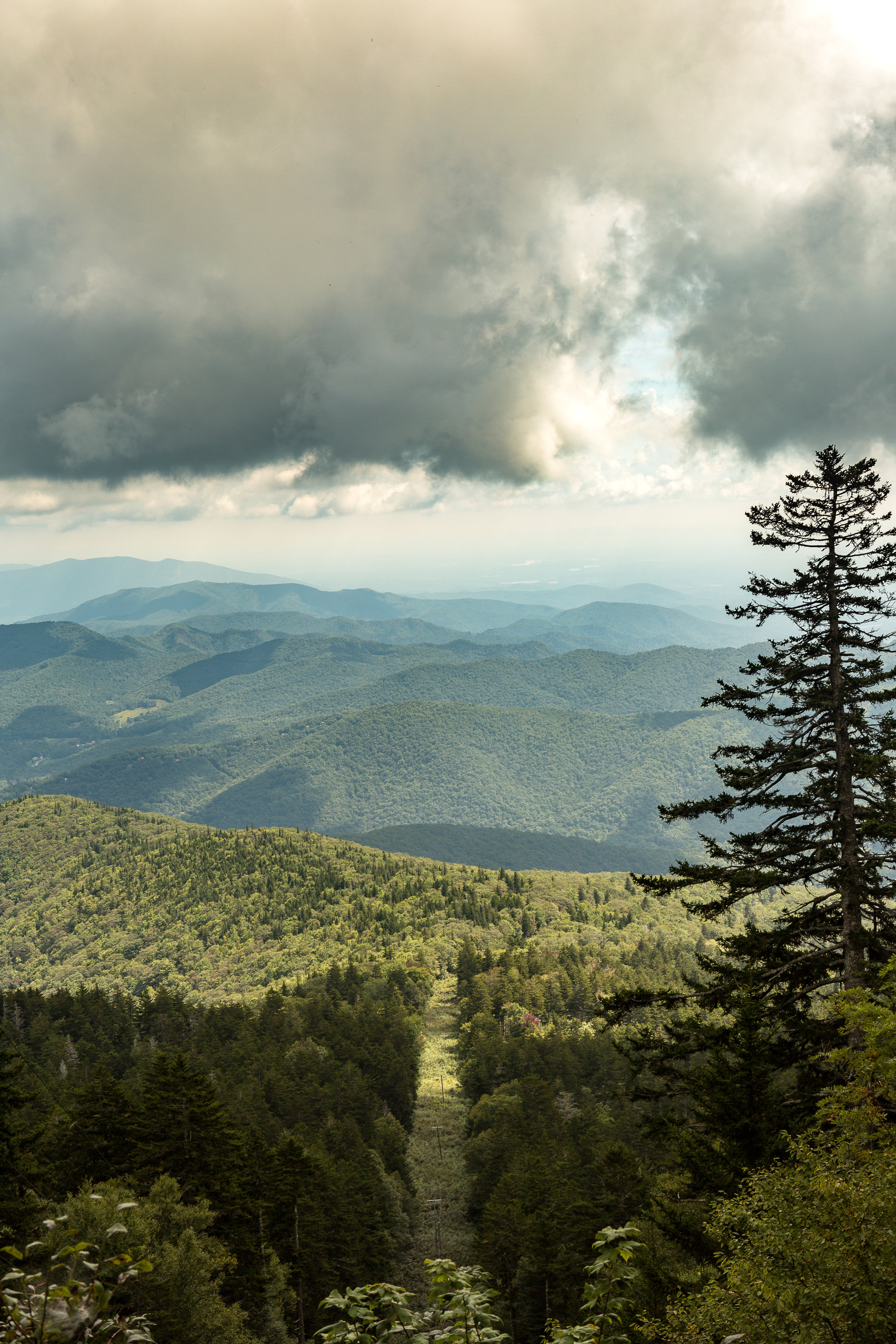
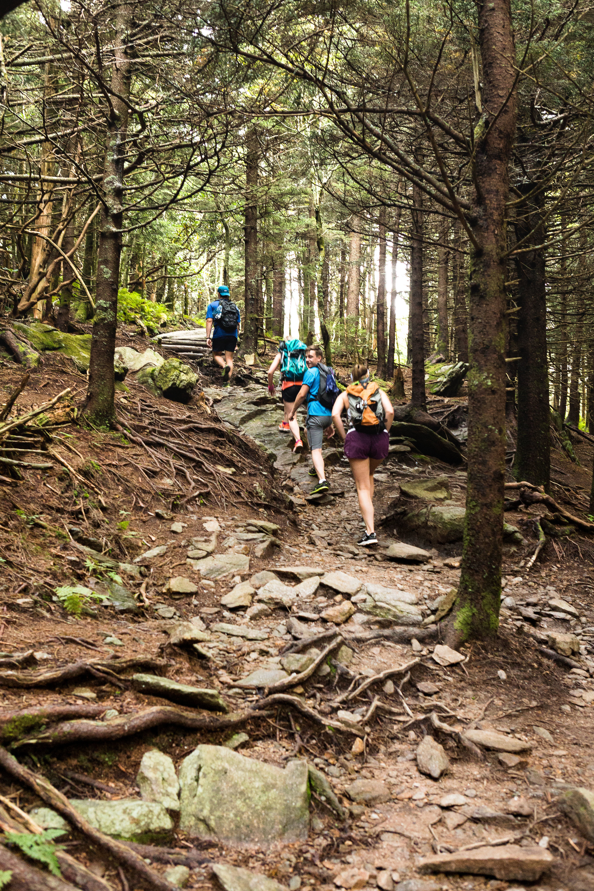
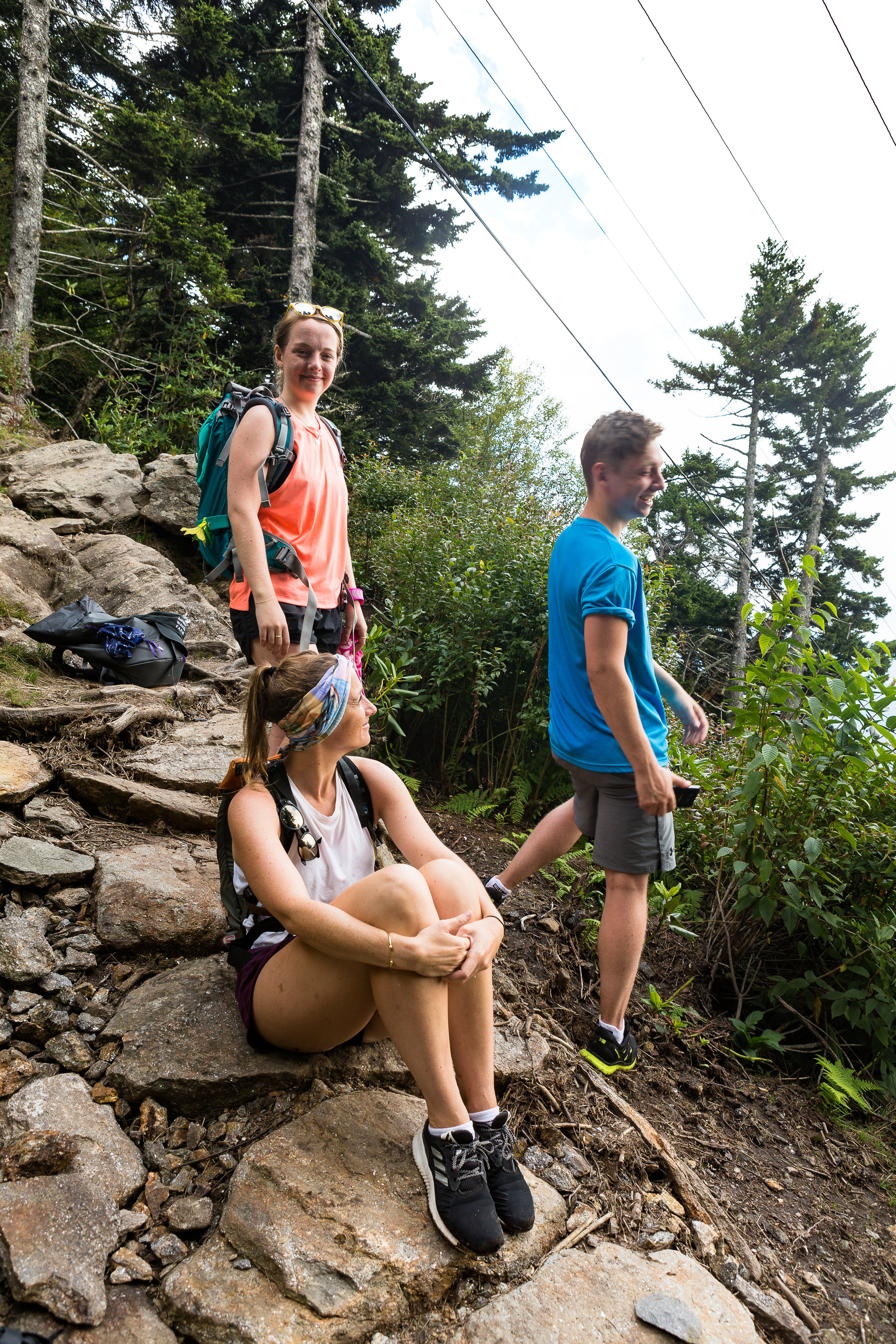
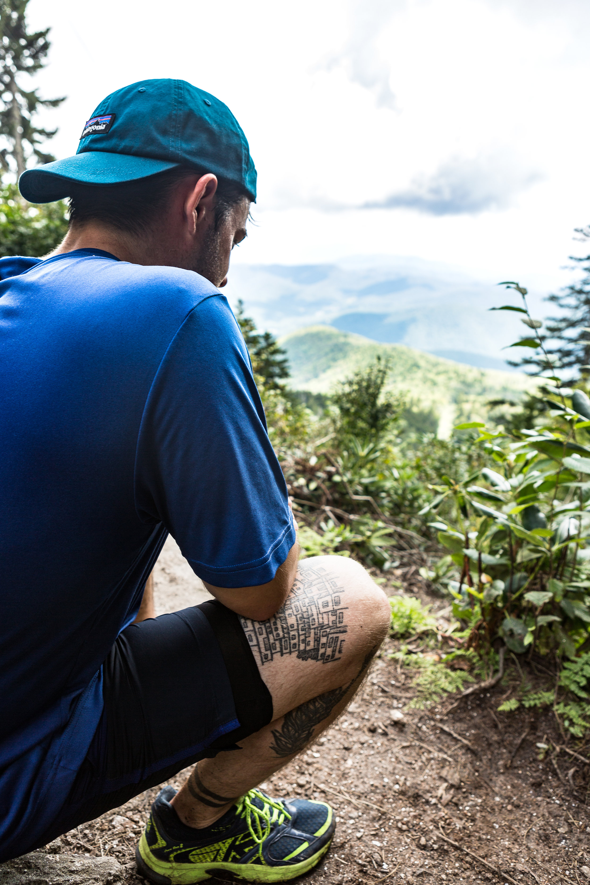
I find it fascinating seeing how the environment changes as we meandered our way along and higher up the mountain. We passed through thick groves of rhododendron’s as we climbed and the scenery slowly changed from chestnuts and oak trees to fir trees as we made our way higher and higher. Unfortunately we didn’t see any flying squirrels or local black bears. Admittedly not seeing a bear up close although an amazing experience would have been a bit nerve racking for the group and the bear.
You can read about my last bear experience in the link below
We were not disappointed on reaching the summit. The 360 degree views were pretty awe-inspiring. We even met some cyclist that had made a bid for the summit under their own power as well. Munching away of some snacks before the second leg of the journey we watched large grey clouds moving in on the area. With the weather on the turn and due to it taking longer than expected to reach our actual starting point we made the decision to make a dash for the bottom rather than continue along the ridge to some other nearby peaks. Part the way down the first rain drops started to make their way through the foliage. We stopped briefly for an attempt at some easy bouldering before pressing on quickly to the bottom. We got back down in pretty quick time, with the rest of the evening to explore the nearby town and its array of Breweries and Bars.

The Weather Turning
If you are interested in reading a bit more on Mt Mitchell and the surrounding area the link below has a bunch of info.
https://www.ncparks.gov/mount-mitchell-state-park/ecology

Views from the Summit
Cayuga Trail Marathon
After much anticipation it was time for the Cayuga trail marathon. Since early on in the year I have been slowly increasing my mileage for this event and despite having to drop from the 50 miler to a marathon so I could make a return journey for a bachelor (stag) party I was very much looking forward to the race.
The race felt like I went from having weeks and weeks to go to nothing. Booking some last minute accommodation and it was suddenly the day before the event. It was Friday and after finishing up work, the evening quickly switched to travel mode with a decent drive to up state New York. In our haste to get on the road we completely neglected thinking of food. Realising our error within a very short period of leaving the house that we were both pretty hungry and had only just started the drive. This was within 20 mins of starting the journey as we hit the first traffic jam. Not wanting to detour too far from the road we opted for the first available standard burger joint. Possible not be best pre-race nutrition nor did it turn out to be that close to the main highway.
Full now of chips, burger and a small milkshake we made good progress up towards Ithaca. The final part of the journey meandering amongst the mountains. Unfortunately we were not able to take in the beauty of the local area with the sun already set. We finally reached the accommodation for the night. Sitting right next Robert H. Treman state park where the race began. It was a perfectly comfortable pre-race spot and despite being a motel had an almost ski chalet type vibe to the place. The car park filled with trucks a few piled high with BMX bikes.
I had prepared most of my gear and snacks for the race prior to the drive. The next morning was a strong start, trying to make a coffee the filter broke spilling coffee grinds all over my mug. Half a sleep and not wanting a repeat I gave up at this point and instead loaded up on locally made bread and jam.
Heading over to the start line before 8am and the temperature was already beginning to soar with runners seeking a bit of pre-race shade, topping up with fluids and having a bit of a warm up before the race began. The 50 miler was a qualifier for the US team, so with that came a number of serious athletes to both it and the marathon. Some had opted to go shirtless right from the start, armed only with a water bottle for the entirety of the event. Finally the time had come as all of us huddled together at the start line. With the blow of a ram’s horn the race began. We started the initial trot. Like many races this initial period is always a bit slow off the mark as runners finally get over the actual start line. It was time to get in front of some of the pack before sections of single track prevented it. It turned out as the race progressed that there were more than enough places to over take or be overtaken.

The course itself was a gorgeous meandering track through the state park, through Lucifer falls and up towards Buttermilk falls. The route had incredible views especially as the course headed up gorges, past glistening cold water falls and along wooded single track. You certainly couldn’t ask for much more.
As the day heated up each pool I ran passed became more and more tempting to dive into. Especially as we saw more people out through the day swimming about in these crystal clear blue coloured pools. It was a hard task to run past them. The aid stops came as a perfect treat and distraction from the heat with an array of trays of cut orange, melon and a few other goodies. I have found it pretty interesting over the years how I seem to crave specific foods depending on the event, the weather, terrain and how many miles I have done or am doing. One of the most memorable being a canal race where I gave into my slight sweet tooth. Munching down a whole load of gummy bears at each stop, I later spent the night curled up in a ball with terrible stomach pain. The second day and stage of this event was less than pleasant, the lesson learnt not to always give in to those immediate cravings! Anyway coming out of one of the check points and rounding the corner there was a river to cross. Perfect!!! Despite briefly thinking of the damage that could happen with wet feet I jumped in and dosed my body in some much needed cold stream water. It was invigorating. My feet were going to get wet regardless so why not enjoy the experience. Cooling station down and it was time to jog on, slightly soggy with squelching feet. Back in the UK this would normally mean wet feet for the remainder of the day. However 20 mins or so later and my feet felt bone dry and ready to roll.

With all race you often end up chatting to some of the runners as your paths cross. I was given some insight into the course that was to come up. I hadn’t realised that the course had a large number of steps. I gave up counting not long after starting when i saw them meandering up the hill side and knowing i was doing a loop to come back down them. We crossed paths with some of the 50 mile runners who were leading the pack and had started earlier in the morning as the out and return loop criss crossed and joined at different sections. I was amazed at their speed and at how little some of them carried. Having got used to everyone using a little body vest with pockets for anything and everything you might need, these guys quite often just had a water bottle strapped round their wrist. Maybe i wasn’t taking enough of a risk and carrying too much on a relatively short course given the number of aid stations.

I ended up with a few runners who seemed to be at a steady pace to myself. We tended to split up a bit on the hills between the up and downs but as soon as it flattened out we bunched back together again. It always helps pass the time chatting to someone new, hearing about their stories of past events, adventures and life in general. The girl in the group worked on a vineyard in the area. So we got a crash course in wine making and how the season was going for the grapes given the unusually wet summer.

The group dissipated and feeling like i had regained some strength in my legs I sped up. I had a brief spell feeling like i was about to get cramp in my calfs. Particularly after tripping on a couple too many roots, but after munching down some salty nuts I was picking up again.
Towards the end of the race I came across a few guys who were going at a good speed to finish off the final few miles. I thought this was probably how the race would finish up for us. Chatting all the way to the finish line. This was almost the case until the final mile or so. Slowly but surely i felt like i was dropping off the back of the group. Initially I put this down to beginning to get tired. I put in a burst of effort to catch back up with them and I realised this was not the case. The chat had stopped and instead the pace was slowly being cranked up. Again naively i thought it was good to have a strong finish but at least the three of us would be crossing the line together. I come to this thinking because we were ahead of the mid pack but still a long old way from the leaders. Maybe this is where I go wrong in races as I like to do well but the difference between say 30th and 31st or 32nd is still a long way off top 3, 10 or even top 15. Any way it is safe to say we looked awesome sprinting into the finish. I crossed the finish line just on the tail of one and slightly a head of the other. Elated, incredibly hot but still feeling like i had more than enough in the tank to keep going. Maybe i should have sprinted harder.

Overall i finished 31st out of 153. 10th in my age group or 1st scot (I am assuming there were no other recent expats from Scotland at the race!)
Until the next race, it would be great to hear whether you compete against others in races or purely against yourself and the clock.

An introduction to Snow Shoeing
We decided that it was time to give snow shoeing a go. The conditions were looking windy but hiding amongst the pine trees of New York state we would be fine, especially with the recent snow fall making for a soft and powdery walk amongst the woodland. We headed over to XC Cascade up in Lake Placid to experience some of their trails. It looked chilly outside with the wind swirling the snow around.

If you have all the equipment you don’t have to be limited to laid out trails but can head up and into the backcountry trails. This season we hadn’t got all the equipment together needed for this and we were total rookies, so maybe next year!
After getting kitted out we opened the door of the warm, cozy hut. We were blasted by the wind as the door crashed closed behind us. Despite the lure of the cozy hut, we took our first incredibly large, cumbersome and awkward steps. Trying to make a quick dash across the cross country ski trails, dodging the speedy and more agile skiers, was probably quite a site but we made it onto the start of the quieter snowshoe trail. Soon enough the towering pine trees swallowed us up and blocked out any trace of a raging wind behind us.
Walking between the trees and over the soft powdery snow felt like walking into Narnia. A magical quiet world with hardly a disturbance. A wave of feeling completely at peace came over us as we began meandering along the trail with the snow sparkling on the drooping trees. Not long after starting we got into the stride of things. My large feet now felt like ginormous platforms flopping around the place. Yet despite the speed at which we became accustomed to our new oversized flip flops taking pictures was a new challenge what with the poles swinging about the place, a camera in hand and padding about through the winding trail.
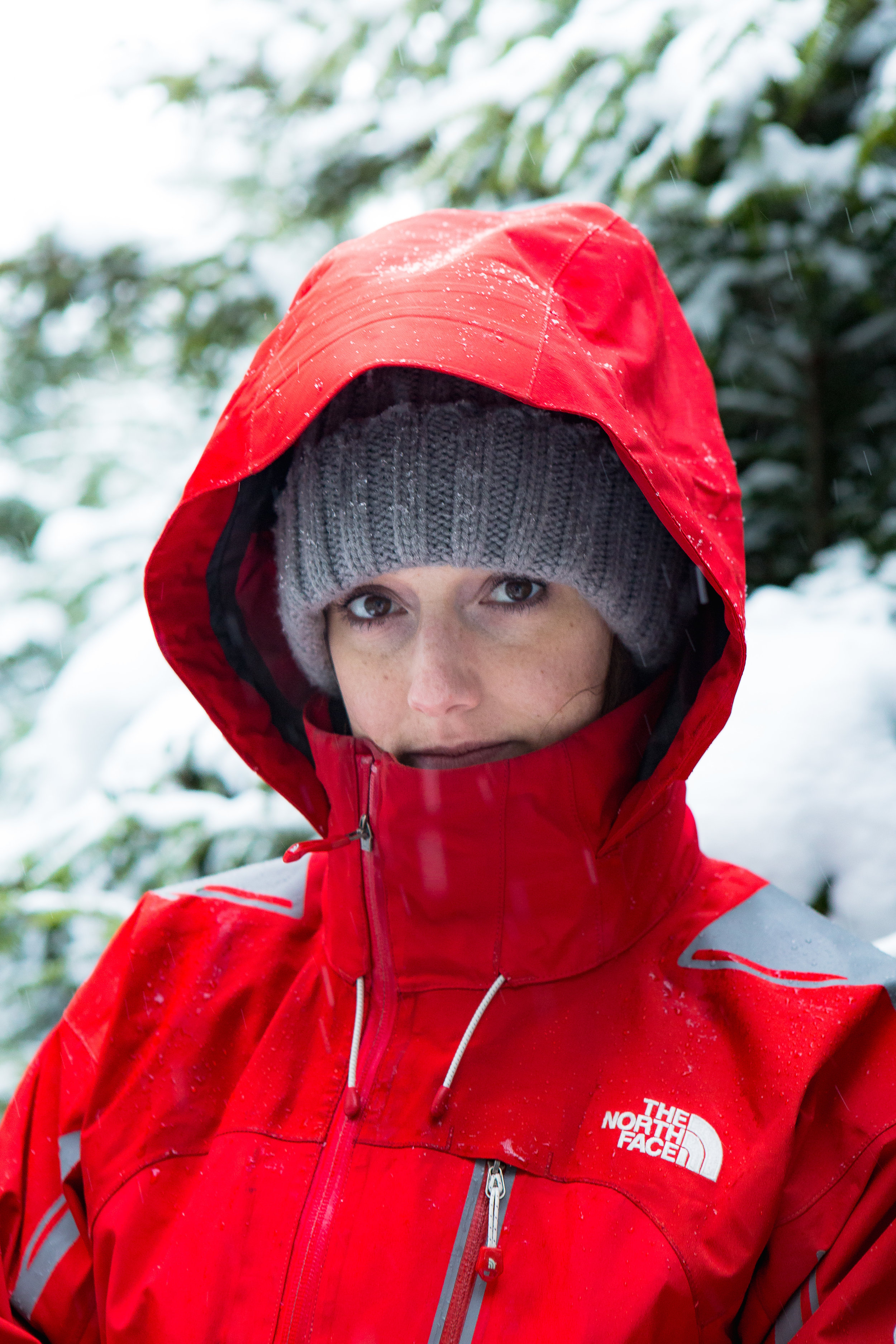
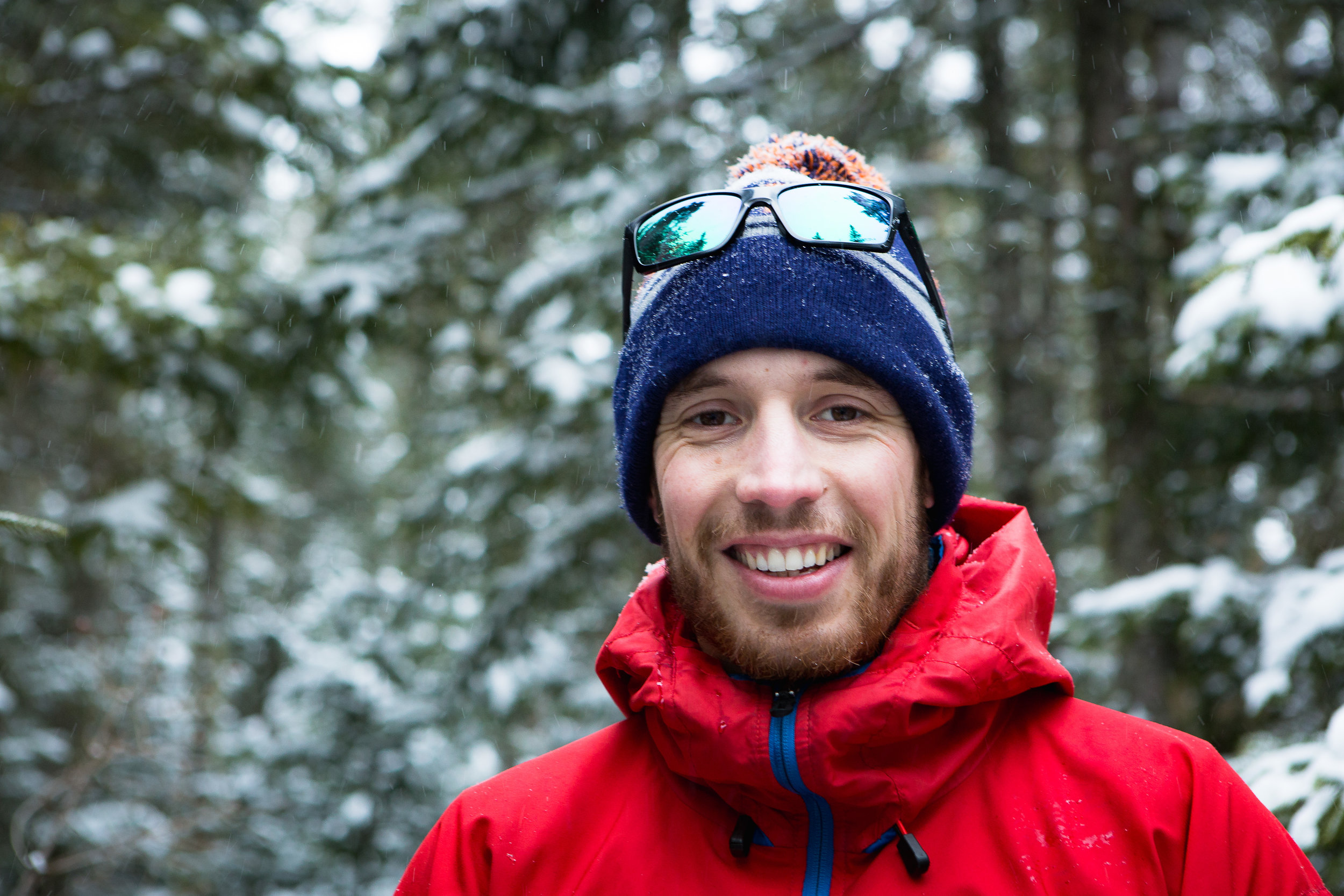


Further a long the trail we came to the first of a few obstacles in the form of a tree blocking the path. Carefully and gingerly we stepped over forgetting that the snowshoes would flop almost completely open catching and scraping over the tree. I am not sure smooth or seamless would have been used to describe the transition over the obstacle but it was successful if the benchmark was not to fall over.
After being out for a few hours we meandered back to the hut for a warm drink by the fire. Coming out of the protection of the trees we were reminded that all was not so tranquil. As we flung ourselves through the doorway with little grace but huge grins and red cheeks from the cold breeze and great conditions.

Very quickly we commandeered some seats near to the fire with hot chocolates and some soup on order.
All in all a great experience and one that will definitely be repeated once the snow comes again.

Returning to Skimo
It had been a year since my last (and first) skimo competition. Last season I had grand ambitions of filling my weekends with skimo competitions, possibly slightly ambitious given I had only just moved over to the US. Last year’s competition fell on my very first weekend in the US. I ranked it higher priority than, you know, trivial things like finding my nearest supermarket or studying for my US driving license.

A year on and with slightly more of an idea of what to expect, I made the drive north to Berkshire east to kick off the season. Despite all my best intentions of arriving fresh to the start line the snooze button at 4am was too tempting. In a bid to speed up the morning I had packed the car and prepared breakfast and coffee the night before…The evening prep took much longer than expected. When I finally jumped into bed it felt like only a couple of hours before I was up again and rubbing my eyes awake as we drove north.
The sunrise revealed an overcast day and as we reached the mountains the wind picked up, trees swaying and snow drifts forming and flowing at the sides of the road. Despite a heavy right foot we still hadn’t made up for the heavy use of the snooze button. Wife’s are useful for times like these for any extra pair of legs to help run around sorting the pre-race entry and parking the car.
Entry complete and caffeine level replenished we all stood together on the start line - a mixture of either Lycra clad, carbon covered racers to those with the intentions of maximising the workout with heavier telemark skis or setups designed more for a short hike from a nearby lift ideally. I was one of the latter, the additional weight of my skis were clearly going to make a significant difference to my time and general efficiencies over the mountain. After a year of hunting for the best American BBQ, burning off as much energy as possible fitted the bill perfectly. This year I opted for the short course rather than the full. Mainly due to preferring not to be spend as much time boot packing (hiking uphill with skis on my back) on this occasion.

As the starter went, the group made a dash up the hill. Everyone letting the more competent and quicker competitors to go first. Soon a line was spread out up the mountain with our skis sliding beneath us. Compared to last year the cooler conditions felt much more enjoyable. Making it to the top of the first hill and I got tempted by the longer course for a lap. The shorter course is much more about taking part aspect so doing a hybrid certainly when I wasn't in a competitive position wasn't going to affect anyone. Skins off and tucked into my already sweaty top I skied back down the mountain before applying my skins and heading back up the mountain. The next stage included a couple of boot packing sections. Hidden amongst the trees and what felt at times like I was hiking up a small frozen stream with ski boots on I slipped, slide and scrambled my way up hill. At times trying to perch on anything I could. Trees, rocks and anything poking out from the snow became a possible hand hold. I am sure there is a better techniques for this but on this occasion it wasn't coming to me. I wasn't helped by my poor attempt at strapping my skis to my bag - resulting in my skis smacking off my helmet with every other step. Good thing it wasn’t my head. A final skin up and it was time to ski all the way back to the base of the mountain for round 2 of 3.

For the next 2 rounds I went back to my original plan of not boot packing and purely skinning and skiing. As the field spread out working out who was on what loop and which course became increasingly hard. Nonetheless I mostly ended up skiing along with someone for at least part of the lap, which provided some distraction from my now burning legs as we headed up hill again. The second lap went by without any hiccups, my transitions seemed to be improving between skinning up and getting them off as quickly as possible before skiing back down the mountain.
The third lap and my energy levels were beginning to dip a bit. I munched down some food and finished the last few remaining drips off water in my water platypus pack. As I was eating and drinking though I knew I had missed timed it. At this stage it would not give me much of benefit compared to if I had started slightly earlier. A learning for the next one.

A tough race, but brilliant! The thing I really enjoy with skimo is how it uses so many different muscles and the satisfaction (smug feeling) you get from self-powering your way up the mountain. It certainly makes me appreciate the ski down much more than if I just jump on a lift.
Its all about earning your turns.
In terms of top tips that I have learnt so far from doing skimo
1) know the course as best you can. It can be difficult converting a not to scale map of a resort with the various sections so ideally visit the area.
2) practise taking your skins on and off your skis as well as how to pack them away.
3) most importantly enjoy the experience and hopefully you will end up doing it a few times.

Something new! - cross country skiing
Despite my time spent pulling a pulk, the skills and techniques although similar to cross country are also certainly very different. With both pulk pulling and cross country skiing you are trying to build up speed as efficiently as possible. But having to drag additional 60 - 100kg’s or so of weight behind you certainly slows you down, makes you more cumbersome and changes your concept of speed. Pulk pulling uses large snow boots and bindings that clamp your foot onto the ski, kind of like a snowboarding binding. In comparison the cross country setup feels incredibly sleek and light weight. So despite having done some cross country skiing in Scotland (when the conditions allowed) it was time to get out on the slopes in the US.

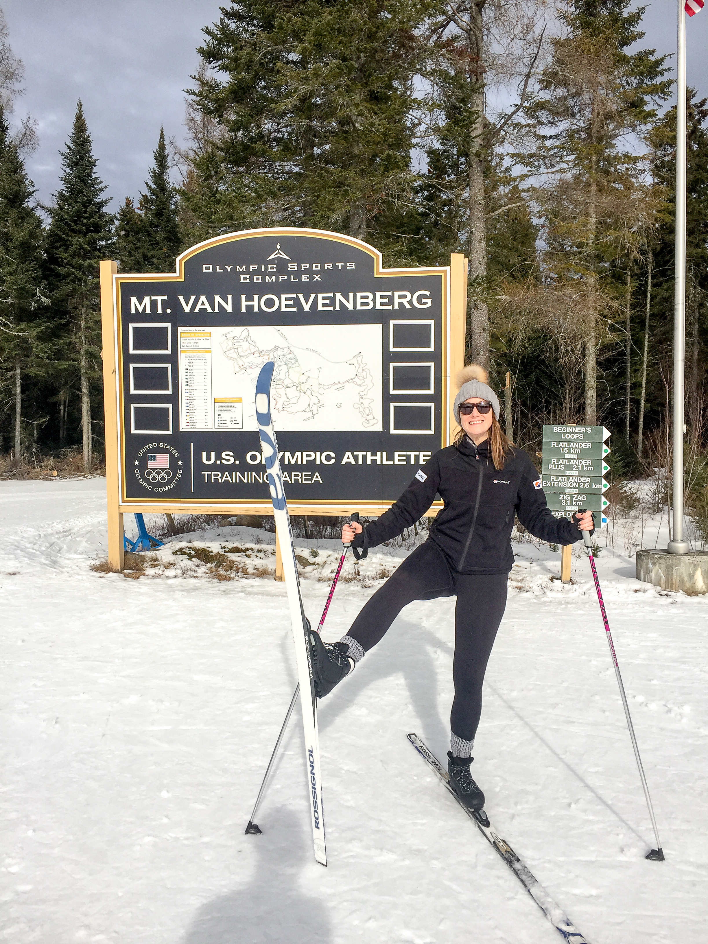

We are slightly spoilt for choice in the northeast US. With a trip to Lake Placid on the cards (home to the 1983 and 1932 winter Olympic Games), we had the opportunity to have a blast round their cross country course. The conditions had been pretty warm along with a forecast of rain, so going downhill skiing was a bit less tempting. Heading over to the the venue and we soon found ourselves kitted out with all the gear. Having spent years downhill skiing the difference in weight and feel of the kit still amazes me (comfy!). Admittedly the boots we had were very much the recreational type but its much more like wearing trainers (sneakers) compared to the heavy, rigid boots for skiing or snowboarding. And the bindings only clip the very tip of your toe to the ski. After a few pointers we were out on the course doing laps of the place - imagining ourselves as Olympians flying round the course in style (albeit a fair bit slower)! Having watched the olympics and the speed with which they can go round it is going to take some time and practise to reach those levels. That said, cross country skiing is relatively easy for snow newbies to pick up and much less intimidating than facing a steep downhill slope. I really recommend it if you are ever looking for a snow sport with friends of varying levels of ski skills and fitness.

The course started in a large opening between the lodge and the old start line. There were kids, teens, grown-ups, octogenarians and even nonagenarians! flying all over the place with varying degrees of control, most of them a lot better than myself, clearly enjoying themselves and making the most of the break in the weather. We headed from the opening up towards the woods. The ice conditions in parts made for some interesting skiing as we got used to this relatively new sport. Particularly the descents, where despite being short and not very steep became quite challenging as I shot towards a tree… That said the majority was of the snow was softening up making it slower and easier for us, the woodland had protected the course from the worst of the conditions. (Tip for newbies: fresh fluffy snow or wet slushy snow are the easiest to learn on. Hard packed icy snow is great for adrenalin junkies! When in doubt call ahead and ask the lodge for advice on what time of day to go).
On the other side of the venue there was a competition taking place. Passing some sections we could hear cheers and clapping with the occasional glimpse of a racer shooting past. It certainly gave us an appreciation for the speed that you see the racers going!
After a few hours the sky began to threaten with a few splots of rain. Time to head indoors to taste our first maple steamer - a perfect warm combination of milk and local maple syrup to end. We will certainly be back for more and hopefully to try out skate skiing.


Mount Jo - New york
The plans for a weekend packed from start to finish with skiing were soon dashed by a wave of warm weather hitting the region. After a month of decent low temperatures everything was melting.
Having spent Saturday mostly cross country skiing, the day was finished when the rain began to fall. I don’t mind skiing in most conditions from hot weather to bitterly cold. But skiing in the rain is less enjoyable!
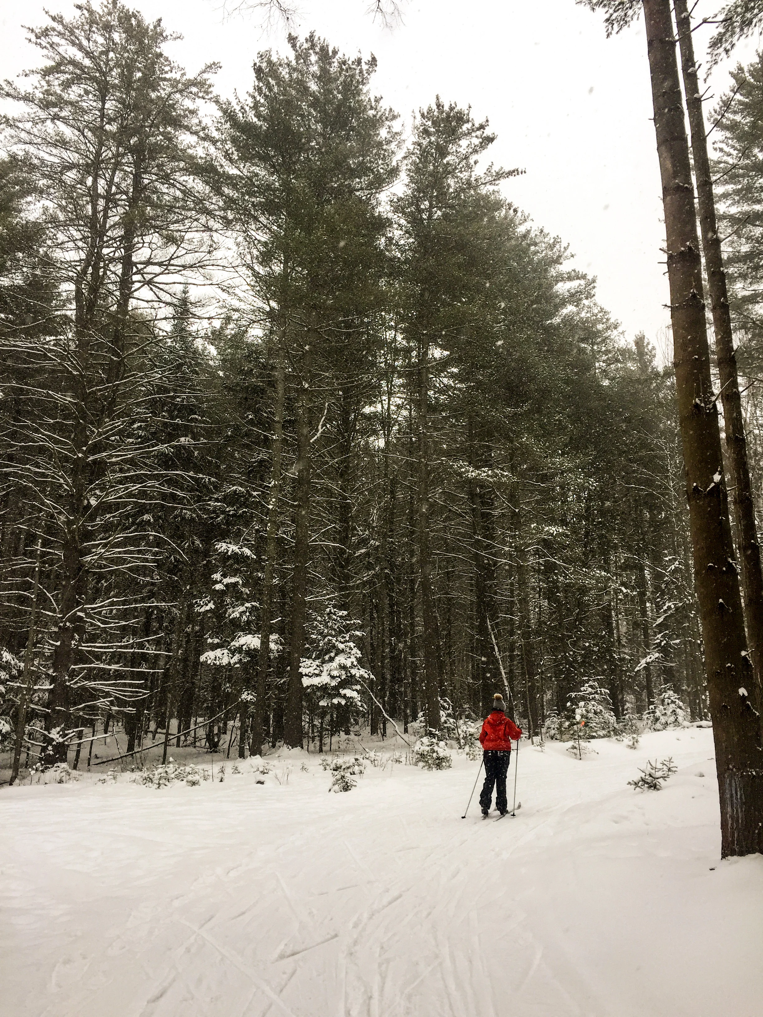
After an early finish we were all set for the next day. Rising early we found the car park to be a mini ice rink covered in a sheet of ice It turned out it was much the same as the nearby cross country course we intended to visit.
Instead we opted for a slow start to work out some new plans as we visited an outdoor equipment shop called High Peak Cyclery. After having a look round and a chat with the team they recommended heading to Mount Jo. A nearby spot which would provide a short hike to its summit.
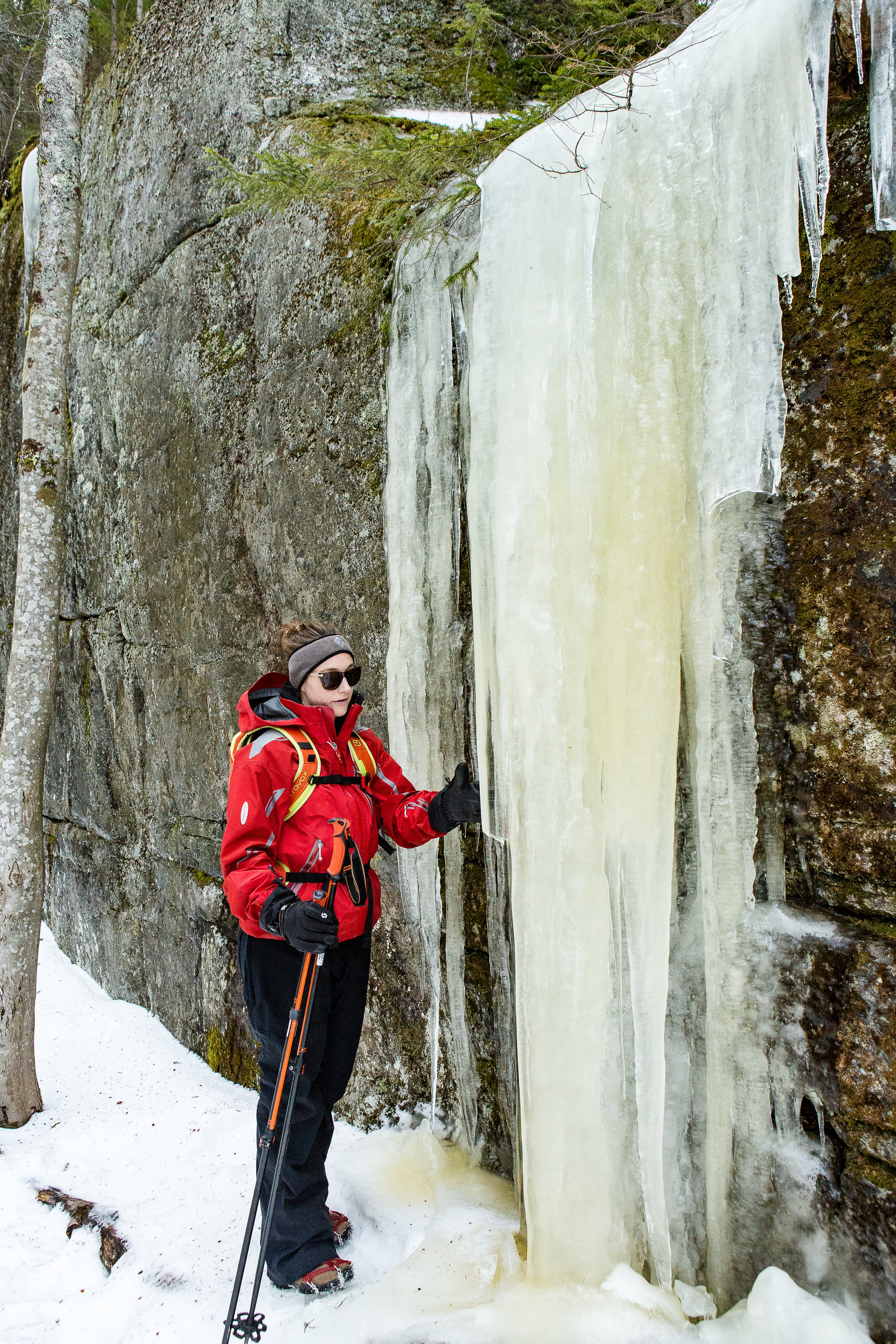

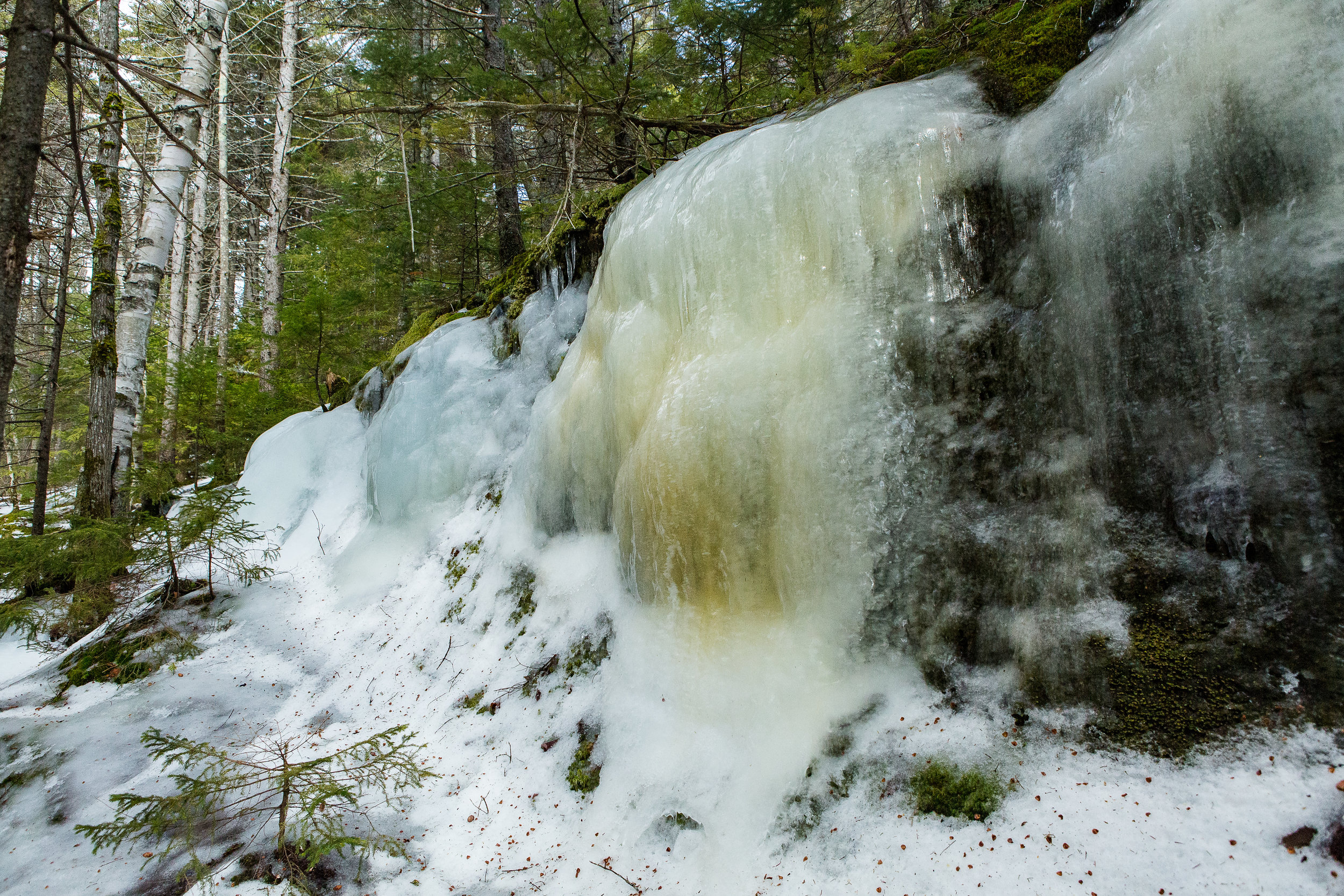


Armed with a map of the area, various bits of winter kit and some micro spikes we drove up to the starting point of the route. The sun was making the occasional glimpse and as soon as we stepped out the car the spikes were on. We made our way towards the trail head wondering past frozen streams, lakes and the entire path being one frozen slab of ice. Soon the path veered from the lakeside up towards the summit. Admittedly still a fair bit below it.

Micro spikes on and ready
Despite the relatively warm temperatures that had hit the area the path was still coated in a huge layer of ice. And in some cases large steps of solid ice. We passed huge icicles dripping and in some areas collapsing with the sudden warm spell.

Bit by bit we made our way towards the summit before the final steps, arriving at the plateau with views over the valley beneath. As we sat down absorbing the winter beauty we could feel the difference in wind chill as we were now exposed to the elements with no protection from the wind. Below we could hear people playing on a nearby frozen lake as the sound travelled clearly through the cold crisp air. Compared to hiking in the summer where the trees and undergrowth cover and conceal the area the winter provided this opportunity to see all around us. Through the leaf less woodland bar the odd evergreen. Having spent much more time hiking in the UK where heading up the summit is often a treeless and open expanse I still find it strange despite being far more natural to have these woodland covered summits.
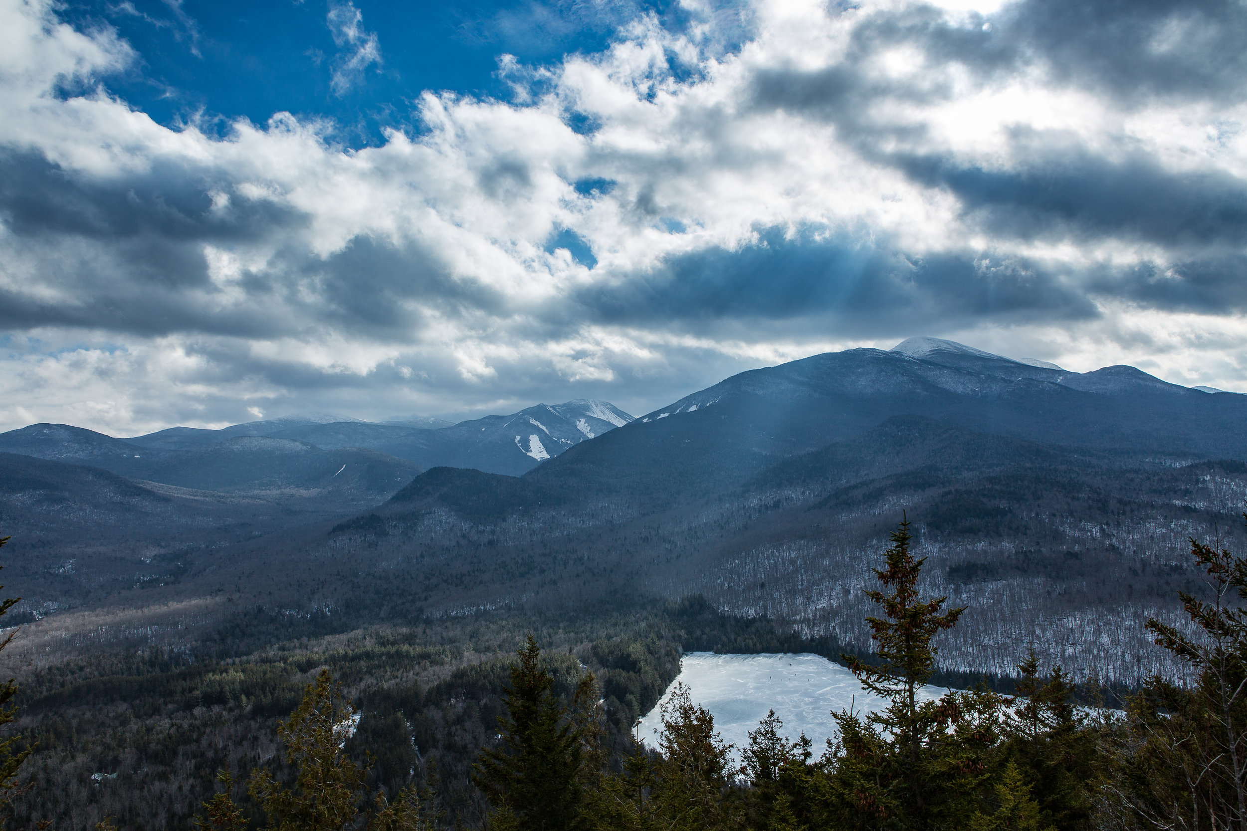
After a quick drink it was time to head back down the mountain. Very quickly we were reminded that it is often easier hiking and climbing up compared to going down. We scrambled down the steps and over some icy rocks to make it back to the initial path. I don't normally walk with poles, so it was an experience heading down with all this additional stuff! We soon came across the split in the path between the long path we had come up and the short path on the way down.

Although not much in it we chose the shorter path for a different view and way down. The short path as the name suggests takes a much more direct way down the mountain. We clambered down the icy structure that was a head of us. In many ways it was much easier than during the summer with all the rocks and rubble covered, it felt like we didn’t have to take quite so much care of tripping over the undergrowth. Which wasn’t entirely true as instead it was more about where we will get the most purchase from the tiny little metal spikes beneath our feet.
The final crux came through a little ravine, with trees to one side and a short cliff face with large icicles hanging down onto the path we meandered through this slightly steeper section. After picking our way down and passing another couple we finally reached the bottom. Our first winter ascent together.
Arriving at the bottom we headed back to the car. It had clearly been a warm day, by this stage rather than completely jacketed up i was hiking with just a thin merino wool top and the car park that was an ice rink had become a slushy and in some places stream flowing area. Now just time for some lunch!
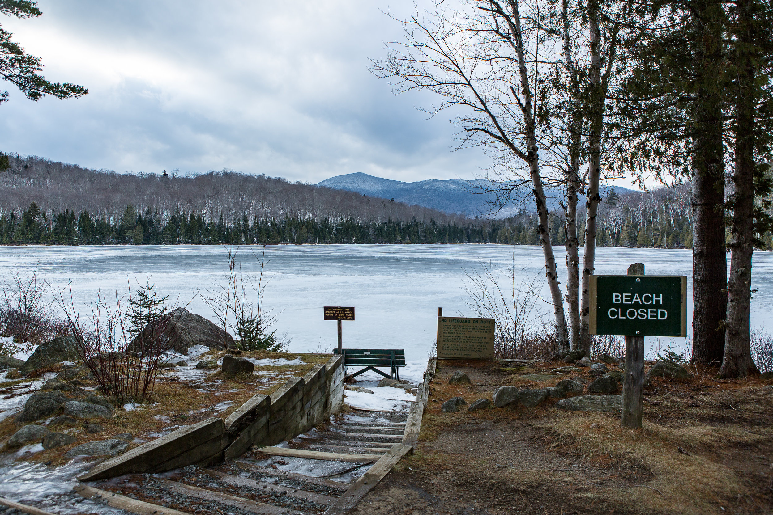
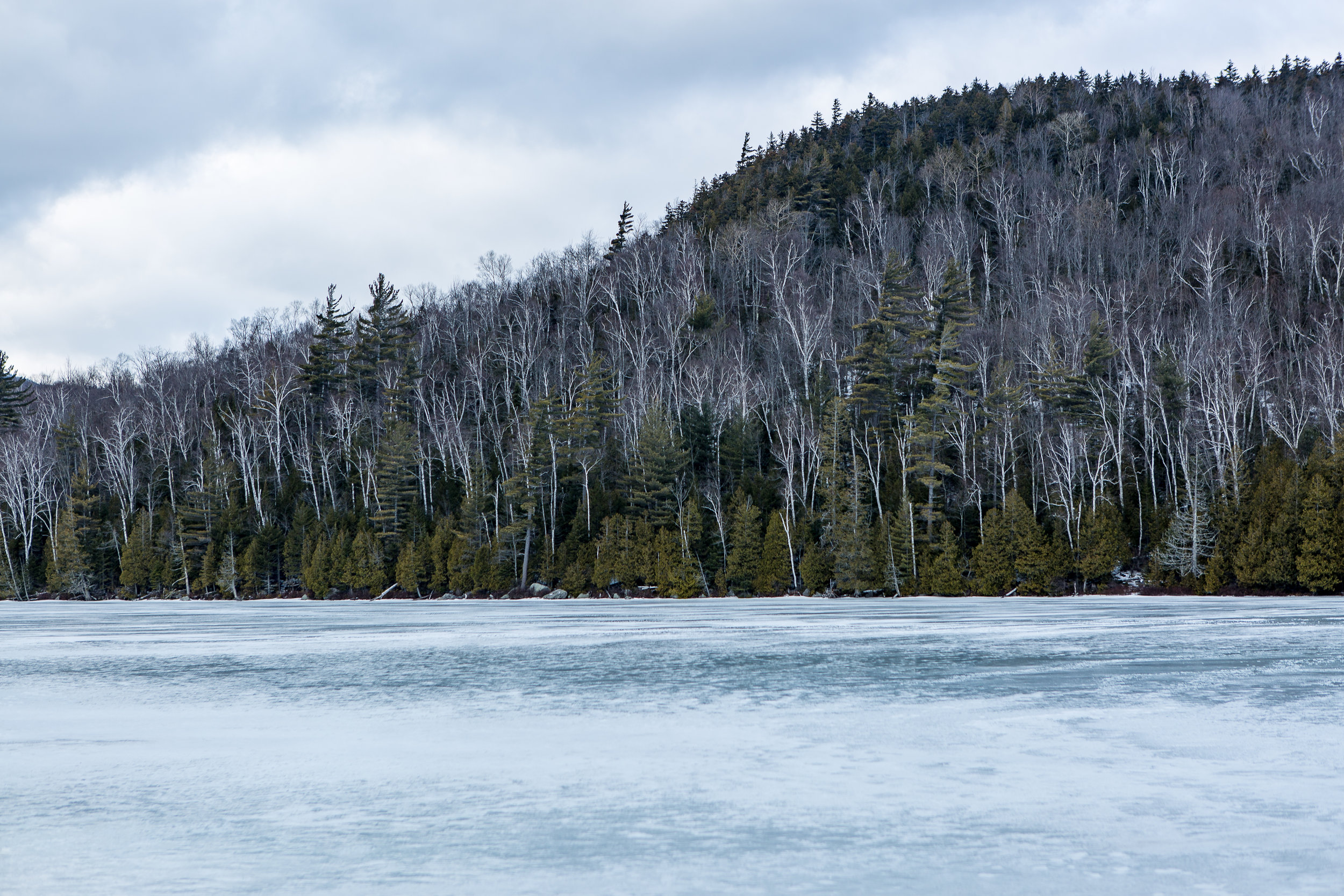


Paragliding in the UK
I have been debating whether or not to write about paragliding for a while. Partly because it has now been a couple of years ago since I did it. But, more importantly, by far, is I unfortunately had a family member who was killed during a sky dive and a few friends who have been injured paragliding. So making the decision to have a go is filled with so many thoughts, questions and concerns mixed in with the excitement of trying something that I have watched for years.
Going back to 2008 I got my first taste of paragliding. I was out in Argentina on a ski trip where we heard of someone offering paragliding tandem jumps. It was near my birthday and I jumped at the opportunity. There wasn't a huge amount of lift that day so it was a fairly short flight but nonetheless it sparked an idea to try it again one day.
Fast forward to 2015 and I had my chance. Whilst on Baffin Island I had been listening to a audio book called Hanging in There by Jon Chambers. It's quite a niche subject but despite not knowing much about paragliding I enjoyed it as it helped pass the time away. It was interesting hearing about how they pushed the limits of technical skill and ability during the competition as well as inspiring me to have another go at the sport of paragliding.
Once back in the UK from Canada I had a look round and came across High Adventure Paragliding on the Isle of Wight. Finding a route over from Southampton was easy enough and I made my first journey over to the Island. Jumping on the ferry from Lymington to Yarmouth. I sat on the top deck in the glorious sunshine as it pulled away into the channel not far from Christchurch where I had previously practised ocean rowing. I met up with Pad the instructor where he went over how we would progress and an introduction to paragliding. Outside the office sat a swing setup like a paraglider without the wing where we could go over some of the basics before we headed out to the hill.
Chilling in the Sunshine on the Top deck
Pad took the time to show me how to setup the wing as we laid it out for the first time in a small valley looking out onto the sea. I could see in the distance small white horses gleaming in the sunshine.The sea breeze channelled up this small gorge providing the lift for us to play on. He talked me through it bit by bit before showing me the first short flight of him lifting and dropping down safely. The main point being to concentrate on each section of the journey and breaking it down into shorter sections. The first bit being the take off. Wing primed it was a case of waiting for the right breeze before running down the hill. Bit by bit the wing would rise above before it felt like you couldn’t run downhill as it started to lift me from the hillside. Focussing on the direction I wanted to go i ran harder, i probably looked like some odd bird desperately trying to take off in a completely ungraceful manner. I was finally up and enjoying my short and sweet flight back down to the grassy slope beneath me as I was directed on the radio.
Paragliding swing
The day was spent making longer and longer walks up the hill, setting up under the supervision of Pad before waiting for his signal and taking off for a small hop down the field. The feeling each time was incredible with that small piece of weightlessness cruising down the field and landing. It is of course a big learning curve and I was trying to absorb as much as I could with the terminology and new technique. In the midst of all this I even forgot to about lunch which soon passed me by.

As conditions became stronger into the early evening it was time to call it a day. We finished up with a tandem ride. Taking off near one of the cliffs we cruised backwards and forwards on the sea breeze. It gave me a true feel for what it would be like to be able to paraglide by myself with nothing but the wind on my face. I even got a go at steering us along the cliff line.
We made our final top landing on the cliff before packing up. We made our way back to the ferry and I was excited about my next time already.

With me being a beginner and it being Britain that next flyable day took a bit longer than expected. But soon enough I was on day 2. This time from a slightly different location and a bit of a longer path to fly. I got to practise some reverse launches. This is where you get your paraglide to form a bank in front of you further up the slope as you fill each of the pockets. Once ready and with the wind at the right level towards you I would pull the paraglider up where it would ideally slowly rise above me before I would smoothly turn around and run down the slope. After I got the knack of remembering which way to turn around, the lines at this point are twisted over one another, I quite liked this method. It was a lot more visual and i felt you could see what was happening through each stage.

Came across an adventurous Renault Clio
Again a lot of the day was spent marching up and down the hill. Each landing meant the packing up of the wing before quick marching back up the hill for the next round. Not wanting to miss out on potential flying time I marched up and down as much as I could. By the end of the day there was a bit more flying to do and a written test to complete the first stage. I managed a couple of more days in the UK each time heading higher up the hill side and getting more valuable air time.
At this stage though I got the opportunity for a week of intense paragliding.
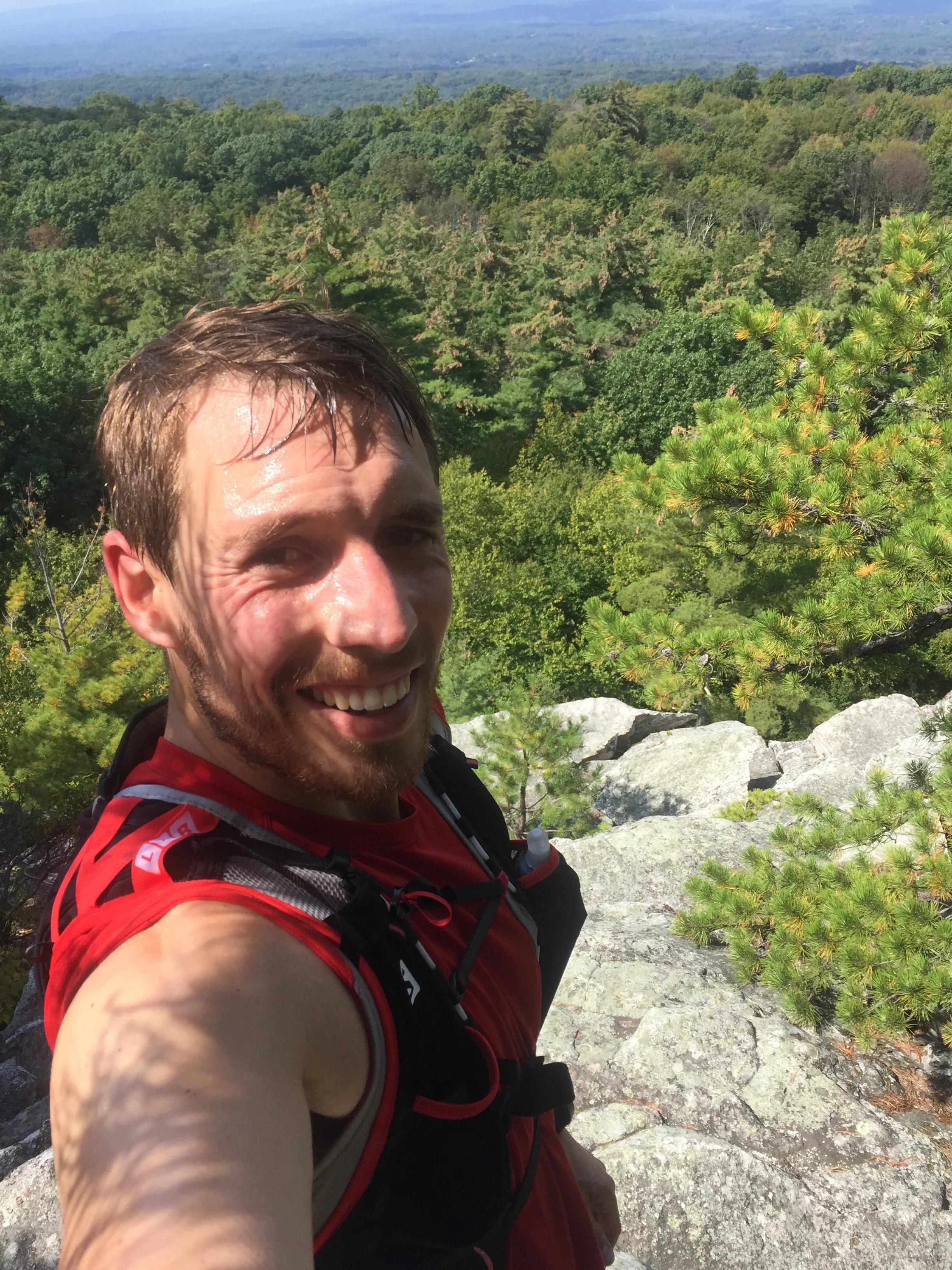
Trail Run Racing North East USA
I recently took part in my first running trail race in just over a year and prior to that one it has been a couple of years. It also happened to be my first since arriving in the USA.
The race was along the Shawangunk ridge in the state of New York. It's a beautiful part of the state as well as being a tree covered ridge line with enough hills to add to the difficulty. The event had 4 choices of race lengths; 70, 50, 30 miles and half marathon distances. Each followed the same route you just jumped onto the course at different stages along the way. The beauty of it being point to point is the added interest along the trail. When looking out for races I managed to find a large number of them in the northeast of the US that did laps of a trail circuit. Both options have different benefits. But for my first one back in a while a point to point was perfect. You can check out the race details on the link below
https://www.longpathraces.com/shawangunk-ridge-trail-run
I had opted for the half marathon, having not had a suitable amount of time to train up for some longer I was thinking of using it to get me used to races run in the US as well as a good stepping stone to some longer events later in the year.
Turning up to the event early on a cloudy and cool Saturday morning I had estimated my finishing time. Not on many hard facts for this one just rough estimates based on the distance. As I got chatting to people at the start line it transpired that my estimation was probably off, a quick time for the half marathon and winning time the previous year was just over the 2 hour mark. Along with this a number of people mentioned various points in the course where it was difficult finding the route. There are route markers but they are intermittent and are just the normal Shawangunk ridge trail markers, rather than any additional ones being used other than at the end where some occasional additional red strings of tape had been used. I picked up the map which being for the full length of the course (70 miles long) didn't provide great detail on a side of A4 to really navigate by. With the route on my gps I thought this would suffice. But after speaking to the fellow runners I decided to try to download the route map onto my phone as a back up. Being out in the middle of nowhere with limited reception this took until part the way through the race to download fully. Better late than never.

My first yellow bus journey
Boarding a couple of yellow school buses at the finish line we headed to where the half marathon started. It was my first time on one of these American icons. Boarding the buses made me realise the vast array of runners from whippets at the front to experienced runners right through to those who fancied the challenge for a weekend. Arriving at the start line we all bundled out and did our final preparations before the race started. This along with the race briefing where getting lost was mentioned again. I hoped this would not be me...
We were set off in waves according to our running numbers and I quickly got into a rhythm following behind a few people. We were making good progress along the trail and had made the transition from the little tributary of a trail the half marathon started on to the main trail. It followed beneath pine trees on a hard packed trail as the day began to heat up. Well above the temperatures I was expecting. Rather than being in the mid teens (60F range as I get into the US metric) it was well into the high 20's ( high 70F low 80's).
All was going well till we passed another runner but he was heading in the other direction. It turned out the girl who I was following was his wife. They had a brief chat and she carried on. Now I assumed that he had come out to meet his wife on the trail and as she had continued on we must be heading on the right direction. Turned out this wasn't the case he was doing the 70 miler and we were going the wrong way. About 15 to 20 of us spread out along this part of the trail. Checking and re-checking the maps we turned around and headed promptly back in the reverse direction. We had travelled about 30 mins round trip in the wrong direction. Not ideal on a race that was already due to be a tough half marathon.
Turning around and it was back the way we had come. Sweat already soaking through my top. I met up with a runner who it turned out spent a lot of time of the years running in the area and knew some of the tougher sections of the course. It was great way of passing the time chatting away as well as getting some local insight on the course or at least pointing out some cool looking areas which I may have otherwise just run past without looking up. Despite being hard packed trail we had already passed one guy limping the other way having gone over on his ankle on one of a number of roots, which I had almost slipped on as well. The trail meandered along a spectacular ridge line with views up into the Catskills. The odd tree hinted at the transition to autumn or fall with the colours beginning to change but there was still a way to go for the real show to begin.

Views from a clearing
Making it to the second a final check point marked the start of a long ish up hill section. As well as a short scramble through a boulder field to reach the top. A definite possibility for some scrambling or potentially some bouldering at a later date. I had heard the area was famous for roped up climbing as well.
Making it to the top and my legs still felt pretty good I bid farewell to my running buddy for the morning and headed off. The trail flattened out and was beginning to descend towards the finish I passed by one of the 70 mile racers who was running in sandals although he was doing incredibly time wise looked to be struggling a bit. Think I would have looked distinctly worst at that stage of a 70 mile run! The heat of the day had clearly had an impact on me as I could feel the odd twinge of cramp setting in. I just hoped a random movement wouldn't set it off. Easing up on the pace for a bit I was trying to minimise the risk of it happening before picking up again. The course by this stage was a gentle descent through cool and damp under growth. With old pine needles littering the floor making for a soft cushioning feeling for the body.

Warm conditions out on the course
I came across a few more runners not really knowing which course they were on I greeted them as I passed them by on route to the finish. Coming round the corner and I was greeted to the bridge I had driven under earlier in the day. By now the day had well and truely cleared from the initial clouds of the early morning to reveal the view across the valley. I quickly stopped to admire the view before the final few hundred metres to the finish line.
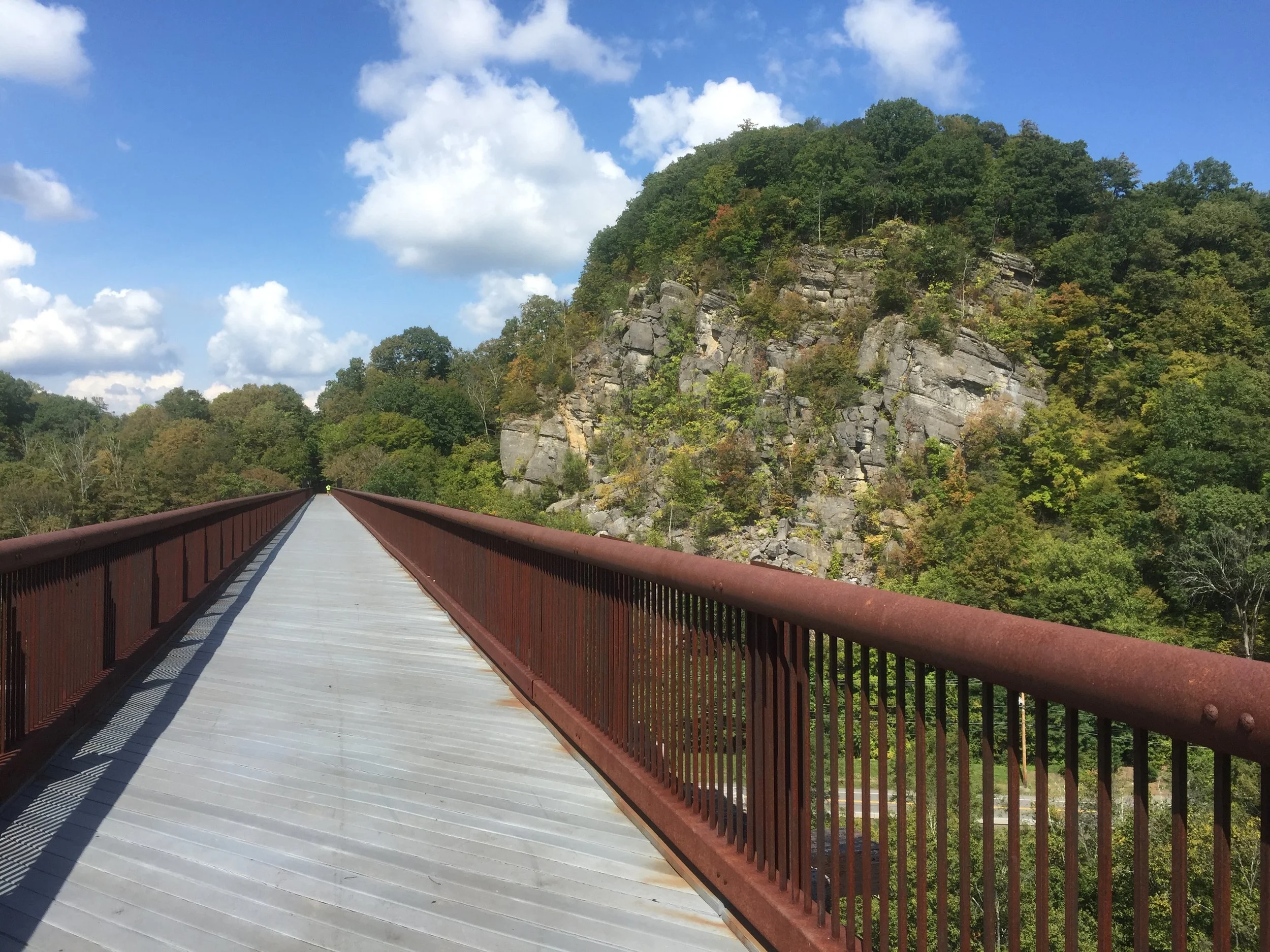
Crossing the finish line and being welcomed to cold drinks, a toast with a very small beer and a slice of pizza was a perfect finish for the race. Before making a rather sweaty journey back south again.
16th place in 3hrs 10mins. Shouldn't have got lost for 30 mins! 1st place was completed in 2hrs 8mins. I think i will be back for one of these events next year.

Blinded by the sun a great shot...
Got any race recommendations? Or have any questions about trail run racing?

Catskills 3500
Not long after moving to the US I came across the Appalachian mountain club in my search for some backcountry skiing. After chatting with some fellow skiers they introduced me to the Catskills 3500 club. It's a group who wish to climb the highest 35 peaks in the state of New York. To "officially complete" the 35 peaks you have to repeat 4 specific ones in winter as well. Since spending more time with the guys and girls in the group many have finished their first round and are now well into multiple rounds. More on that later.
the 35 peaks within the Catskills
Every Saturday and Sunday throughout the year they have a selection of hikes. One free weekend earlier I got in touch with the groups leader. Not long later we got a reply saying we were all good to join them. These guys volunteer their personal time to take other folk up the mountains. There are of course safety briefings and waivers to be signed but none the less a cool experience just being able to rock up and meet someone who knows the mountains, surrounding areas and of course where to get some great food and drink afterwards.
First up was a couple of mountains called Vly and Bearpen. It was described as a bush wack. Sounding much more like an exploration through the Australian outback than some mountains in the north east of the USA. Which a bit like "mountains in Scotland" are not quite the alps but some brilliant playgrounds nonetheless.
Waking at the crack of dawn we made our way up north on what has become a standard weekend route. Coming across an ideally placed Starbucks on route for a coffee boost before the walk. This was also to become part of our Catskills hiking routine as long as we hadn't overslept the 5 or 5.30 am alarm on a Saturday or Sunday morning.
Rocking up we met up with a whole variety of people who had travelled from near and relatively far to hike these mountains. Unlike the vast majority of the UK version of 3000+ ft's these mountains turned out to be coated in a landscape of trees. Making it difficult to see or in some cases know when you have reached the summit.
We made our way up a muddy track past some go kart like off road vehicles making our way steadily up the mountain. The canopy of trees above us shading us from the increase heat of the sun as it began to rise above us. We soon reached the point where the "bushwack" began. A cross road and the saddle between the two peaks. Turning off the main path we wondered along what looked like a sheep track heading in a meandering fashion upwards. The odd tree marked with a blue splosh which turned out to indicate the boundary of a local land owner. The false summits came across even more bizarre as with all the trees in the way it was seriously challenging to work out whether the peak had been reached with no visual clues to go by. We passed a sign marking the crossing of 3500ft and the start of the no camping zone. Rounding the corner we came to a clearing with a can suspended high up on one of the trees. It turned out this small area marked the summit. Opening the can up we signed our names to show we had completed the hike to the top before turning back round and heading down to the saddle of the mountain. It was still mid morning as we reached the saddle. Being out in the hills in a new environment felt like an incredible experience and with it still being mid morning by the time we reached the saddle where we had cut off the main track very satisfying to think we had seized the day to get up here so early.
Vly down and on wards and up wards to Bear pen.
One of the cool aspects of these mountains is how visible the changes in flora are as the altitude and direction of the slope change. From dark and damp corners with lush vegetation dripping with droplets of water to the upper slopes covered in pines which look stunted in growth. We also witnessed areas on a number of summits showing what happens when the trees are cleared. Although revealing gorgeous views over the valley the irony is the scar left on this lookout point of a treeless, dry, bare patch of soil and rock on what otherwise from above looks like a pristine environment.
We meandered our way past a closed up cottage which made me think of the books I read on cabins in the far flung reaches of Canada and Alaska such as in call of the wild.
Heading up the hill we soon made it to the top. I was thinking it would be more like the alps with treeless summits and potentially the chance for some paragliding. Instead the narrow passages back down the mountain between trees Im sure would make for a daunting if not virtually impossible take off point. We came across another group who had a 70 and 80 year old in their group. I very much hope I'm still hiking up mountains at that age!! As we got chatting to the group it transpires one of them had once owned a now long gone ski slope that was once situated on the mountain. Some remnants of the lift we still evident on the hill side.

A quick bite to eat we headed back down the way we had come and out to the cars at the base of the hill. Our first two US 3500 footers. The day was still pretty early so we opted for searching out a good place to eat. We came across a place called the gunk house. Recommended in an awesome wee book called 36 hrs in New York and the east coast. Serving up wholesome German inspired food food overlooking mountains and apple orchards.

Now just 33 summits to complete....
Since then we have knocked off a few more and are almost half way at 23 to go.
If you are in the north east of the US check out:
http://catskill-3500-club.org/ - for the catskills 3500 club
http://www.outdoors.org/ - for the Appalachian mountain club
And for those in the UK why not set the challenge of the munros, corbetts or wainwrights
https://www.themountainguide.co.uk/highest/

Kite Skiing - In the White Mountains
For the last couple of years I have been playing around with kites trying to get into kite surfing and although I haven’t done masses it is something i have really enjoyed.
Back in the winter months I met up with Jamie from our Baffin Island expedition with the idea of heading to the white mountains for a spot of kite skiing and any other mountain activities we could squeeze into the time up there.
A couple of weeks out and the conditions were looking great. We were then hit by a heat wave as I watched the snow quickly melt. It was February and instead of spending the weekend skiing I was down on jersey shore in shorts and a t-shirt flying a kite instead.
Despite hoping for a final dump of snow it never came as we hit the road for the drive north. Conditions in Quebec looked marginally better but the additional day spent in the car wasn't going to be worthwhile. We soon found ourselves reaching our destination of Conway. A wee town with mountains on its door step.
The following day we met up with our instructor Zeb who has amassed an amazing breadth of experience in kiting and any activity that involves the mountains to the ocean. The conditions for the week were quite mixed which provided a perfect balance of classroom time going through theory of kite flying as well as working through everything kite related from setting it up to taking it down quickly and under control. All in the warmth of the mountain store.
Indoor Kiting Skills
As conditions improved we headed out to a nearby frozen potato field. Patches of ice shone turquoise blues in the sunshine. Pulling out the kites we laid them on the ground. Stretching out the lines as we had done been practising, it was certainly a different sensation doing it with large mitts on rather than board shorts . The final part of hooking ourselves in and putting our skis on.
One of the biggest differences of kite skiing vs kite surfing is you don't have the same challenges of the water start and that initial period of having to get just the right amount of pull to get yourself out of the water. Instead you are standing as we launch the kites and as soon as they pick up enough power we are soon gliding across the snow and ice.
Kiting Conway
As we got more used to the kites and conditions are confidence grew. We were soon zooming across the ice. We would occasionally hit patches of hardened ice where our skis would skip and skid as we tried to find some grip and purchase on our edges.
The next step was heading up wind. This involved digging our edges in even harder and working the kite in the wind to start tacking in the direction we wanted to head in. Bit by bit we began to get the hang of it making it slightly further up wind with each attempt. There were of course mistakes along the way as we got to grips with the setup. Factoring in trees, the large overhead watering system, the odd pipe and the occasional patch of solid ice was certainly different to kite surfing. And a bit like how I was told there are either paraglider who have hit a tree or those who will the same seems to hold true with kite skiing. As we got one of the kites spectacularly held up in one of the trees. Fortunately there was no spectacular crashes of being lifted into the air and ceremoniously dumped onto the ground.
Working our way up wind
As the week wore on our confidence grew along with our skills we were soon making it up to ends of the field we had been looking at all week. To continue spicing things up we also started including drills to take them down quickly in an emergency.
It had been a fantastic week with a huge amount to absorb but we both certainly wanted more time playing about with kites in the snow. Packing up we were sad to see the mountains grow small in the mirrors as we made our way south to warmer less mountainous areas.
Of course only a couple of weeks later the snow finally came and temperatures plummeted.
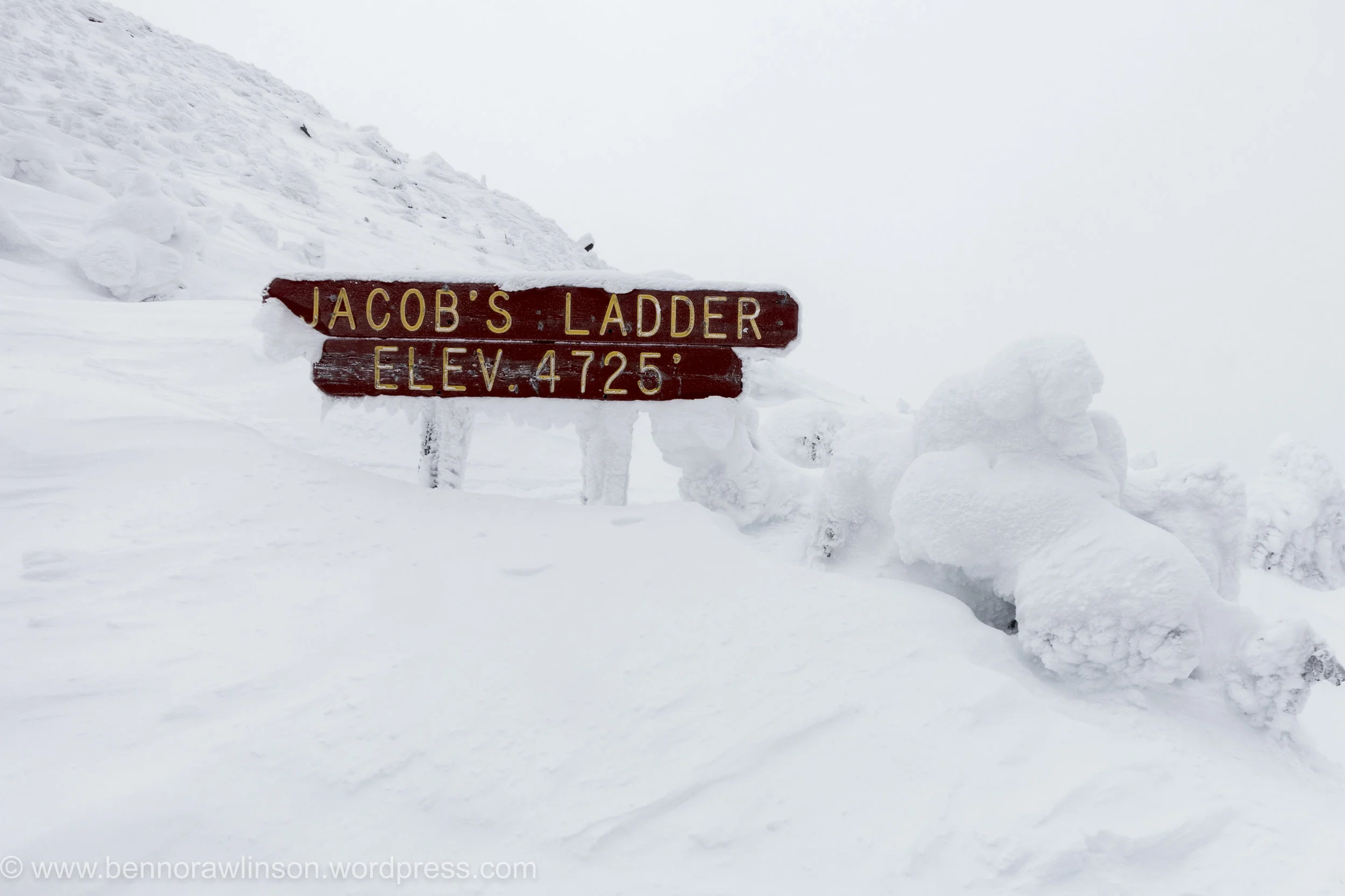
Windiest Place on Earth
Mount Washington The chance to ski on the windiest place on earth. Why wouldn’t I turn that option down.
Not long after moving to the North east I found out about an organisation called the Appalachian mountain club who were organising a ski tour up the Cog railway on mount Washington. Situated in an incredible area known as the white mountains in New Hampshire. Mount Washington I quickly discovered once had (only relatively recently beaten into second place) the highest recorded surface wind speed outside of a tropical storm coming in at 231mph.
It isn’t the closest ski area but with the warmer than usual temperatures in the north east it was always going to be about travelling further north to get the best snow possible. Unlike the previous weekend, the temperatures had certainly begun to cool down. As I started to make the drive north the weather began to change and by the end of the night it was snowing. I was seriously looking forward to getting out the car after a fairly brutal 7 hour drive after a full days work. As much as I wanted the snow I didn’t really fancy the slowing down of the journey.

OLYMPUS DIGITAL CAMERA
Arriving at the lodge I crashed out as soon as I hit the mattress, it didn’t feel like many hours later than the first people began to stir, all trying to get the best conditions for the day. Munching a quick breakfast all washed down with large mugs of coffee, I made my way to the meeting point. Now despite it once having the highest recorded wind speed on earth there is still a railway to the summit along with an access road. Our plan was to follow the train tracks up the mountain and once out of the tree line see what the conditions were like. Summiting was highly unlikely with forecasts of high winds and a thick layer of cloud covering it.
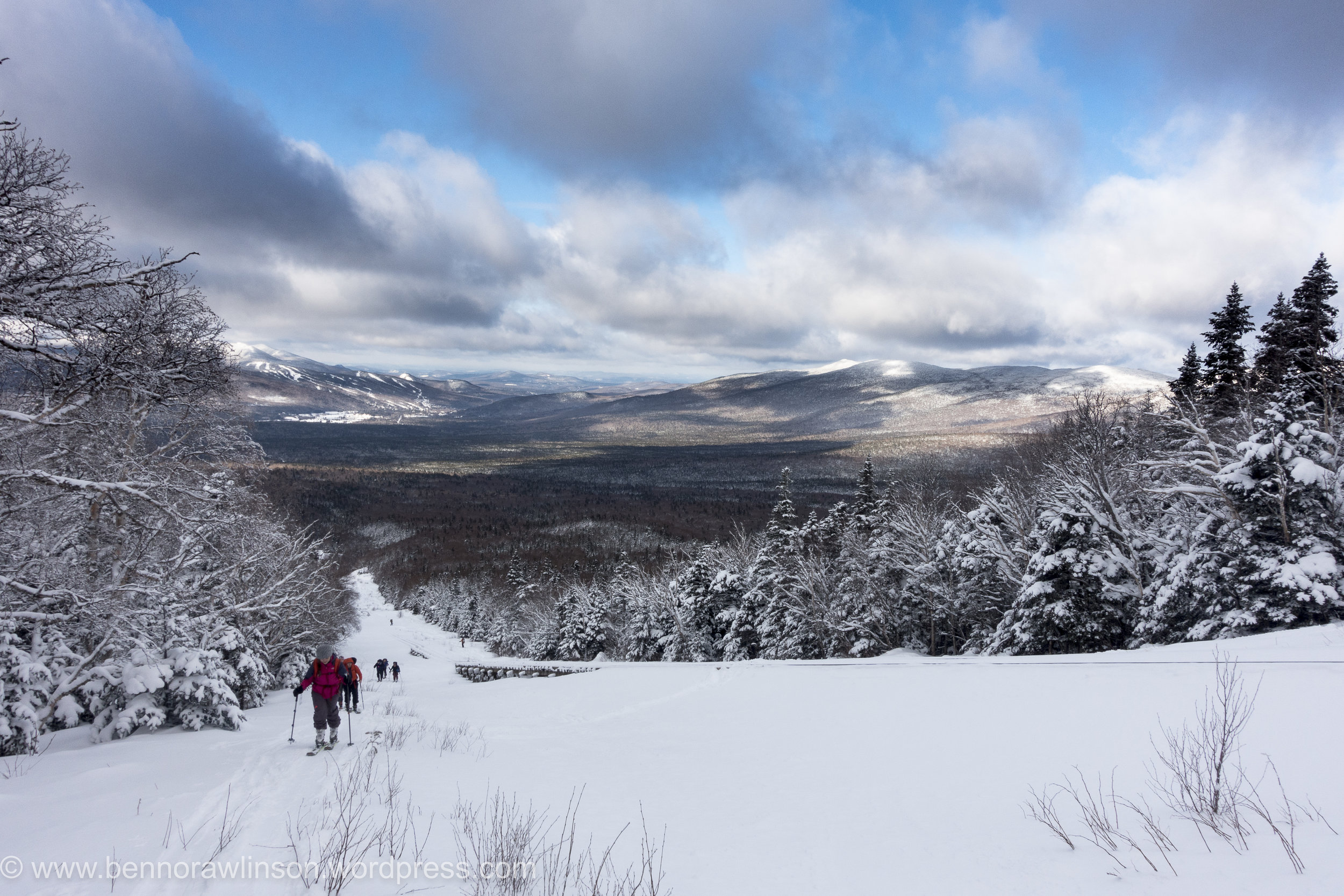
DSC04796
I had enjoyed the ski mountaineering racing but this was a completely different experience again. The pace obviously much more sedate with the emphasis being on efficiency and trying not to sweat. Compared to my race strategy of trying to go as fast and efficiently as possible. Which was more of a brute strength and endurance exercise. And certainly less care for the amount of sweating going on. It was however a lot colder, hovering around the -5 to -15F , a balmy -20 to -26C and the wind chill on top. Despite this it still felt quite warm as we meandered up hill surrounded by trees which looked incredible. Like frozen statues dotted all the way up the mountain side. Pausing occasionally to have a drink and admire the views behind and in front of us, despite the large bank of clouds hiding the summit. It wasn’t the blue bird day we had all hoped for but still fantastic being out on the mountain.

DSC04805
Arriving at the first split point and we soon bundled up as the temperature plummeted. We had come out of the trees and the wind now had us in its sights. The rail line had clearly taken the full force of this onslaught for quite a while as its frozen structure looked like something from another planet. Not even in the arctic had I seen buildings covered in ice to this extent.

DSC04807

DSC04815

DSC04812
A few of us opted to continue slightly further up the mountainside. It is safe to say we needn’t have bothered. All that proceed was some skating around on an icy surface of wind stripped mountainside. We tried to get purchase on what little friction we could get but despite this effort we hardly made it any further up for a lot more huffing and puffing. With the wind battering our faces and bodies it was only sensible to head back down. There was no chance of a summit today and the possibility of some better powder round the corner was never going to happen without some more hardware of ice axes and crampons. Even then we were not convinced there would be any great powder.
It was a quick turn around to get out the wind. I say quick but the ice and strong winds made it tough work wrapping up our ski skins to get them put away. Its like trying to roll loose duck tape up in a strong gale into a neat organised bundle.
And then the bit we had built up for, the ski down. Despite the odd patch of ice there were some great stretches of powder. The three of us who had tried to go a bit higher made the most of the descent getting in as many tight wee turns to float on the powder. In the hunt for some I managed to find a fairly lightly covered rock. Skiing over it I stopped almost instantly, trying to recover my balance from the forward momentum only to finally pop out of my bindings. Unfortunately one of the guys saw the whole thing unfold in a particularly slow and inelegant fashion.

DSC04821
We made it down to the bottom and back to the lodge for a well deserved hot shower and drink.
The next day I headed up to the in famous tuckermanns ravine. You can check out a couple of pro skiers hitting this on the link below:
https://www.youtube.com/watch?v=CM7YknhIKeU
It isn’t recommended generally to ski it until later in the season but whilst in the area I at least wanted to have a peek at what it was all about. I followed the trail up which is incredibly well marked. Past people snow shoeing up and a number of groups up for the weekend as part of a nearby ice festival learning about avalanche rescue techniques. The wind certainly felt less strong and it was definitely a warmer day than the previous one. Snow occasionally fell from the trees. It was a pretty magical sight.

DSC04829
Slowly but surely the ravine revealed itself. Each glimpse between the trees showing a bit more until I came round the corner and caught sight of the whole area. With clear views of the summit of mount washington in the background. There in front the huge tuckermanns ravine and the steepest ski descents in the north east, or at least one of the better known ones.
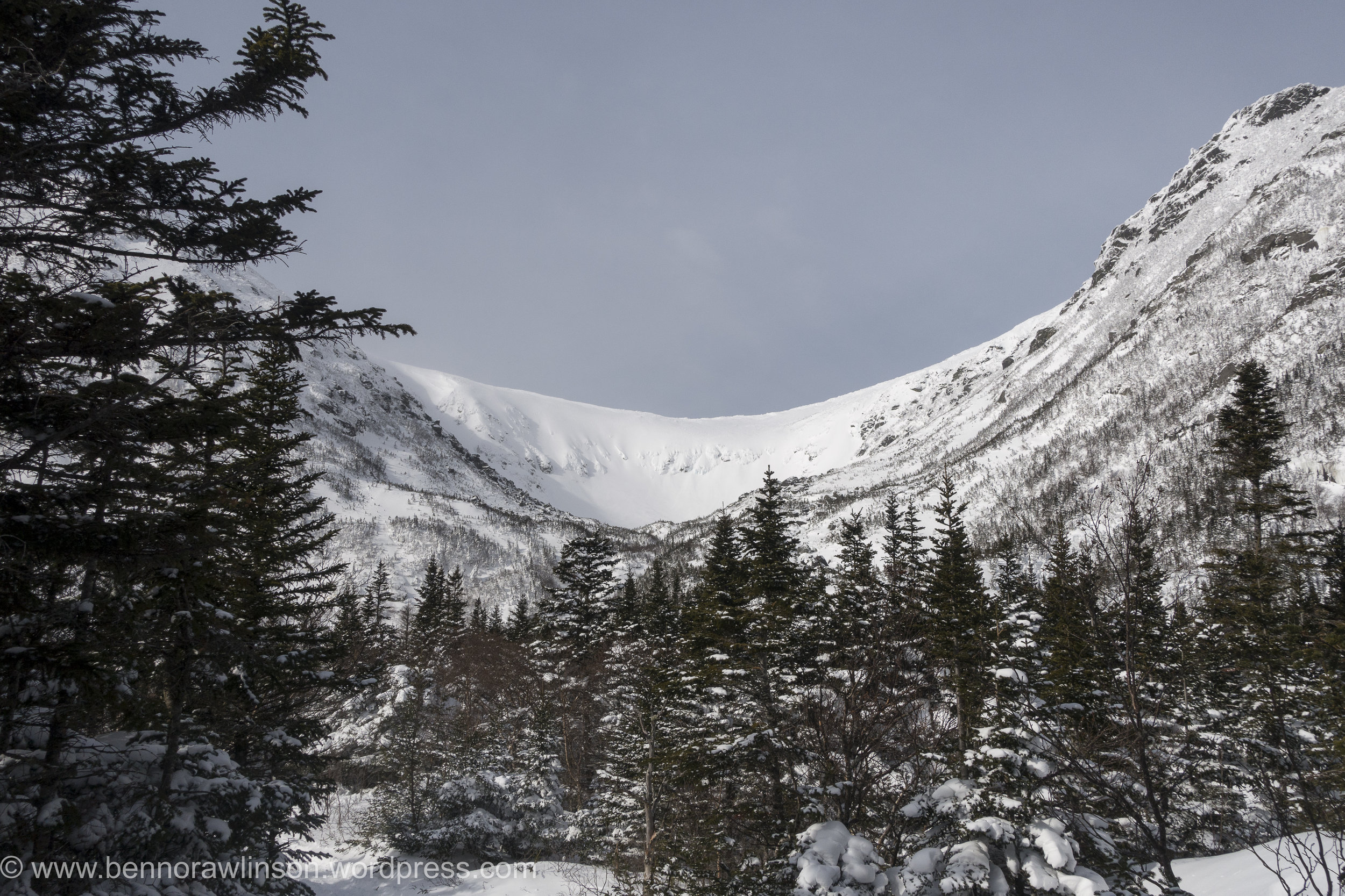
DSC04830
Arriving at a small cabin and there were groups continuing up as part of their avalanche course as well as some skiers who despite the now windy conditions had opted to try a few routes. It looked pretty incredible and in places pretty intimidating even from a distance. I headed on up the mountain as I wanted to see the full face of it. Some of the slopes are up at 40 - 50 degree range. The wind had certainly picked up though and I was now taking a bit of a beating even if it was warmer than the previous day. Arriving at the bottom of tuckermanns and I could finally take it it. I definitely want to return to the slopes here and take on some of these descents.

DSC04832
Heading back down the mountain and my legs could finally enjoy a bit of a down hill ski. After trekking up it made for a nice change. Despite this I still had to walk a few bits at the top due to not being able to find a decent route to ski down as well as the path I walked up being really quite tight between rocks, trees and a small stream that with the warmer conditions wasn’t completely covered in snow.

C43A2315
I soon found myself down the bottom of the mountain just in time to munch a load of food in the car and before the return journey back down south to new jersey.
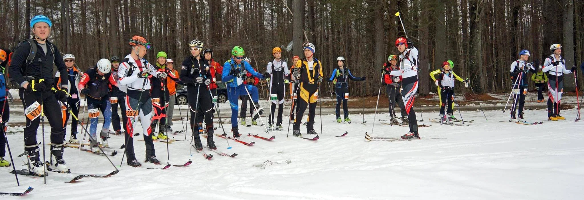
Skimo - Berkshire East
Over the last few years there has been a huge increase in the number of ultra running races and trail races around the world with people looking beyond the standard road marathon to get their athletic fix. Regardless of what I do the option to go out running in the hills and mountains is always tempting.
The winter months give an opportunity for some down time, change the activity or generally prepare the coming season. For a while now I have been reading and watching more about skimo racing also known as randonee and ski mountaineering. Which from a racing stand point and ignoring the degrees of difference in technical descents and ascents basically involves hiking up hill either boot packing (going up hill with skis on your back), skinning (ski up hill with special material on the base of the skis called skins) and then descending the mountains as fast as you can.
When I moved to the north east of the U.S. and with the mountains nearby I went about searching for an event to enter. I found the north east rando race series. A series of events around the north east of the US and the timing was perfect. My first weekend in the U.S and there was an event on.
With snacks for the drive bought, I woke in the early hours of the morning to make the 4 hour drive up the road. The conditions over the last few weeks had been warm and the day was looking to continue this trend.
Despite this there was still a chill in the morning air and with this came the occasional blanket of fog which made for some spectacular scenery particularly where there were small clearings.

Arriving at Berkshire east and there was one guy making an early start on the course in shorts and t-shirt. Which was a long way of my ski trousers and jacket. I hoped the day would stay cold, otherwise I was going to be ridiculously hot scaling the mountain. After getting organised it was time to start the race amongst a group of people ranging from the lycra clad to the occasional ski tourer.
Making a dash up the mountain the group soon dispersed as we made our first lap up the mountain. Before the first corner my jacket was as off and for the ascents only my helmet soon came off too. It was sweltering. First up hill done and it was the transition back to skiing down hill. The skins were off the bottom of the skis and everything switched back into ski mode for a brief ski half way down the mountain. This sounds much quicker than it was in practise, initially with the skins flapping all over the place nothing helps speed things up with either bad weather or the time pressure of a race. That and a desire to cool down on the descent. It was then a walking stage up a steep wooded part of the route with our skis on our backs before we exited the forest and could get ours ski’s back onto ski touring mode for the last bit back to the top of the mountain. Skins off and it was time to go full speed down to the bottom of the mountain to repeat this a three more times. On the way up I ended up chatting to one of the local ski patrollers and another guy who turned out to be the owner of the ski resort which passed the time and made sure we were going at a steady pace up hill. With the U.S elections only just completed it was certainly interesting to start getting more of a local insight into it.

With the day heating up I stopped to get some water from a nearby stream having used up my small water bottle over the first few laps. Despite it being in january most people had switched to open jackets or just a thin shirt. One guy had even opted to go topless.
After the third lap it was time to head to the second stage of the race on the other side of the mountain. Amazingly some people had already finished. The skiing down became increasingly harder as my legs became more tired. This was my first ski day of the season, ski touring race and I had literally arrived in the US three days earlier.

Despite this i finished the final couple of laps and very quickly ended up in the cafe for a well deserved feast of food before the prize giving. It was at this point I realised the quality of the field. Ranging from those competing for positions in the US team to the previous record holder Ed Warren for the fastest ascent of Denali before this was taken by Kilian Jornet. Certainly an impressive range of athletes.


All in all I seriously enjoyed the north east rando race and will certainly be working out how to fill the next seasons schedule with races. It mixes mountains, skiing and running into a pretty epic combination. By the end I was sufficiently knackered, yet despite this my legs still felt good enough the following day to tear through some laps of a nearby mountain before the rain descended on the area. I can certainly see why this is the perfect winter trainer or event in its own right when you have mountains nearby.
Bring on the next season.
For those interested check out:
http://nerandorace.blogspot.com
and for those in the UK there is always the Scottish one:
http://www.skimoscotland.co.uk

